A flood can change direction between two satellite images.
A construction corridor can develop a new risk between drone surveys.
A ground sensor can report rising water without showing which access road is becoming unsafe.
For infrastructure operators, the problem is often the time between observations and whether the available evidence explains enough to support action.
That is why the space between satellites and drones deserves attention.
Stratospheric platforms could add another observation layer: one that watches a priority area for longer, while satellites, UAVs, ground sensors and field teams contribute different parts of the picture.
The business question is straightforward:
Can this additional layer reduce the time between physical change and a useful decision?
A different position in the observation stack
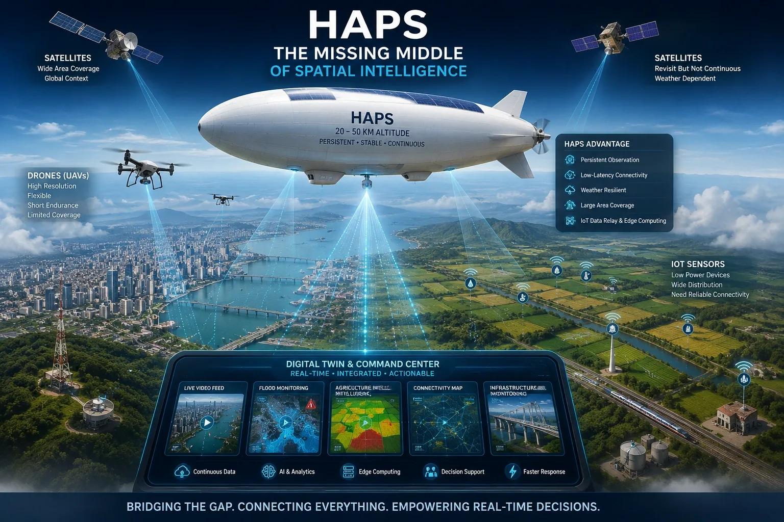
High-altitude pseudo-satellites, commonly called HAPS, include aircraft, airships and balloons operating high in the atmosphere.
ESA describes their potential for prolonged regional observation and communications. However, endurance and the ability to remain over a target depend on the platform and mission; they are not universal capabilities.
Involve Space provides a current example. Its stratospheric platforms target Earth observation and security applications at around 20 kilometers altitude. Its website currently lists the StratoRelay SRX mission for 9 October 2026. That is an upcoming mission, rather than evidence of a completed operational deployment.
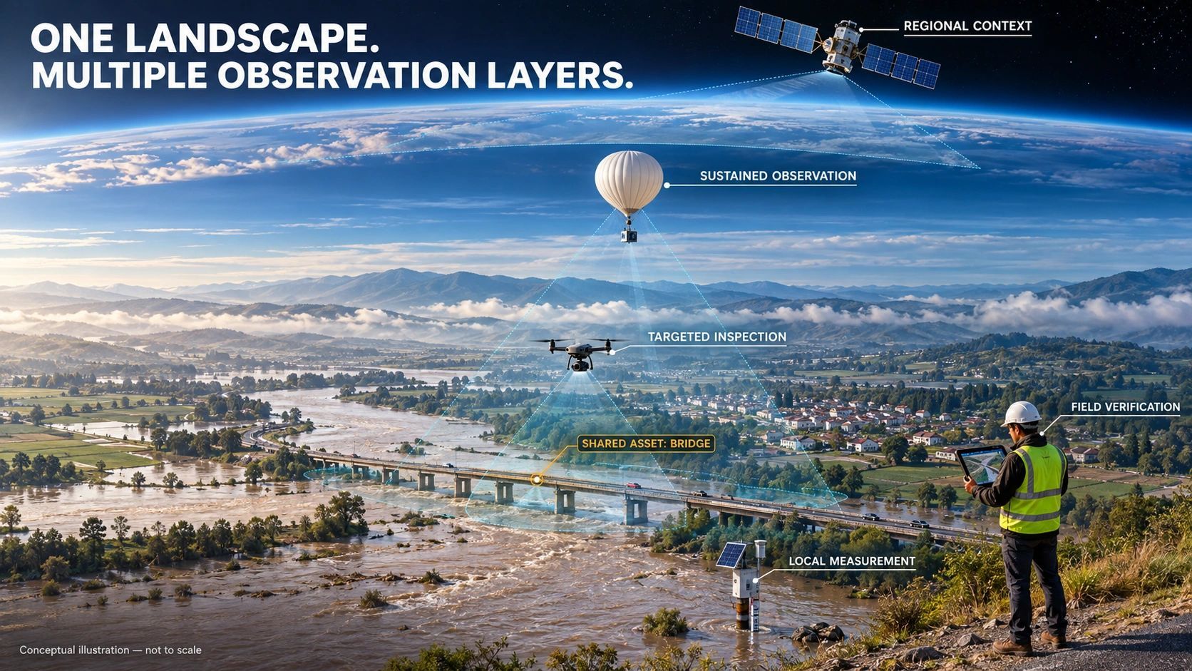
These developments suggest an observation architecture with more choices:
- Satellites for broad geographic context and repeated coverage.
- Stratospheric platforms for potentially sustained regional observation.
- UAVs for targeted inspection and detailed capture.
- Ground sensors for continuous measurements at specific locations.
- Field teams for physical verification and local context.
Each layer answers a different question.
The opportunity comes from coordinating those answers around the same event.
Persistence changes what teams can ask
Periodic surveys are good at showing differences between capture dates.
More sustained observation could help teams understand how a situation develops between those dates.
Consider a hypothetical flood-response workflow.
Satellite imagery establishes the wider affected area. A stratospheric imaging platform, where technically and operationally suitable, watches a priority corridor. Ground sensors report water levels. A UAV inspects a vulnerable crossing. A field team checks whether an evacuation route remains usable.
Together, these observations could help answer:
Where is the water moving?
Which assets are becoming exposed?
Where should the next inspection happen?
What evidence supports restricting access?
This is a proposed workflow, not a claim that these systems already operate together everywhere.
Its value lies in directing scarce people and equipment toward the places that need attention first.
Altitude does not guarantee useful evidence
A platform’s position above the ground tells us little by itself about the decision its data can support.
Payload, viewing geometry, spatial resolution, positioning accuracy, capture frequency and delivery latency all matter.
So does the ability to maintain useful coverage.
An optical sensor in the stratosphere can still have its view of the ground obstructed by clouds below it. A radar payload offers different capabilities and limitations. A long flight does not automatically mean continuous observation of one location.
Buyers therefore need mission-specific answers.
Can the system detect the relevant change?
Can it locate that change accurately enough?
Will the information arrive before the decision window closes?
Can the service maintain coverage under the conditions that matter?
The procurement unit should be the decision requirement: what must be observed, where, how often and with what assurance.
More sensors create a harder integration problem
Adding another observation source can also add another dashboard, coordinate system, timestamp convention and set of assumptions.
That becomes a problem when teams try to combine evidence.
A satellite image may indicate surface change. A sensor may report an abnormal reading. A drone may reveal visible damage.
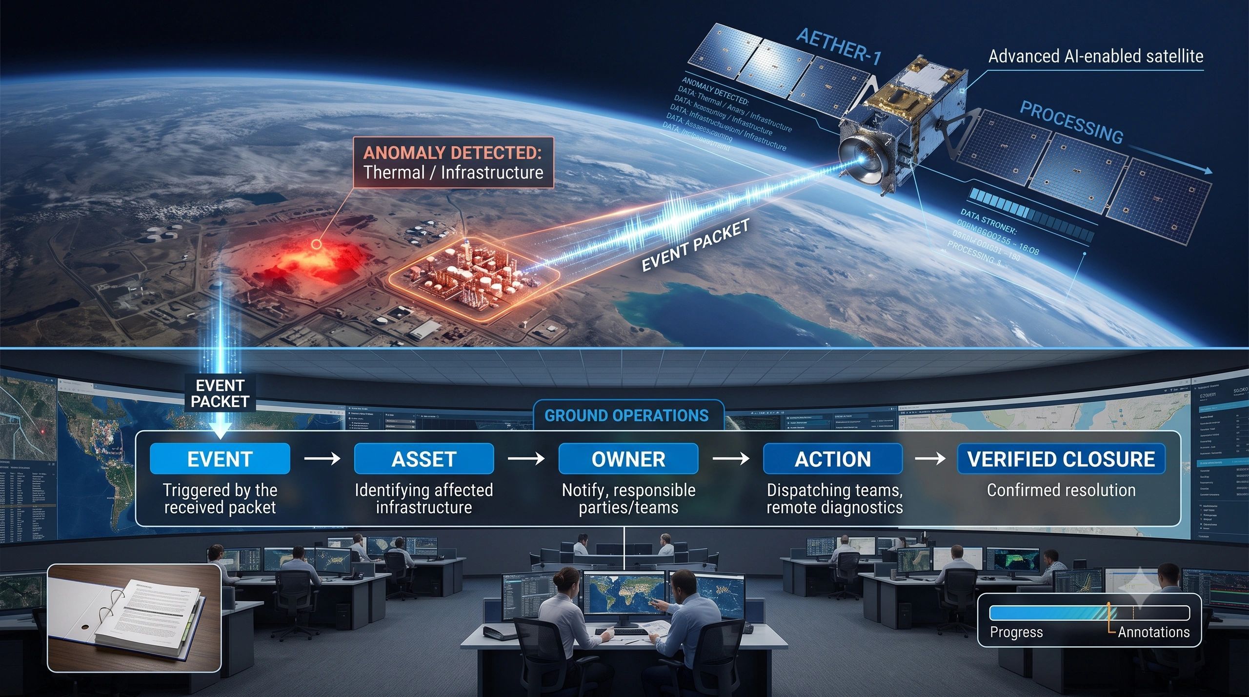
Before connecting them, the system must establish whether they concern the same asset, location and period.
For digital twins, this means observation records need more than an image attachment.
They need a durable connection to:
- The asset or event being observed.
- Capture time and availability time.
- Sensor, payload and processing method.
- Location accuracy, coverage and known limitations.
- The claim the observation can reasonably support.
Capture time and upload time deserve separate fields. A recently uploaded image can still describe an old condition.
Likewise, two observations may disagree because the physical situation changed between captures. Preserving that disagreement can help identify the next verification step.
Build around three decisions
A practical approach is to organize the observation stack around three decisions.
1. Where should we look?
Start with exposure: critical assets, vulnerable communities, hazardous areas or expensive interruptions.
Use existing data to identify where additional observation could change an operational outcome.
2. What evidence is sufficient?
Match evidence to the intended decision.
An indication of change may justify an inspection. Restricting access, accepting completed work or approving an intervention may require additional measurements and professional judgement.
3. Who acts next?
Define the responsible person, response window and verification step before introducing another feed.
Otherwise, better observation can simply produce a larger queue of unattended alerts.
These three decisions make the technology easier to evaluate and the resulting workflow easier to operate.
The commercial case needs an operational measure
The economic case for an additional observation layer should be tested against a specific problem.
Possible measures include detection delay, unnecessary inspection trips, time spent locating an incident, coverage of priority assets and time to verified closure.
These are evaluation criteria, not promised outcomes.
A pilot should compare the proposed stack against the existing workflow. It should also account for deployment, payload, communications, processing, integration, permissions and verification costs.
Persistent observation may be valuable during a high-risk period. A periodic survey may remain sufficient elsewhere.
That distinction helps owners invest where additional evidence has a clear purpose.
What this means for spatial platforms
For platform builders, the strategic opportunity is to make observations from different sources usable within one operational context.
A new sensing layer should connect to existing asset identities, event histories and response workflows.
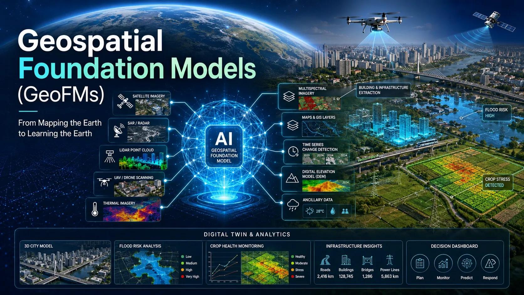
AI can help identify changes, prioritize review and suggest follow-up capture. Its interpretation should remain traceable to the supporting observations and their limitations.
The decision-maker still needs to know what was observed, what was inferred and what remains unresolved.
As the observation stack expands, the most useful systems will help teams decide when they have enough evidence to act and when another look is necessary.
A new layer in the sky earns its place when it improves a decision on the ground.