An infrastructure operator opens a dashboard.
The map is current. Sensors are streaming. Drone imagery has arrived. The digital twin shows the assets in detail.
Yet one question remains unanswered:
Which of these observations requires a different decision today?
That question exposes a gap in spatial intelligence.
We have become increasingly capable of observing the physical world. Turning those observations into a clear, accountable next step remains harder.
For an owner or project leader, the consequence is practical: more information can arrive while the decision stays delayed.
A measurement needs a decision context
Imagine a drainage network producing thousands of readings throughout the day.
Most show expected behavior. Some reflect rainfall. Others may result from sensor drift, communication problems or changing upstream conditions.
Then a particular combination appears: rising water level, reduced velocity and an unusual upstream discharge pattern.
Does this justify an inspection? A maintenance response? Further measurement?
The answer depends on more than the readings.
It depends on the pipe geometry, recent rainfall, maintenance history, sensor reliability and the consequences of failure.
A similar signal could require different responses in two locations. One serves a low-risk area. The other sits upstream of a hospital access road.
Decision relevance comes from the relationship between an observation, its context and its consequences.
A threshold crossing starts the assessment. It does not necessarily settle it.
Observe what the system can do
The OzFuel-1 satellite payload illustrates a useful direction.
The Australian National University describes it as designed to observe vegetation flammability traits and provide landscape flammability information for planning, preparation and response. This is a mission objective, rather than evidence of an already operational satellite service.
The significance extends beyond bushfire monitoring.
Knowing where vegetation exists answers one question. Understanding characteristics that affect how readily it may burn supports a different set of decisions.
The same distinction applies to infrastructure.
A reservoir’s outline tells us where it is. Storage, inflows and operating constraints help explain what supply it can support.
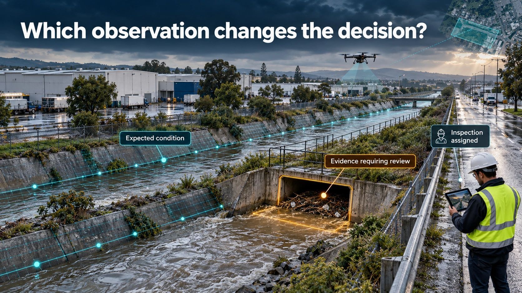
A drain’s location identifies the asset. Its obstruction, flow conditions and downstream dependencies help explain whether it can carry the expected load.
A construction model records intended geometry. A verified deviation may change whether the next activity should proceed.
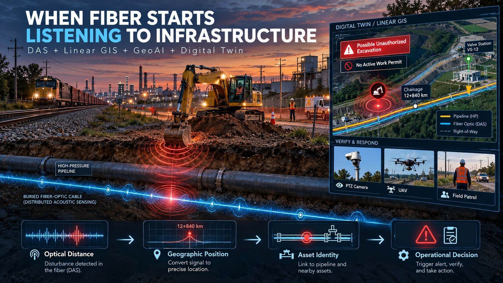
Spatial intelligence becomes more useful when it connects physical condition to current capability and capability to a decision.
Data, evidence and decisions are different things
I find it useful to separate five steps:
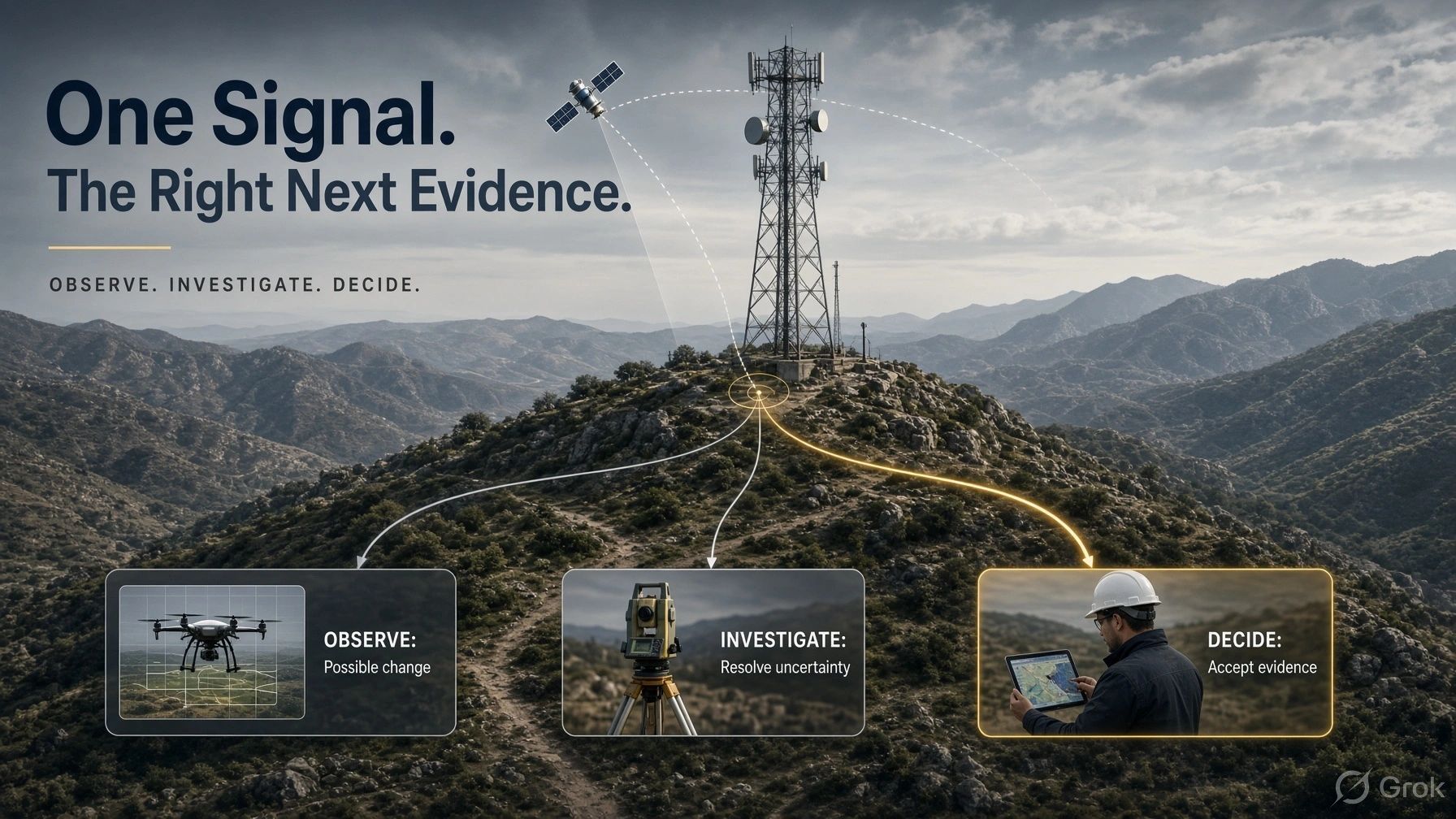
Observation → Evidence → Assessed state → Decision → Verified outcome
An observation records something measured.
Evidence connects that measurement to a physical asset or event, with its time, method and limitations.
An assessed state expresses what the available evidence supports.
A decision determines the next step, including whether further verification is needed.
A verified outcome establishes what happened after the response.
Consider a hypothetical drone inspection identifying a possible bridge defect.
The image is an observation. Its location, capture conditions and comparison with previous inspections help establish evidence.
A qualified assessment determines whether the apparent defect changes the accepted condition of the structure.
The responsible authority then decides whether to inspect, restrict access or schedule maintenance.
A later inspection checks whether the intervention achieved its purpose.
Each step carries a different responsibility. Compressing them into a single AI-generated alert hides those distinctions.
Three questions for every incoming observation
A practical starting point is to evaluate evidence through three questions.
1. What does this change?
Does it confirm the current assessment, reveal deterioration, resolve a disagreement or expose an information gap?
Evidence that confirms normal operation still matters. Repeated measurements establish baselines, support trend analysis and help detect gradual change.
But the user should be able to see which observations alter the assessment and why.
2. Which decision does it affect?
A construction deviation may affect an approval.
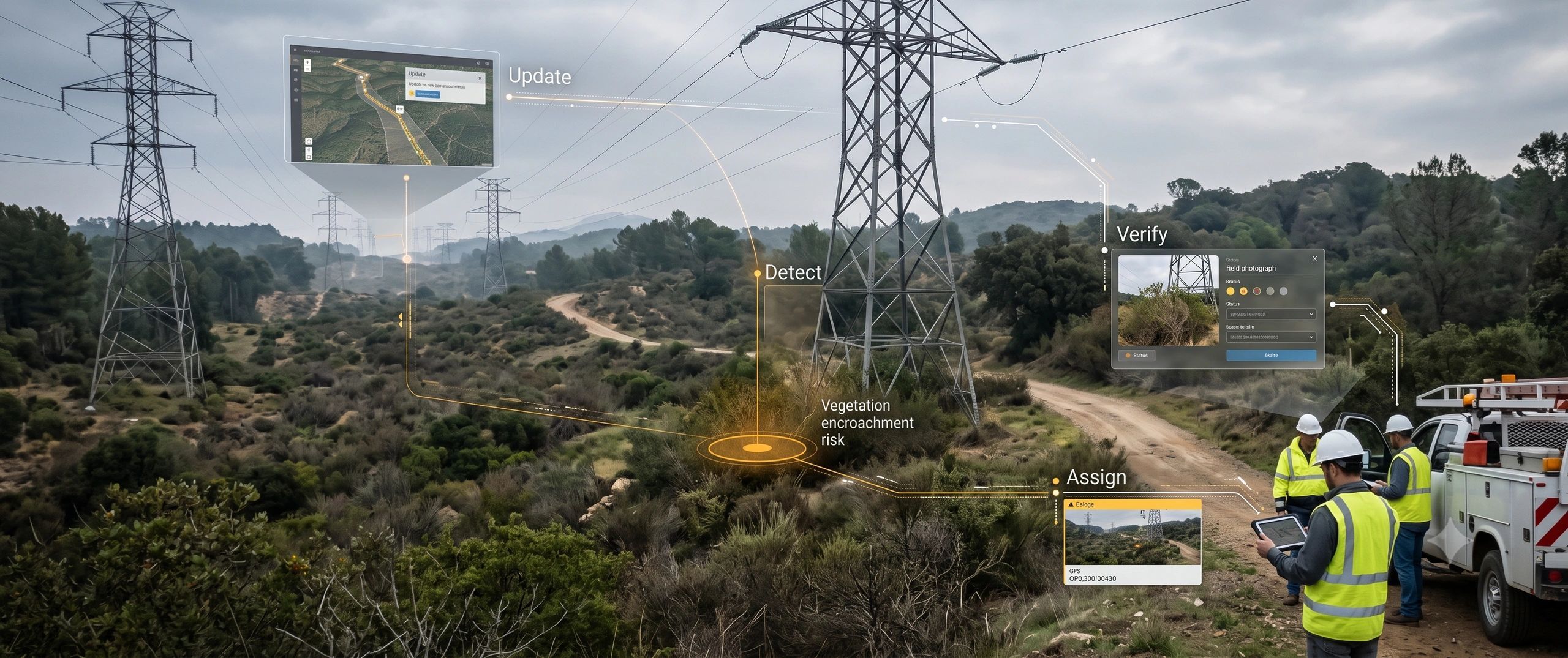
A vegetation change may affect inspection priority.
An equipment anomaly may affect maintenance timing.
The relationship should be explicit: the asset, the pending decision, the responsible person and the time available to respond.
An alert without that relationship leaves the interpretation work with the recipient.
3. What response does the evidence justify?
The next step might be action, review or another observation.
A high model-confidence score alone does not establish permission to act. Evidence quality, operating limits and the consequences of a wrong decision also matter.
Sometimes the most useful output is:
“We cannot yet support this decision. Here is the missing evidence.”
That gives uncertainty an operational purpose.
Relevance must remain open to challenge
There is a risk in designing systems to prioritize “the data that matters.”
The system may suppress weak signals, unfamiliar patterns or inconvenient contradictions.
A reading that appears unimportant today may become significant when combined with tomorrow’s inspection. A stable condition may still require intervention because the operating context has changed.
Prioritization therefore needs traceability.
Users should be able to inspect the underlying evidence, challenge its interpretation and understand why something received attention or did not.
The design goal is to guide attention while preserving the ability to reassess.
That becomes especially important when AI helps rank anomalies or recommend actions.
Start with one recurring decision
For organizations building digital twins or spatial platforms, I would begin with a decision that already consumes time or creates risk.
For example:
Which drainage locations need inspection before the next heavy-rainfall event?
Work backwards from that question.
Identify the evidence needed, its required freshness, the known failure modes and who can authorize the response.
Connect rainfall, asset geometry, observations and maintenance records around that workflow.
Then measure whether the system improves inspection prioritization, reduces unnecessary visits or helps teams respond sooner.
This approach also clarifies where additional data has value.
Another sensor is useful when it resolves an uncertainty that affects the decision. Higher-resolution imagery is useful when the existing imagery cannot support the required assessment.
Collection requirements should follow the question being answered.
Measure the decision, then the outcome
Data volume, map coverage and model accuracy remain useful technical measures.
Operational value also requires questions such as:
How long did it take to reach a supported decision?
How many alerts led to useful responses?
How often was additional verification necessary?
Did the intervention resolve the physical problem?
My position is that spatial platforms should make these relationships visible: what was observed, what it changed, who decided and what happened next.
Before adding another data source, ask which decision it will improve and how you will know.
That question can shape a more useful spatial-intelligence system from the beginning.