AI agents can reason over documents, databases and digital workflows.
Physical AI has a harder task. It must understand and act within a world that keeps changing.
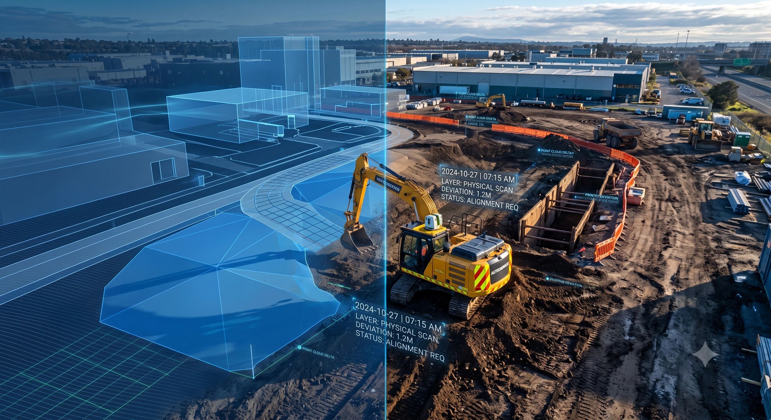
A warehouse aisle may be reorganized. A machine may be replaced. A construction wall may be completed. A temporary barrier may appear. A road may become inaccessible. A valve that was reachable yesterday may be obstructed today.
A robot operating in these environments cannot depend only on what was mapped during commissioning. It needs to know what exists now, what has changed and whether its information remains reliable enough for the next action.
That means Physical AI will need more than computer vision, robotics or a static digital twin.
It will need a spatial memory of the real world.
A model of reality is not necessarily current reality
Most reality-capture workflows still end with a deliverable:
Capture → point cloud → model → handover
This is useful for surveying, design coordination, construction documentation and asset management. But Physical AI introduces a continuous operational loop:
Capture → spatial representation → semantic context → machine observation → permitted action → reality update
The difference is important.
A robot does not simply need to recognize that an object exists. It may need to establish:
- Where am I?
- Which asset is in front of me?
- Has this area changed?
- When was it last observed?
- Is the route still accessible?
- What hazards or restrictions apply?
- Am I authorized to perform this action?
- Did my action produce the intended physical change?
A geometrically accurate model may answer the first two questions. It may not answer the rest.
This is where a spatial model must begin behaving like memory rather than a static representation.
Spatial memory must connect geometry with meaning
Physical AI needs to relate observations to enterprise context.
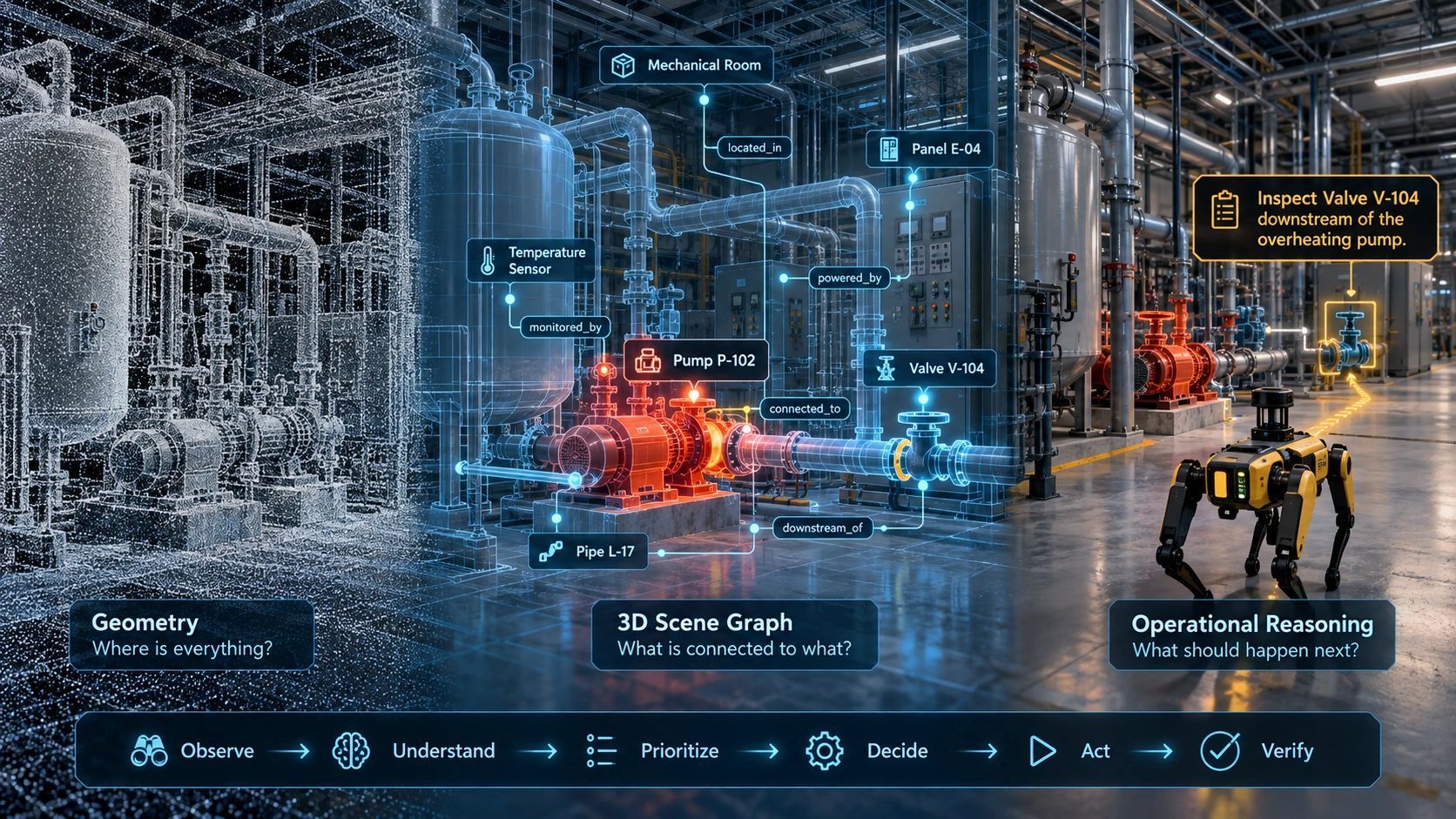
A detected pump is not merely an object with a shape. It has an asset ID, maintenance history, operating condition, safety boundary, responsible team and permitted intervention procedure.
A construction opening is not simply empty space. It may be an approved access route, a temporary condition, a fall hazard or an area scheduled to be closed later that day.
This requires several layers to work together:
- Reality capture establishes observable physical conditions.
- BIM provides engineering geometry and asset semantics.
- GIS provides location, networks and wider environmental context.
- IoT reports dynamic conditions.
- Enterprise systems provide ownership, maintenance and workflow information.
- Operational rules define what a machine may do.
No single layer provides sufficient context by itself.
The opportunity is therefore not just to produce better 3D models. It is to create a persistent spatial context layer that connects what a machine sees with what the organization knows and permits.
Reality freshness becomes an operational metric
One of the missing measures in many digital twins is the age of their underlying evidence.
We often assess accuracy, resolution and completeness. Physical AI adds another question:
Is the information current enough for this decision?
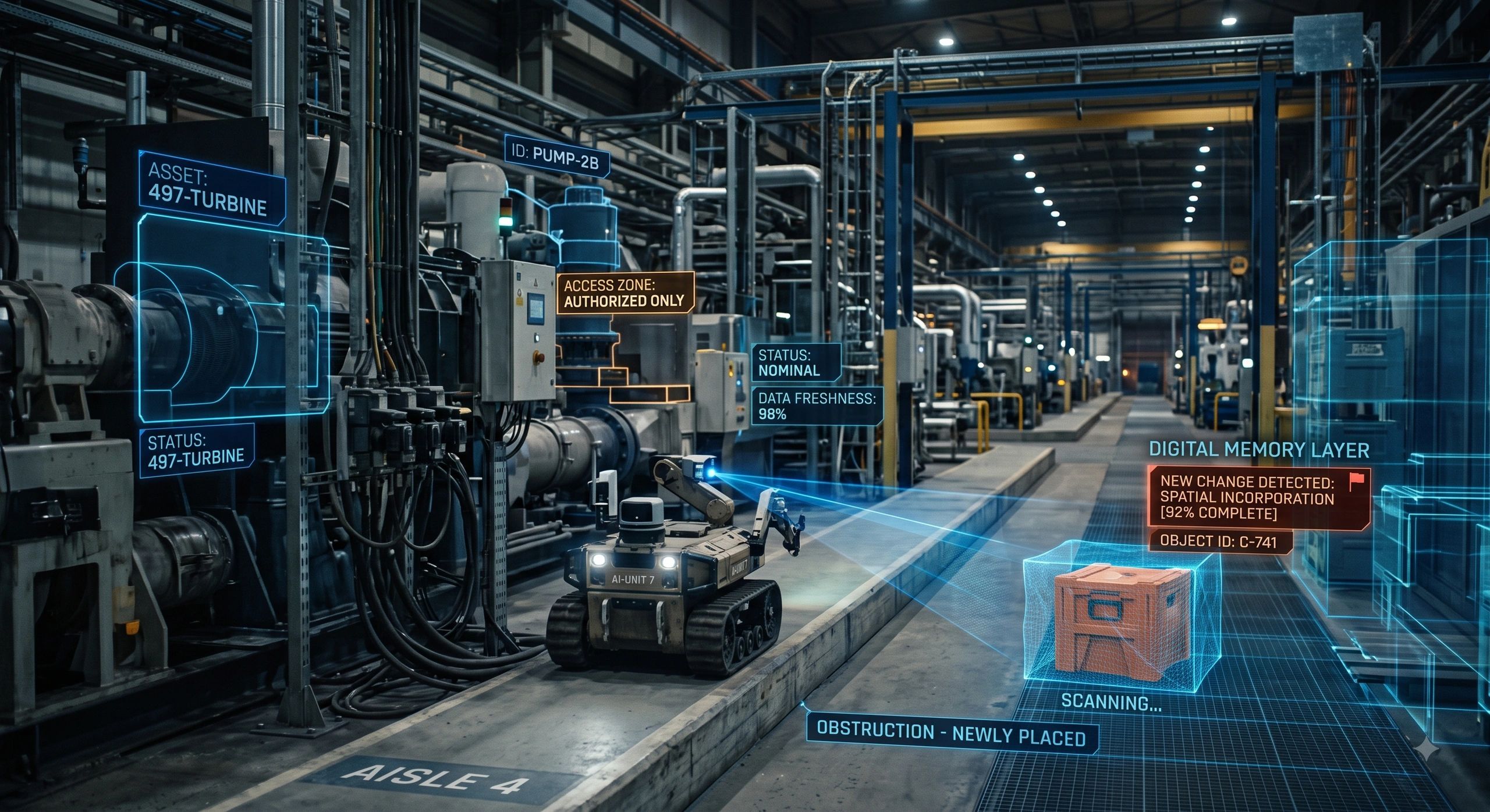
Consider an autonomous inspection robot using a six-month-old facility map. The walls and floor may remain correctly positioned. But a new machine, storage rack or temporary maintenance enclosure may now occupy its planned route.
The model is still geometrically accurate. It is also operationally unsafe.
Every important asset or location in a Physical AI environment should therefore carry a basic freshness record:
- Last observed date and time
- Capture source
- Observation accuracy
- Detected or suspected change
- Required refresh frequency
- Current evidence status
That status could be expressed simply as:
CURRENT / AGING / STALE / UNKNOWN
The required freshness will depend on the consequence of the decision. A building exterior used for planning may remain valid for months. A robot navigation route in an active construction site may need to be observed continuously.
Freshness should therefore be linked to operational risk, not applied as one standard refresh interval across the entire twin.
BIM may become the semantic map for machines
BIM has traditionally supported design, coordination, construction and handover.
Physical AI could extend its role:
BIM → spatial semantics → machine understanding → operating boundary → task execution → updated reality
This does not mean that existing BIM models are automatically ready for robots.
A model created for design coordination may not contain reliable accessible-space definitions, dynamic obstacles, precise operating zones, machine-readable hazards or consistent asset identities. Its coordinates may not align sufficiently with the real environment. Some installed conditions may differ from the model.
Before a BIM environment supports autonomous or semi-autonomous operations, it should be assessed for:
- Geometric and coordinate reliability
- Real-world alignment
- Asset classification and identity
- Accessible spaces and tolerances
- Hazards and restricted areas
- Dynamic operating conditions
- Change-management processes
- Machine-readable operational rules
The test is no longer merely whether the BIM model is complete. It is whether the model can support a safe, traceable physical decision.
Machines also need permission, not just perception
Spatial memory must record more than what exists.
It must also preserve what actions are permitted.
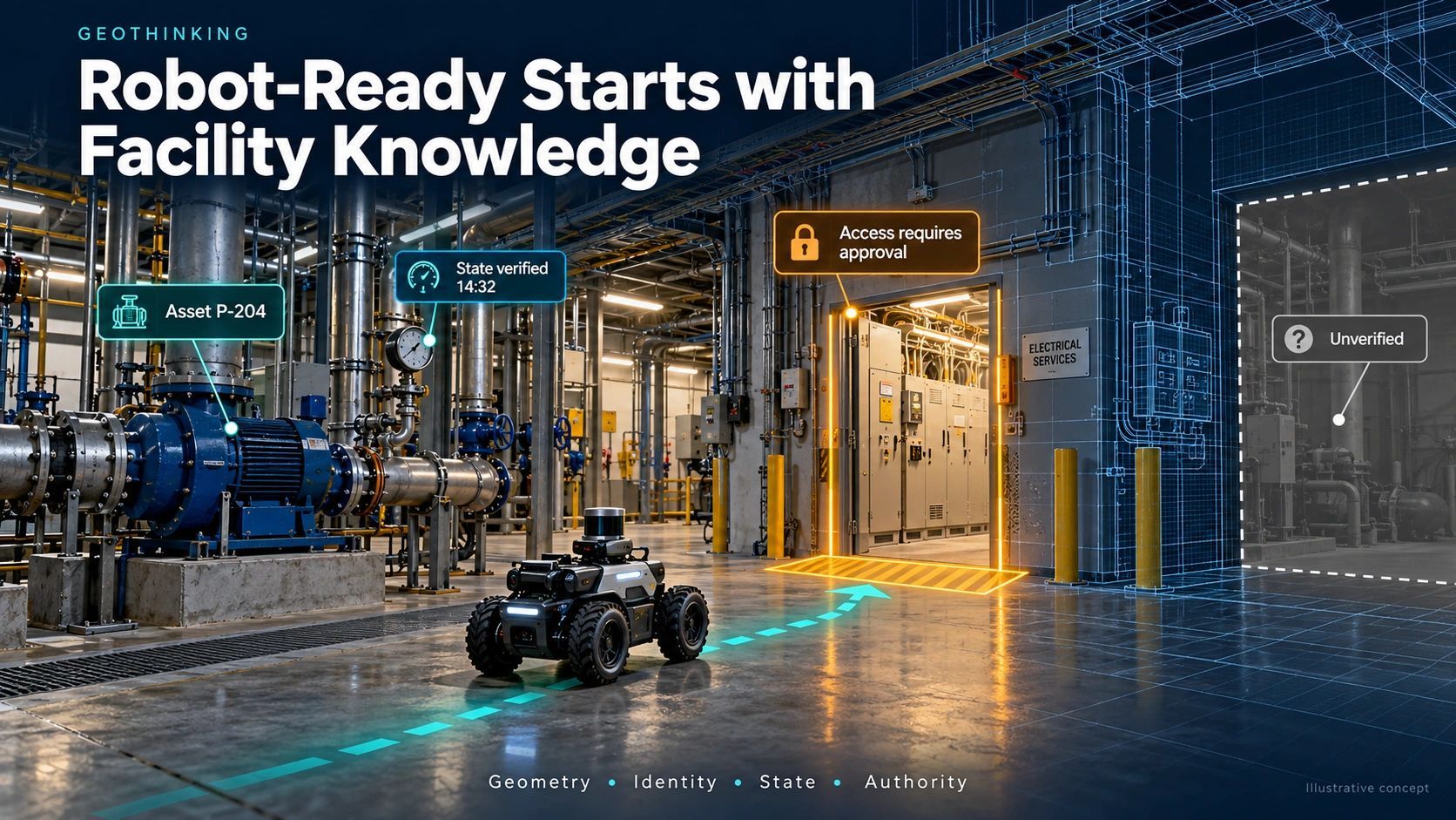
A robot may correctly identify a valve and still lack authority to operate it. An inspection system may enter one zone but be prohibited from another. A construction machine may work within an approved envelope but must stop when people enter the area or site conditions change.
This creates a crucial boundary between observation and action.
Physical AI should not infer operational authority merely because it recognizes an object or predicts an appropriate task. Permissions, safety constraints and escalation conditions should come from governed rules outside the model’s unrestricted discretion.
A trusted workflow might follow:
Observe → identify → check freshness → assess conditions → verify authority → act or escalate → record the outcome
This turns spatial context into a control and accountability mechanism, not simply a navigation aid.
Synthetic reality must remain distinguishable from observed reality
Physical systems will not experience every scenario an AI system needs to understand.
Autonomous inspection systems may need training for rare equipment failures. Cities may want to examine floods more severe than their historical records. Data centers may need to test simultaneous cooling, grid and equipment disruptions.
Synthetic data and simulations can help fill these gaps. But a spatial memory must distinguish among:
- Observed reality: captured by sensors, UAVs, scanners, cameras or field inspections.
- Modelled reality: calculated through physical or statistical simulations.
- Synthetic reality: artificially generated for training or scenario exploration.
These classes should never be mixed silently.
A machine trained on synthetic situations may perform effectively, but an operational decision must still disclose whether it is responding to current observation, a modelled condition or an artificial scenario. Provenance becomes part of safety and governance.
The commercial signal is becoming clearer
NavVis’s recently announced $85 million funding round is a useful market signal. The company intends to expand its large-scale spatial-data engine and accelerate its AI roadmap.
The significance goes beyond one reality-capture company.
Capital is beginning to recognize that reliable spatial data may become foundational infrastructure for machines operating in buildings, industrial facilities and construction environments.
The strongest opportunity for geospatial and BIM companies may not be to manufacture robots or compete with capture-hardware providers. It may be to make captured reality operational:
Capture systems observe the environment. A spatial context layer establishes what those observations mean. Governed workflows determine what happens next.
In more than 27 years of working with spatial information, I have repeatedly seen that producing the map or model is rarely the final difficulty. The harder task is maintaining its connection to changing ground conditions and to the decision someone, or something, is about to make.
Physical AI will make that gap impossible to ignore.
The machines entering our workplaces will need perception. But reliable perception without identity, history, freshness, authority and change records will remain incomplete.
The organizations that help AI understand continuously changing physical reality may become as important to Physical AI as databases became to enterprise software.