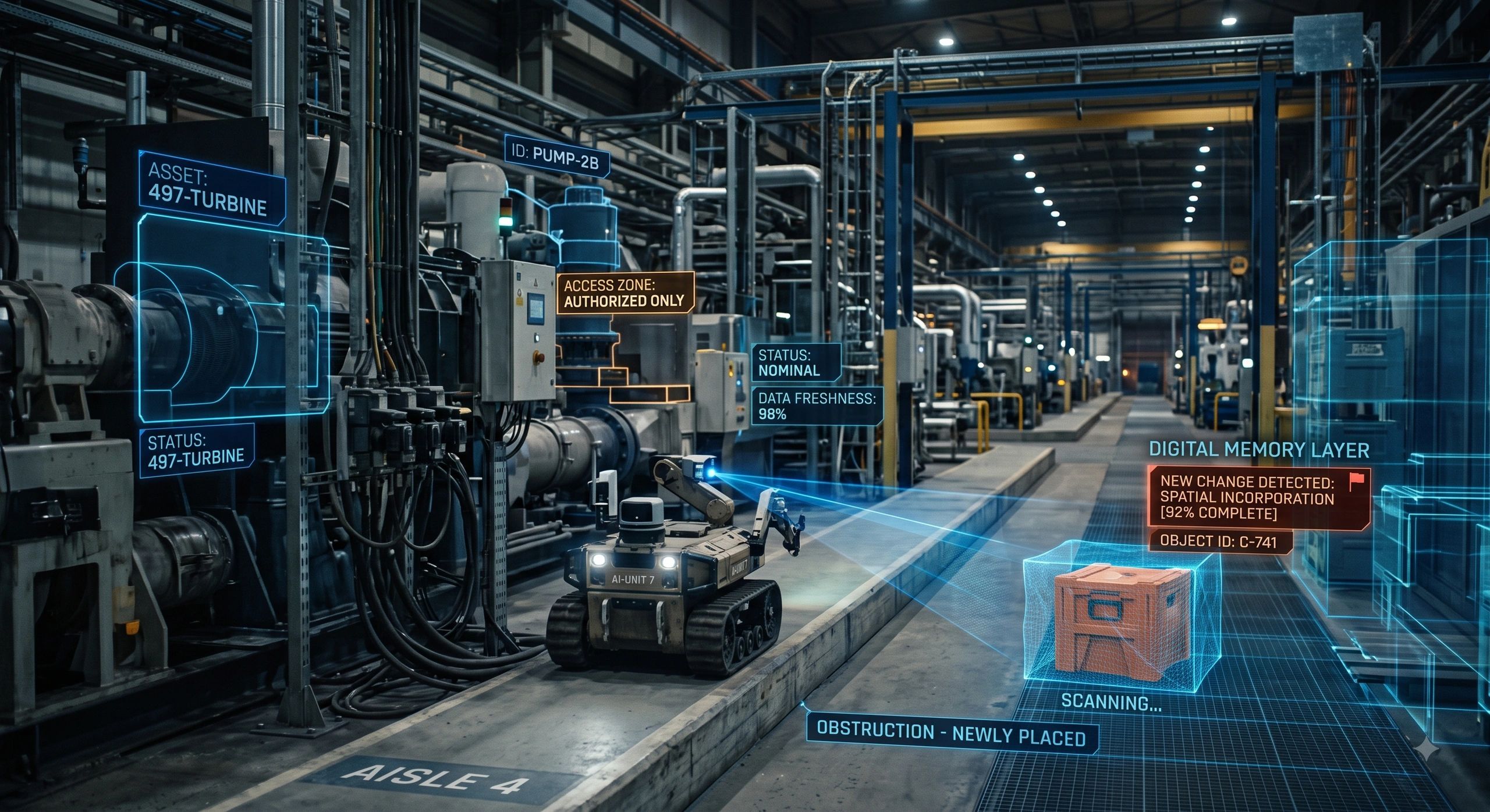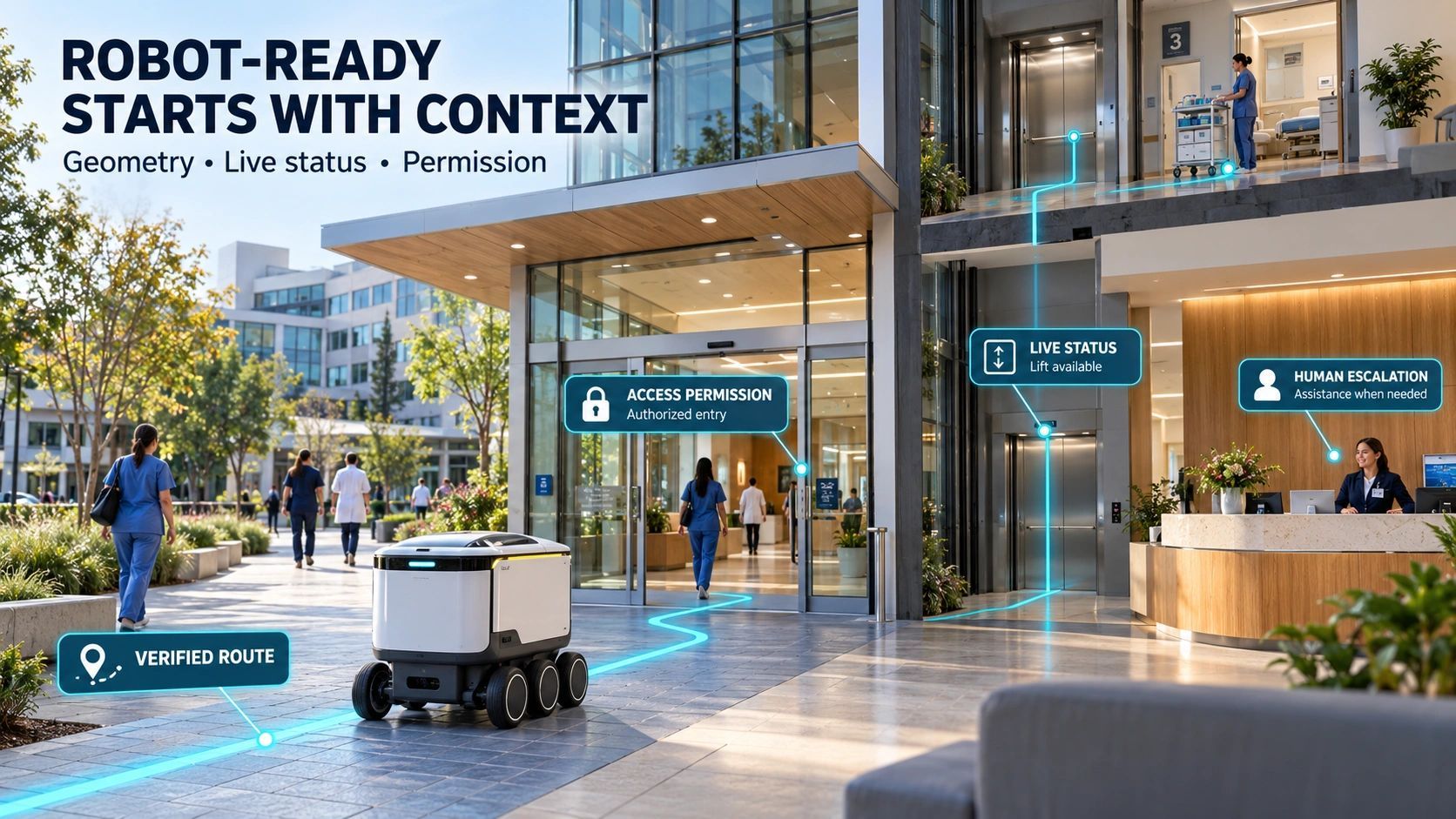
A facility can have a detailed BIM model, a recent laser scan and an operations dashboard and still leave a robot without the information it needs to complete a useful task.
The robot may locate a doorway. It may recognize a pump. But which pump is it? Is the room accessible today? Has the equipment changed since the last scan? Who authorizes the inspection?
For a facility owner, those gaps can become additional integration work, delayed commissioning and repeated manual intervention.
My view is that robot readiness will increasingly become a property of the facility’s information infrastructure. Buying capable hardware will be only one part of the decision.
Reality capture gains another customer
Hesai’s 14 October launch of Kosmo offers a useful signal. The company combines a spatial camera with a cloud platform to turn real environments into reusable 3D assets for robot training and world-model development. Its announcement describes synchronized LiDAR, imagery and inertial measurements, with outputs that include Gaussian splats, meshes and depth data.
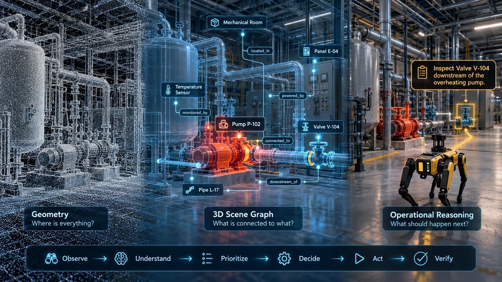
These representations serve different purposes. A visually convincing scene helps reproduce what a camera sees. Geometry supports spatial reasoning. Neither automatically supplies a facility’s asset identities or operating permissions.
The strategic implication extends beyond one product: reality capture is gaining machine users alongside human viewers.
That changes what we should ask of the resulting information.
A training environment and an operating environment have different duties
A captured space can help developers create simulated experiences. Deploying a robot in the corresponding facility introduces additional questions about current conditions, task authority and exceptions.
Hesai says its platform uses generative AI to fill unscanned areas. That makes the distinction between observed and generated content especially relevant.
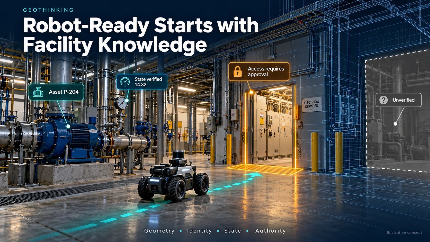
For an operational workflow, a reconstructed surface should retain its evidence status. An unobserved passage cannot become a verified route simply because software produces a plausible continuation.
I would require the information layer to distinguish measured, inferred and unknown conditions. The robot’s deployment process must then determine which evidence is sufficient for each task.
Visual completeness and operational confidence need separate acceptance criteria.
Follow one inspection task
Consider a hypothetical inspection robot assigned to photograph a gauge in an electrical services room.
The facility model shows a clear corridor and a doorway. The asset register lists the gauge. The maintenance system contains the inspection instruction.
Those records still need to agree on the same physical location and equipment instance.
The task also needs an authorized access window, a current route assessment and a defined response if entry is blocked. A room’s identity may remain stable while its contents, occupancy and access conditions change.
If the robot encounters an unrecognized panel or a closed route, the useful outcome may be to stop and request verification. Recording that exception is part of completing the workflow responsibly.
The resulting inspection image should return with the asset reference, capture time, task identity and relevant location context. Otherwise, someone must interpret and reconnect the evidence manually.
This is where spatial information becomes operational infrastructure.
Three questions for facility owners
I would organize a readiness assessment around three questions.
Can the machine locate and identify the task?
Check the coordinate framework, coverage, relevant clearances and relationship between physical labels and digital records. A label in BIM needs a maintained association with the installed asset. Replacements need their own history.
Can it establish the conditions for action?
Connect the task to relevant operational state, access rules and evidence age. Define what happens when a required sensor is unavailable or records disagree. Unknown conditions need an explicit response.
Can the organization verify the result?
Define the expected evidence, acceptance criteria, reviewer and escalation route. A robot reporting task completion should produce something the maintenance or operations team can assess and use.
These questions create a practical bridge between BIM, GIS, IoT and robotics without assuming that every facility needs the same technology stack.
Readiness belongs to a task and a place
Calling an entire factory “robot-ready” hides too much variation.
A warehouse aisle may support a supervised inventory mission while an adjacent loading area remains unsuitable. A utility building may support a scheduled visual inspection but lack the information needed for equipment manipulation.
I would therefore record readiness against a defined task, robot capability, operating zone and set of conditions.
A useful progression could move from digitally mapped, to asset-linked, to operationally connected, and finally to a verified machine workflow. This is a proposed assessment framework, rather than an industry certification.
Progress should depend on demonstrated capability. A comprehensive model cannot compensate for an unresolved access rule at the point where the task requires it.
Start with one bounded workflow
For owners exploring this direction, I would begin with one inspection route or inventory zone.
Document the current human workflow. Identify the spatial and operational information it relies on. Reconcile the relevant asset records, then test the proposed machine workflow with the robotics partner and facility team.
Measure mission completion, manual interventions, evidence matched to the correct asset, and time spent investigating exceptions. Include changed conditions in testing: a blocked route, a replaced asset or an unavailable state feed.
The pilot should expose the cost of maintaining readiness after commissioning. Layout changes and equipment replacements must trigger updates with clear ownership.
The commercial value lies in reducing repeated integration effort and making each task’s outcome easier to verify. Those benefits should be measured against the existing workflow.
The platform opportunity above capture
For BSMA Enterprises, I see an opportunity in assessing and connecting these information layers. In a proposed architecture, operational intelligence platform could associate captured environments with BIM/GIS asset context, operational state, evidence and permissions, then expose the relevant information through agreed interfaces.
That would require validation of connectors, data structures and robotics integrations for each use case. Robot control and deployment safety would remain responsibilities to resolve with the robotics provider and facility operator.
The larger opportunity is to make facility knowledge reusable across people, enterprise systems and authorized machines.
My position is that owners should begin specifying that knowledge layer in digital-twin and handover requirements today. Otherwise, each new autonomous workflow risks paying again to establish what the facility already ought to know.
For one inspection route in your facility, which would take longest to verify: the asset identity, the current conditions or the permission to act?