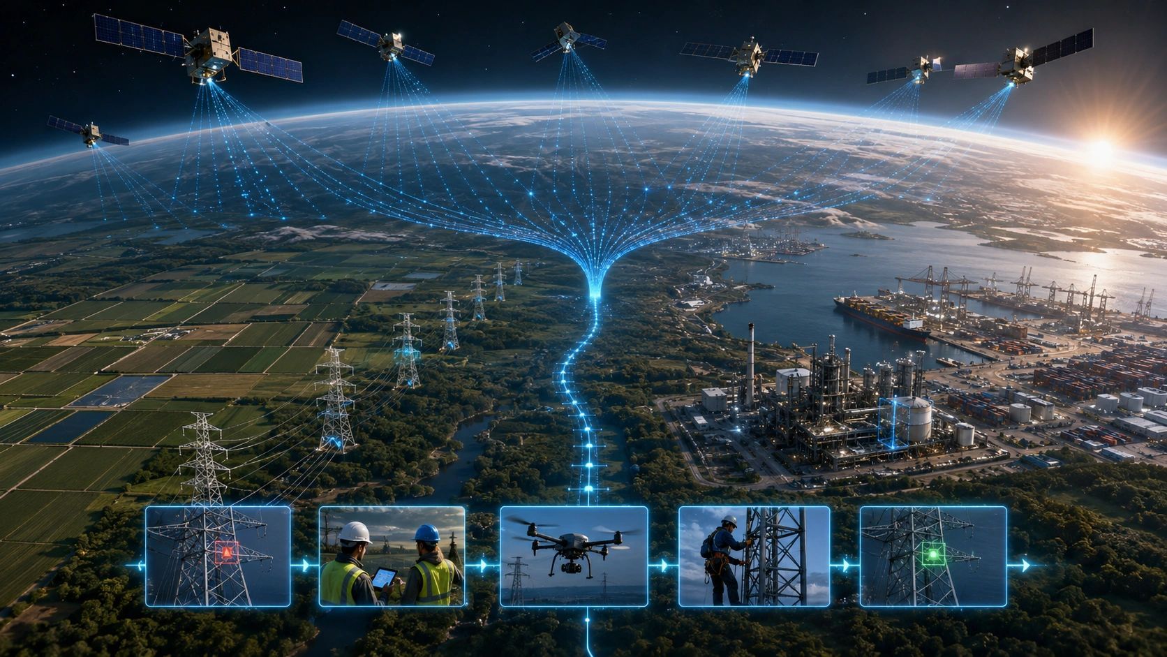
Earth observation is entering a multisensor phase.
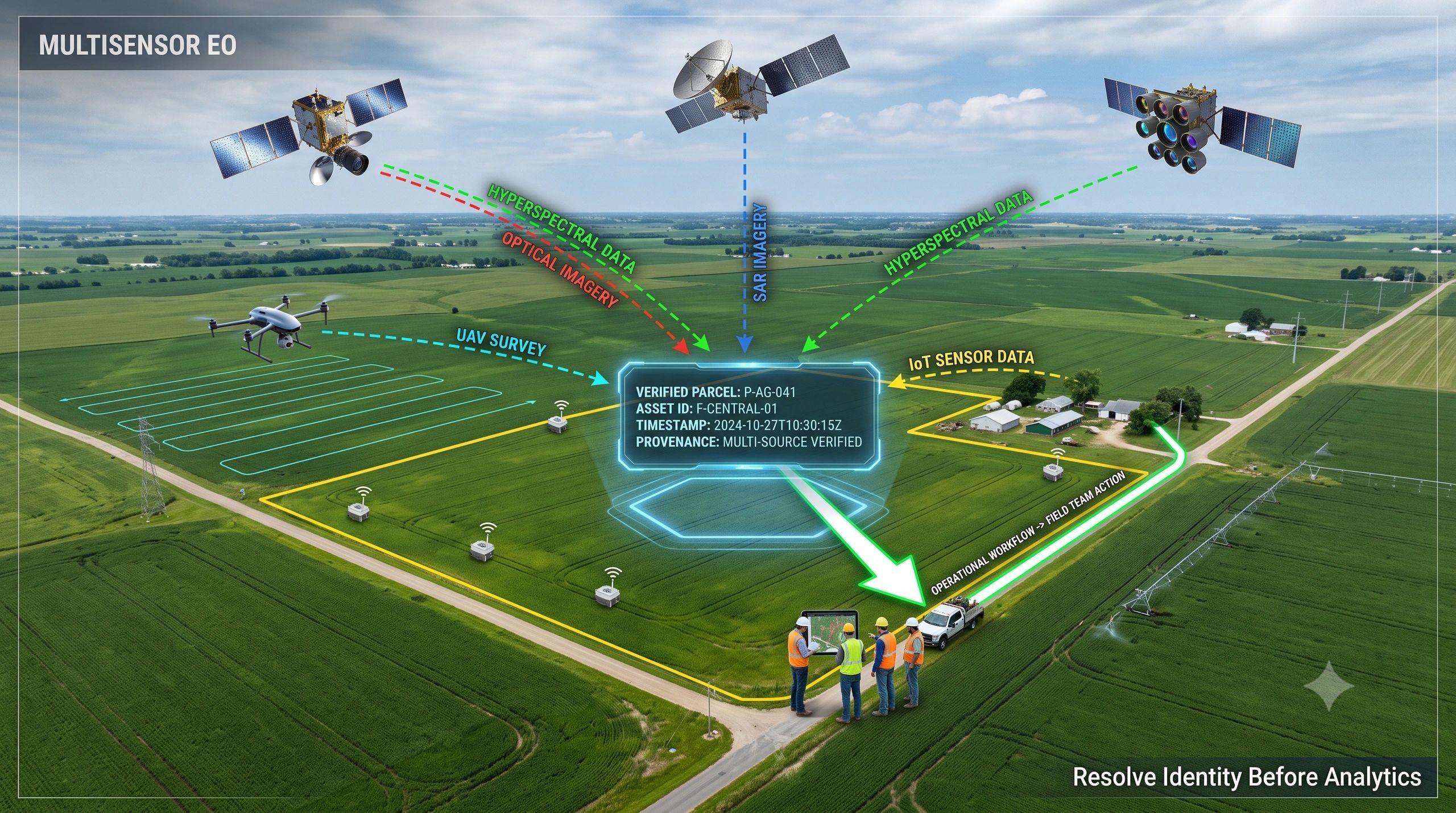
Hyperspectral imagery can detect material and vegetation properties. SAR can observe through clouds and darkness. High-resolution optical imagery provides visual detail. UAVs add local evidence. IoT sensors report conditions at specific points. Field teams contribute observations from the ground.
This should create better intelligence.
Yet adding more sensors can also create more versions of the same physical reality.
A stressed crop may appear as a spectral anomaly in one dataset, a moisture pattern in another, a temperature change in a third and a field complaint in a fourth. Each observation may be correct. The operational problem is determining whether they describe the same place, asset, condition and event.
That is why identity resolution may become more valuable than another analytics model.
The EO market is moving beyond single-sensor products
Pixxel’s reported $100 million Series C reflects a broader change in the Earth observation market.
The company is expanding beyond its Firefly hyperspectral constellation toward next-generation hyperspectral sensing, SAR, ultra-high-resolution optical imagery and the Aurora Earth-intelligence platform.
The strategic signal is larger than one funding round.
EO companies are moving from supplying imagery toward combining sensing, interpretation and decision-ready intelligence. The emerging architecture is no longer:
One sensor → one analysis.
It is increasingly:
Multiple sensors → fused evidence → operational decision.
The first part of that chain is advancing quickly. More satellites, better revisit rates and specialized analytics will detect more physical changes.
The difficult part comes afterwards.
Which observations belong together?
Data fusion does not automatically establish identity
Multisensor fusion is often treated as a technical alignment problem.
Correct the coordinates. Match the resolution. normalize the formats. Synchronize the timestamps. Then run the model.
These steps are necessary, but they do not fully resolve identity.
Consider an agricultural example.
A hyperspectral image indicates vegetation stress. SAR suggests a change in soil moisture. A UAV survey shows irregular crop growth. A weather dataset reports several days of heat. A field officer records a blocked irrigation channel.
Before combining these signals, the system must establish:
- Whether every observation refers to the same field boundary.
- Whether the boundary changed between surveys.
- Whether the crop is from the same planting cycle.
- Whether the observations occurred within a meaningful time window.
- Whether the detected patterns represent one event or several unrelated conditions.
- Which source, processing method and confidence level produced each finding.
Without those connections, an apparently sophisticated analysis can produce a weak recommendation.
The system may identify the correct symptom but associate it with the wrong farm, crop stage, irrigation asset or responsible team.
Four identities must remain connected
A useful multisensor EO architecture needs to resolve at least four forms of identity.
1. Entity identity
What physical entity is being observed?
It could be a farm parcel, building, transmission tower, road segment, waterbody, forest compartment or industrial asset.
Names and database identifiers are often inconsistent across agencies, systems and contractors. Geometry alone may not solve the problem because physical assets and administrative boundaries change over time.
2. Spatial identity
Where exactly is the observation valid?
Different sensors have different resolutions, coordinate systems, viewing geometries and uncertainty. A satellite pixel, UAV ortho-mosaic, IoT reading and field photograph do not describe space in the same way.
The system must preserve both location and spatial confidence.
3. Temporal identity
When was the observed condition true?
A cloud-free optical image from Monday, SAR acquisition from Wednesday and field inspection from Friday may support the same conclusion or describe a condition that evolved during the week.
A fused output must preserve observation time, processing time and the period for which the evidence remains operationally relevant.
4. Event identity
Do multiple signals represent the same physical change?
This may be the hardest layer.
A vegetation anomaly can result from water stress, disease, crop maturity, soil variation or processing error. The platform must determine whether observations reinforce one event, contradict each other or require further evidence.
The goal is not to force every signal into a single conclusion. It is to maintain a traceable relationship between evidence, interpretation and uncertainty.
Identity resolution changes the operational value of EO
An analytics model can say:
“Vegetation stress detected.”
An identity-aware operational system must answer:
Which farm?
Which field?
Which crop cycle?
What supporting evidence exists?
What is the likely cause?
Who is responsible for checking it?
What action is appropriate?
How will we confirm that the intervention worked?
This distinction applies far beyond agriculture.
For infrastructure monitoring, the same crack or deformation must remain connected across satellite observations, drone surveys, inspection records, BIM objects and maintenance systems.
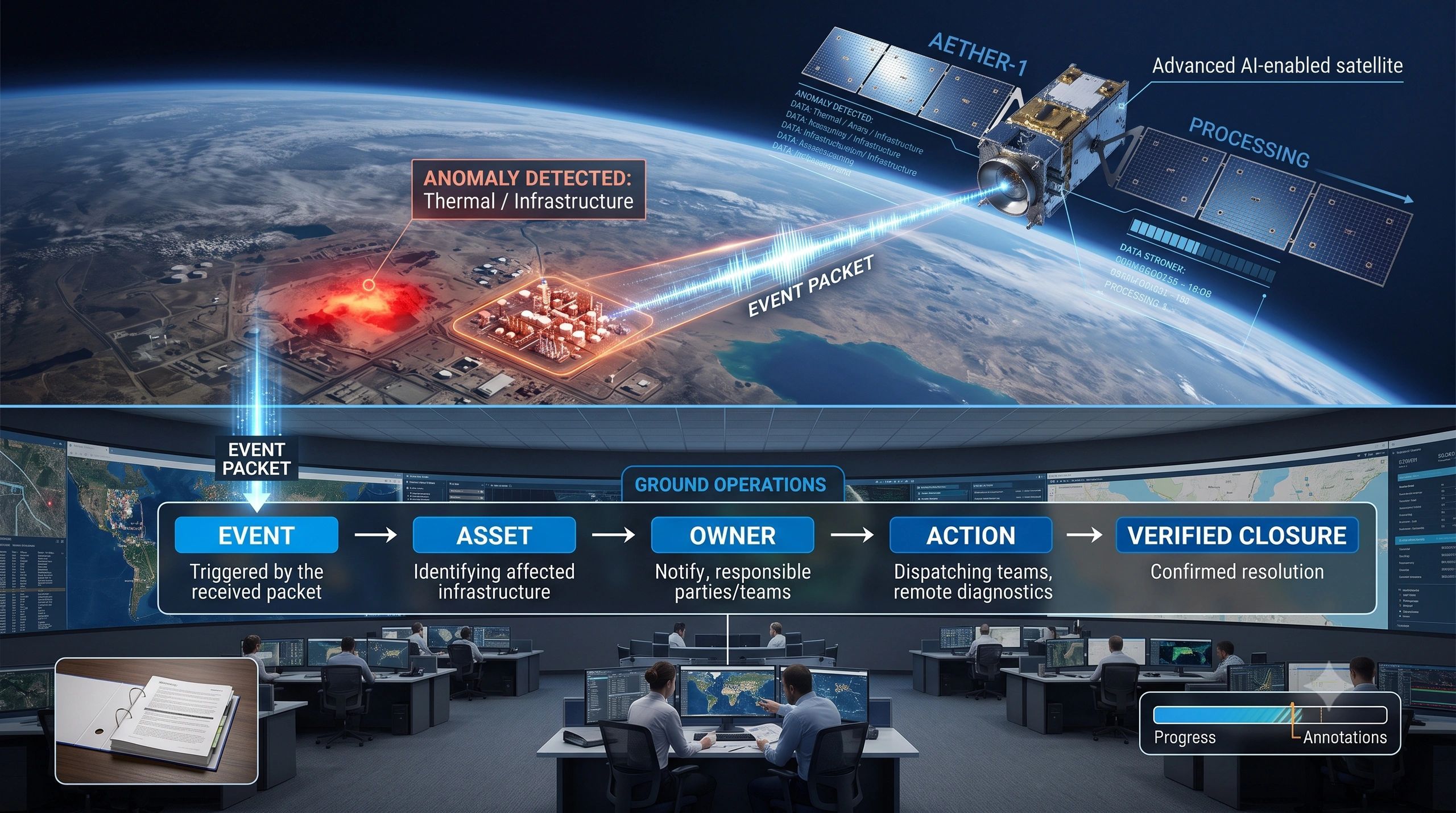
For wildfire intelligence, a detected hotspot must connect to the evolving fire event, affected settlements, air-quality observations, transport assets and response actions.
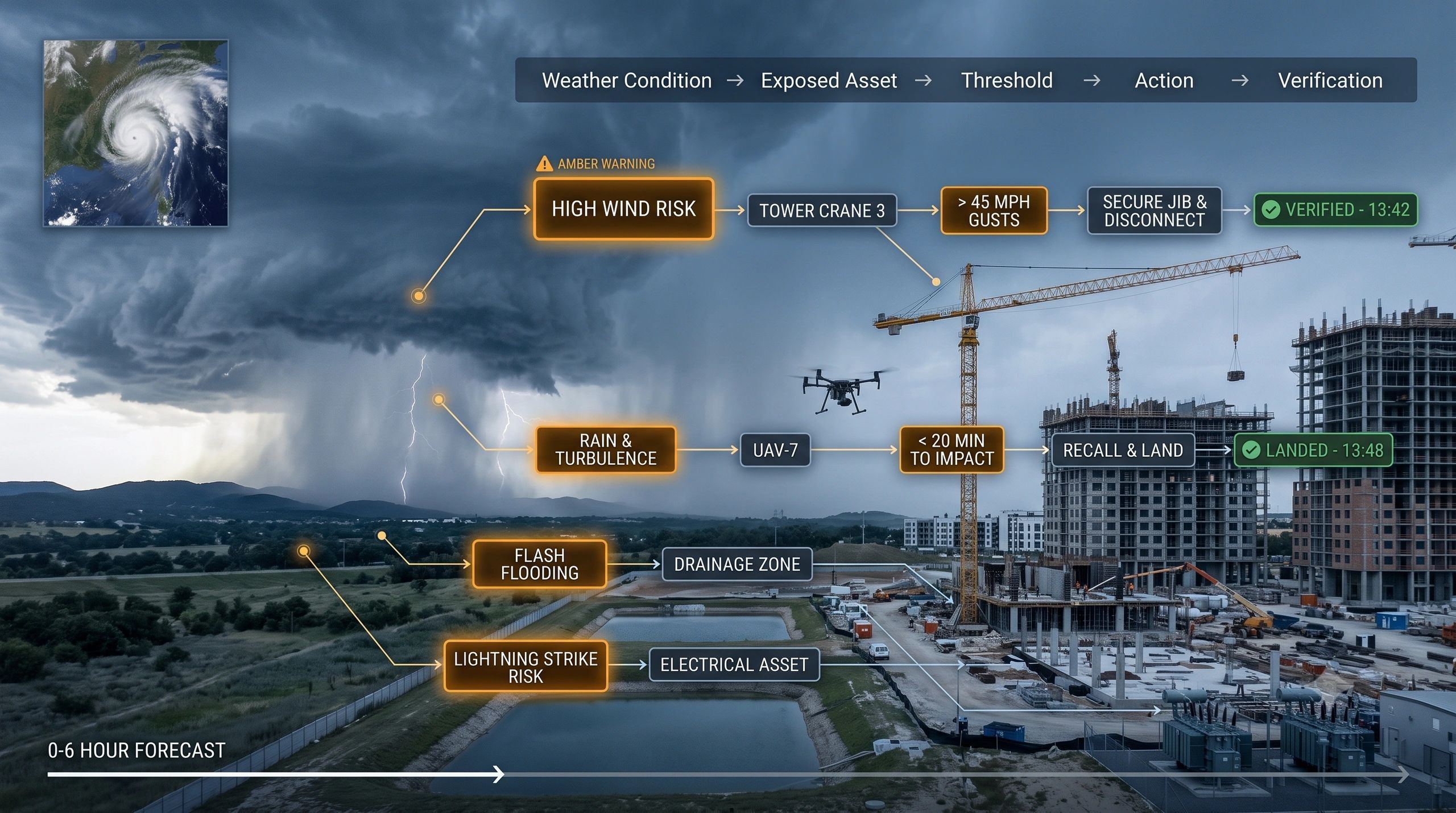
For urban flooding, predicted water extent must connect to actual roads, culverts, transformers, hospitals and vulnerable communities.
In each case, the value emerges when an observation becomes part of a persistent operational record.
The enterprise opportunity is in the final mile
EO providers will continue to improve sensors and specialized analytics. Enterprise platforms do not need to recreate those capabilities.
The more defensible role may be to manage the handoff from Earth intelligence into operations.
For our organization Dhineu, this suggests a clear division between the proposed S-MDIP layer and our NeuSpatial platform.
S-MDIP can manage multimodal ingestion, spatiotemporal alignment, identity resolution, provenance and evidence reconciliation.
NeuSpatial can connect that evidence to enterprise assets, business rules, responsibilities, interventions and verification.
A practical workflow could look like this:
Hyperspectral intelligence detects vegetation stress.
S-MDIP associates it with relevant SAR, UAV, weather, IoT and historical evidence.
NeuSpatial connects the finding to the farm, crop cycle, irrigation system, priority, field team and recommended action.
New observations then determine whether the intervention resolved the condition.
This is where multisensor intelligence becomes operational intelligence.
More observations increase the need for discipline
During my years in geospatial delivery, I have repeatedly seen that accurate datasets can still produce unreliable decisions when identity, time and context are inconsistent.
Multisensor EO magnifies this risk.
More sensors will detect more changes. More models will classify those changes. More alerts will enter enterprise systems.
But organizations will not benefit from receiving five technically valid descriptions of the same event under five different identifiers.
They need one traceable evidence chain that can preserve disagreement, update confidence and support action.
The next competitive advantage in Earth observation may therefore come less from producing another isolated analytical output and more from reliably answering:
What changed, where did it change, which real-world entity does it affect, and what should happen next?
As observation becomes abundant, trusted identity becomes scarce.
That scarcity will make identity resolution one of the most valuable layers in the multisensor EO stack.