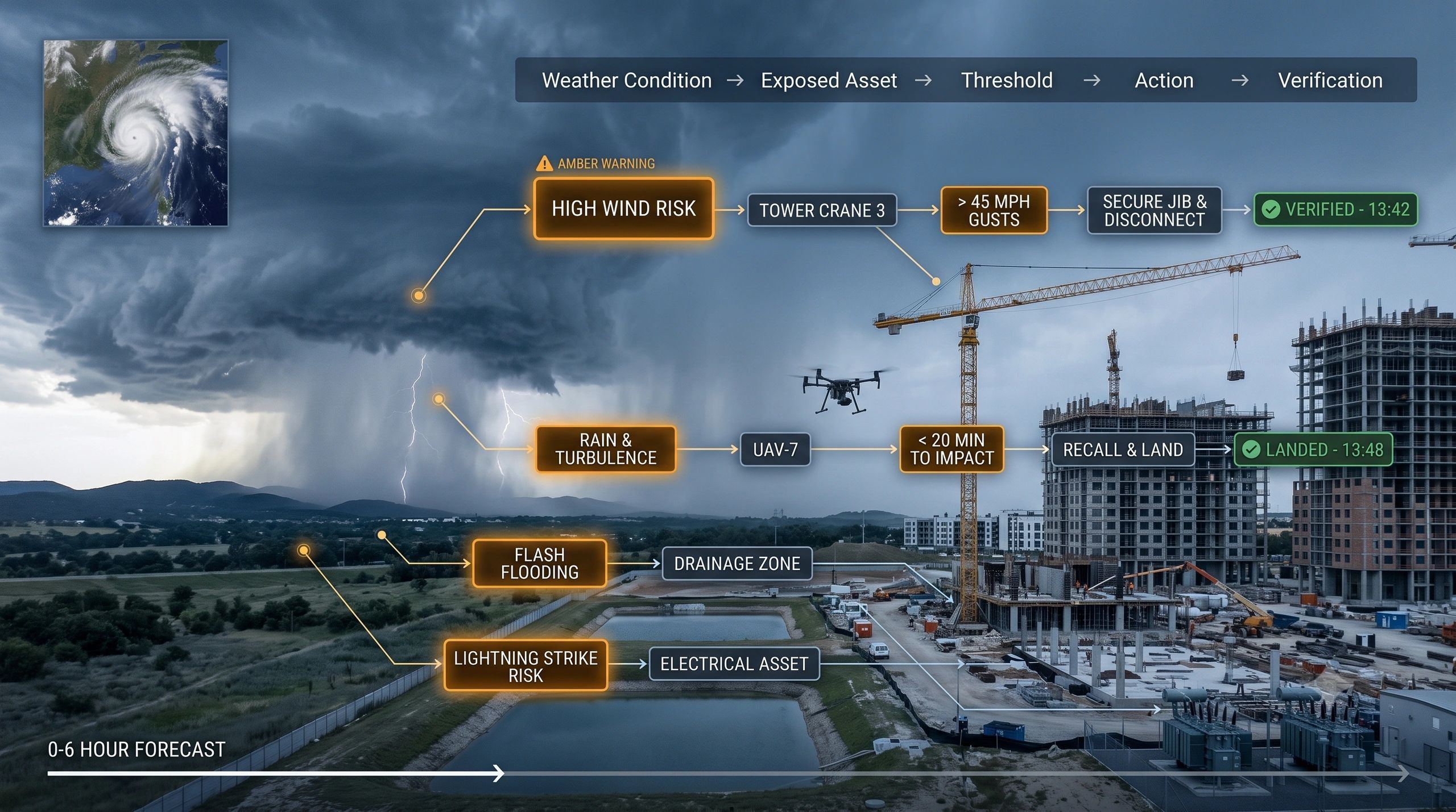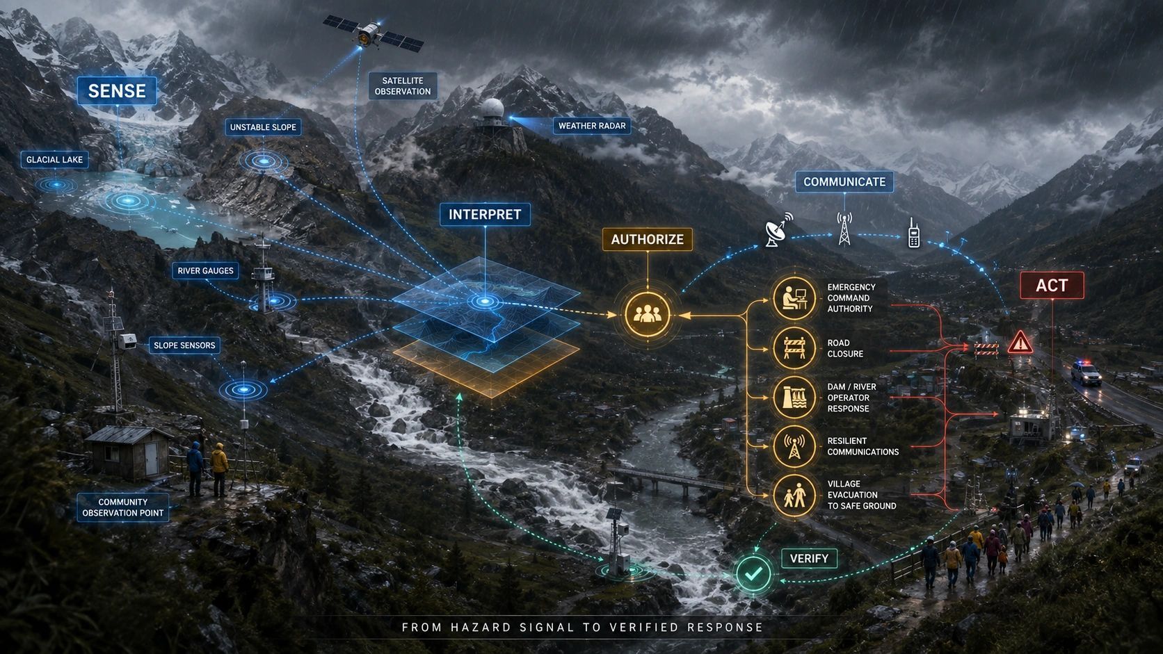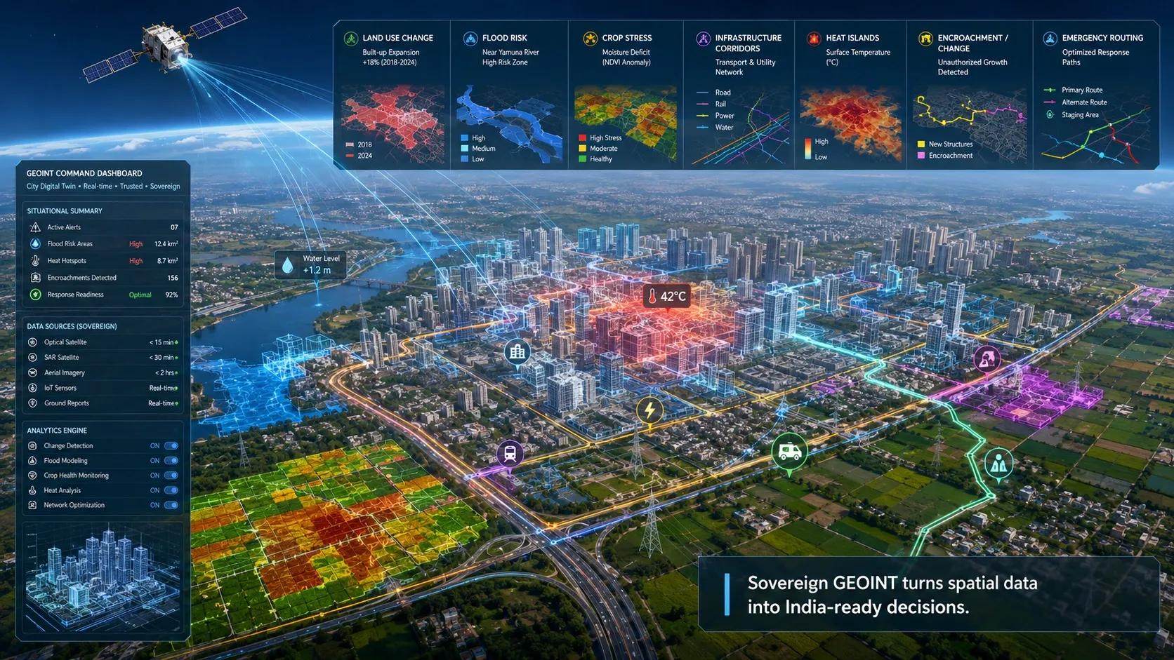
A satellite detects a change near a critical asset.
The alert reaches the dashboard. An email follows. Several people open it.
Who checks the site? Who decides whether operations should change? What evidence allows the issue to be closed?
This is where an Earth observation investment can lose its operational value.
As observation capacity grows, organizations can receive more frequent updates about the physical world. But if their capacity to assess, assign and resolve those updates stays unchanged, better visibility can create a growing backlog.
The constraint shifts from seeing the problem to handling it.
For infrastructure owners, utilities and public agencies, that means buying more intelligence also requires designing the work that follows.
The August 27 founder briefing prompted this question through its discussion of faster weather observations and downstream opportunities in the space ecosystem.
EUMETSAT describes a planned Meteosat Third Generation rapid scanning service covering the northern quarter of the Earth disc every 2.5 minutes. That illustrates how quickly the observation cycle is advancing. It does not mean every organization receiving the information can respond at that speed.
The operational question is how much of that additional information changes a decision while there is still time to act.
Consider an illustrative utility scenario.
A thermal anomaly appears near a transmission corridor. Another observation arrives later. A weather feed indicates conditions that could increase exposure, while a field photograph suggests activity nearby.
An organization could treat these as separate notifications, assigning each to a different reviewer.
Or it could assemble them into one evolving case: a possible hazard affecting a specific asset, with a named owner, an assessment deadline and a defined next step.
The difference lies in how the organization manages the evidence.
A detection also needs interpretation. NASA explains that a satellite hotspot represents a pixel containing a fire or another thermal anomaly; its reported position should not be treated as the exact location of a fire. That matters when deciding which asset or field team may be affected.
Detection confidence and operational priority answer different questions.
Confidence concerns the strength of the detection. Priority concerns the consequences, urgency and available response.
A strong detection far from exposed assets may need monitoring. A less certain observation close to critical infrastructure may justify prompt verification under an agreed procedure.
Routing every alert by confidence alone misses that distinction.
There is another complication: repeated observations do not necessarily represent new incidents.
Several providers may observe the same event. Successive images may show its progression. An algorithm update may revise an earlier interpretation.
If each update creates a fresh ticket, teams can duplicate work while the underlying situation remains unresolved.
A useful system should connect related observations without discarding their individual sources, timestamps or disagreements. New evidence should update the case and, where necessary, change its priority or reopen it.
I would structure this around three responsibilities.
1. Qualify the situation.
Establish what was observed, when it was observed, which geography it covers and which assets may be exposed.
Then assess whether it represents a new event, an update to an existing one, or something requiring further evidence.
Keep observation time separate from delivery time. Information received now may describe conditions from hours earlier.
Also record uncertainty and coverage limits. A missing detection may reflect observation conditions rather than the absence of a hazard.
2. Assign the decision.
Every actionable case needs an accountable owner, a response deadline and a permitted next step.
That step might be a desk review, a field inspection, a request for another observation or escalation to an authorized operational team.
“Sent to the department” is an incomplete assignment.
The workflow should specify who accepts responsibility and what happens if nobody does. It should also distinguish the person reviewing the evidence from the person authorized to change operations.
This is where geospatial intelligence must connect with maintenance, safety, work-order and field-service processes.
3. Verify the disposition.
An acknowledged notification is still an open operational question.
A case may be resolved because an intervention was completed and checked. It may be dismissed with supporting evidence, transferred to another responsible authority, or retained under monitoring.
Each outcome needs a reason and a record.
Closure should remain open to challenge when new evidence arrives. A later observation may show that the original interpretation was wrong or that the intervention did not achieve its purpose.
This makes resolution traceable without pretending that every alert requires physical action.
The workload implications are straightforward.
Suppose, purely as an illustration, a team receives 200 actionable cases daily but can resolve only 120. Its backlog grows by 80 cases a day.
Adding a better sensor will not fix that imbalance by itself.
The response may involve improving qualification, consolidating duplicates, changing priorities, adding field capacity or automating routine administration.
AI can help assemble evidence, suggest related cases and prepare summaries. Operational authority still needs explicit boundaries, particularly where a recommendation affects safety or service continuity.
The measures of success should therefore extend beyond alerts generated.
I would track:
- Time from observation to accountable ownership.
- High-priority cases overdue for a decision.
- Duplicate observations consolidated into existing cases.
- Cases closed with adequate evidence.
- Cases reopened because conditions changed or closure was premature.
These measures also need context. A falling backlog can look positive while difficult cases are being dismissed too easily. Closure speed should be assessed alongside evidence quality and unresolved risk.
For founders and platform builders, this creates a practical opportunity.
Start with one recurring decision: checking a suspected encroachment along a utility corridor, assessing flood exposure around operating assets, or verifying a reported environmental change.
Connect the observation to the asset, the responsible team, the decision rule and the evidence needed to resolve the case.
That gives a buyer something concrete to evaluate: whether the service reduces the time and effort required to reach a defensible outcome.
My position is that every proposal to expand monitoring should include a response-capacity plan.
More satellites can improve what we know. The enterprise must be ready to carry that knowledge through to a decision.