When a flood, landslide, wildfire, or industrial hazard causes severe damage, the first question is often:
Why was there no warning?
But in many cases, some warning signs existed.
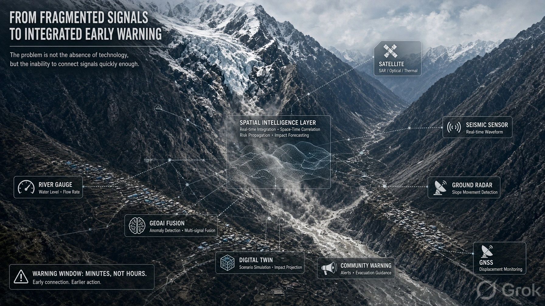
A satellite observed unusual surface change. Rain gauges recorded intense precipitation. River sensors showed rising water levels. Weather models indicated elevated risk. Local communities noticed changes before formal systems did.
The problem was not necessarily the absence of data.
The problem was that the available evidence did not move through a trusted decision process quickly enough to change what happened next.
This is the larger lesson emerging from the Nepal–Tibet flash-flood discussion. The future of early warning cannot be designed only as a larger network of sensors. It must be designed as a decision architecture.
Detection is only the beginning
Early-warning programmes often concentrate on improving observation:
- More weather stations
- More river gauges
- Higher-resolution satellite imagery
- Better radar coverage
- AI-supported forecasting
- Connected cameras and IoT sensors
- Community reporting applications
Each improves situational awareness. But none, by itself, determines whether a road will be closed, a village evacuated, a dam operated differently, a worksite suspended, or emergency resources repositioned.
That requires a sequence of decisions.
A sensor can indicate that something has changed. A model can estimate what might happen. An analyst can identify an anomaly. But someone must still determine whether the evidence is sufficient, which assets and communities are exposed, who has authority to act, and what action is proportionate to the uncertainty.
This is where many warning systems become fragile.
They are technically capable of observing hazards but institutionally weak at converting observations into action.
Prediction and anomaly detection are not the same
The discussion around the Nepal–Tibet event raised an important distinction.
Prediction asks:
What is likely to happen, where, and when?
Anomaly detection asks:
What is happening now that differs from the expected condition?
For complex hazards, exact prediction may remain difficult. Weather, terrain, glacial conditions, sediment, river morphology, infrastructure, and human activity interact through stochastic processes. No single model may represent all of them reliably.
But uncertainty in prediction does not mean that action must wait for certainty.
A practical warning system can also monitor for combinations of anomalies:
- Rainfall exceeding local thresholds
- Unexpected river-level acceleration
- Rapid changes in a glacial lake
- Ground movement near a vulnerable slope
- Loss of connectivity from upstream monitoring stations
- Sudden differences between satellite observations and hydrological models
- Community reports that contradict the official operating picture
The objective is not always to forecast the complete event perfectly.
It may be to detect that the system is leaving its expected operating range early enough to initiate verification, restrict activity, or prepare an evacuation.
What a decision architecture must contain
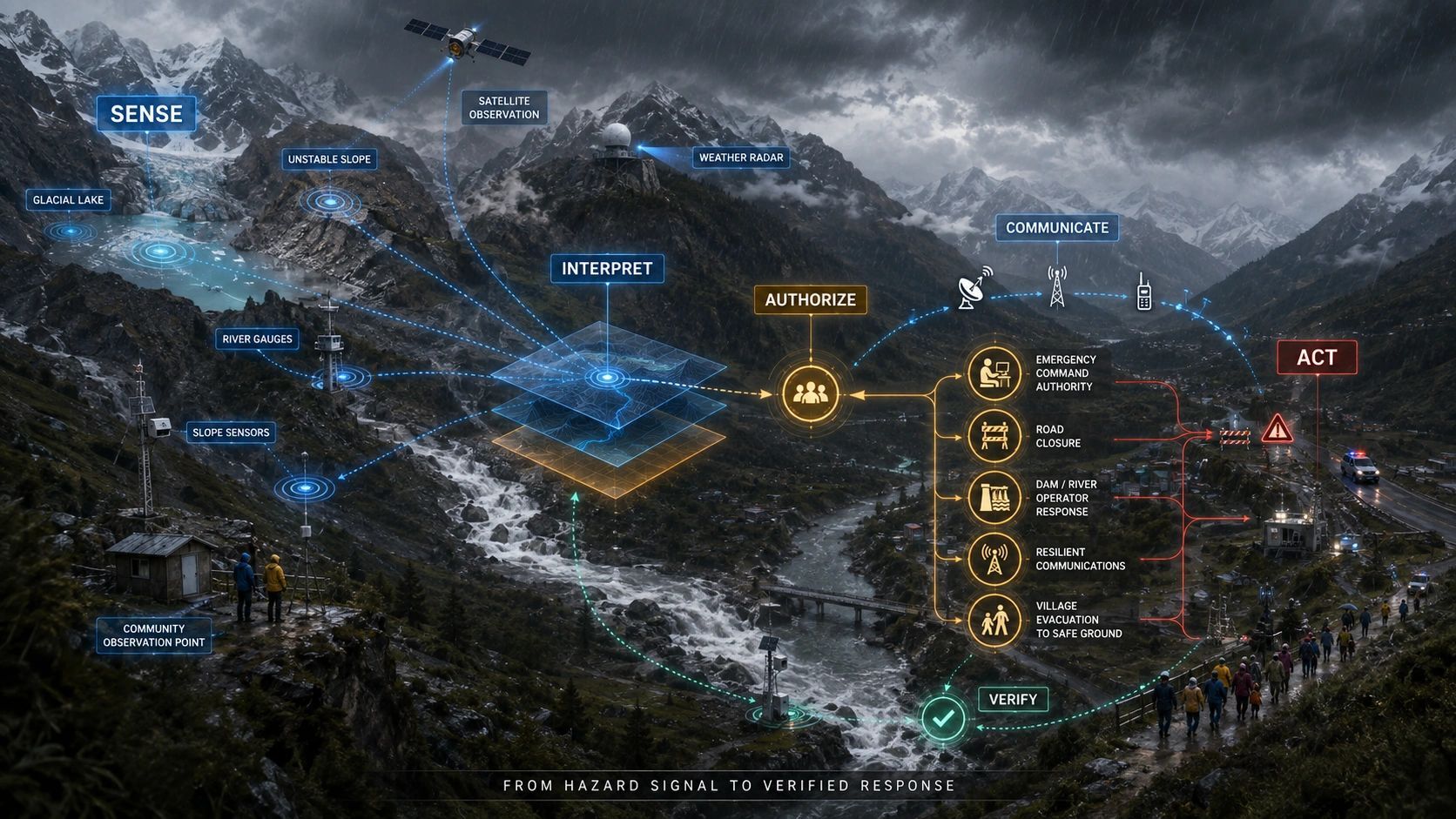
A decision-ready warning system needs at least six connected functions.
1. Observe
The system receives evidence from multiple sources: Earth observation, weather radar, gauges, seismic instruments, IoT devices, infrastructure systems, UAVs, telecommunications networks, and people on the ground.
No single source should be treated as the complete truth.
2. Interpret
Raw observations must be converted into a common operational picture.
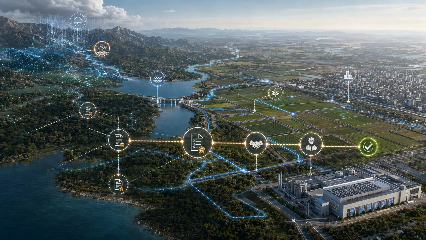
This requires spatial alignment, timestamps, provenance, uncertainty, and an understanding of what each sensor can and cannot establish. Platforms such as cloud-based geospatial processing environments can help combine data across institutional silos, but computational access alone does not resolve ownership or authority.
3. Assess consequences
A hazard signal becomes operationally meaningful only when connected to exposure.
Which villages, bridges, power assets, roads, construction sites, reservoirs, hospitals, or communication networks could be affected?
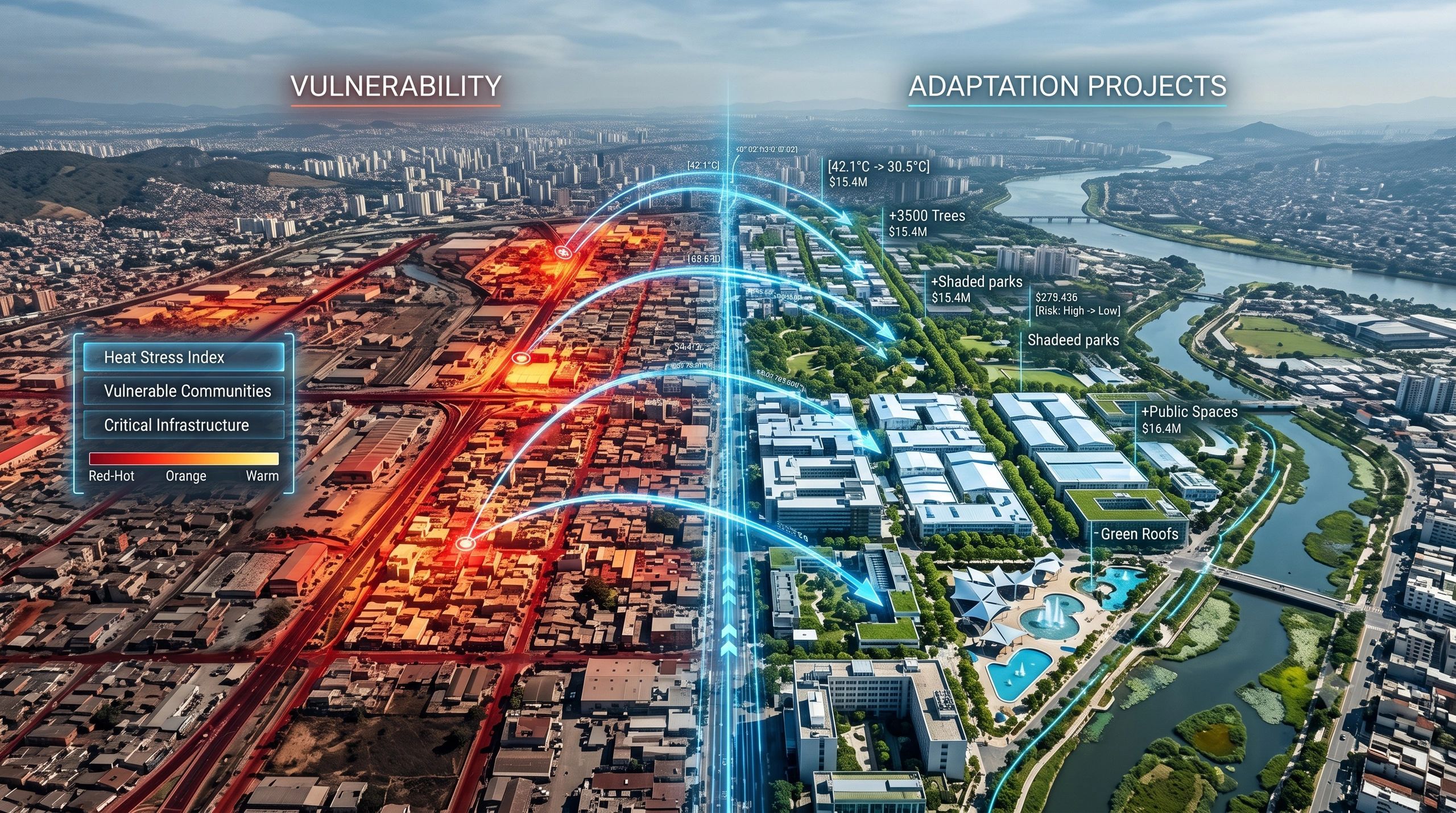
This is where GIS and digital twins become more than visualization tools. They connect the evolving hazard to assets, dependencies, population, accessibility, and possible cascading failures.
4. Decide
The system needs predefined rules for converting evidence into a response level.
For example:
- Monitor
- Request additional verification
- Issue an advisory
- Restrict access
- Pre-position resources
- Evacuate
- Escalate to regional or national authority
These rules should consider confidence, consequence, time available, and the cost of delayed action. A low-confidence signal associated with catastrophic consequences may justify precautionary action earlier than a high-confidence signal associated with limited exposure.
5. Communicate
A warning is not complete when it appears on a dashboard.
It must reach the people who can act, and those at risk, in a form they understand and through channels that remain available during disruption.
That may require combinations of cellular networks, satellite connectivity, radio, sirens, local officials, community volunteers, transport operators, and machine-to-machine alerts.
Connectivity must therefore be treated as part of the safety system, with redundancy designed in advance.
6. Verify and learn
The system must confirm whether the warning was received, whether the intended action occurred, and whether conditions subsequently changed.
After the event, the full chain should be auditable:
- What was observed?
- When was it observed?
- What confidence was assigned?
- Who received the information?
- Who had authority to decide?
- What action was taken?
- What caused delay or disagreement?
- Did the intervention reduce exposure?
Without this feedback loop, early-warning systems repeat institutional failures even while their technology improves.
Cross-border hazards expose governance gaps
Floods, storms, wildfires, river systems, and atmospheric events do not respect administrative boundaries.
The upstream observation may belong to one institution or country. The exposed population may be elsewhere. Satellite data may be global, while local evacuation authority remains municipal. Telecommunications infrastructure may be operated by private companies. Roads, dams, power systems, and emergency services may have different command structures.
This creates a difficult question:
Who is responsible for acting on evidence that originates outside their jurisdiction?
A decision architecture must define data-sharing agreements, escalation protocols, alert thresholds, authority, and accountability before an emergency begins. Trying to negotiate these relationships during the event consumes the limited time that the warning was supposed to create.
The human layer cannot be designed last
Even a technically accurate warning can fail if operators do not trust it, understand it, or know what they are permitted to do with it.
Models should therefore communicate more than a red, amber, or green status. Decision-makers need to understand:
- What changed
- Which evidence supports the alert
- How uncertain the assessment is
- What may be affected
- How quickly the situation is evolving
- What action is recommended
- What would justify escalation or withdrawal
This is not about removing human judgement.
It is about giving human judgement a clearer operating structure under uncertainty.
The next investment priority
The next generation of early-warning systems will certainly need better sensing, faster models, resilient connectivity, and improved spatial intelligence.
But the investment case should not stop at detection performance.
It should measure the complete decision chain:
Time to detect. Time to interpret. Time to authorize. Time to communicate. Time to act. Time to verify.
A system that detects a hazard five minutes earlier but takes twenty minutes to establish authority has not created a five-minute advantage.
A system that produces a highly accurate alert but cannot reach the affected community has not completed its function.
And a system that warns people without connecting the warning to a defined action transfers uncertainty to those least equipped to manage it.
The central design question is therefore changing.
It is no longer only:
Can we detect the hazard earlier?
It is:
Can we convert uncertain, distributed evidence into a timely, proportionate, and accountable decision?
That is the difference between a sensor network and an early-warning system.