A corridor can be surveyed with high accuracy and still be managed with weak operational evidence. The problem is rarely the absence of data. It is that survey records, asset registers, inspection findings, risk alerts, work orders and completion evidence often describe the same physical corridor in different ways.
That fragmentation becomes expensive when a decision crosses departmental boundaries. A maintenance team may know that a culvert is deteriorating. A risk team may know that intense rainfall is approaching. A survey team may hold the latest geometry. Yet the operator may still struggle to answer a basic question: which segment is exposed, what action is required, who is responsible and what proves the work was completed?
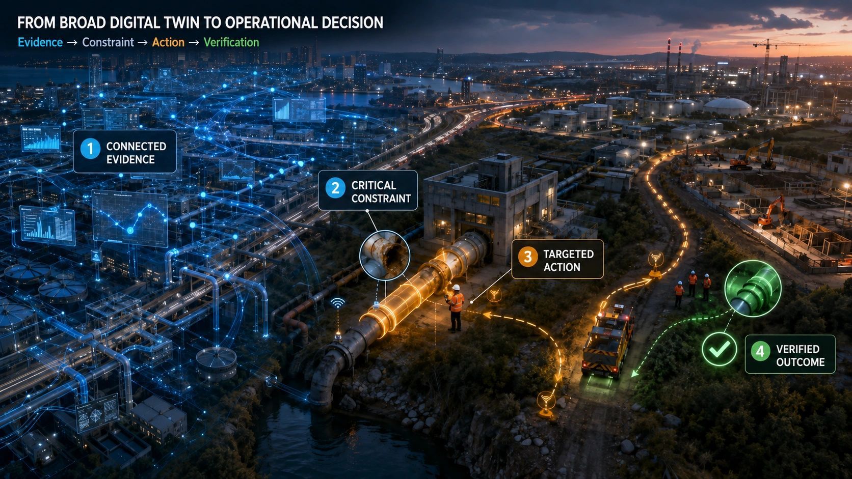
The next step in corridor intelligence is therefore not another standalone dashboard. It is one operational evidence model that preserves identity, location, time, provenance and responsibility from observation through verified action.
A corridor is not one asset
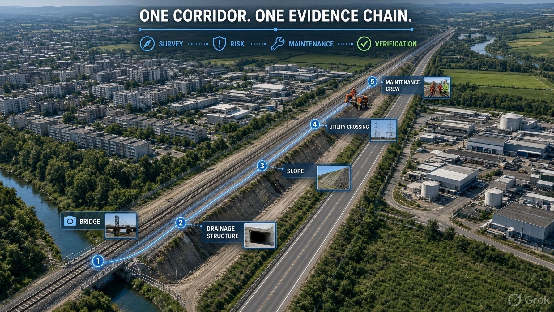
Railways, highways, transmission lines, pipelines and canals are often managed as linear assets. Operationally, however, each is a connected system of segments, structures, crossings, utilities, land parcels, drainage elements, access points and surrounding hazards.
A 300-kilometre corridor may pass through different terrain, contractors, administrative areas and maintenance regimes. Conditions also change continuously. Vegetation grows, slopes move, drainage is blocked, traffic loads shift, encroachments appear and extreme weather alters risk.
This is why a corridor cannot be represented adequately by a centerline and an asset inventory. It needs a shared model that connects every observation and intervention to a persistent spatial identity.
The failure usually occurs between systems
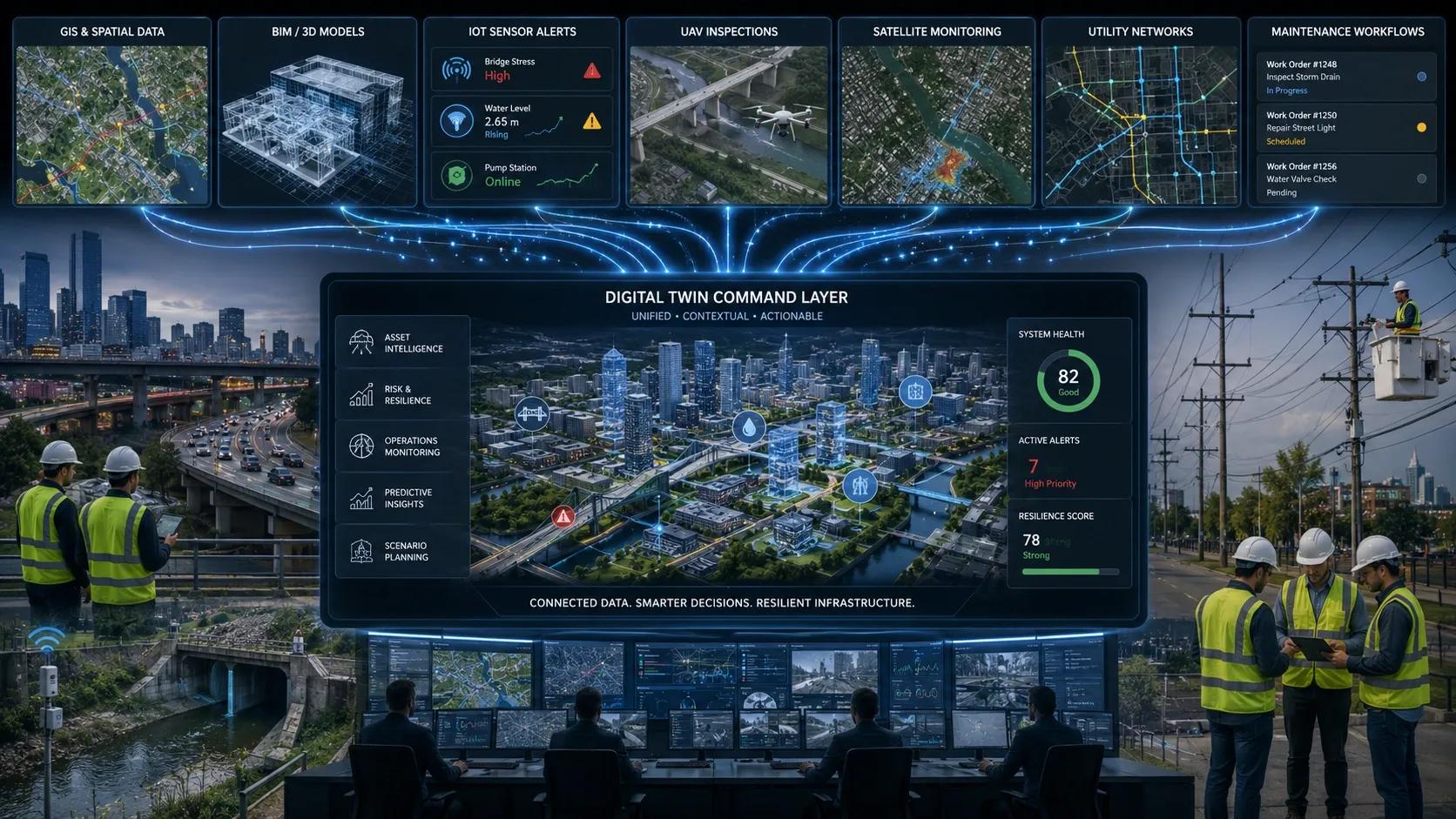
Survey teams typically work with coordinates, chainage, point clouds, imagery and drawings. Maintenance teams work with asset IDs, defects, priorities, crews and work orders. Risk teams work with hazards, exposure, vulnerability and forecast conditions. These are all valid views, but they often lack a common operational key.
The result is familiar: an inspection identifies a defect, but the work order references a different asset code; a flood alert intersects a corridor segment, but the responsible team cannot see the affected drainage assets; a contractor uploads completion photographs, but they cannot be reliably linked to the original finding or the correct location.
Every handoff introduces a chance of losing context. The operational risk is not simply inaccurate data. It is evidence that cannot be connected quickly enough to support a decision.
What one operational evidence model should preserve
A reusable corridor model can begin with a simple hierarchy: corridor, segment, physical asset, observation, condition, risk, intervention and verification. Each layer should retain the same underlying identity and location logic.
Evidence layer - Core question - Typical inputs
Identity - What exactly is being described? - Corridor, segment, asset ID, chainage, geometry
Observation - What was seen, when and by whom? - Survey, UAV, EO, IoT, inspection, imagery
Condition and risk - What does the evidence mean now? - Defect, severity, exposure, confidence, forecast
Intervention - What action was authorized and executed? - Work order, contractor, method, date, restriction
Verification - What proves the outcome? - Post-work survey, photo, sensor change, acceptance record
The value comes from continuity. A risk alert should resolve to the same segment and assets used in the inspection record. The maintenance action should inherit the evidence that justified it. Verification should close the same event rather than create an unrelated record.
Multimodal data becomes useful when it changes work
Corridors are well suited to multimodal monitoring. Mobile mapping can establish geometry and condition. UAVs can inspect structures and inaccessible areas. Earth observation can reveal change, subsidence, flooding or encroachment. IoT sensors can monitor vibration, flow, pressure or movement. BIM and engineering models can add design intent and component detail.
But more sensing does not automatically create better operations. The evidence must answer an operational question.
Is the event new?
Which asset is affected?
Has the risk crossed a threshold?
Is field verification required?
Does an operating restriction apply?
Has the intervention reduced the risk?
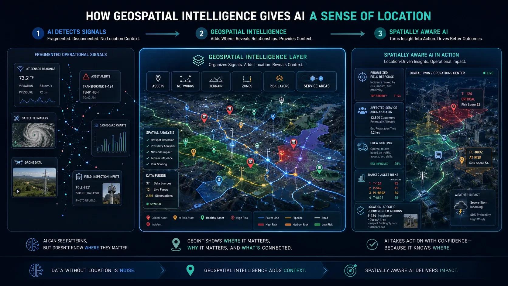
This is where GeoAI and digital twins should add value. Their role is not only to visualize layers or detect anomalies. They should connect evidence to dependency, responsibility and the next permitted action.
Risk must connect to the maintenance cycle
Many risk systems stop at exposure maps or alerts. Many maintenance systems begin only after a defect is entered. The gap between them is where preventable failures can persist.
Consider a drainage structure beside a highway. A forecast indicates intense rainfall. Recent imagery suggests obstruction. The asset register identifies the culvert, while inspection history shows repeated blockage. A unified evidence model can raise the priority, assign an inspection, record clearance work and verify flow after the event.
Without that chain, each dataset may be correct and the corridor may still remain exposed. Operational intelligence is created when changing external risk modifies internal work in a traceable way.
A reusable architecture is better than separate twins
Rail, roads, transmission lines, pipelines and canals have different engineering rules, but they share a large part of the same information architecture. Each needs segmentation, asset identity, inspection evidence, condition history, external risk, work execution and closure.
That suggests a better product strategy: build a corridor intelligence core, then configure domain-specific rules and workflows. A transmission corridor may focus on vegetation clearance and tower access. A pipeline may prioritize pressure anomalies and third-party activity. A canal may track embankment condition and water flow. The evidence pattern remains recognizable.
For organizations entering this space, a services-led approach is practical: start with a multimodal corridor survey, align the evidence with existing asset and maintenance systems, then introduce operational-twin capabilities where they improve decisions. The platform should follow a verified workflow need, not precede it.
The governance requirement is as important as the technology
A shared model must also preserve authority.
Who can declare a defect?
Who can change the risk state?
What confidence is sufficient to trigger field action?
Which contractor evidence is acceptable?
Who closes the event?
These controls matter because corridor data increasingly influences safety, payment, compliance and service continuity. A convincing map is not enough. The operator must be able to reconstruct what was known, which rule applied, who acted and what evidence supported closure.
From corridor visibility to corridor accountability
The strongest corridor systems will not be judged by how many layers they display. They will be judged by whether they reduce the time between a credible signal and a verified intervention.
That requires one evidence model across survey, maintenance and risk. Survey establishes what exists and what changed. Risk adds context and urgency. Maintenance turns evidence into accountable work. Verification proves the outcome.
When these functions share identity, time and provenance, the corridor becomes more than observable. It becomes governable and that is where geospatial intelligence begins to create measurable operational value.