For years, digital twins have been presented as comprehensive digital replicas of physical assets.
The ambition was understandable: connect every model, sensor, document, system and operational record into one digital environment.
But many organizations discovered a practical problem.
The broader the twin became, the harder it was to define the decision it was supposed to improve.
A technically impressive twin could visualize an entire facility, city or infrastructure network yet still leave operators asking:
What should we do next?
The strongest digital-twin implementations are beginning to answer that question differently. They are becoming narrower in scope, clearer in purpose and more closely connected to operational action.
This is not a reduction in ambition. It is a shift from modelling everything to resolving something specific.
The operational problem should define the twin
Bentley’s 2026 Year in Infrastructure finalists offer a useful signal.
Among 36 finalists selected from more than 300 submissions across 53 countries, 24 reported using AI in some form. Twenty-two showed strong or supporting evidence of a connected digital foundation.
But the important point is not simply that AI and digital twins are becoming mainstream.
It is what the projects are using them to do.
The examples include:
- operating a 14,000-kilometre water network;
- predicting landslide risks;
- inspecting infrastructure through drones;
- connecting construction delivery with field reality;
- managing a campus through a smart-operations twin;
- planning stormwater drainage for Delhi.
These are not generic “digital transformation” exercises.
Each one is organized around a defined operational problem: inspection, flooding, network performance, construction coordination, geological uncertainty or asset operation.
That distinction matters.
A twin becomes useful when its boundary is set by a decision not merely by the physical boundary of the asset.
Narrow does not mean technically simple
Consider an urban flood twin.
Its objective does not need to be “create a complete digital replica of the city.”
A more useful objective might be:
Predict which roads, buildings and utilities will be affected by a rainfall event and identify the intervention required.
That narrower objective still requires several connected information layers:
- terrain and elevation;
- rainfall observations and forecasts;
- catchment behavior;
- drainage capacity;
- roads, buildings and utilities;
- field conditions;
- asset ownership;
- departmental responsibilities;
- emergency-response resources.
The system may be technically complex, but its operational purpose remains clear.
Rainfall becomes catchment response. Catchment response becomes predicted inundation. Inundation becomes asset exposure. Exposure becomes an assigned action.
A stronger version goes one step further: it measures whether the intervention worked.
After a drain is cleaned, a pump installed or a detention structure constructed, did flooding decline? Under what rainfall intensity? For how long?
The twin then moves beyond visualization and prediction. It begins building operational evidence.
Critical infrastructure needs transition-state twins
The same principle applies to water-treatment plants, substations, airports, hospitals, industrial facilities and operational data centers.
These assets often cannot be shut down while they are expanded or modernized.
A conventional project model commonly represents:
existing condition → planned modification → completed condition.
But live infrastructure moves through more complicated states:
existing operation → temporary configuration → construction → commissioning → transition → final operation.
Risk frequently sits in those temporary states.
Which part of the network is isolated? What service area is affected? Is a temporary bypass carrying the required capacity? Which dependencies must be verified before commissioning? Can the asset be returned safely to normal operation?
A narrow transition twin can focus specifically on maintaining service continuity while work proceeds.
Its value does not come from representing every detail of the facility. It comes from making the consequences of each temporary change visible before that change is made.
Construction robotics reveals the same requirement
As autonomous equipment enters construction sites, digital twins face an even stricter operational test.
A human can sometimes interpret an outdated drawing, recognize an undocumented obstacle or question a coordinate mismatch.
A machine cannot safely rely on that level of informal interpretation.
It needs current terrain, reliable coordinate systems, machine-readable work instructions, underground-service information, permitted operating zones and explicit tolerances.
This creates a narrow but high-value role for the twin:
design intent → current site reality → machine task → operating boundary → executed work → tolerance verification → updated state.
The objective is not to reproduce the entire construction project. It is to maintain a trustworthy operational bridge between the design, the changing site and the machine’s next action.
This is why construction robotics may have a data-readiness problem before it has a robot-capability problem.
A practical way to define a digital twin
In my experience across geospatial and infrastructure workflows, twin discussions often begin too early with platforms, models and integrations.
A better starting question is:
Which infrastructure decision must become faster, safer or more defensible?
That question can lead to four reusable operational patterns:
Inspect → Decide → Repair
For roads, bridges, ports, utilities and industrial assets.
The twin connects observations to defects, priorities, work orders and repair verification.
Design → Build → Verify
For construction and infrastructure delivery.
The twin connects design intent to site progress, deviations, acceptance criteria and as-built evidence.
Monitor → Predict → Intervene
For flooding, water networks, asset health, environmental risk and operational facilities.
The twin identifies an emerging condition, estimates its consequence and supports a timely response.
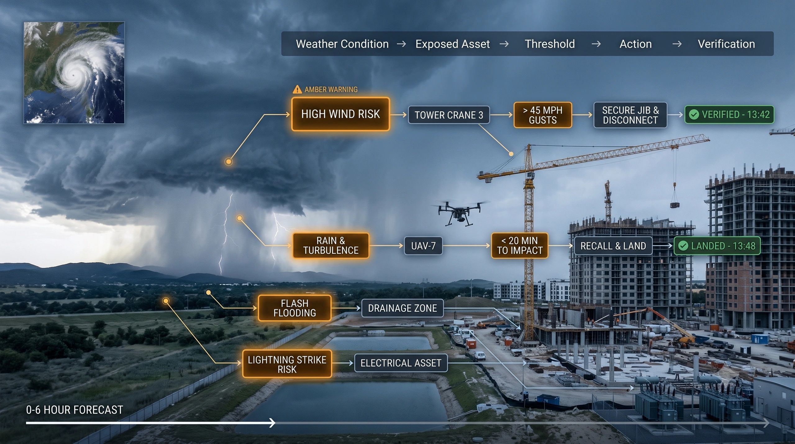
Event → Impact → Response → Recovery
For disasters, service failures, extreme weather and operational disruptions.
The twin connects the event to exposed assets, responsible parties, response actions and recovery evidence.
Each pattern may combine GIS, BIM, IoT, Earth observation, reality capture and AI. But technology is assembled around the workflow, rather than the workflow being forced into a broad technology platform.
Governance becomes easier when purpose is explicit
Narrower operational scope also improves governance.
When the decision is clear, teams can define:
- which data is authoritative;
- how current it must be;
- what uncertainty is acceptable;
- who owns each intervention;
- when human approval is mandatory;
- what evidence confirms completion;
- how the twin is updated afterward.
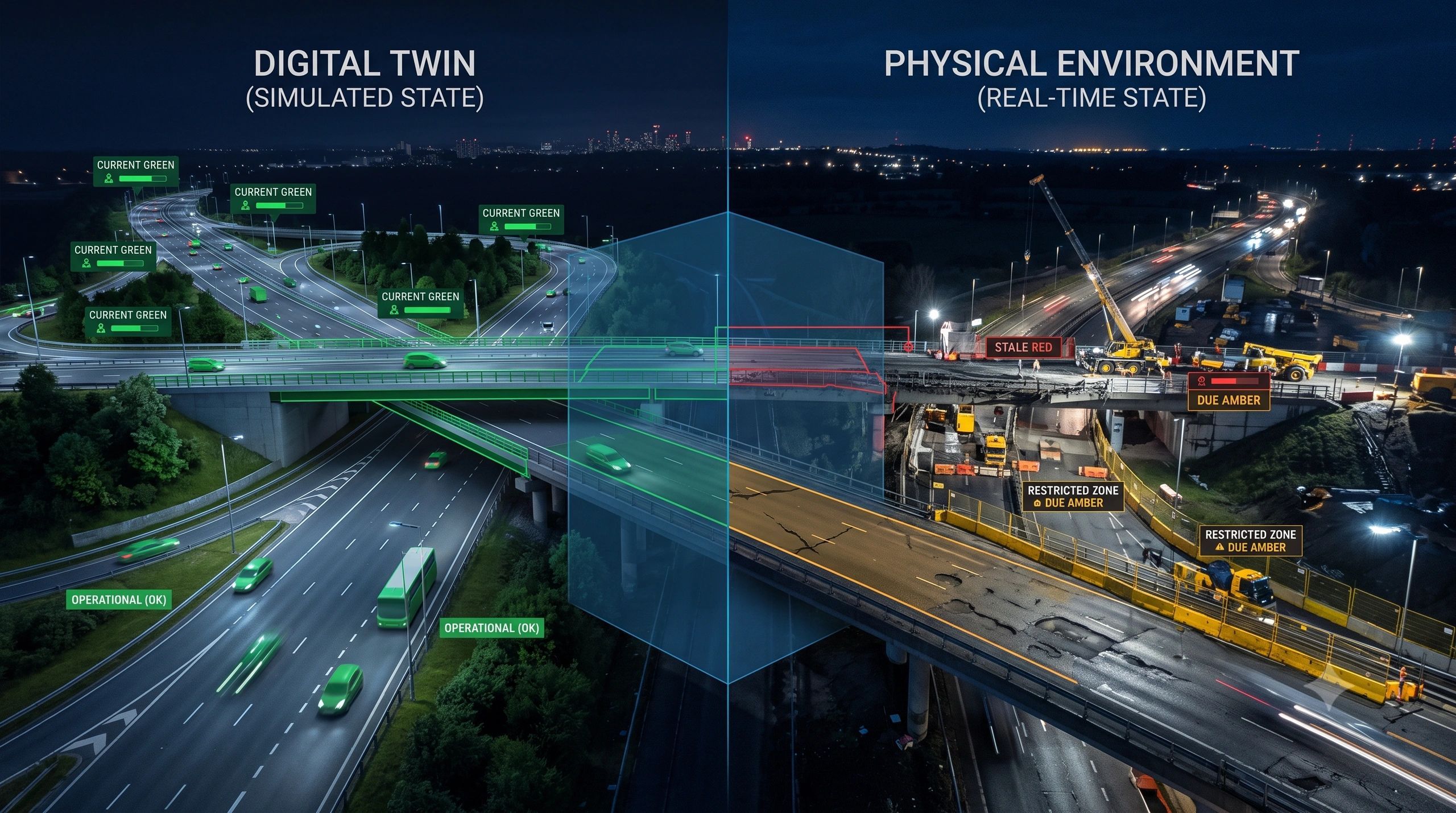
Without these rules, a digital twin may provide awareness without authority.
It may show a predicted flood, detected defect or construction difference but fail to establish who must act, within what timeframe and against which approved baseline.
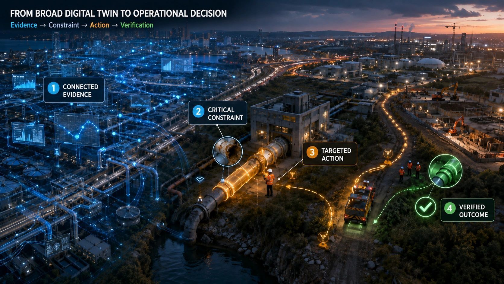
The real operating chain is therefore not simply:
data → model → dashboard.
It is:
evidence → interpretation → decision → action → verification → updated evidence.
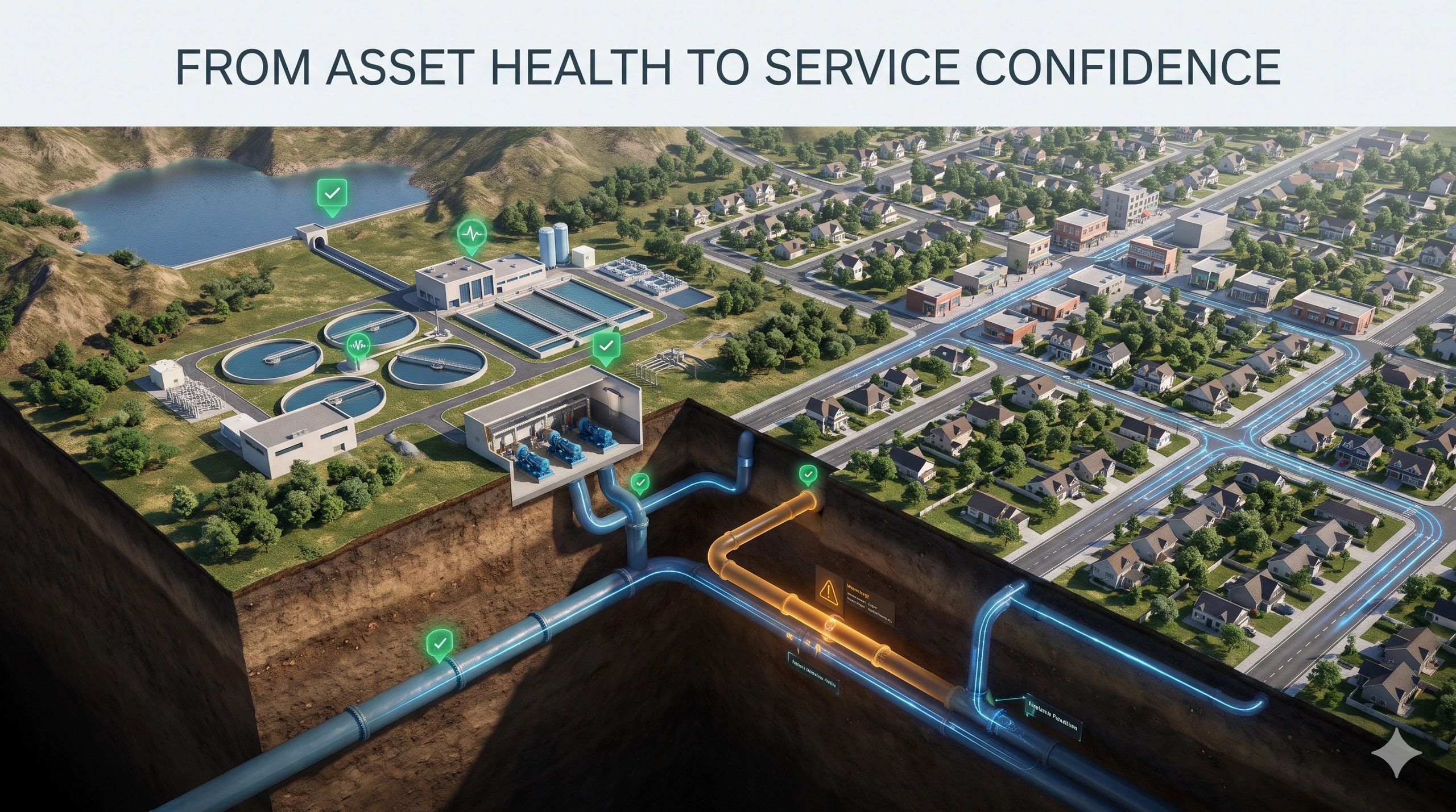
Model the constraint, not only the asset
The operational value of a twin often lies in the constraint surrounding the asset.
For an AI data center, the constraint may be grid capacity and connection time.
For an autonomous machine, it may be the freshness and coordinate integrity of site data.
For a water plant under construction, it may be continuity of service through temporary configurations.
For an urban flood programme, it may be drainage capacity and ownership of the next intervention.
This suggests a practical product principle:
Model the asset, make its critical constraint visible, and connect that constraint to the next decision.
The market may still use the term “digital twin,” but buyers will increasingly judge these systems by a more direct standard:
Did the twin help us inspect, verify, intervene or operate better?
That is why the most valuable twins may not be the most comprehensive.
They may be the ones that know exactly what operational problem they exist to solve.
The next stage of digital-twin adoption will be defined less by how much reality a system can reproduce and more by how reliably it can guide the next action.