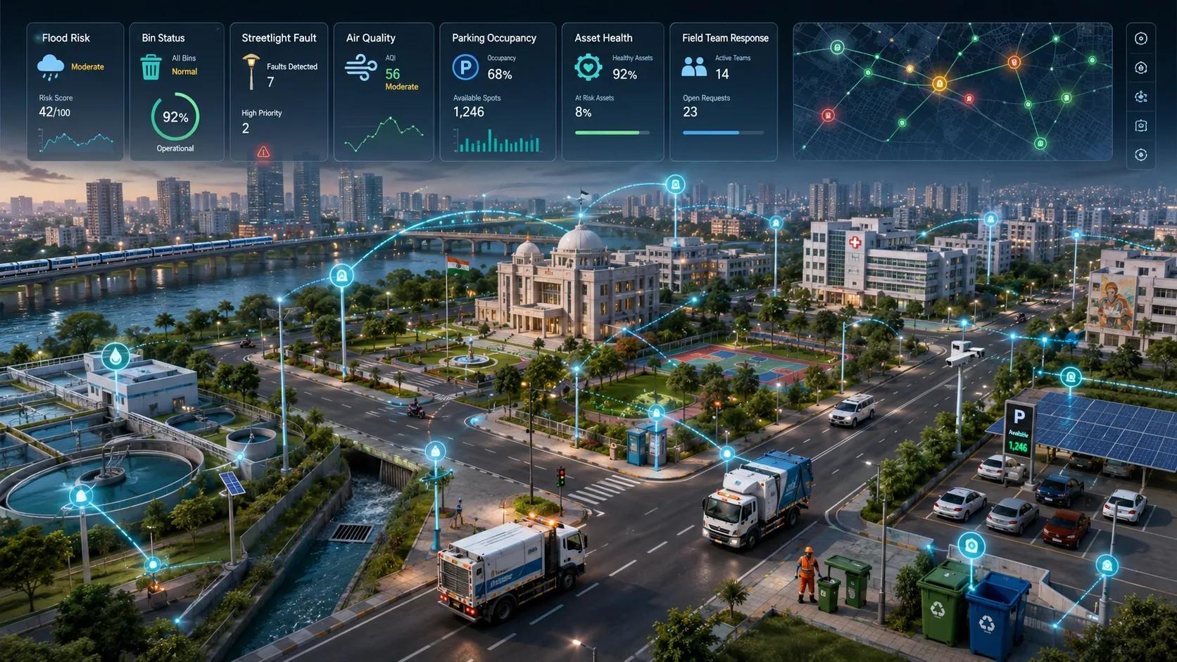
Cities have invested heavily in command centers, sensor networks, GIS portals, digital twins and urban dashboards.
These systems can display traffic congestion, flood exposure, air quality, infrastructure condition, water consumption and public-health risk. Some provide real-time alerts. Others combine dozens of datasets into a single view.
Yet the operational question often remains unresolved:
What should be done next, where, by whom and with what evidence?
A dashboard can show that a neighborhood faces elevated flood risk. It may not identify the blocked drain responsible, assign the field team, specify the intervention or confirm whether the work reduced the risk.
That is the gap between situational awareness and an intervention loop.
Cities do not act on colored pixels. They act on physical assets: drains, manholes, road segments, transformers, buildings, pumps, pipes and land parcels.
The next stage of smart-city intelligence must connect the detected problem to the specific physical action required.
The problem is not a lack of visibility
Many urban platforms are designed around a familiar sequence:
Collect data → analyse conditions → display results
This helps officials understand what is happening. But understanding does not automatically produce action.
A heat-risk map may identify vulnerable areas without identifying which buildings require cooling interventions.
A road-condition system may detect deterioration without specifying whether the affected segment needs inspection, patching or reconstruction.
A flood dashboard may show accumulated water without determining whether the cause is a blocked drain, insufficient capacity, a failed pump or encroachment on a natural channel.
When that connection is missing, the dashboard becomes the end of the technology workflow. The city must still rely on phone calls, spreadsheets, departmental judgement and manual coordination to convert the insight into work.
The harder challenge is therefore not displaying more information. It is closing the loop between evidence and intervention.
A narrow public-health example carries a larger lesson
An ESA-backed project called ZikaSeal illustrates this shift.
The project uses Sentinel-1 and Sentinel-2 Earth observation data with machine learning to identify street drains associated with a higher probability of Asian tiger mosquito breeding. The analytical output is connected to a physical barrier that municipalities can install at the targeted drains.
The important outcome is not another citywide mosquito-risk map.
It is the identification of the individual drains where preventive work should begin.
The traditional workflow would look like this:
Environmental data → risk map → municipal interpretation → field decision
The emerging workflow is more specific:
Environmental observation → risk assessment → affected drain → prescribed intervention → installation → monitoring
That difference may appear small, but it changes the role of spatial intelligence. The system is no longer only describing a public-health problem. It is helping organize a physical response.
This principle can extend far beyond mosquito control.
Every urban problem needs an intervention object
A citywide problem becomes operational only when it is connected to something that can be inspected, repaired, replaced, cleaned, restricted or monitored.
For example:
- Road-condition intelligence should identify the affected segment and appropriate repair category.
- Flood intelligence should identify the drain, culvert, pump or channel requiring attention.
- Water-loss analytics should connect an anomaly to a pipe section, valve or service zone.
- Urban heat analysis should identify buildings, roofs, streets or public spaces suitable for intervention.
- Vegetation-risk monitoring should identify the particular power line or telecom asset requiring clearance.
- Building-energy analysis should locate the façade, roof or equipment element responsible for abnormal performance.
- Environmental enforcement should connect detected change to a parcel, responsible party and applicable rule.
This requires moving from a map-centered architecture to an asset-centered architecture.
The spatial model must know not only where the problem is, but which real-world object is affected and how that object connects to municipal responsibility.
A practical intervention loop
A useful urban intelligence system should support a repeatable sequence:
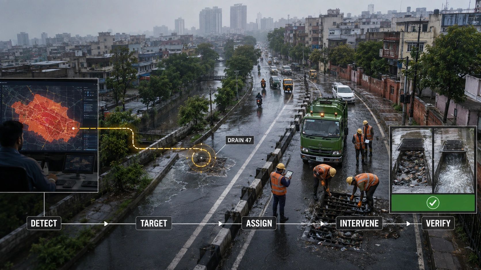
Detect → locate → diagnose → prioritize → assign → intervene → verify
Each stage answers a different operational question.
Detect: What changed, failed or crossed a threshold?
Locate: Where is the issue, and which asset or area is affected?
Diagnose: What is the likely cause, and what additional evidence is required?
Prioritize: How urgent is the problem relative to other cases?
Assign: Which department, contractor or asset owner has authority to respond?
Intervene: What physical or administrative action should be performed?
Verify: Did the action occur, and did it produce the expected result?
Most dashboards concentrate on the first three stages. Municipal value is created when the system reliably supports the remaining four.
This also changes how success should be measured. The number of sensors connected, datasets integrated or dashboard views generated tells us little about urban outcomes.
More useful measures include:
- time from detection to assignment;
- time from assignment to field action;
- percentage of alerts linked to identifiable assets;
- percentage of tasks completed within their service level;
- recurrence of the same issue after intervention;
- before-and-after evidence demonstrating the result.
These measures expose whether intelligence is actually changing operations.
The loop must include authority
Better analytics alone will not solve the problem.
A recommendation becomes useful only when the organization knows who can approve it, who must execute it and what evidence is sufficient to close the case.
Not every observation should carry the same decision authority. A citizen report, low-cost sensor, satellite-derived indicator and calibrated engineering instrument may all contribute evidence, but they should not automatically trigger the same response.
A practical governance model can classify evidence by permitted use:
- INFORM: provides context but cannot initiate formal action.
- ALERT: triggers review or inspection.
- DECIDE: supports an authorized operational decision.
- CONTROL: may influence an automated system or physical operation.
This distinction is especially important as cities introduce AI into infrastructure management.
An AI model may recommend cleaning a drain based on combined rainfall, terrain and historical blockage data. But automatic pump control, road closure or enforcement action requires a different level of evidence, validation and authority.
The intervention loop must therefore preserve data provenance, confidence, responsible ownership and approval history not merely the final recommendation.
Start narrow, then federate
The phrase “smart-city digital twin” often implies that a city must first create a comprehensive model covering every asset, department and service.
That approach can become expensive before it becomes useful.
A more practical path is to begin with one high-value municipal loop:
- drainage inspection and cleaning;
- road repair prioritization;
- water-loss response;
- property compliance;
- waste-collection exceptions;
- environmental enforcement;
- critical-asset inspection.
The city can define the affected assets, decision rules, departmental responsibilities, field workflow and verification evidence for that use case.
Once several intervention loops are operating, they can share the same spatial foundation, asset identities, evidence records and governance controls. A broader city twin can grow from proven operational workflows instead of being imposed as one large platform from the beginning.
This is federation through demonstrated value.
From actionable intelligence to intervention intelligence
The smart-city sector frequently promises actionable intelligence. But the term is often used for any insight that appears potentially useful.
A sharper distinction is needed.
Actionable intelligence says:
“There is likely to be a problem here.”
Intervention intelligence says:
“This particular asset requires this action, under this authority, with this priority and this evidence will show whether the action worked.”
That is a much higher standard.
It requires geospatial systems, IoT, AI, digital twins and field operations to function as parts of the same decision architecture. It also makes the business case clearer because value can be measured through reduced response time, avoided failures, better resource allocation and verified service outcomes.
The next generation of urban intelligence will not be defined by how much information a city can display.
It will be defined by how reliably the city can convert evidence into coordinated, accountable and verified action.
A city does not become smarter because its problems are visible on a screen.
It becomes smarter when the right intervention happens before the same problem appears on that screen again.