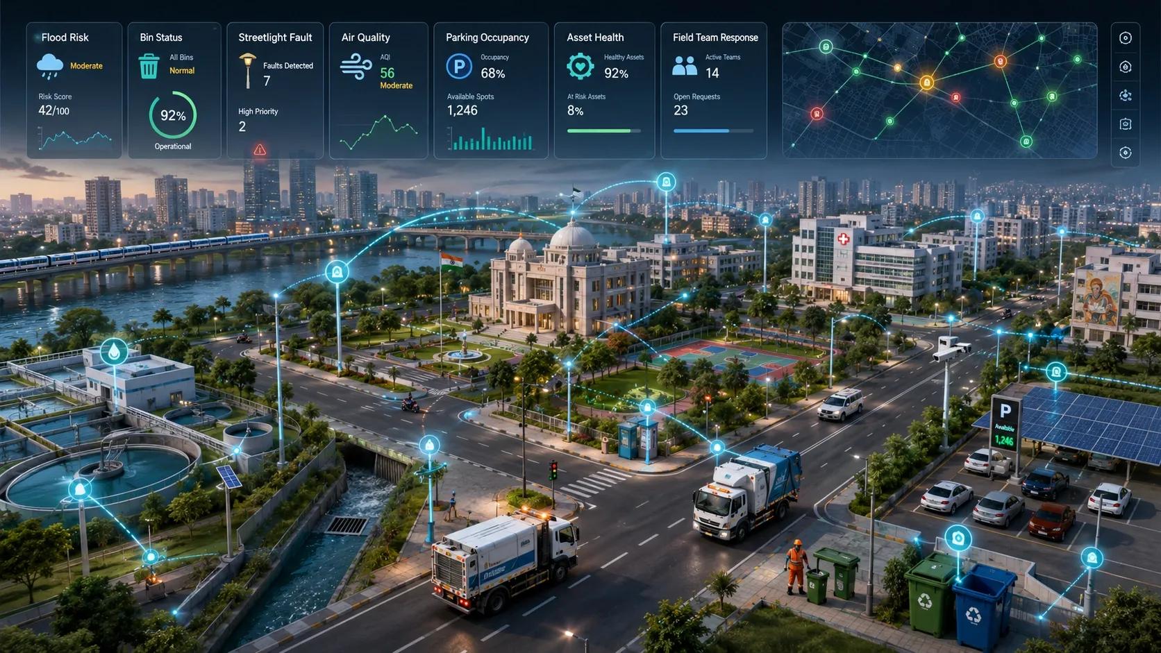
For many years, smart-city projects have been built around individual use cases.
A department installs sensors for waste bins. Another deploys devices for streetlights. A separate team experiments with air-quality monitoring. Flood sensors come through another project. Parking sensors are managed by a different vendor. Public safety systems follow their own architecture.
Each project may be useful. But together, they often create a fragmented digital city.
The problem is not the lack of sensors. The problem is that every use case is treated as a separate technology deployment.
This is where the next smart-city opportunity is emerging: shared IoT infrastructure.
Municipalities do not need a separate network for every problem. They need one common operational layer that can support many municipal services over time.
The Essex Example: One Network, Many Use Cases
A recent example from South Essex shows why this shift matters.
Six councils in Essex used a unified IoT network instead of building separate networks for each use case. Through radio frequency planning and detailed network mapping, the project reduced the required number of gateways from an estimated 60 to 44. It also came in £40,000 under budget while still achieving wide regional coverage.
This is not just a technology success story. It is an operating model lesson.
The councils did not start by asking, “How do we install one more sensor project?”
They started by building shared digital infrastructure that multiple services could use.
That is the key difference.
When IoT is treated as a common municipal layer, the economics change. The same network can support footfall counters, building occupancy sensors, flood monitoring, temperature sensors, waste-bin monitoring, vehicle counting, public-space monitoring, and environmental sensing.
The value is no longer limited to one department. It becomes a city-wide capability.
Why This Matters for Indian Municipalities
Indian cities face a different scale of complexity.
Urban local bodies deal with drainage, solid waste, street lighting, road maintenance, water supply, parking, encroachments, air quality, flooding, public safety, and asset management. Many of these problems are spatial. They happen at a location, change over time, and require field-level action.
Yet many municipal technology deployments still happen in silos.
A smart-lighting system may not talk to the asset registry. A flood sensor may not connect with the drainage map. A waste-management system may not integrate with ward-level operations. Air-quality data may remain separate from traffic, construction, or public-health planning.
The result is predictable.
Cities collect data, but teams still struggle to coordinate action.
This is why unified IoT infrastructure is important. It creates a shared sensing backbone across departments. Instead of asking each department to build its own digital layer, the municipality creates one network, one geospatial asset base, one data governance model, and multiple service applications on top of it.
The Geospatial Layer Is the Foundation
IoT without geospatial context is only a stream of device readings.
A sensor may tell us that water is rising, air quality is poor, a bin is full, a streetlight has failed, or a vehicle count has increased. But the municipality still needs to know where it is happening, what assets are nearby, which ward is responsible, which contractor must respond, which roads may be affected, and what the operational priority should be.
That is where geospatial intelligence becomes the foundation.
A unified IoT network for municipalities should not begin with devices alone. It should begin with a mapped understanding of the city.
This includes ward boundaries, roads, drains, streetlights, buildings, public spaces, water assets, waste routes, parking zones, flood-prone areas, critical infrastructure, and field-team jurisdictions.
Once this spatial layer is in place, sensor data becomes operational intelligence.
A flood sensor is no longer just a point on a dashboard. It becomes part of a drainage-risk system.
A smart bin is no longer just a fill-level reading. It becomes part of route optimization and ward performance.
A streetlight fault is no longer just a maintenance ticket. It becomes part of public safety, energy efficiency, and contractor accountability.
This is the difference between displaying IoT data and using IoT data.
What a Unified Municipal IoT Architecture Should Look Like
A practical unified IoT model for municipalities should have five layers.
The first layer is the city asset map. This is the spatial foundation. It should include municipal assets, infrastructure networks, administrative boundaries, service zones, and risk areas.
The second layer is the shared IoT network. Depending on the use case, this may include LoRaWAN, NB-IoT, 4G, 5G, Wi-Fi, fibre, or hybrid connectivity. The goal is not to force one technology everywhere. The goal is to create a planned network that can support multiple services.
The third layer is the sensor and device layer. This may include flood sensors, air-quality sensors, bin sensors, smart meters, lighting controllers, parking sensors, environmental sensors, occupancy counters, CCTV integrations, and asset-health devices.
The fourth layer is the data and integration layer. This is where device data, GIS layers, work-order systems, ERP systems, dashboards, and analytics are connected. This layer is critical because municipalities rarely operate from one system.
The fifth layer is the decision and action layer. This is where the real value appears. Alerts, work orders, escalation rules, field-team routing, SLA tracking, maintenance planning, and executive reporting should all connect back to the same operational view.
Without this fifth layer, unified IoT becomes another dashboard.
With it, IoT becomes part of daily municipal operations.
The Right Starting Point Is Not a Mega Project
Municipalities do not need to begin with a large, expensive smart-city transformation.
A better approach is to start with three to five high-value use cases that can share the same network and geospatial base.
For example, a city can begin with flood monitoring, waste-bin monitoring, and streetlight fault tracking in selected wards. These three use cases are different, but they can share the same spatial registry, network planning, dashboard layer, and field-response workflow.
Once the model works, the city can add air quality, parking, water assets, public-space monitoring, and building occupancy.
This phased approach is more practical because it proves value early while building reusable infrastructure.
The key is to avoid isolated pilots.
Every new use case should strengthen the common platform rather than creating another standalone system.
Why Open Architecture Matters
A unified IoT network should not become a closed vendor dependency.
Municipalities need the freedom to add different sensors, integrate different applications, and work with multiple vendors over time. The infrastructure should be open enough to support future use cases that may not be fully known today.
This is important because city needs change.
Today the priority may be waste and flooding. Tomorrow it may be heat stress, water leakage, parking, school safety, carbon reporting, or energy optimization.
A shared infrastructure model allows the city to respond without rebuilding the technology stack each time.
From Smart City Projects to Municipal Operating Systems
The next stage of smart cities will not be defined by how many sensors are installed.
It will be defined by how well cities convert sensor data into coordinated action.
That requires more than IoT. It requires geospatial context, asset intelligence, governance, analytics, and field workflow integration.
The Essex example shows that shared IoT infrastructure can reduce duplication and improve economics. For Indian municipalities, the opportunity is even larger because the operational problems are more complex and the need for coordination is higher.
A unified IoT network can become the sensing layer of a municipal digital twin. It can help cities move from reactive service delivery to more predictive and accountable operations.
But the principle must be clear.
The goal is not to build another smart-city dashboard.
The goal is to create a common operational layer where sensors, maps, assets, risks, departments, and field teams work together.
That is where municipal IoT becomes truly valuable.
And that is why the next smart-city opportunity is shared infrastructure.