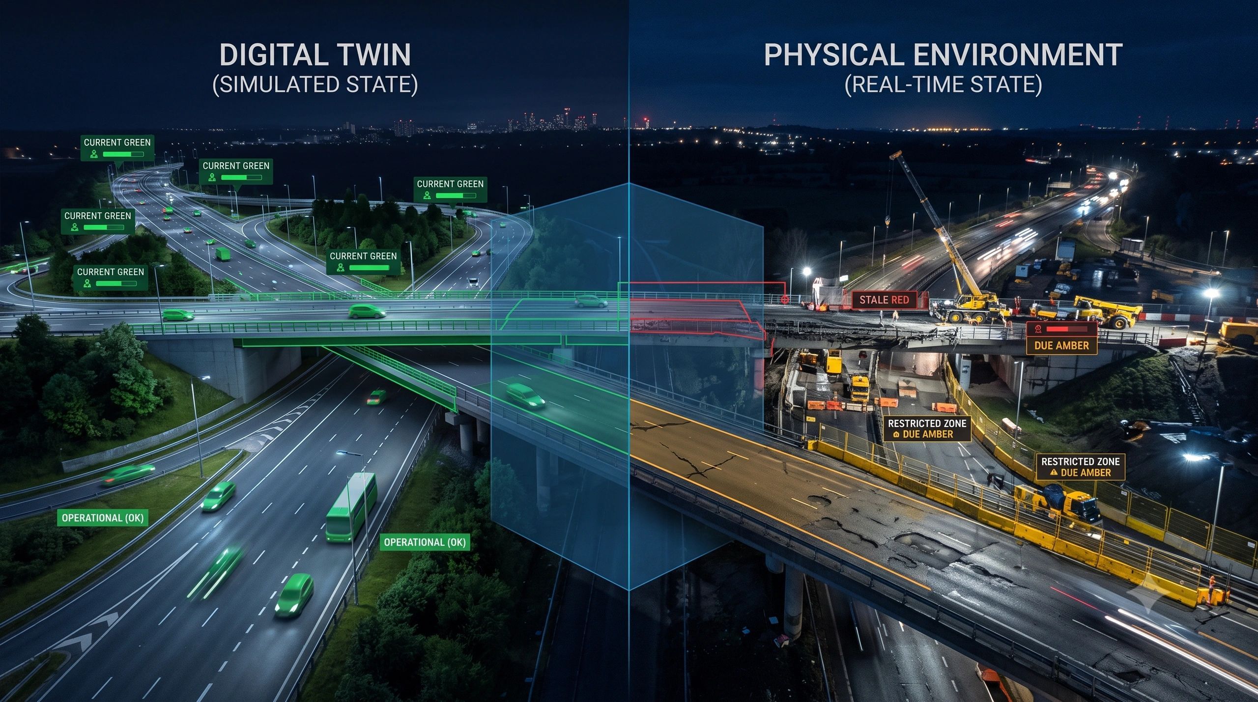
A digital twin can look current while describing a reality that no longer exists.
The building may have been modified.
The road may have deteriorated.
The construction site may have changed overnight.
The warehouse may contain equipment that is missing from the model.
Yet the digital twin can continue presenting its information with the same visual confidence.
This exposes a critical weakness in many digital-twin programmes: we measure positional accuracy, model completeness and sensor performance, but often fail to measure the age of the evidence supporting a decision.
A twin should not only tell us what it knows.
It should tell us when that knowledge was last verified.
Spatial accuracy does not guarantee operational truth
A model can be geometrically accurate and still be operationally wrong.
Consider a road-condition system. A survey conducted three months ago may have captured every crack and pothole accurately. But after heavy rainfall, construction activity or increased traffic, those observations may no longer represent the current road.
The problem is not necessarily poor data quality. The data may have been excellent when collected.
The problem is evidence age.
The same issue appears across sectors:
- A BIM model may not include recent site changes.
- A utility map may not reflect an emergency repair.
- A mine plan may not represent the latest excavation.
- A warehouse twin may omit relocated equipment.
- A climate-risk layer may rely on environmental conditions that have already shifted.
- A smart-city platform may combine live traffic data with an outdated road network.
In each case, the system can produce a technically valid answer based on evidence that is no longer suitable for the decision.
That distinction matters.
“Real time” is not a system-wide condition
Digital twins are often described as real-time systems. In practice, most twins contain information of different ages.
A temperature sensor may update every minute.
A satellite image may be several days old.
A UAV survey may be conducted monthly.
A BIM model may have been updated at the previous project milestone.
An underground utility record may not have been independently verified for years.
Calling the complete environment “real time” hides these differences.
A better approach is to treat freshness as an attribute of every operational layer, object and observation.
For each piece of evidence, the twin should be able to answer:
- When was it last observed?
- Which source produced the observation?
- How quickly is the physical condition expected to change?
- What refresh interval does the decision require?
- Has anything occurred that could invalidate the previous observation?
This creates a more honest representation of what the system knows.
Freshness depends on the decision
There is no universal definition of fresh data.
A building footprint might remain reliable for years. The temporary barriers around that building could change within hours.
A bridge’s structural geometry may require infrequent updates. Its water level, traffic load or vibration condition may require continuous monitoring.
A cadastral boundary and a construction-progress record cannot share the same refresh policy.
Freshness must therefore be linked to three factors:
Change rate: How quickly can the physical condition change?
Decision consequence: What happens if the system is wrong?
Evidence requirement: How recent must the observation be for this specific action?
A 30-day-old image might be acceptable for strategic planning but unacceptable for authorizing excavation near a buried utility.
The question is not simply, “How old is the data?”
It is, “Is this evidence recent enough for the decision being made?”
A practical Reality Freshness framework
A digital twin could assign every critical object or operational layer one of four states:
CURRENT: The evidence remains within the approved refresh interval and no invalidating event has been detected.
DUE: The evidence is approaching its refresh threshold. It may still support routine decisions, but another observation should be scheduled.
STALE: The approved interval has been exceeded or a known change may have invalidated the evidence.
UNKNOWN: The source, observation time or verification status cannot be established.
These states should not remain passive labels on a dashboard. They should change what the system permits.
For example:
- CURRENT evidence may support normal action.
- DUE evidence may support action with monitoring.
- STALE evidence may require human review or a new survey.
- UNKNOWN evidence may prevent a high-consequence decision.
This turns freshness from metadata into an operational control.
Refresh intervals alone are not enough
Scheduled data collection is useful, but physical reality does not change according to a calendar.
A road may normally require inspection every three months. A flood, collision or utility excavation may require immediate reassessment.
A construction model may be updated weekly. A major lift, design revision or safety incident may make yesterday’s capture inadequate.
Digital twins therefore need both time-based and event-based refresh rules.
The refresh workflow could be:
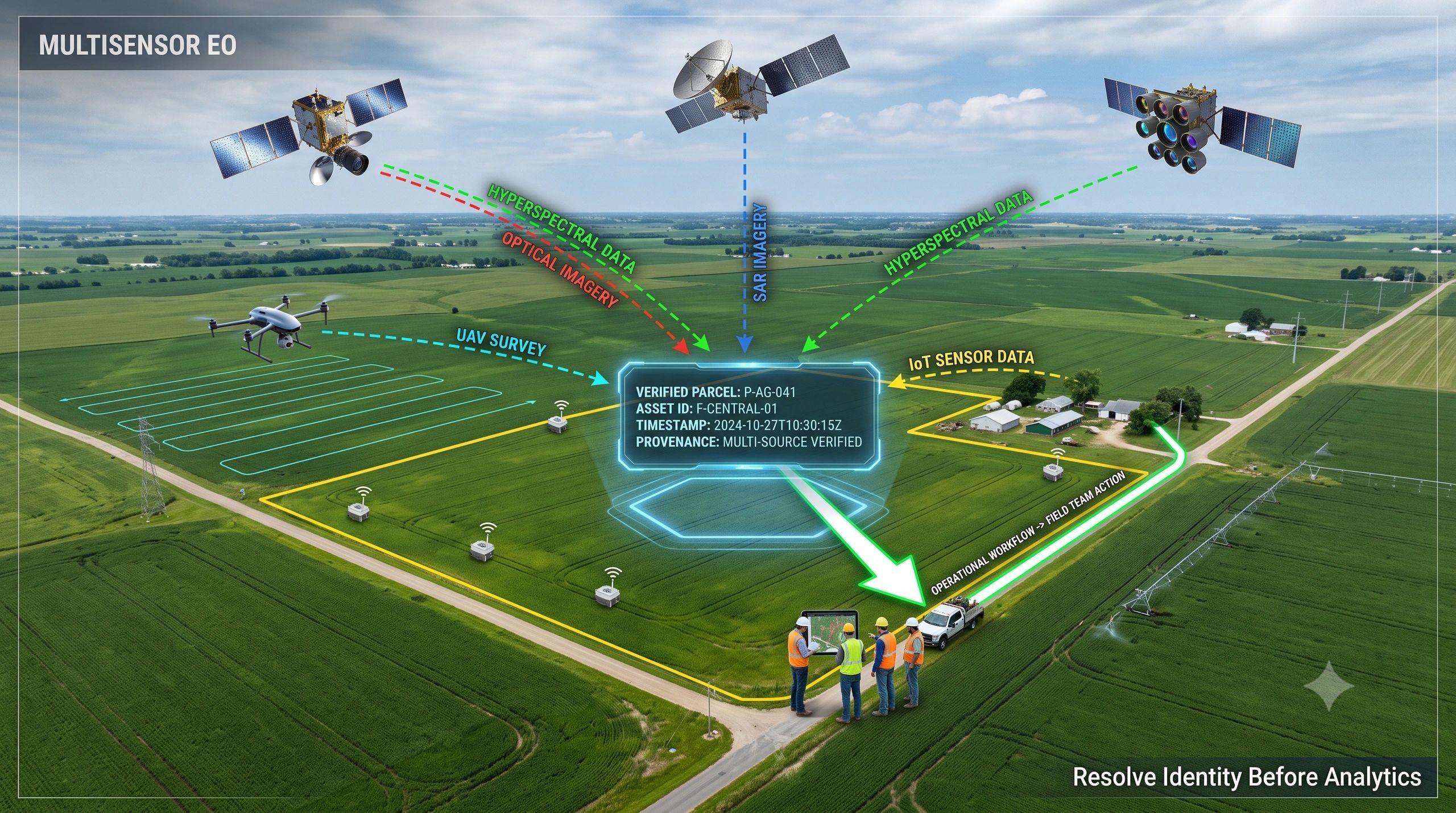
physical change or elapsed interval → freshness state changes → new evidence requested → UAV, satellite, sensor or field inspection deployed → observation validated → twin updated → decision authority restored.
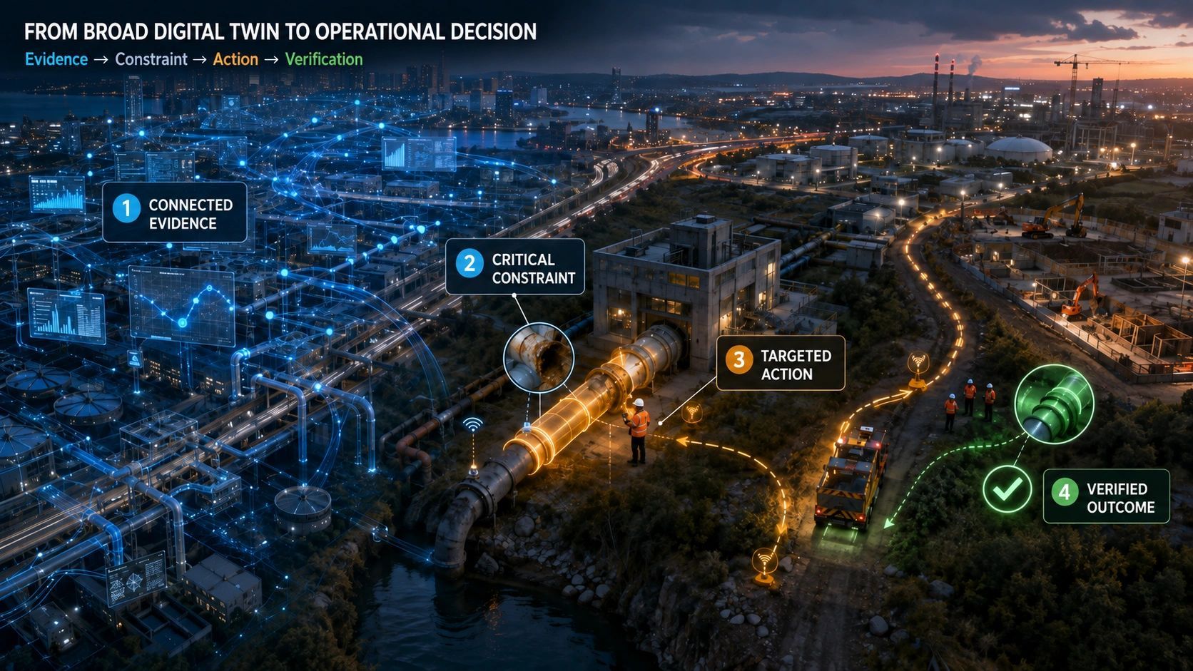
This is where UAVs, Earth observation, IoT and mobile field applications become more valuable when connected.
Their purpose is not merely to collect additional data. They help maintain the relationship between the digital representation and the changing physical environment.
Provenance is part of freshness
A recent observation is not automatically trustworthy.
The system must also preserve where the evidence came from, how it was processed and what it actually observed.
A useful freshness record should contain:
- observation timestamp;
- source and sensor;
- spatial coverage;
- processing method;
- confidence or quality status;
- responsible party;
- expected change rate;
- required refresh interval;
- events occurring since observation;
- decisions that rely on the evidence.
This makes it possible to distinguish between evidence that is simply new and evidence that is fit for purpose.
It also supports auditability. When a decision is challenged, the organization can reconstruct what the twin knew, how recently it knew it and why the evidence was considered sufficient at that time.
Freshness should be visible as a dependency
A decision rarely depends on one dataset.
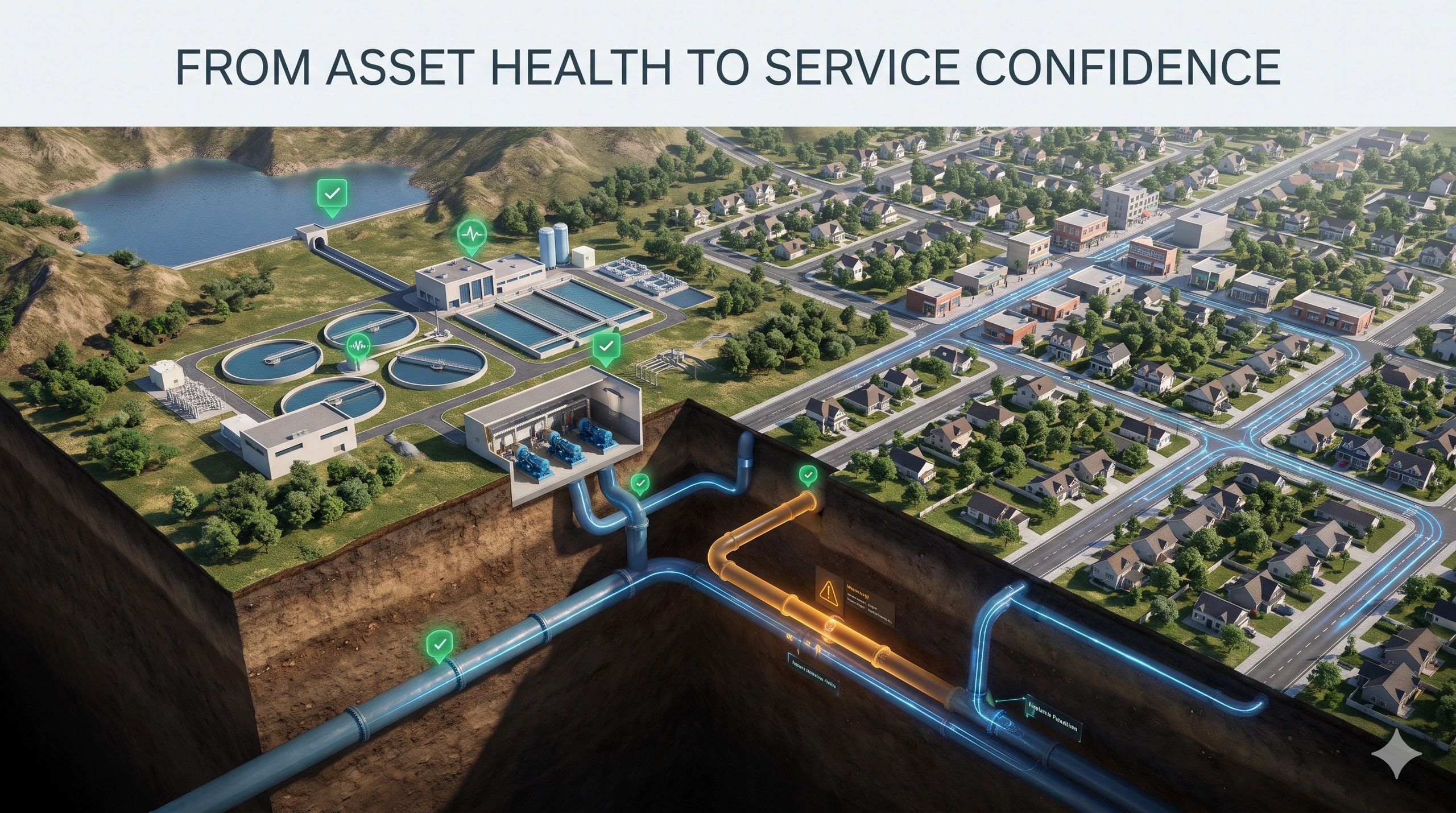
Suppose a road-safety platform recommends an engineering intervention. That recommendation may depend on recent accident records, road geometry, pavement condition, traffic behavior, weather and field observations.
If five inputs are current but the pavement survey is stale, the recommendation inherits that weakness.
The same applies to construction verification, industrial maintenance and climate adaptation.
The decision is only as current as the evidence that can materially change it.
This suggests that digital twins need a freshness dependency graph—not merely a timestamp beside each layer. The graph should show which decisions, predictions and workflows become unreliable when a particular source becomes stale.
That is operational intelligence.
Freshness changes the business case
Reality freshness has direct commercial value.
It can reduce unnecessary surveys by refreshing only what is due or likely to have changed.
It can prevent teams from making high-consequence decisions using obsolete conditions.
It can help owners prioritize UAV missions, field inspections and satellite acquisitions.
It can strengthen progress verification, claims assessment, maintenance planning and regulatory evidence.
Most importantly, it provides a defensible answer to a basic governance question:
What evidence supported this decision, and was it still valid when the decision was made?
Digital twins will increasingly influence physical actions, financial approvals and automated workflows. As their authority grows, visual credibility will not be enough.
A useful twin must distinguish between what was true, what is probably still true and what must be observed again.
The next measure of digital-twin quality may not be how much reality it contains.
It may be how clearly it tells us when that reality has expired.