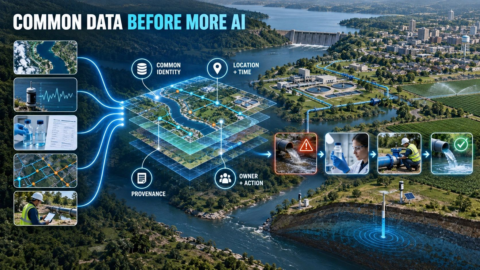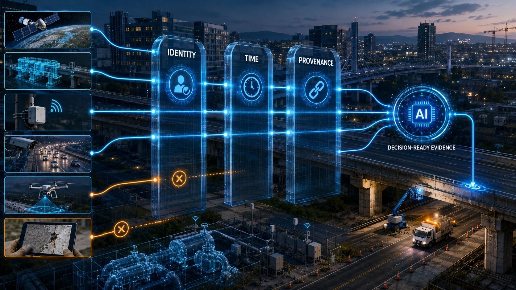
A city may have satellite imagery, traffic cameras, weather stations, IoT sensors, BIM models and citizen reports.
That sounds like a strong foundation for AI.
But if those sources do not agree on what they are observing, when it was observed and how reliable the evidence is, adding AI may create more confidence without creating more truth.
This is becoming one of the most important implementation problems in smart cities, infrastructure and digital twins.
The industry often frames multisource AI as a model-integration challenge. In practice, the harder problem comes earlier:
- Does every system refer to the same physical asset?
- Were the observations captured at comparable times?
- Can the origin and transformation of each record be traced?
- Which source has authority when evidence conflicts?
Before asking AI to combine data, we need to make the evidence combinable.
More data does not automatically create better context
Consider a road intersection represented across several systems.
The GIS database identifies it as Junction 214. The traffic-management system uses a camera ID. The maintenance application refers to a road segment. A BIM model assigns identifiers to individual structures. Citizen complaints refer only to a landmark. Satellite imagery captures the area as pixels within a scene.
All these sources may describe the same location, but the connection is not automatic.
An AI system could correlate them using proximity, language or visual similarity. Yet correlation is not the same as verified identity.
A camera may have been relocated without its database record being updated. A road segment may have been divided after resurfacing. The BIM model may use the design position while the installed asset sits elsewhere. A citizen report may describe the nearest landmark rather than the affected asset.
If AI silently resolves these inconsistencies, the system may produce an answer without exposing the assumptions behind it.
That becomes dangerous when the answer triggers an inspection, closes a maintenance case, redirects traffic or influences public spending.
Identity is the first control
Every operational object needs a persistent identity that can connect its records across systems.
For infrastructure, this could mean linking:
GIS feature → facility or site → BIM object → IoT device → inspection record → work order → field observation.
The objective is not necessarily to replace every existing identifier. That is rarely practical.
The objective is to maintain governed relationships among them.
A bridge can retain its GIS identifier, its asset-management code and the identifiers of its BIM components. What matters is that the system knows how they relate, which relationship is current and who confirmed it.
This turns identity from a database field into a controlled operational link.
Without that link, multisource AI may detect something interesting but still fail to answer the most basic question:
Which physical asset requires action?
Time must describe more than a timestamp
Time is equally difficult.
Different sources operate at different speeds. An IoT sensor may generate readings every second. A drone survey may be conducted once a month. Satellite imagery may be several days old. A BIM model may reflect the approved design but not the latest field change. A citizen report may describe a condition observed hours before it was submitted.
Placing one timestamp on every record does not solve this.
An operational system may need to distinguish:
- when the event occurred;
- when it was observed;
- when the data was received;
- when it was processed;
- when it was validated;
- how long it remains suitable for a particular decision.
This last point is critical.
Freshness is not an absolute property. A month-old survey might remain suitable for long-term planning but be unsuitable for approving excavation near an active utility.
The question should therefore not be, “Is this data current?”
It should be, “Is this evidence current enough for this decision?”
Provenance determines whether evidence can be trusted
Provenance records where information came from and what happened to it before it reached the decision-maker.
For a satellite-derived flood alert, provenance might include the source scene, acquisition time, processing method, model version, confidence level and analyst review.
For an AI-detected construction issue, it might include the image, camera position, associated BIM object, comparison rule, model output, human validation and subsequent resolution.
Without provenance, a result may look authoritative but remain difficult to defend.
This matters when teams disagree. It matters during audits. It matters when a contractor challenges a finding or when an authority needs to explain why an intervention was approved.
Provenance allows an organization to move backwards from a decision to the evidence, assumptions and transformations that supported it.
It also prevents AI-generated interpretations from being confused with direct observations.
A practical evidence contract
Before data enters a critical AI workflow, each observation should carry a minimum evidence contract:
- Source: Which device, organization, application or dataset produced it?
- Observation time: When did the represented condition exist?
- Location: Where was it captured, and with what spatial accuracy?
- Asset association: Which physical object or operational area does it concern?
- Quality: What confidence, completeness or uncertainty applies?
- Authority: Is it raw evidence, an AI inference, an expert validation or an approved record?
- Provenance: How was it collected, processed and modified?
- Freshness: For which decisions and until when can it be used?
Not every use case needs the same thresholds. A public information map and an autonomous traffic-control system should not apply identical evidence requirements.
The contract must match the consequence of the decision.
What happens when sources disagree?
Multisource systems should expect disagreement rather than treat it as an exception.
Suppose BIM shows a utility line in one position, a recent ground scan places it elsewhere and an IoT device reports activity from a third reference point.
The system should not quietly average the evidence.
It should expose:
- the conflicting observations;
- their capture times and spatial uncertainty;
- the authority of each source;
- the decision that is currently blocked;
- the additional verification required;
- the person responsible for resolving the conflict.
Sometimes the correct AI response is not a prediction. It is abstention.
A well-governed system must be able to say: the evidence is insufficient, inconsistent or too old to support this action.
That is a sign of operational maturity, not model weakness.
From data integration to evidence orchestration
After more than two decades in geospatial work, I have seen technically accurate datasets fail to support decisions because their operational context was missing.
The recurring gap is rarely the absence of data. It is the absence of governed relationships among datasets, assets, events, people and decisions.
This changes how we should design multisource platforms.
The architecture should not begin with sending every available source into an AI model. It should begin with an evidence-harmonization layer that resolves identity, time, location, quality, provenance and authority.
Only then should AI classify, predict, recommend or orchestrate a response.
For a platform such as NeuSpatial, the opportunity is not to replicate every upstream analytical capability. Satellite analytics, BIM tools, IoT platforms and specialist AI models can remain independent.
The higher-value role is to connect their outputs to enterprise assets and controlled workflows:
observe → identify → contextualize → assess → decide → act → verify.
This is how multisource data becomes operational intelligence.
The next competitive advantage in GeoAI may not come from connecting the greatest number of data sources. It may come from knowing precisely which evidence describes which asset, at what time, under whose authority and whether it is trustworthy enough to change something in the physical world.