A correct map can still support the wrong decision
A satellite detects trees on a parcel. An AI model labels the area as forest. A project dashboard carries that label into a carbon eligibility assessment.
The observation may be accurate. The decision may still be wrong.
For a farmer, the consequences could include delayed participation or unnecessary documentation. For a developer or investor, they could mean spending money on a project whose eligibility remains unresolved.
The gap sits between what land looks like and what the relevant legal framework establishes.
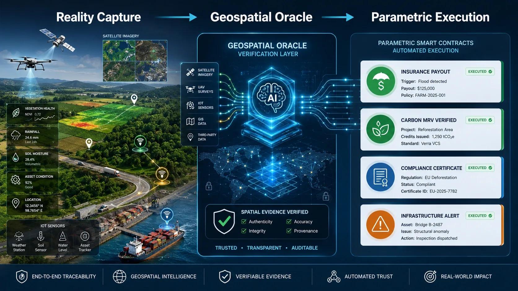
GeoAI can help identify vegetation, buildings, water and physical change. It can also help organize documents and flag inconsistencies. But a prediction does not acquire legal authority simply because it appears on a map.
That distinction deserves more attention as spatial intelligence moves into decisions involving land, infrastructure and carbon finance.
The same trees can sit inside different classifications
TERI’s published agenda for its 21 September 2026 agroforestry-carbon roundtable identifies confusion between tree cover, forest classification and agroforestry on agricultural or revenue land. It calls for land records, historical evidence and statutory criteria to be evaluated together. Its proposed evidence package is an expected outcome, rather than proof that a common standard has already been adopted. TERI
This issue is broader than a model’s accuracy.
“Tree cover” describes a physical condition. “Agroforestry” describes a land-management system. Legal classification depends on the applicable framework and evidence.
Even technical definitions serve different purposes. FAO’s forest-resource reporting definition considers predominant land use and excludes certain agricultural tree systems. That reporting definition should not be substituted for a jurisdiction’s legal determination. fra-data.fao.org
Before a platform labels something “forest,” it should make clear which definition it is applying.
Otherwise, one word can quietly carry several incompatible meanings.
Confidence cannot supply missing authority
Consider an illustrative carbon-project screening workflow.
Recent imagery shows tree canopy. An AI model suggests agroforestry. A farmer supplies plantation records. Historical imagery indicates some trees existed before the proposed intervention. Land documents require review.
These findings answer different questions.
The imagery helps establish physical conditions. Historical evidence helps examine the baseline. Plantation records describe an intervention. Land records and applicable legal instruments inform tenure, classification and rights.
A high confidence score for detecting trees does not settle those other questions.
Nor does verified land classification, by itself, prove additionality or entitlement to carbon revenue.
The useful output at this stage could be:
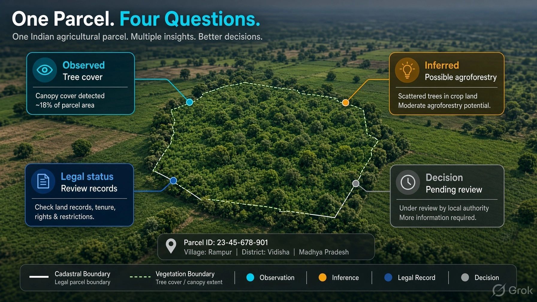
“Tree cover detected. Baseline assessment incomplete. Land-status review pending.”
That sentence tells a project team what it knows and what needs to happen next. A premature “eligible” badge conceals the unfinished work.
Preserve four distinct kinds of information
For land intelligence and operational digital twins, I would separate four layers.
Observed evidence: What did a satellite, drone, sensor or field team record? Preserve the acquisition date, source, coverage and limitations.
AI interpretation: What does the model infer? Preserve its version, inputs, confidence and classification scheme.
Authoritative context: Which records, instruments and authorized determinations govern the question? Preserve their issuing body, effective date, scope and any unresolved dispute.
Accepted decision state: What has the responsible organization approved for a specific purpose? Record the reviewer, evidence considered, conditions and review date.
This is a proposed design framework, not a universal legal standard.
Its value is that each layer remains inspectable. A project team can accept a parcel for further assessment while keeping its final eligibility unresolved.
Internal acceptance does not change legal status.
Records can also be incomplete or disputed
Separating AI from authority does not mean treating every official record as flawless.
A cadastral boundary may be difficult to align with current imagery. Records may be old. Different instruments may conflict. A parcel may have been subdivided while some systems still reference its former identity.
The platform should expose that disagreement.
It should retain the competing evidence, identify the affected decision and route the issue to the responsible reviewer or competent authority.
The parcel’s identity matters here. A canopy polygon, a cadastral parcel and a project boundary can overlap without describing the same unit.
Before evidence is combined, teams need to know whether it refers to the same land, the same period and the same claim. A visually convincing overlay cannot answer that on its own.
Make evidence completeness a workflow
My practical recommendation is to organize the system around the next decision.
For an initial screening review, the required package might include parcel identity, boundary provenance, relevant land records, historical observations and unresolved conflicts.
A later carbon assessment may require additional evidence about baseline conditions, interventions, rights, methodology and verification.
The platform should distinguish:
- Evidence missing.
- Evidence available but awaiting review.
- Evidence conflicting.
- Evidence accepted for the specified step.
The checklist must match the applicable programme and jurisdiction. Completing an internal checklist should never be presented as certification.
AI can help extract document fields, compare boundaries, detect changes and prioritize exceptions. Human review becomes more focused when the system makes gaps visible.
The business value is less avoidable rework
This approach offers a practical commercial opportunity for geospatial firms: help clients assemble, reconcile and trace the evidence behind a decision.
It connects GIS, remote sensing, document systems and approval workflows without claiming that a platform can replace legal authorities or accredited verification bodies.
Useful measures include time to prepare a review package, unresolved parcel conflicts, submissions returned for missing evidence and the ability to reconstruct why a decision was approved.
The same principle applies to infrastructure. A drone can observe an access road; permission to use it requires other evidence. A scan can show a completed structure; approved construction status requires its own review.
For me, the central test of spatial intelligence is whether it makes the decision easier to defend.
As AI produces more interpretations, organizations will need clearer records of who accepted them, for which purpose and on what evidence.
A map should make uncertainty visible before that uncertainty becomes a commitment.