Most inspection drones today are automated.
Very few are truly autonomous.
That distinction matters.
A drone may follow an RTK flight plan with centimeter-level precision. It may carry high-resolution cameras, LiDAR and thermal sensors. It may even run computer vision onboard and detect cracks, corrosion, spalling or damaged components.
But in most workflows, these capabilities remain disconnected.
The flight system follows the route.
The vision system observes what appears in front of it.
And the real decision about whether the evidence is sufficient often happens later, after the drone has landed.
That is beginning to change.
Vision-Language-Action, or VLA, models are introducing a different possibility: an aerial system that does not simply observe an asset but can decide how it should observe it next.
The important shift is not better object detection.
It is the emergence of an observe-understand-act-verify loop in physical space.
The Limitation of Today’s Inspection Automation
Consider a transmission tower inspection.
The mission planner defines a sequence of waypoints around the structure.
The drone follows them.
An onboard vision model detects something that may be a damaged insulator.
But the image is partly obscured by glare.
A conventional computer vision system can flag the anomaly.
What it usually cannot do is reason:
“The current evidence is insufficient. I need another viewpoint.”
So the aircraft continues along its programmed path.
Only later, during post-flight review, does an engineer discover that the critical image cannot support a confident judgement.
Someone must schedule another flight.
This is an architectural problem rather than simply a vision problem.
The perception system and the flight-control system operate largely as separate layers.
From Vision-Language Models to Vision-Language-Action
Vision-language models already allow machines to relate imagery to semantic concepts.
They can interpret a scene, answer questions about it and connect visual information with language.
VLA models extend that idea into action.
Instead of producing only descriptive outputs, the model can generate an intended physical response, such as a new viewpoint, camera orientation, local waypoint or velocity command.
For aerial inspection, that changes the nature of mission planning.
An operator might specify:
“Inspect the insulator string on Tower 14. Identify chipped porcelain and obtain another angle where glare prevents verification.”
The mission is no longer defined entirely as hundreds of pre-programmed coordinates.
It becomes partly defined by intent.
The drone still needs navigation constraints, maps and control logic.
But within those boundaries, the inspection system can begin deciding what evidence it needs.
That is a much deeper form of autonomy.
Inspection Becomes Active Evidence Gathering
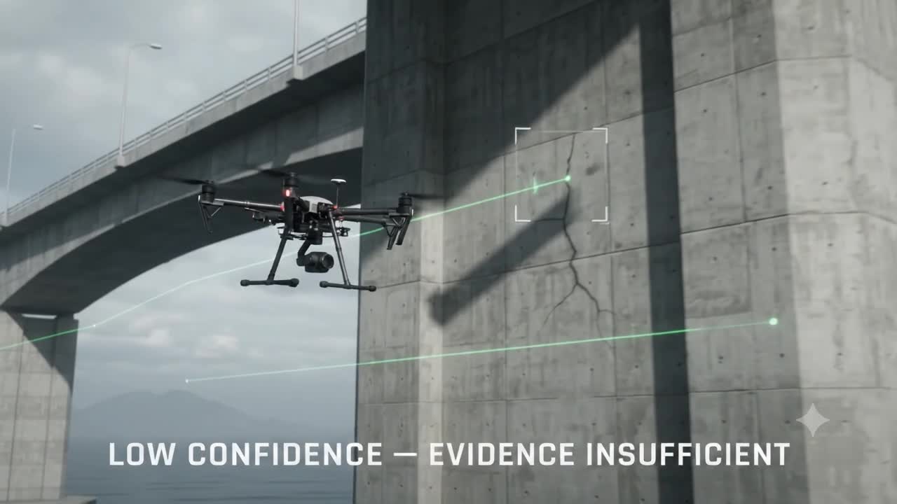
Imagine a drone inspecting a bridge pier.
Its camera detects a narrow line across the concrete surface.
The system cannot determine whether it is:
a superficial surface feature,
a construction joint,
or a potentially significant structural crack.
A passive inspection system records the image and continues.
A VLA-enabled inspection system could treat uncertainty itself as a reason to act.
It might determine that the image resolution is inadequate.
It could request a closer viewpoint.
It could reduce its standoff distance.
It could reposition laterally to eliminate shadow.
It could rotate the gimbal.
It could capture the anomaly from multiple angles.
Then it could reassess the evidence.
The original document describes this as a closed operational sequence:
Observe → Understand → Prioritize → Decide → Act → Verify.
That loop is more important than the specific AI model implementing it.
Because inspection begins moving from:
automated data collection
toward:
autonomous evidence acquisition.
But the AI Should Not Fly the Drone Directly
This is where the concept needs grounding.
Giving a large multimodal model unrestricted control of an aircraft would be difficult to justify operationally or from a safety perspective.
The more practical architecture separates reasoning from flight stability.
At the upper level, an edge VLA model operates relatively slowly.
It interprets video, depth information and mission goals.
It may decide:
“Move three meters left.”
“Inspect this joint more closely.”
“Rotate the sensor toward the rear surface.”
Below that sits a deterministic safety layer operating much faster.
That layer enforces hard limits such as:
minimum obstacle distance,
geofences,
battery thresholds,
collision avoidance,
vehicle-state constraints,
and permitted velocity envelopes.
Only then does the conventional autopilot execute the manoeuvre using established flight-control mechanisms such as PX4 or ArduPilot.
So the architecture becomes:
AI proposes. Safety logic constrains. Autopilot executes.
That separation may prove essential for industrial Physical AI.
Intelligence does not replace deterministic control.
It operates above it.
The Real Product May Be Verified Evidence
There is another important implication.
The final output of an autonomous inspection should not simply be:
“Crack detected.”
It should be an evidence package.
For example:
- anomaly classification,
- precise spatial coordinates,
- capture timestamp,
- camera pose,
- viewing direction,
- distance from the asset,
- confidence,
- supporting images,
- and the manoeuvre used to obtain verification.
That package can then be associated with the corresponding asset inside a GIS, BIM environment or digital twin. The source concept specifically describes synchronizing verified anomaly information, RTK coordinates and camera geometry with the asset model.
Now the drone is no longer just collecting photographs.
It is generating spatially traceable evidence.
That distinction becomes important when inspection outputs influence maintenance decisions.
We Are Not Yet at General-Purpose Autonomous Inspection
The technology is promising, but the maturity boundary matters.
According to the concept outlined here, VLA-based aerial systems are moving from applied research and benchmarking toward industrial field pilots rather than widespread production deployment.
Several constraints remain.
Large multimodal models demand significant onboard compute.
Drones operate under strict size, weight and power limits.
Models therefore need techniques such as quantization, distillation or more efficient action-generation architectures.
Regulation presents another boundary.
Aviation authorities require predictable and fail-safe aircraft behavior. An AI reasoning layer therefore cannot simply bypass conventional flight-control protections.
And there is a deeper challenge:
A machine deciding to gather more evidence is useful.
A machine deciding what that evidence legally, structurally or operationally means is a different level of authority.
Those should not automatically be treated as the same problem.
The GeoThinking Lens
The most interesting part of VLA-enabled drones is not the language interface.
It is not even the foundation model.
Those are the fingers pointing at a larger shift.
The real transformation happens when spatial intelligence enters the operational loop.
A machine observes the physical world.
It identifies uncertainty.
It changes its position to reduce that uncertainty.
It gathers stronger evidence.
It attaches that evidence to the correct physical asset.
And only then does it hand the result into a human or machine decision process.
That is where Physical AI starts becoming relevant to infrastructure.
Not because machines can “see.”
But because they are beginning to understand that where they look next can matter as much as what they already saw.
The future inspection drone may therefore be defined less by how accurately it follows a flight path and more by whether it knows when the flight path is no longer enough.