An inspection can be accurate and still arrive too late.
A drone surveys a utility corridor. The imagery is processed, a report is delivered, and the team leaves. Between that inspection and the next visit, vegetation grows, excavation begins, drainage changes, or equipment deteriorates.
The operator has evidence of what existed during the flight. The assets continue changing.
This is where beyond visual line of sight (BVLOS) could change the role of drones in infrastructure.
It creates a path toward repeatable observation services embedded in operations. But the business value depends on what happens between capturing a change and resolving it.
The inspection gap is an operational problem
Conventional drone surveys already deliver value through mapping, measurement, progress monitoring and condition assessment.
However, inspections often depend on mobilizing people, coordinating access, arranging flights and processing the results. Those steps shape how frequently an organization can afford to observe an asset.
For a construction site, a weekly capture may be sufficient for some progress decisions. For a utility corridor facing active excavation, the same interval may leave a significant blind spot.
The useful question is therefore: how long can this asset remain unobserved before the uncertainty becomes unacceptable?
That answer varies by asset, hazard and consequence.
BVLOS can help address this gap by enabling missions beyond the remote pilot’s direct visual view, subject to the applicable operating conditions and authorizations.
It does not automatically mean autonomous flight. A dock, an automated mission and permission to conduct BVLOS operations are separate parts of the operating model.
India’s policy direction deserves commercial preparation
India’s Civil Aviation Minister has reportedly outlined a goal of enabling BVLOS certification by the end of 2026.
For infrastructure owners, the significance extends beyond longer flight routes. A workable certification and operating framework could support new inspection models across utility corridors, mines, solar farms and large industrial sites.
The announcement should be treated as a policy direction. Any deployment must still establish the permissions, operating conditions and responsibilities applicable to its missions.
Nevertheless, owners can begin defining their requirements now.
Waiting until flight permissions are available to decide how observations enter maintenance workflows would leave much of the preparation unfinished.
Persistent infrastructure means persistent responsibility
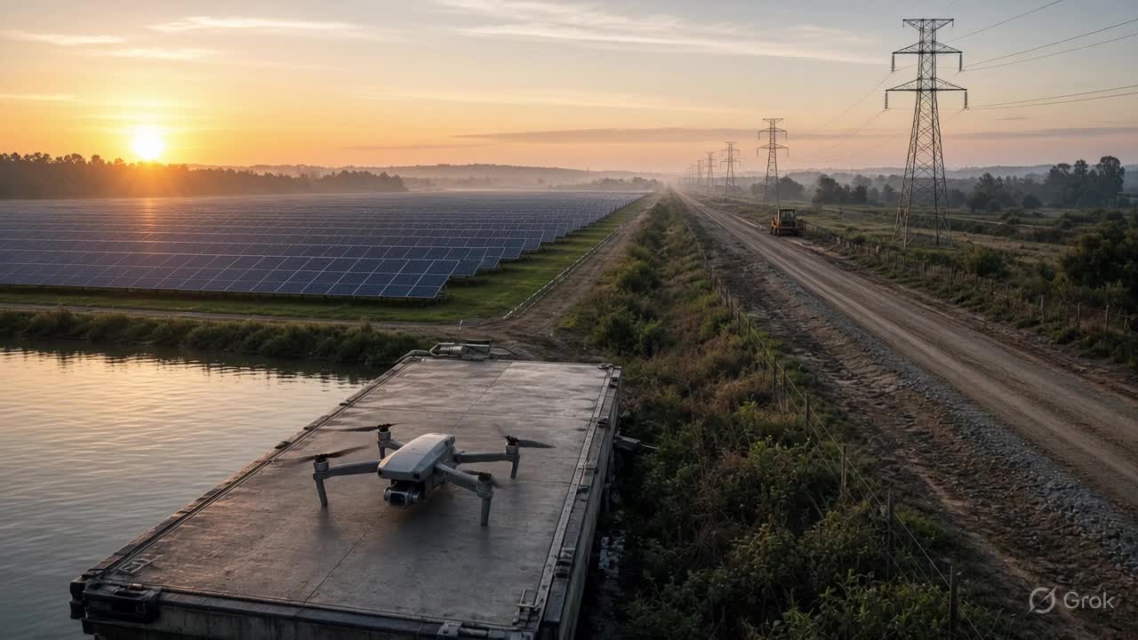
Imagine a drone dock serving a large solar farm.
An approved mission captures thermal and visual evidence. Analytics flag a possible anomaly. The finding is linked to a specific asset, reviewed by an authorized person and assigned for investigation.
After the intervention, a subsequent inspection checks whether the issue remains.
This is an illustrative operating model, rather than a claim about a particular deployment.
Its significance is the repeatable loop:
Mission → Observation → Review → Intervention → Verification
The drone becomes one component of an ongoing service.
That service needs power, connectivity, maintenance, cybersecurity, mission supervision and clear ownership. It also needs procedures for weather interruptions, unavailable equipment and inconclusive observations.
“Persistent” describes the availability of the inspection capability. It should not imply uninterrupted aerial coverage or guaranteed detection.
A photograph must become an asset-level event
A drone may identify an unusual condition without knowing its operational significance.
A disturbed patch of ground could be authorized maintenance, unrelated activity or a threat to buried infrastructure. A thermal anomaly could require urgent investigation or further evidence before any action.
An enterprise system must connect the observation to context:
- Which asset or location does it concern?
- When was the evidence captured?
- What operating condition or approved activity applies?
- Who should review the finding?
- What evidence would justify closing it?
GIS contributes location and relationships. BIM can contribute asset and engineering context. IoT can provide operating measurements. Maintenance systems hold responsibility and intervention history.
A digital twin becomes useful when these sources support a decision with traceable evidence.
The volume of imagery is secondary to the organization’s ability to explain what changed and what should happen next.
Three layers determine whether the model works
Infrastructure owners can assess readiness through three connected layers.
1. Flight readiness
Can the mission be conducted safely and within its authorized conditions?
This includes the aircraft, communications, operating area, mission supervision, contingency procedures and the requirements applicable to the operation.
2. Evidence readiness
Can the observation support the intended decision?
A successful flight may still produce unsuitable evidence because of visibility, sensor limitations, positioning uncertainty or incomplete coverage. The system should preserve capture time, source identity, location and analytical confidence.
3. Action readiness
Can the organization respond?
A finding needs an owner, a review path, an intervention process and a closure criterion. Without these, more frequent inspections can simply create a larger backlog of unresolved alerts.
These layers must work together. Flight capability creates access to evidence; organizational readiness turns that evidence into value.
The economics must be measured across the workflow
BVLOS could reduce mobilization effort and enable more frequent inspections in suitable settings.
However, a lower cost per flight does not automatically produce a lower cost per resolved issue.
Owners should consider the full service: equipment, docks, communications, maintenance, supervision, data processing, integration, review and field response.
Useful pilot measures include:
- Time from a physical change to its detection.
- Time from detection to an accepted decision.
- Proportion of findings requiring additional verification.
- Cost per completed inspection and resolved event.
- Percentage of interventions closed with supporting evidence.
The pilot should also record missed missions and observation gaps. A dashboard should make stale evidence visible.
Start with one decision that matters
A useful first deployment should have a defined operational question.
For example: can repeated inspection help a utility identify and respond to unauthorized excavation near a selected corridor sooner?
That question establishes the mission area, required evidence, review owner, response process and success measures.
A broad promise to “monitor everything” makes those choices harder.
For geospatial and digital-twin teams, the integration opportunity lies in linking mission targets, permissions, asset identities, observations and verified outcomes. Aircraft providers and authorized operators retain responsibility for their respective flight capabilities and operations.
BVLOS opens a route toward a different inspection model. Whether that model becomes valuable infrastructure depends on the reliability of the entire service.
My view: the strongest drone programmes will be judged by how reliably they shorten the gap between a physical change and a verified response.
More frequent observation matters when the organization is ready to act on it.