
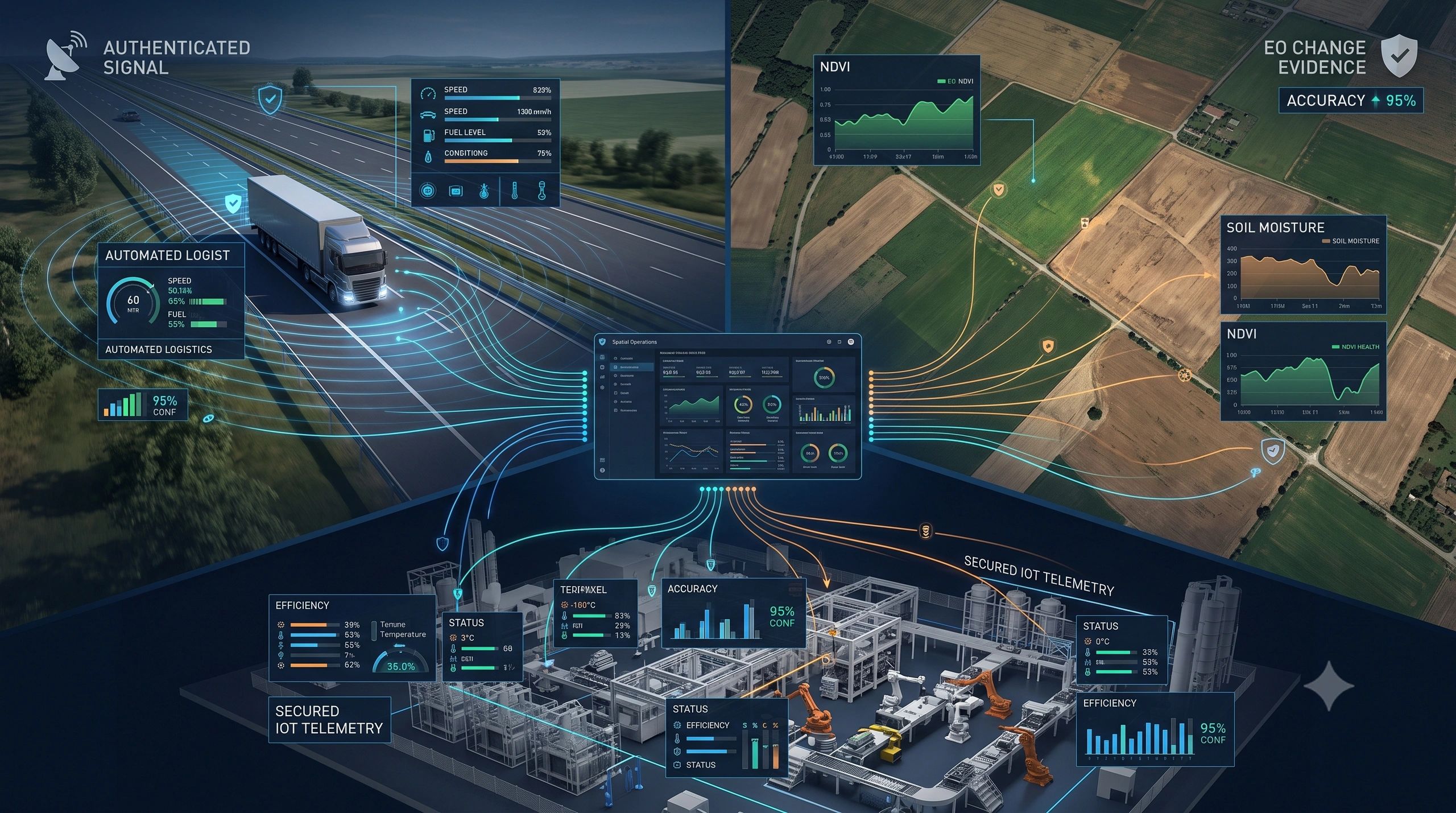
A vehicle appears at the correct location on a fleet dashboard. A sensor reports an abnormal temperature. A satellite image indicates that a farm adopted a sustainable practice.
But can the organization prove that the location was genuine, the sensor reading was untampered, or the sustainability claim accurately reflects what happened on the ground?
This is becoming a central operational question.
Geospatial systems have traditionally focused on capturing, analyzing and displaying spatial information. The next phase must establish whether that information is trustworthy enough to support automated action, regulatory reporting, financial decisions and public safety.
This is the shift toward trusted spatial operations.
It brings together three capabilities:
- Authenticated positioning that helps verify where an asset was.
- Secure telemetry that establishes where sensor data came from and whether it changed.
- Earth observation evidence that documents physical conditions and changes over time.
Individually, these technologies are useful. When connected through an operational platform or digital twin, they create an evidence chain from physical reality to organizational action.
A Coordinate Is No Longer Sufficient
Most digital systems accept latitude, longitude and time as facts.
That assumption is increasingly risky.
GNSS signals can be spoofed, causing a receiver to calculate a false location or time. They can also be jammed, preventing reliable positioning altogether. These risks matter across logistics, maritime operations, UAV missions, road transport, energy infrastructure and autonomous systems.
Galileo’s Open Service Navigation Message Authentication, or OSNMA, is designed to help receivers verify that navigation messages originated from Galileo and have not been altered.
The technology is now moving into commercial receivers, smart tachographs, patrol vessels, infrastructure-timing applications and compact asset trackers. It helps detect certain forms of spoofing, although it does not prevent signal jamming.
This distinction is important. Authentication does not make positioning infallible. It adds an integrity signal that an operational system can use.
Instead of displaying only:
Vehicle at Location X
a trusted-location workflow could report:
Vehicle at Location X; navigation message authenticated; accuracy within threshold; no integrity warning detected.
When authentication fails or signals conflict, the system can request corroboration from inertial sensors, cellular positioning, road-network constraints or nearby devices.
The operational value lies in changing the response according to the confidence available.
Trusted Telemetry Must Extend Beyond the Device
Secure positioning proves only one part of the picture.
Connected operations also depend on temperature sensors, smart meters, environmental stations, machinery monitors, cameras, gateways and satellite-connected IoT devices.
A digital twin may faithfully display the data it receives while remaining unaware that a sensor was incorrectly calibrated, a gateway was compromised or a record was altered in transit.
This is why telemetry security must cover the complete sensor-data lifecycle:
- Device identity
- Calibration history
- Measurement timestamp
- Communication integrity
- Transformation and processing history
- Anomaly detection
- Software and firmware status
- Evidence of human intervention
An ESA-supported programme involving Keysight and Sateliot is exploring AI-based anomaly detection, blockchain and digital calibration certificates for 5G non-terrestrial networks.
The broader signal is clear: expanding IoT coverage through satellites also expands the attack surface. Remote connectivity must therefore be accompanied by stronger device identity, provenance and interference detection.
Europe’s Cyber Resilience Act reinforces the same direction. Connected products entering the European market will increasingly require risk assessments, vulnerability-management processes, secure updates and lifecycle cybersecurity evidence. Reporting obligations begin in September 2026, with the principal obligations applying from December 2027, according to the European Commission’s implementation guidance.
Cybersecurity can no longer be treated as a separate checklist added after an IoT or digital-twin system is built. It must become part of the operational architecture.
Earth Observation Is Becoming an Evidence Layer
The third component is Earth observation.
Satellite data has often been sold as imagery, classifications or periodic reports. Its more valuable role is emerging as independent evidence of conditions, activities and change.
During the recent France–Spain wildfires, Copernicus rapid mapping supported active emergency response alongside aircraft, field crews and vehicles. In such situations, satellite observations become part of a live operational picture combining fire extent, settlements, critical assets, evacuation routes and field reports.
The same change is happening in agriculture.
European heatwaves have shortened grain-filling periods, reduced soil moisture and lowered several crop-yield forecasts. For processors, lenders and insurers, a regional forecast identifies exposure. Parcel-level EO analytics can show where the risk is concentrated and how conditions are changing.
An ESA-backed dairy sustainability initiative is taking this further by using EO observations to detect farm-management activity and translate it into audit-ready reporting.
This changes the product.
The customer is not simply buying an image of a field. The customer is receiving evidence connected to a parcel, practice, reporting requirement and decision.
India’s expanding digital-soil ecosystem points in a similar direction. Parcel identity, soil characteristics, crop observations, weather and advisory systems are gradually becoming connected. This could support input optimization, credit assessment, sourcing risk, sustainability reporting and carbon programmes.
But EO evidence also requires governance. Each output should retain the source imagery, observation date, processing method, model version, confidence level and any field validation used.
Without this context, a polished sustainability dashboard may still carry weak evidence underneath.
The Digital Twin Becomes the Evidence Coordinator
A digital twin provides a natural place to connect these trust layers.
Consider a refrigerated food shipment.
Authenticated positioning establishes the vehicle’s reported route. Secure telemetry records the temperature inside the container. EO and weather data document external heat conditions or disruption along the corridor. The twin links these observations to the shipment, vehicle, driver, contract and delivery event.
If a quality dispute arises, the organization can examine the complete operational evidence chain rather than rely on isolated system logs.
The same architecture can support:
- A utility inspecting remote assets with UAVs
- A port tracking vessels and high-value cargo
- A city coordinating flood or wildfire response
- An insurer validating agricultural loss
- A food processor verifying farm practices
- An industrial operator monitoring critical equipment
- A carbon programme documenting land-management change
The digital twin should not merely display the latest state. It should preserve how that state was established.
A practical trusted-spatial record would connect:
Asset identity → authenticated position → verified telemetry → EO observation → processing history → confidence → responsible decision → outcome evidence
This transforms the twin from a visual representation into an operational evidence system.
Start with One Decision, Not a Universal Trust Platform
Organizations do not need to redesign their entire technology landscape at once.
A focused pilot can begin with one costly or high-risk decision:
- Was the vehicle actually on the approved route?
- Did the cold-chain breach occur before or after custody transfer?
- Was the reported field practice visible during the required period?
- Is a disaster alert reliable enough to dispatch a field team?
- Can a UAV inspection record be tied to the correct asset and flight?
- Did the maintenance intervention restore normal performance?
For that decision, identify the minimum evidence required, the source of each record, the integrity checks, the acceptable confidence threshold and the action to take when trust falls below that threshold.
This approach turns “data trust” from an abstract ambition into a measurable operational control.
Trust Will Become a Product Capability
The next competitive advantage in geospatial technology will not come from displaying more layers.
It will come from proving that the location, measurement and observed change behind a decision are sufficiently reliable for the intended use.
Authenticated GNSS can strengthen location integrity. Secure telemetry can protect the sensor-to-platform chain. EO can provide independent evidence of physical conditions and change. Digital twins can coordinate these elements with assets, obligations, decisions and outcomes.
The map remains important.
But in mobility, climate intelligence and connected infrastructure, the real value will increasingly lie in the evidence behind every point on it.