
No-code GeoAI can reduce the time required to build a model.
It can also reduce the time required to make a bad decision.
A planner can select a few examples of damaged roofs, illegal structures, unhealthy trees or road defects.
AI can identify similar features across satellite, aerial or drone imagery.
A model that previously required months of specialist work may soon be configured, tested and deployed within days or even hours.
That is an important shift.
GeoAI is moving beyond specialist development teams and becoming accessible to domain experts in insurance, agriculture, infrastructure, utilities, environmental management and urban planning.
But easier model creation does not automatically produce decision-grade intelligence.
A detector may be technically functional while still being operationally unreliable.
It may perform well in one location but fail in another.
It may recognize an object without understanding the asset, ownership, regulation or operational priority connected to it.
It may produce a confidence score without explaining whether that score is sufficient to trigger an inspection, payment, enforcement notice or maintenance task.
This is where the next GeoAI challenge begins.
The real problem is not model creation
The emerging no-code model-building workflow appears simple:
Select an example.
Allow AI to label similar examples.
Configure a model.
Run it across a larger area.
Review the detections.
This lowers the technical entry barrier. But it does not remove the need for judgement.
Before using the result, an organization must still ask:
Does the training sample represent actual operating conditions?
How does the model perform across seasons, sensor types, locations and image resolutions?
What level of false positives is acceptable?
What happens when the model misses a critical feature?
Which outputs require human review?
Who has the authority to approve the next action?
How will the organization record the model version, source imagery, confidence score and final decision?
These are not secondary questions.
They determine whether the GeoAI output is an interesting visual layer or trusted operational evidence.
A detection is not yet a decision
Consider an insurance company using imagery to identify storm-damaged roofs.
The model may correctly detect a visible change. But the insurer still needs to connect that detection to a property, policy, event date and claims process.
A false positive could initiate an unnecessary inspection.
A false negative could delay support to an affected customer.
The same issue appears in infrastructure.
A model may identify vegetation near a transmission corridor. But the required response depends on distance from the line, vegetation type, voltage level, access conditions, weather exposure and the asset’s criticality.
In agriculture, a crop-stress detection cannot automatically become a fertilizer recommendation. The decision also depends on crop stage, soil condition, weather, irrigation history and local agronomy.
For environmental reporting, a change detected through Earth observation cannot, by itself, prove that a restoration, afforestation or compliance claim is valid. The evidence must be connected to the correct parcel, reporting period, baseline, methodology and field verification.
In every case, the model provides one part of the evidence.
Governance determines how that evidence is interpreted and used.
Decision-grade governance is not bureaucracy
Governance is often treated as something that slows innovation.
In GeoAI, good governance should do the opposite.
It should create a clear path from experimentation to operational use.
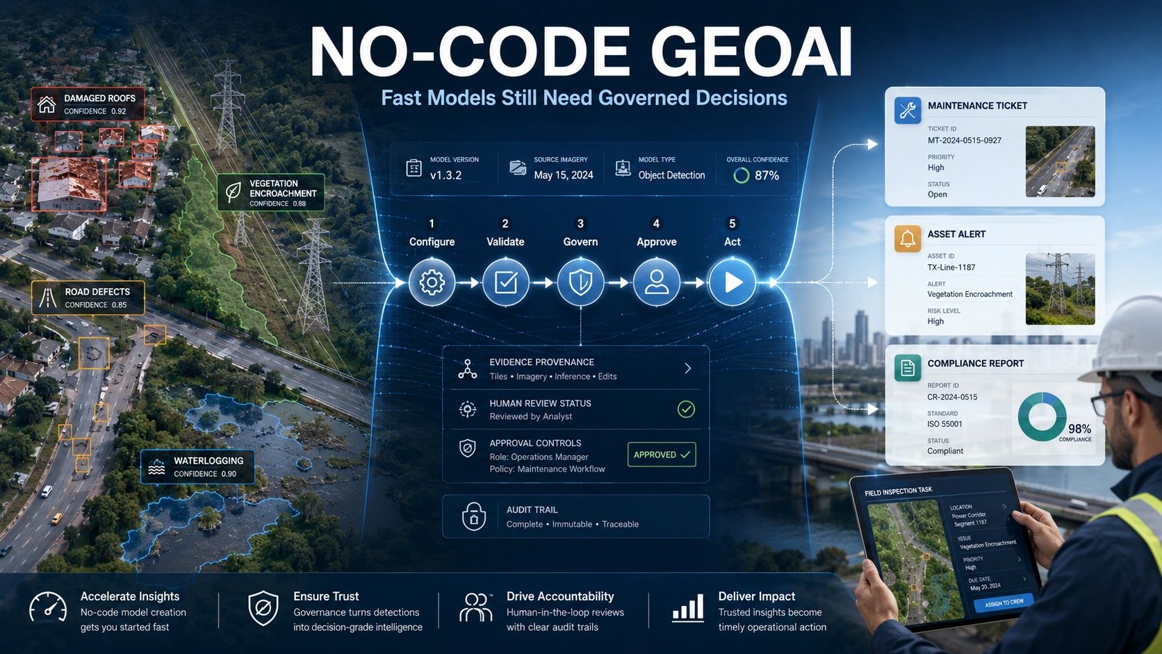
A practical workflow could follow five stages:
1. Configure
A domain expert selects representative examples and defines what the model should identify.
The system assists with labelling, segmentation or object detection.
But the examples must include variations not only the clearest or easiest cases.
2. Validate
The model is tested on a separate area and across realistic conditions.
Performance should be reviewed by geography, season, sensor, object type and operating environment rather than through one overall accuracy figure.
3. Govern
The organization defines confidence thresholds, review rules, user permissions and escalation paths.
A low-risk output may be accepted automatically.
A high-consequence output may require two-stage approval or additional field evidence.
4. Act
Approved detections should connect directly to a business workflow.
That could be a field-inspection task, maintenance ticket, claims review, compliance report, farmer advisory or emergency-response priority.
5. Learn
The field outcome must return to the model workflow.
Was the detection correct?
Was the issue more or less severe than predicted?
Did the intervention solve the problem?
Without this feedback loop, the model may continue repeating the same errors.
What my experience in geospatial has taught me
Over more than two decades in this sector, I have seen data production become faster, cheaper and more automated.
But faster data has not removed the trust problem.
In many projects, the technical output is available long before the organization agrees on how it should be used.
The map is ready.
The dashboard is live.
The model is producing alerts.
But the team has not defined which alert matters, who owns the response or what evidence is required before action.
No-code GeoAI could widen this gap unless governance is designed into the platform from the beginning.
The answer is not to restrict model creation to specialists.
The answer is to give domain teams a controlled workspace where they can configure intelligence without bypassing validation, provenance and operational accountability.
The platform opportunity is changing
GeoAI platforms may increasingly compete less on who can build the most models and more on who can manage the complete decision chain.
The stronger enterprise architecture will connect:
Example selection → AI-assisted labelling → model configuration → test-area validation → confidence threshold → human review → asset and location context → field task or report → verified outcome.
This also changes the role of solution providers.
They do not need to recreate every foundational AI capability.
They can partner with specialist EO and model-development platforms while focusing on industry templates, asset integration, validation workflows, approvals, evidence management and enterprise deployment.
That is where repeatable operational value is created.
No-code does not mean no accountability
The purpose of no-code GeoAI should not simply be to let more people build models.
It should allow domain teams to safely convert physical-world evidence into faster and better decisions.
That requires speed and control.
Automation and human judgement.
Configuration and validation.
Model confidence and operational context.
The organizations that combine these elements will move beyond experimental GeoAI.
They will build spatial intelligence that people are prepared to trust, defend and act upon.
Where do you see the greatest governance gap in GeoAI today: representative training examples, confidence thresholds, human approval or the field-feedback loop?