
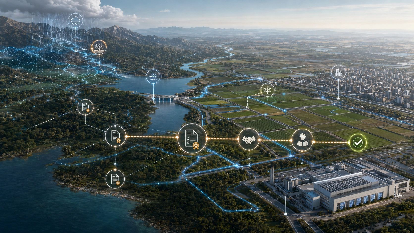
A data center may have an approved cooling design but no dependable long-term water source.
A farm may hold an irrigation allocation but receive insufficient water when the crop needs it.
A city may know where flooding occurs yet remain unclear about which department, contractor or asset owner must resolve the underlying cause.
These are not simply water-data problems. They are dependency and accountability problems.
Most water digital twins represent the physical system: rainfall, rivers, reservoirs, groundwater, soil moisture, pipelines, treatment plants and consumption. That physical view is essential, but it does not explain whether water will be available to a particular user, under what conditions, through which infrastructure, or who must act when the situation changes.
The next water digital twin must connect the catchment to the contract.
Water availability is not the same as water access
A catchment may contain water while an individual facility still faces a shortage.
The difference lies in the operational chain between the resource and the user:
Water must be captured, allocated, treated, transported and delivered. Each stage may be controlled by a different organization, governed by a different agreement and exposed to a different failure.
A complete water-dependency model therefore needs to connect:
Water condition → infrastructure → user → entitlement or obligation → operational decision → evidence of outcome
Consider an industrial campus drawing water through a municipal network.
Its operational risk does not depend only on reservoir levels. It may also depend on pipeline capacity, treatment availability, pumping reliability, permitted withdrawal, seasonal restrictions, competing municipal demand and contractual supply commitments.
A conventional dashboard may show that the reservoir is at 55% capacity. A decision-ready twin should explain what that level means for the campus:
- Is its allocation likely to be reduced?
- Which production processes would be affected?
- When should recycled-water capacity be increased?
- Who has authority to change the operating plan?
- Which contractual or regulatory condition triggers that action?
That is where a water twin moves from observation to operational intelligence.
Earth observation expands the physical evidence layer
New observation sources are improving our ability to understand water conditions across large areas.
The European Space Agency’s HydroGNSS mission has entered scientific operations, with data made openly available worldwide. The mission uses reflected satellite-navigation signals to observe hydrological variables such as soil moisture, inundation, wetlands and aspects of vegetation and water availability.
HydroGNSS adds another layer alongside optical imagery, SAR, terrain models, weather information and ground sensors.
Together, these sources can support:
- Flood and inundation assessment
- Soil-moisture monitoring
- Drought and water-stress analysis
- Wetland observation
- Irrigation planning
- Catchment and watershed intelligence
But access to more data does not automatically create a better water decision.
A soil-moisture anomaly becomes operationally useful only when it is connected to the affected irrigation zone, crop stage, available water allocation, pumping capacity, responsible field team and required response.
Similarly, an inundation signal must be connected to roads, buildings, drains, vulnerable communities and the authority responsible for intervention.
Open satellite data is reducing the cost of observing water. Commercial value is shifting toward integrating that evidence with assets, responsibilities and workflows.
Every water dependency has an ownership layer
Water systems rarely have one accountable party.
The catchment may fall under one authority. A reservoir may be operated by another. Treatment may be handled by a utility, distribution by a concessionaire and internal consumption by a facility operator.
The associated rights and obligations may be distributed across permits, allocation orders, service agreements, leases, environmental approvals, operating contracts and maintenance arrangements.
A useful water digital twin should therefore maintain a responsibility graph connecting:
- Water sources and catchments
- Reservoirs, canals, pipelines and treatment plants
- Asset owners and operating parties
- Permitted withdrawals and allocation limits
- Contracted users and service commitments
- Environmental-flow requirements
- Maintenance responsibilities
- Community dependencies
- Risk thresholds and response authority
This is especially important for infrastructure financed, owned and operated through multiple parties.
In a data-center campus, for example, the landowner, infrastructure investor, developer, tenant, operator, utility and cooling-technology provider may each control a different part of the water dependency. A supply disruption cannot be resolved by knowing only that consumption has exceeded a threshold. The platform must identify whose obligation has been activated and which action is authorized.
Water risk changes over the asset lifecycle
Water is often assessed during site selection as a fixed suitability factor.
The site has a water connection. The proposed withdrawal is within the permitted limit. The design includes the required cooling or treatment capacity. The project therefore appears viable.
But those findings can become outdated.
Seasonal scarcity may intensify. Groundwater levels may decline. Municipal demand may increase. Treatment infrastructure may reach capacity. Regulations may change. Local communities may challenge industrial withdrawals. A critical pipeline may deteriorate.
Water risk must therefore be monitored through planning, construction and operation.
A dynamic water-dependency twin could connect:
Catchment condition → seasonal availability → withdrawal entitlement → infrastructure capacity → operational demand → community dependency → risk threshold → mitigation action
For an AI or industrial campus, this could reveal when projected cooling demand is approaching a water constraint before the constraint turns into operational disruption or community conflict.
Water should not be treated as one score inside a site-suitability matrix. It is a changing infrastructure dependency.
The twin must preserve evidence of action
Detection is only the beginning.
Suppose a water twin identifies falling soil moisture across an agricultural zone. The resulting decision chain could include:
- Confirm the anomaly using satellite, weather and field observations.
- Identify the affected fields and crop stages.
- Check the applicable allocation and irrigation schedule.
- Determine whether sufficient canal or pumping capacity is available.
- Assign the required field action.
- Record what was implemented.
- Measure whether soil moisture and crop condition improved.
The final step is essential.
Without outcome verification, the system records alerts and activities but does not establish whether the intervention worked.
The same principle applies to cities. A drainage blockage may be cleared, but did the next rainfall event produce less flooding? A watershed may be restored, but did infiltration, soil moisture or seasonal flow improve? A facility may install water-efficiency measures, but did withdrawal decline after accounting for changes in production?
This evidence also matters for climate disclosure, insurance, infrastructure investment and regulatory reporting. Automated reporting may reduce the administrative burden, but it cannot replace reliable asset-level evidence.
A decision-ready water twin needs three connected models
A practical implementation should bring together three views:
1. The physical water model
Catchments, rainfall, soil moisture, groundwater, reservoirs, inundation, drainage, treatment and distribution infrastructure.
2. The dependency and responsibility model
Users, owners, operators, allocations, permits, contracts, environmental duties, community requirements and response authority.
3. The intervention and evidence model
Risk thresholds, decisions, assigned actions, field observations, completed work and verified outcomes.
Separately, these models answer what is happening, who is responsible and what was done.
Together, they answer the question that owners and operators actually face:
Given the current water condition, which dependency is at risk, who must act, under what authority, and how will we prove that the response worked?
That is the difference between a water dashboard and a water digital twin capable of supporting real decisions.
Water intelligence becomes commercially useful when it shows not only where water is, but who depends on it, who controls it, and what action is required when availability changes.