
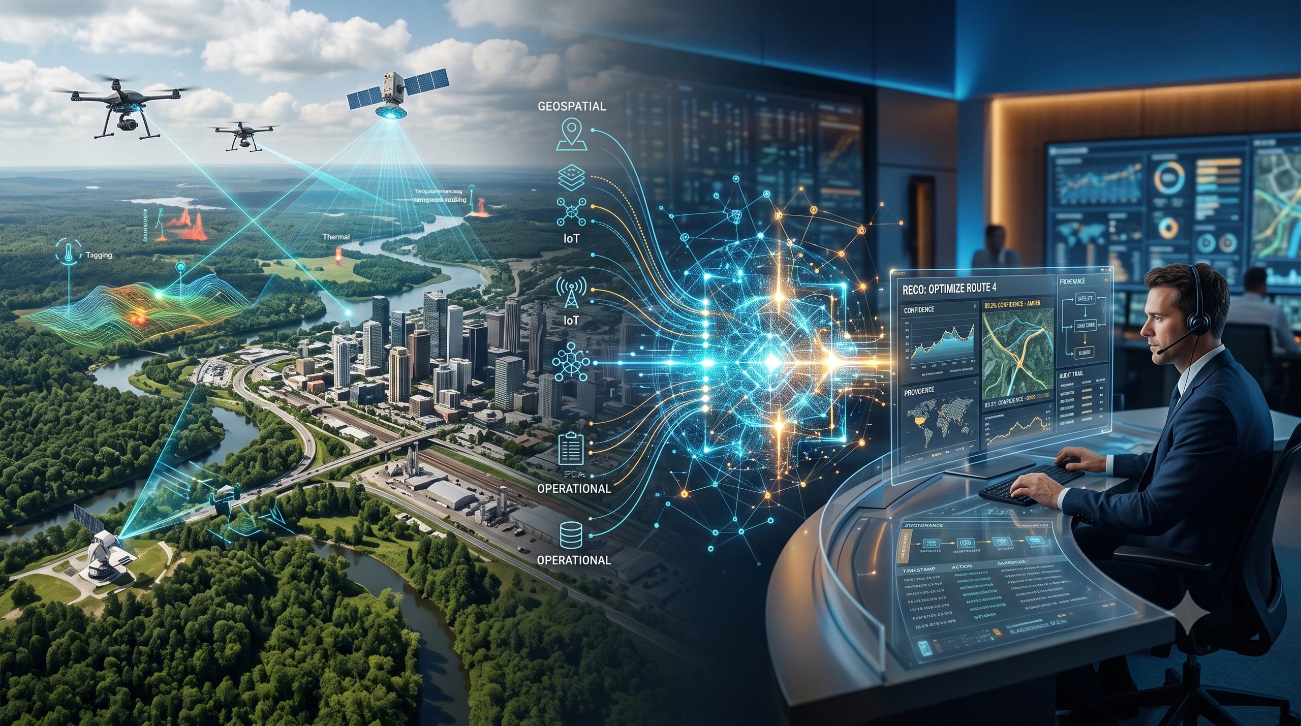
A map can show where something happened. A dashboard can show when it changed. An AI assistant can suggest what to do next.
But none of these, by itself, proves that the resulting decision was reliable.
This is becoming the central challenge for geospatial technology. As GeoAI, Earth observation, IoT, digital twins and operational agents converge, organizations are gaining faster ways to interpret physical conditions. Yet faster interpretation does not automatically create accountable action.
The real opportunity is therefore larger than producing another intelligent map. It is to build an auditable decision system, one that connects physical evidence, operational context, analytical reasoning, uncertainty and human authority.
The gap between insight and accountability
Most spatial systems were designed primarily to answer descriptive questions:
- Where are the assets?
- What has changed?
- Which locations are exposed?
- Where should we investigate?
These remain essential questions. But operational decisions require additional evidence.
If a model reports forest-carbon growth, an auditor must know which imagery, field plots and assumptions supported that estimate. If an agent recommends rerouting a shipment, an operator needs to understand the live conditions, contractual rules and confidence behind the recommendation. If a city prioritizes a neighborhood for heat adaptation, decision-makers should be able to trace the result back to temperature observations, buildings, vegetation, demographics and critical facilities.
This is where GeoAI is beginning to move from visual intelligence to decision infrastructure.
Remote-sensing MRV is becoming performance-based
The American Carbon Registry’s recently described approach to remotely sensed forest-carbon estimates is an important signal.
Rather than prescribing one sensor or algorithm, the framework focuses on accuracy, uncertainty and project-scale validation against field plots. Satellite imagery, UAV data, LiDAR and analytical models can contribute, but their results must meet defensible quality benchmarks.
That changes the role of remote sensing in measurement, reporting and verification.
The objective is no longer simply to detect vegetation change or estimate biomass. The system must preserve how the estimate was produced: the source imagery, calibration data, model version, calculation boundary, uncertainty range and validation results.
Australia’s decision to wind down Climate Active certification reinforces the same direction from another angle. Organizations may have less dependence on a government certification mechanism, but they will not have less need for credible emissions evidence. Independent assurance, sector standards and auditable primary data may become even more important.
Spatial evidence can provide much of the necessary grounding. It connects emissions and environmental claims to facilities, utilities, transport networks, land parcels and observed land-use change.
But a satellite image alone is not an audit trail. The workflow around it creates the audit trail.
Operational agents add context and speed
At the same time, operational platforms are embedding AI agents directly into their data environments.
Project44’s logistics analyst, for example, uses customer shipment histories, business rules and a logistics data graph to respond to operational questions. Soracom’s technology-preview agent spans IoT requirements, design, development and operations while retaining project memory within a customer-dedicated environment.
The important development is not the conversational interface.
These agents are being grounded in domain data, operating rules and project context. That makes them more useful than generic assistants because they can interpret exceptions in relation to how a particular organization works.
Consider a delayed shipment. Its coordinates and estimated arrival time provide only part of the picture. A useful operational agent may also need to assess port congestion, weather, geofence events, vehicle availability, customer service-level agreements and alternative routes.
The agent can bring these signals together quickly. However, its recommendation becomes decision-ready only when users can see the evidence used, the rules applied, the confidence level and the actions the agent is permitted to initiate.
An intelligent recommendation without traceability remains difficult to govern.
GeoAI becomes the connective layer
GeoAI can connect the environmental evidence of MRV with the real-time context of operational agents.
Location provides a shared frame for satellite observations, field measurements, assets, transactions, sensor events, contracts and human activity. It allows an organization to ask not only what happened, but where it happened, what else was affected and which operational responsibility applies.
This convergence can support several practical situations:
- A carbon project links forest change to field plots, ownership boundaries, interventions and uncertainty.
- A logistics operator connects shipment exceptions to ports, roads, weather and customer commitments.
- A city combines satellite-derived heat observations with vulnerable populations, buildings, vegetation and health facilities.
- An industrial operator links point clouds and equipment locations to machine telemetry, quality deviations and maintenance records.
- An agricultural risk system relates local soil moisture to upwind vegetation and atmospheric moisture transport.
In each case, the map is not the final output. It is the organizing layer for evidence and action.
Five requirements for an auditable spatial decision
Organizations developing these systems should preserve five connected elements.
1. Evidence
Every significant result should retain its source: sensor reading, image, field observation, enterprise record or external dataset.
2. Context
The system must relate the evidence to assets, boundaries, events, obligations, operating conditions and affected stakeholders.
3. Reasoning
The model, rule or analytical method used to reach the recommendation should be identifiable. A natural-language explanation is useful, but it is not a substitute for a reproducible analytical record.
4. Confidence
Uncertainty should influence the next step. High-confidence results may support action. Medium-confidence results may require review. Low-confidence results may trigger additional data collection.
5. Authority
The system should define who can approve, reject or execute the recommendation. Agents should operate within explicit permissions, with consequential actions subject to appropriate oversight.
If one of these elements is missing, the decision chain becomes weaker.
Governance must follow the complete trajectory
Governance cannot stop at securing the underlying dataset or validating a model before deployment.
An operational agent may retrieve information from several systems, interpret it, choose a tool and recommend or initiate an action. Authorization, task alignment, data isolation and action alignment therefore need to be assessed across the complete trajectory.
Provenance should survive each transition: from observation to analysis, from analysis to recommendation, and from recommendation to intervention.
The system should also preserve the result of the intervention. Otherwise, it can explain why an action was selected but cannot demonstrate whether that action worked.
This closes the loop between evidence, decision and measurable outcome.
The next geospatial product is a decision record
The competitive advantage in GeoAI will not come only from having more imagery, a larger model or a better-looking interface.
It will come from maintaining the connection between evidence and responsibility.
Organizations that build this foundation can shorten analysis cycles, improve regulatory reporting, reduce disputes, support independent assurance and learn from previous interventions. They can use operational agents without turning critical processes into an unexplained black box.
The next geospatial opportunity is not another map.
It is an auditable decision system in which spatial evidence shows what changed, operational context explains why it matters, AI recommends the next step, and accountable people retain authority over what happens next.