
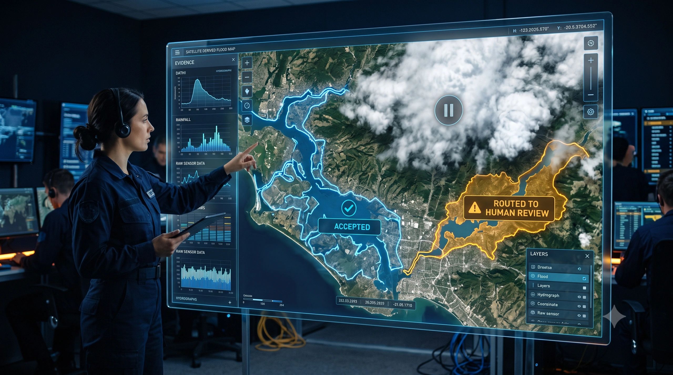
A flood map can be wrong in two very different ways. It can miss the flooded area. Or it can draw a precise-looking boundary where the evidence was never strong enough to support one.
The second failure is more dangerous because it arrives with the appearance of certainty. Once that boundary enters a dashboard, it can influence evacuation priorities, insurance assessment, field deployment, relief allocation, or infrastructure inspection. The map stops looking like a model output and starts behaving like an accepted fact.
This is the next trust problem for GeoAI. The goal cannot be to make a spatial claim for every image, asset, parcel, or event. A decision-ready system must also know when the available evidence is too weak, unfamiliar, or contradictory to justify a claim.
Why a confidence score is not enough
Most spatial-AI demonstrations focus on accuracy, speed, coverage, and reduced labelling effort. These are useful measures, but they describe model performance under evaluated conditions. They do not automatically tell an operator what to do with one particular prediction in the field.
A model may encounter cloud, haze, shadow, seasonal change, unfamiliar terrain, a different sensor, poor resolution, stale imagery, or conditions that were rare in its training data. It may still produce a class and a probability. A high score can therefore reflect the model’s internal preference among the choices it knows, not proof that the scene itself is familiar or adequately observed.
This distinction matters. Confidence is a model signal. Reliability is a decision condition. Reliability depends on the input evidence, the model’s familiarity with that evidence, the intended task, and the consequence of being wrong.
A road-defect model used to prioritize routine inspections can tolerate a different error profile from a flood model used during emergency response. The same numerical confidence should not trigger the same action in both workflows.
The emerging idea: prediction, warning, or abstention
Recent work backed by ESA’s lab offers a useful direction. SHRUG-FM: Systematic Handling of Real-world Uncertainty for Geospatial Foundation Models, combines signals from the raw input, the model’s internal representation, and task-specific predictive uncertainty. Its purpose is to help identify likely failures and support three outcomes: provide a prediction, raise a warning, or abstain.
The research addresses a known weakness of geospatial foundation models: they can perform poorly in environments that were underrepresented during pretraining while still appearing confident. The framework has been demonstrated on burn-scar segmentation, with broader evaluation proposed for flood mapping and landslide detection. ESA reported that the work received the Best Paper Award at the EarthVision 2026 workshop.
The important lesson for industry is larger than one framework. Abstention should not remain a research metric or a message hidden in a technical log. It should change the operational path taken by the system.
A three-state operating model for spatial AI
A practical GeoAI workflow should treat every output as one of three operating states.
ACT: The source evidence meets the defined quality rules, the scene is sufficiently familiar to the model, uncertainty is within the use-case threshold, and the proposed action is within the system’s authority. The output can enter the next approved workflow step.
REVIEW: The result may be useful, but one or more signals require validation. The system should route the case to the right reviewer, show why it was flagged, present the source evidence, and record the reviewer’s decision.
ABSTAIN: The evidence is insufficient or the situation is outside the model’s dependable operating range. The system should make no substantive spatial claim. It should state what is missing and trigger a suitable next step: acquire a clearer image, use another sensor, request a field survey, compare another date, or escalate to a domain specialist.
These states should not be based on one universal confidence threshold. They should combine data-quality checks, out-of-distribution signals, model uncertainty, spatial plausibility, business rules, and the consequence of error.
The decision record matters as much as the prediction
Once uncertainty changes the workflow, the organization needs a record of why that path was chosen. For each material output, the system should retain the source data and acquisition time; model and version; task and geographic area; quality and uncertainty signals; operating state; reviewer and decision; authorized action; and later outcome.
This creates a Spatial AI Assurance Record. It allows a project team to answer questions that a confidence score cannot: What evidence supported this boundary? Was the input outside the model’s familiar conditions? Who reviewed the warning? Why was the claim accepted? Did later field evidence confirm it?
The record also makes improvement possible. Abstentions can reveal recurring coverage gaps, weak training geographies, sensor limitations, or seasonal failure patterns. Review outcomes can become labelled evidence for targeted retraining. The system becomes more dependable because it learns where additional evidence creates value not because it is forced to answer every time.
What this changes across spatial use cases
In flood mapping, abstention may prevent a cloud-obscured scene from becoming an authoritative flood boundary. In road inspection, it may separate a likely defect from shadow or surface staining. In crop monitoring, it may prevent stress from being inferred when the available image cannot distinguish water stress from harvest stage or soil background.
For illegal-construction detection, a flagged change should not silently become an enforcement claim. Parcel context, permissions, imagery date, positional accuracy, and human review still matter. In carbon and vegetation monitoring, detected change is not automatically proof of cause, quantity, permanence, or verification status.
Across these cases, the model’s role is not reduced. It becomes more precise. AI can screen, prioritize, propose, and explain its uncertainty. The workflow must decide when that output is sufficient for action and when stronger evidence is required.
Abstention is not lost automation
Some teams may see abstention as a reduction in coverage or productivity. That is the wrong operational comparison. The alternative is not complete automation versus incomplete automation. It is controlled automation versus unsupported claims entering consequential workflows.
A well-designed abstention policy can improve efficiency by directing scarce expert attention to the cases that genuinely need it. It can also prevent rework, field misallocation, false alerts, weak regulatory evidence, and disputes caused by treating a probabilistic output as a settled fact.
The useful business measure is therefore not simply how many predictions the model produces. It is how many dependable decisions the overall system enables and how safely it handles the remainder.
The next requirement for decision-ready GeoAI
Spatial AI is moving from experiments into infrastructure, environmental monitoring, agriculture, asset management, and public-sector workflows. As that happens, benchmark accuracy will remain necessary, but it will not be sufficient.
Owners and operators will need to define the conditions under which a model may make a claim, the conditions that require review, and the conditions in which it must remain silent. Those rules must be visible, testable, use-case specific, and connected to an evidence trail.
The most trustworthy spatial-AI system will not be the one that always produces an answer. It will be the one that can distinguish between a prediction it can support, a case that needs human judgement, and a situation where the evidence does not justify a claim.
Knowing when not to answer is not a model weakness. It is the beginning of operational responsibility.