Most large projects don’t fail during construction or operations.
They fail much earlier, when a location is chosen with incomplete understanding.
Once that decision is locked in, every downstream system is forced to compensate. No amount of execution excellence can fully undo a weak location decision.
The real decision behind most failures
Across infrastructure, logistics, utilities, agriculture, and urban development, leaders face similar questions:
Where should we build or expand?
Which locations carry long-term risk?
Which assets deserve priority investment?
These are strategic decisions , not engineering problems.
Yet they are often made using experience, fragmented reports, or static feasibility studies. The problem isn’t lack of data, it’s the absence of a unified decision lens.
Why location is the missing variable
Every physical decision has one constant: location .
Still, location is frequently treated as a background attribute rather than a core decision variable.
Geospatial intelligence changes this. It places where at the center of planning, revealing how terrain, infrastructure, demographics, climate, access, and risk interact in the real world.
Instead of isolated data points, leaders gain context .
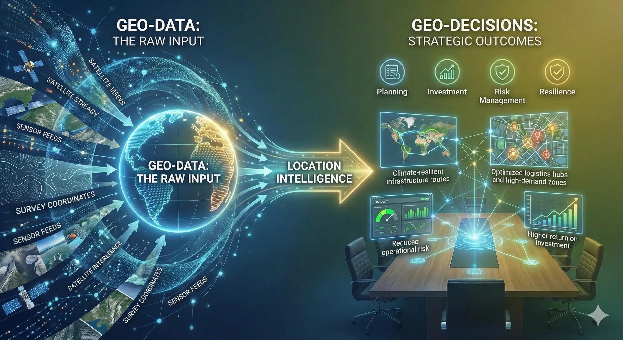
From data to decisions (the simple flow)
Effective geospatial decision-making follows a clear progression:
Physical reality → spatial signals → contextual analysis → insight → decision
Satellite imagery, surveys, sensor data, and administrative records capture reality. Spatial analytics connect these signals. What emerges is clarity, what to prioritize, where to invest, and what to avoid.
This is not about technical complexity.
It’s about decision confidence.
A real-world decision scenario
Imagine a regional authority planning new logistics hubs.
On cost alone, several sites appear viable. But once spatial intelligence is applied, deeper patterns emerge:
Some sites face recurring flood exposure
Others lack long-term connectivity growth
A few align strongly with demand density and resilient infrastructure
The final decision changes, not because the budget changed, but because risk and opportunity became visible .
Business and operational impact
When location intelligence informs decisions early, organizations typically see:
Lower exposure to environmental and operational risk
Faster planning and approval cycles
Better alignment between investment and demand
More resilient long-term asset performance
These outcomes often matter more than short-term cost savings.
Where most organizations struggle
Despite having data, many teams face the same challenges:
Insights exist but don’t influence leadership decisions
Spatial analysis stays project-specific
Data remains siloed across departments
Decisions still rely on intuition
The gap is rarely technical.
It’s structural, how insight flows into decision-making.
From analysis to decision systems
More mature organizations move beyond one-off studies.
They build repeatable decision frameworks where location intelligence continuously informs planning, investment prioritization, and risk management. This is where geospatial capabilities connect naturally with BIM, IoT, and digital twins, not just to execute projects, but to guide strategy.
The natural next step
At scale, spreadsheets and static maps fall short.
Organizations begin looking for structured advisory support and decision platforms that make location intelligence repeatable, auditable, and trusted. This is less about new tools, and more about embedding spatial thinking into the organization.
Looking ahead
With real-time data, AI-driven analytics, and regional-scale digital twins, location-based decisions are shifting from reactive to predictive.
Those who adopt this mindset early won’t just respond better to change, they’ll anticipate it.
Final thought
The question today is not whether we have enough data.
It’s whether we are using location intelligence to make the right decisions, in the right place, at the right time .