The Planet’s Soft Infrastructure
Concrete dams and levees get the credit for flood control, but nature built its own long before we did.
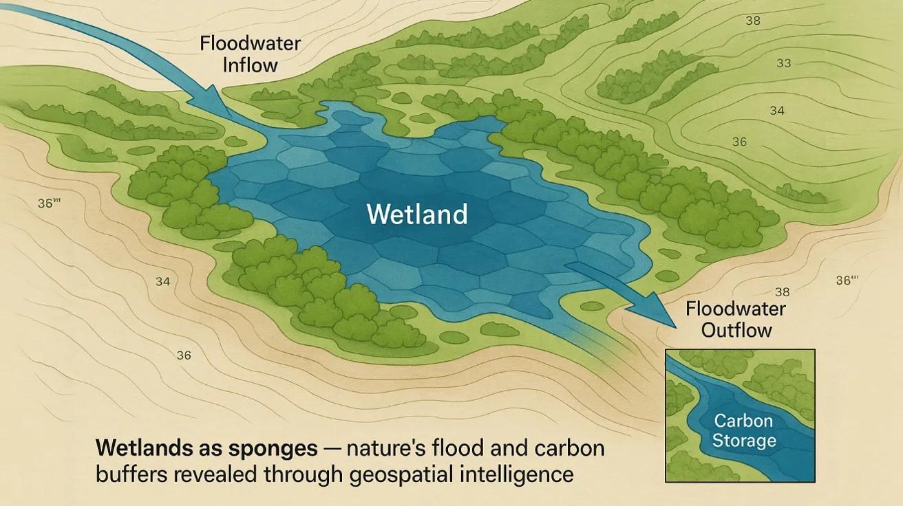
Wetlands, floodplains, marshes, mangroves, and peat bogs, act as the planet’s soft infrastructure , quietly storing, filtering, and releasing water while locking away carbon for centuries.
In geospatial terms, they are dynamic, multifunctional polygons that change seasonally but maintain a constant purpose: stabilizing hydrology and moderating climate.
Hydrological Logic: Wetlands as Natural Buffers
When it rains excessively, wetlands absorb and store water. When it doesn’t, they release it slowly, smoothing the peaks and valleys of the hydrological curve.
Key hydrological functions:
Flood Moderation: Each hectare can store up to 9–10 million liters of stormwater, reducing downstream flood peaks.
Groundwater Recharge: Wetlands promote infiltration through organic, permeable soils.
Baseflow Maintenance: During dry seasons, slow release sustains river discharge and ecosystem continuity.
Sediment Retention: Wetlands trap suspended sediments, improving downstream water quality.
This hydraulic buffering capacity is why wetlands are now treated as living infrastructure in urban and regional flood models.
Geospatial Mapping of Wetland Dynamics
Wetlands are notoriously dynamic, expanding and contracting with rainfall, tides, and human influence.
Hence, they require multi-temporal remote sensing and GIS-based delineation.
Mapping Workflow:
1️⃣ Data Sources: Sentinel-1 (SAR) and Sentinel-2 (Optical) provide dual-season coverage.
2️⃣ Indices:
NDWI (Normalized Difference Water Index): Detects open water.
MNDWI (Modified NDWI): Separates water from built-up areas.
NDVI/NDMI: Tracks vegetation and soil moisture response.
3️⃣ Classification: Machine learning algorithms (Random Forest, SVM) classify wetlands vs. waterlogged fields or shallow ponds.
4️⃣ Change Detection: Multi-year analysis identifies encroachment, drainage, or reclamation trends.
The National Wetland Inventory and Assessment (NWIA) by ISRO, using IRS-LISS III and CartoDEM, mapped 757,000 wetlands across India , covering 4.86% of the national area.
Wetlands as Carbon Banks
Wetlands store 20–30% of global soil carbon , despite covering only 6% of land area . They act as long-term carbon sinks because:
Anaerobic (oxygen-poor) conditions slow decomposition.
Peat formation locks organic carbon for centuries.
Coastal mangroves sequester “blue carbon” at rates 5–10 times higher than tropical forests.
In India, the Sundarbans mangroves alone sequester around 0.3 Tg C/year .
When wetlands are drained or degraded, this stored carbon oxidizes, converting them from sinks into emitters.
Thus, mapping wetlands isn’t just hydrology, it’s climate accounting.
Flood Moderation in Action: The East Kolkata Wetlands
A striking example of urban ecosystem services:
The East Kolkata Wetlands , spanning 125 sq. km , act as both a flood buffer and wastewater treatment system.
Absorb over 900 million liters/day of storm and sewage water.
Naturally purify the flow through fishponds and vegetation filtration.
Delay flood peaks during monsoons while recharging groundwater.
Satellite-based monitoring (Sentinel-2 NDWI + LULC classification) revealed that between 2010–2022, urban encroachment reduced wetland area by ~12% , directly increasing urban flood vulnerability.
Such cases underline the policy urgency of treating wetlands as infrastructure , not wasteland.
GeoAI for Wetland Health Monitoring
AI models are increasingly automating wetland health assessment:
Semantic segmentation identifies subtle seasonal wetland shifts from SAR imagery.
Deep learning detects encroachment, siltation, or vegetation overgrowth.
Spatio-temporal analytics correlate rainfall anomalies with wetland shrinkage.
By connecting wetlands to real-time hydrological data (rainfall, flow, storage), GeoAI frameworks can even predict the next floodplain saturation point.
Wetlands in India’s Climate Strategy
India’s Nationally Determined Contributions (NDCs) recognize wetlands as natural climate solutions.
Key initiatives include:
Wetlands (Conservation and Management) Rules, 2017 , regulating reclamation and pollution.
National Centre for Sustainable Coastal Management (NCSCM): Mapping coastal wetlands and blue carbon.
National Adaptation Fund for Climate Change (NAFCC): Supporting state-level wetland rejuvenation projects.
Integrating these efforts into a unified Geospatial Wetland Twin could enable continuous monitoring of area, storage, and carbon sequestration potential.
Toward a Wetland Digital Twin
Imagine a live geospatial twin where:
Sentinel-1 SAR tracks surface water fluctuation.
IoT gauges measure depth and quality.
Carbon flux sensors monitor sequestration rates.
AI dashboards visualize real-time flood absorption capacity.
Such a system would redefine wetlands as operational assets in flood control, water supply, and carbon economy models.
Conclusion
Wetlands are not leftovers of the landscape, they’re the Earth’s natural balancing system .
When we drain them, floods rise. When we restore them, resilience returns.
With geospatial intelligence, we can now quantify what wetlands have always done, absorb extremes, regulate flow, and store carbon.
In nature’s architecture, they’re not empty spaces, they’re safety valves .