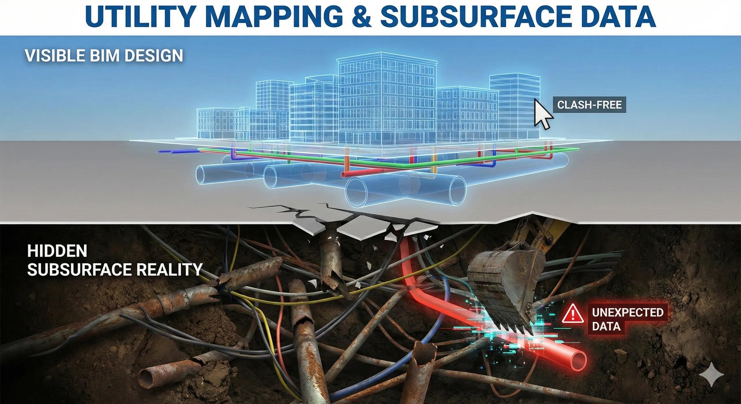
Most BIM models look clean, coordinated, and clash-free, until excavation begins.
That’s when reality surfaces.
Utilities that were “assumed” turn out to be misaligned. Depths are wrong. Routes differ. Unknown services appear. What looked like a design issue is actually a subsurface data problem .
The uncomfortable truth is this:
BIM does not fail underground. Assumptions do.
This article explains why subsurface utility mapping is foundational to BIM design, and how geospatial intelligence turns underground uncertainty into manageable risk.
1. Why Subsurface Is BIM’s Blind Spot
BIM is inherently visual and model-driven.
Subsurface utilities are:
Invisible
Fragmented across agencies
Poorly documented
Often outdated
As a result, many BIM designs rely on:
Legacy drawings
Approximate alignments
Inferred depths
This creates a false sense of confidence.
2. “Clash-Free” Models Can Still Fail on Site
A BIM model can show:
Zero clashes above ground
Perfect coordination across trades
And still fail when:
A utility lies 600 mm deeper than expected
A service crosses diagonally instead of orthogonally
Multiple utilities share undocumented corridors
These are not BIM errors.
They are data fidelity errors .
3. Utility Mapping Is a Geospatial Problem First
Accurate utility representation requires:
Spatial reference consistency
Survey control integration
Attribute-rich data
Confidence classification
This places utility mapping squarely in the GIS + survey domain , not just BIM.
BIM consumes utility data.
It should not invent it.
4. Sources of Subsurface Data (And Their Limits)
Common inputs include:
As-built drawings (often outdated)
Utility records from agencies
Ground-penetrating radar (GPR)
Electromagnetic detection
Trial pits
Each source has:
Varying accuracy
Different confidence levels
Treating all inputs as equally reliable is a major risk.
5. Confidence Matters More Than Geometry
The most important attribute of subsurface data is not shape, it’s confidence .
Best practice:
Classify utilities by reliability
Tag depth certainty
Flag inferred routes
Separate verified vs assumed assets
Design decisions should factor confidence, not just location.
6. How Subsurface Data Should Enter BIM
Instead of embedding raw assumptions into BIM geometry:
Maintain utilities as geospatial layers
Link them into BIM as references
Model protective envelopes, not exact pipes
Update geometry only after verification
This keeps BIM honest and adaptable.
7. Construction Risk Lives Underground
Most cost overruns related to utilities come from:
Unexpected relocations
Emergency design changes
Delays during excavation
Safety incidents
Early subsurface intelligence:
Reduces redesign
Improves sequencing
Supports safer planning
Utility mapping is not a documentation task, it is risk management .
8. India Context: Why This Is Critical
In India:
Utility records are often fragmented
Informal installations are common
Multiple agencies control overlapping assets
Urban density magnifies error impact
Relying purely on drawings is risky.
Geospatial-led utility intelligence is essential.
9. Preparing for Digital Twins Starts Underground
A digital twin without subsurface intelligence is incomplete.
Utilities are:
Long-lived assets
High-risk systems
Expensive to relocate
Mapping them correctly early enables:
Better asset lifecycle management
Predictive maintenance
Future-proof infrastructure planning
10. A Simple Rule for Utility-Aware BIM
If you cannot state how confident you are about a utility’s location and depth, it should not be treated as fixed geometry in BIM.
Conclusion
BIM excels at what is visible.
Infrastructure fails where visibility ends.
When subsurface data is treated as a geospatial intelligence problem:
Design risk drops
Coordination improves
Surprises reduce
BIM becomes realistic, not optimistic
In BIM-to-field workflows, the most important data is often the data you cannot see, but must still trust .