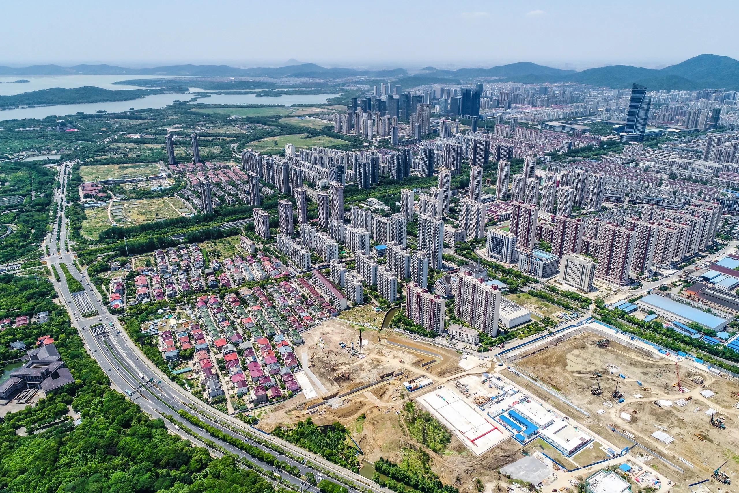
Urban planning has entered a new era with the integration of 3D visualization , enabling professionals to create detailed, interactive models of cities and infrastructure. Through these advanced tools, stakeholders can explore potential scenarios, assess environmental impacts, and make data-driven decisions that improve the quality and sustainability of urban environments. This article delves into how 3D visualization capabilities, particularly geospatial 3D models , have transformed urban planning and how platforms like ours offer the solutions needed to address the challenges faced by modern cities.
The Evolution of Urban Planning Tools
Traditionally, urban planners relied on two-dimensional (2D) maps and blueprints, which often lacked the detail required to fully understand spatial relationships and infrastructure impacts. While useful, these methods often led to inaccuracies or inefficiencies, especially when dealing with complex cityscapes. The rise of 3D visualization marks a significant improvement, offering planners the ability to model cities with greater precision, accuracy, and interactivity.
Geospatial 3D models integrate geographic data with 3D modeling, giving planners a comprehensive view of the urban environment. This helps to address issues such as overcrowding, inefficient land use, and environmental degradation, all while ensuring that plans are grounded in real-world data.
The Solution We Offer
Our platforms enhance these capabilities by integrating a user-friendly interface with powerful 3D modeling tools. Planners can visualize complex data with ease, enabling them to identify potential issues and opportunities early in the planning process. We provide seamless integration of geospatial data, allowing planners to build accurate models that reflect the physical and environmental realities of their urban spaces.
Benefits of 3D Visualization in Urban Planning
1. Improved Spatial Awareness
The primary benefit of 3D visualization in urban planning is the enhanced spatial awareness it offers. Unlike traditional 2D plans, 3D models add depth, allowing planners to understand the true relationship between buildings, infrastructure, and the environment. This is especially crucial in densely populated areas where space optimization is key to sustainable development.
For example, when planning a high-rise complex, 3D models can identify potential problems like overshadowing or noise pollution that might not be immediately evident on 2D maps. These insights allow planners to adjust designs before implementation, saving time and resources.
The Solution We Offer
Our platforms’ advanced visualization tools allow planners to see the real-time impact of their decisions. Whether it’s assessing how a new building fits into the skyline or how transportation networks flow through a city, our solution provides planners with the information they need to make data-driven adjustments that optimize space and resources efficiently.
2. Enhanced Stakeholder Engagement
One of the most challenging aspects of urban planning is gaining the buy-in of various stakeholders—developers, local government, and the public. 3D visualization addresses this by providing clear, understandable representations of complex projects, ensuring that all parties can visualize the outcome and understand the impact on the community.
Interactive 3D models allow stakeholders to explore proposed developments, providing a more engaging and immersive way to understand the project. This reduces the likelihood of disputes or misunderstandings, streamlining the approval process.
The Solution We Offer
Our platforms make stakeholder engagement easier by offering interactive models that anyone can navigate. This feature allows for virtual walkthroughs, scenario testing, and real-time feedback. By enabling stakeholders to visualize the project’s end state, we foster greater transparency and collaboration, ensuring smoother project approvals and better outcomes for the community.
3. Environmental Impact Assessments
Urban development often raises concerns about its impact on the environment. Traditional environmental impact assessments are typically static, presenting data that is often hard to interpret in context. In contrast, 3D visualization allows planners to simulate environmental impacts dynamically, showing how new developments might affect things like sunlight exposure, wind patterns, or stormwater runoff.
For example, 3D models can simulate how a proposed development will affect air quality or energy usage, allowing planners to adjust designs to minimize negative environmental impacts.
The Solution We Offer
Our platforms incorporate environmental simulation tools that integrate with geospatial 3D models to offer real-time impact assessments. From analyzing energy efficiency to simulating stormwater management, our solution empowers planners to make more sustainable choices. These tools ensure that cities are built with a focus on long-term environmental health, while meeting regulatory requirements.
4. Data-Driven Decision Making
Urban planning requires the integration of vast amounts of data—everything from zoning laws to demographic trends. 3D visualization tools enable planners to combine all of this information into a single model, offering a more holistic view of the city and making it easier to identify optimal solutions.
For instance, when planning a new public transportation route, integrating data on population density, land use, and traffic patterns into a 3D model helps planners predict how effectively the new route will serve the community.
The Solution We Offer
Our platforms excel at data integration, combining multiple data sets into one interactive model. From zoning regulations to real-time traffic data, our solution offers planners the ability to test different scenarios and make data-driven decisions that reflect the complexities of modern urban environments. This reduces errors, improves resource allocation, and results in more resilient and adaptable city designs.
5. Scenario Planning and Predictive Modeling
Cities are constantly evolving, and urban planners must be prepared to respond to future challenges. 3D visualization tools offer predictive modeling capabilities that allow planners to forecast future urban conditions based on current data trends. These models can simulate population growth, infrastructure wear and tear, or the effects of climate change on urban areas.
The Solution We Offer
Our platforms’ predictive modeling tools empower planners to visualize various future scenarios, ensuring they can design cities that remain functional and sustainable over time. Whether it's analyzing the impact of a growing population or exploring alternative transportation networks, our tools offer the flexibility needed for scenario planning and strategic decision-making.
Challenges in Implementing 3D Visualization
Data Accuracy and Integration
One of the primary challenges of 3D visualization in urban planning is the need for accurate and comprehensive data. Incomplete or outdated data can lead to inaccurate models, which in turn can result in flawed planning decisions.
The Solution We Offer
Our platforms resolve this by offering seamless integration with geospatial data and real-time data updates, ensuring models are always current. We work closely with local governments and data providers to offer the most accurate data possible, ensuring that urban planners can trust the insights they generate from our platform.
Technological Complexity
Developing and maintaining 3D models can require significant technical expertise, which not all urban planning teams possess.
The Solution We Offer
We provide intuitive tools that require minimal training, allowing even non-expert users to build and interact with 3D models . Our platforms are designed to be user-friendly, with an emphasis on ease of use while maintaining the power and flexibility required for complex projects.
In conclusion, 3D visualization has transformed the way urban planners conceptualize and execute their projects. With its ability to improve spatial awareness, enhance stakeholder engagement, and enable data-driven decision-making , 3D visualization is now an indispensable tool for creating sustainable and efficient urban environments. Our platforms provide the solutions needed to address the challenges faced in urban planning, offering advanced features that make it easier for planners to design cities that meet the demands of today and tomorrow.