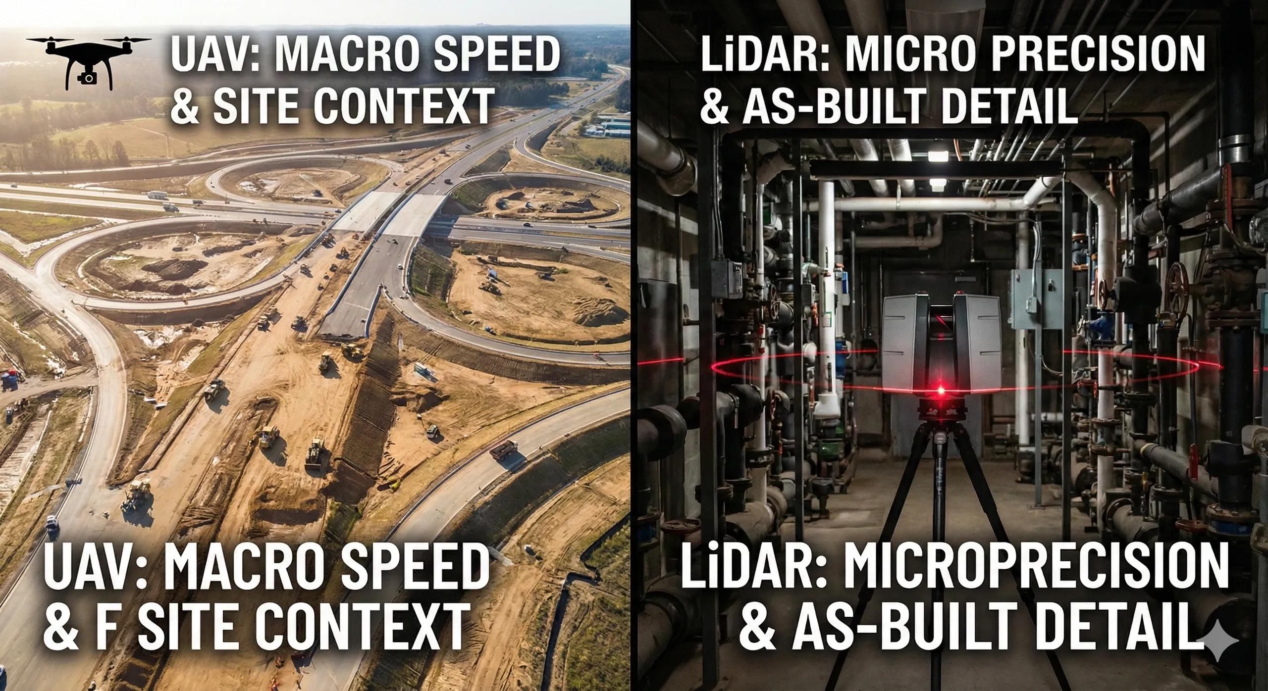
Reality capture has become a cornerstone of BIM-to-field workflows. Yet many projects struggle not because they lack scans or drone data, but because they choose the wrong capture method for the task at hand .
UAV photogrammetry and terrestrial LiDAR are often treated as interchangeable. They are not.
Each technology captures reality differently, serves different accuracy needs, and supports different construction decisions. Misusing them leads to:
Incomplete data
False confidence
Missed deviations
Poor as-built validation
This article explains when to use UAVs, when to use terrestrial LiDAR, and how to combine both strategically for construction-grade reality capture.
1. Why “One Scan Fits All” Fails in Construction
Reality capture serves multiple purposes:
Progress tracking
As-built verification
Clash validation
Quantity measurement
Payment certification
Each purpose has different spatial, accuracy, and density requirements .
Using UAVs where millimeter precision is required, or LiDAR where broad coverage is needed, creates blind spots that only surface during execution.
The question is not which technology is better .
It is which technology is appropriate for this decision .
2. UAV (Drone) Reality Capture: Strengths and Limits
What UAVs Do Best
UAVs excel at top-down, large-area capture .
Typical outputs:
Orthomosaics
Digital Surface Models (DSM)
Point clouds (photogrammetric)
Progress meshes
Ideal Use Cases
✔ Site progress tracking
✔ Earthworks and terrain monitoring
✔ Stockpile volumes
✔ Roofs and facades
✔ Linear infrastructure corridors
✔ Safety-restricted zones
UAVs provide speed and coverage , not precision at interfaces.
Accuracy Considerations
Dependent on GCPs or RTK/PPK
Vertical accuracy varies
Occlusion under slabs, canopies, interiors
UAV data is typically centimeter-level , not millimeter-level.
3. Terrestrial LiDAR: Strengths and Limits
What Terrestrial LiDAR Does Best
LiDAR captures high-density, high-accuracy geometry from the ground.
Typical outputs:
Dense point clouds
Interior scans
Structural alignment data
MEP installation verification
Ideal Use Cases
✔ Structural frames
✔ MEP installations
✔ Tolerance checks
✔ Clearance verification
✔ Interior spaces
✔ Fabrication validation
LiDAR provides precision and completeness , not speed over large areas.
Accuracy Considerations
Millimeter-level accuracy
Minimal distortion
Strong at interfaces and edges
LiDAR excels where installability depends on tight tolerances .
4. Coverage vs Precision: The Fundamental Trade-Off
Requirement - UAV - Terrestrial LiDAR
Area coverage - Excellent - Limited
Speed - Very fast - Moderate
Accuracy - cm-level - mm-level
Interiors - Poor - Excellent
Occlusions - High - Low
Structural verification - Limited - Strong
Cost per sq.m - Low - Higher
Understanding this trade-off prevents false expectations.
5. Construction-Stage Decision Matrix
Early Construction
UAV → terrain, excavation, foundations
LiDAR → column positions, base plates
Structural Phase
UAV → overall progress
LiDAR → steel alignment, slab flatness
MEP & Fit-Out
UAV → limited value
LiDAR → critical for coordination and tolerances
Handover & As-Built
UAV → context and external assets
LiDAR → final verified geometry
Each phase benefits from a different balance of capture methods.
6. Common Mistakes in Reality Capture Strategy
Using UAV scans to validate MEP installations
Relying on LiDAR alone for large sites
No geospatial alignment between datasets
Infrequent capture cycles
Treating scans as visuals instead of data
Reality capture must be planned , not reactive.
7. Integrating UAV & LiDAR Into BIM Workflows
A field-ready workflow:
UAV establishes site-wide context
LiDAR validates critical interfaces
Both datasets align to a common CRS
BIM deviations are measured, not guessed
Progress dashboards update automatically
This fusion creates a trusted as-built pipeline .
8. Reality Capture Frequency: How Often Is Enough?
Earthworks → weekly UAV
Structural → bi-weekly UAV + milestone LiDAR
MEP → LiDAR per zone completion
Fit-out → targeted LiDAR
Final handover → comprehensive LiDAR
Frequency should align with decision risk , not convenience.
9. From Reality Capture to Digital Twins
Digital twins depend on:
Verified geometry
Time-stamped updates
Accurate spatial alignment
UAVs provide temporal awareness .
LiDAR provides geometric truth .
Together, they create a reliable twin foundation.
Conclusion
UAVs and terrestrial LiDAR are not competitors, they are complements .
UAVs answer:
What has changed across the site?
LiDAR answers:
Is this built correctly?
Successful BIM-to-field workflows use:
UAVs for visibility
LiDAR for verification
BIM as the reference truth
Choosing the right tool at the right time turns reality capture from a reporting exercise into execution intelligence .