The Earth’s Heat Map Is Closer Than You Think
Long before we drilled wells or built turbines, thermal springs revealed where the planet breathes heat.
Each spring bubbling at the surface is not random, it’s the visible outlet of a deep geothermal system shaped by faults, fractures, and groundwater flow.
Today, satellites and geospatial analytics are turning this ancient clue into a modern energy strategy, locating geothermal targets without digging a single hole.
Reading Earth’s Heat Through Remote Sensing
Thermal and multispectral sensors detect subtle temperature anomalies that point to geothermal activity. When these are analyzed alongside geological and structural data, they reveal zones of elevated heat flux , active faults, and hydrothermal circulation.
Key remote sensing indicators:
Thermal Infrared (TIR) Anomalies: Sensors like Landsat 8/9 TIRS and ASTER TIR detect ground temperature variations down to 0.1°C. Persistent surface heat patterns can indicate underlying geothermal sources.
Normalized Difference Temperature Index (NDTI): Derived from TIR bands; highlights zones warmer than surroundings.
Hydrothermal Alteration Mapping: ASTER VNIR/SWIR bands help identify minerals like kaolinite, alunite, and illite, chemical fingerprints of geothermal alteration.
Lineament and Fault Analysis: Linear features from DEM, SRTM, or Sentinel-1 SAR show pathways for heat and fluid movement.
Together, these datasets form a multi-parameter geothermal prospect map , highlighting where subsurface systems are most active.
India’s Hidden Heat Reservoirs
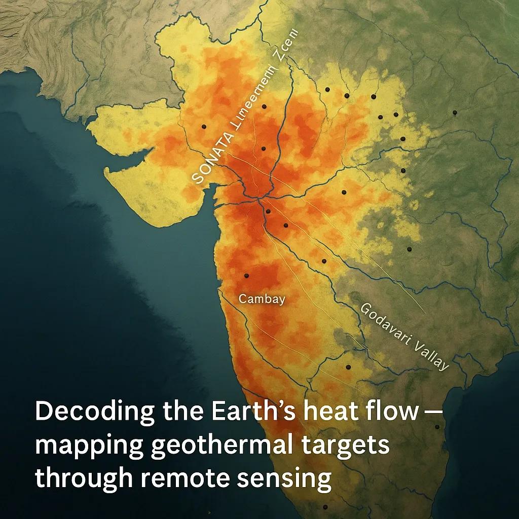
India’s geothermal potential is vast, over 10,000 MW estimated , but largely untapped. Remote sensing and geospatial studies have already mapped more than 300 thermal spring sites , grouped into major geothermal provinces:
Himalayan Province (Puga, Chhumathang, Manikaran): Active tectonic uplift and crustal thinning create high heat flow.
Son-Narmada-Tapi (SONATA) Lineament Zone: Deep fractures act as heat conduits across central India.
Godavari and Mahanadi Valleys: Structural corridors with hydrothermal alteration signatures visible in ASTER data.
Cambay and Gujarat Plains: High heat flow associated with rift systems; promising for geothermal power development.
Example: In Puga Valley (Ladakh) , ASTER and Landsat thermal bands identified a persistent surface temperature anomaly of +6–8°C above ambient. When correlated with LiDAR-derived fault networks, this led to accurate delineation of geothermal reservoirs later confirmed by drilling.
From Anomaly to Opportunity: Integrating GIS Layers
In a GIS environment, geothermal targeting typically follows a weighted overlay approach combining:
Parameter - Data Source - Relevance
Surface Temperature - Landsat/ASTER TIR - Detects thermal anomalies
Hydrothermal Minerals - ASTER SWIR - Identifies alteration zones
Lineament Density - DEM / SAR - Reveals heat and fluid pathways
Lithology - GSI / Geological maps - Determines rock permeability
Seismicity - IMD / USGS - Indicates tectonic activity
Hot Springs - Field / Published data - Ground truth validation
Each factor is normalized, weighted, and integrated into a geothermal potential index map.
Areas scoring high across multiple layers become priority targets for field verification and exploration drilling.
GeoAI for Automated Hotspot Detection
AI and computer vision now accelerate geothermal mapping by processing massive satellite datasets:
Deep Learning on Thermal Time Series: Identifies consistent heat anomalies across seasons.
CNN Models on ASTER & Sentinel Data: Detect alteration zones automatically.
Integrative GeoAI Frameworks: Fuse geological, structural, and thermal inputs to predict high-potential sites with minimal human bias.
These systems can scan an entire country’s landmass in days, a leap from months of manual interpretation.
Environmental and Economic Payoff
Geothermal systems represent 24/7 renewable power , with zero emissions and minimal land footprint.
But they also serve as natural climate sentinels , reflecting subsurface temperature changes, groundwater depletion, and even fault stress variations.
Practical Applications:
Renewable Energy Planning: Identify sustainable, local power sources for remote regions.
Tourism and Wellness Development: Map and manage thermal springs responsibly.
Disaster Monitoring: Track geothermal flux near active volcanic or tectonic zones.
In short, geothermal mapping isn’t just about power, it’s about understanding Earth’s thermal behavior.
Case Example: Remote Sensing in the SONATA Lineament Zone
Using Sentinel-2 , ASTER , and CartoDEM , researchers extracted 1,200+ lineaments across central India.
Weighted overlays of thermal anomalies and hydrothermal mineral indices delineated multiple potential zones between Tapi and Narmada river basins .
Field validation confirmed surface temperature gradients up to 40°C in several new spring sites, a breakthrough for India’s central geothermal belt.
Outlook: From Thermal Maps to Energy Models
As the world pivots toward clean energy, geothermal potential will move from being explored to being modeled in real time .
By integrating remote sensing, field sensors, and digital twins , governments can create Geothermal Decision Platforms that continuously update resource viability.
Imagine a near-future India where geothermal maps are updated dynamically, tracking heat flow, tectonic shifts, and exploration readiness at the national scale.
Conclusion
Thermal springs are the Earth’s natural diagnostics, telling us where energy, water, and geology intersect.
Remote sensing transforms them from geological curiosities into strategic data layers , revealing where the planet’s deep heat is waiting to be tapped.