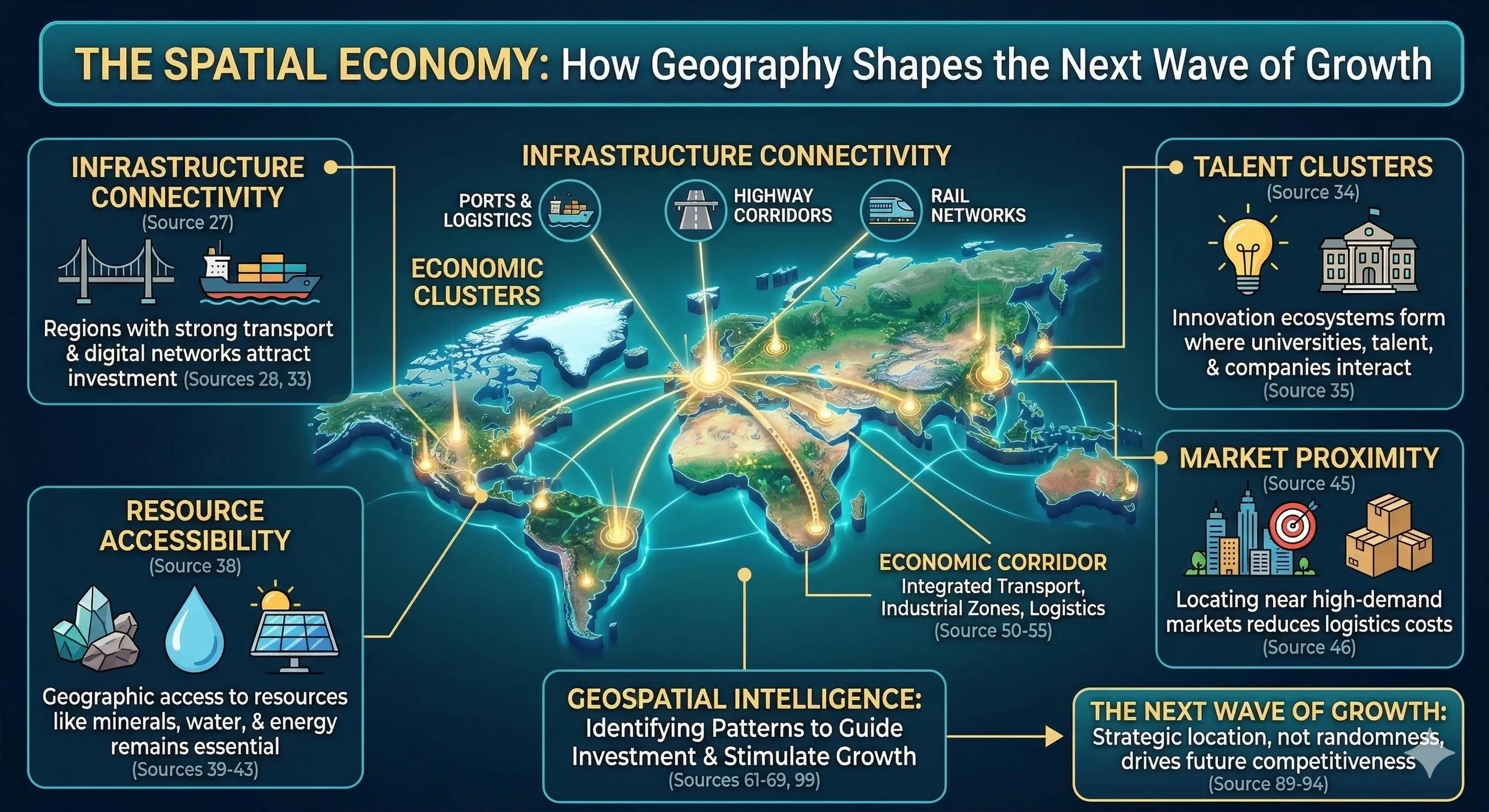
The Digital Economy Still Has a Location
We often hear that the digital economy has removed the importance of geography.
Cloud computing enables global services.
Remote work allows distributed teams.
Digital platforms connect markets across continents.
Yet, despite these changes, economic growth continues to cluster in specific locations.
Technology companies concentrate in certain cities.
Manufacturing hubs emerge around logistics corridors.
Innovation districts form near research institutions.
The digital economy may be global, but economic growth remains spatial .
Understanding this spatial structure is becoming essential for governments, investors, and businesses.
What Is the Spatial Economy?
The spatial economy refers to how economic activity distributes across geography.
It studies how location influences:
investment flows
infrastructure development
workforce distribution
industrial clusters
logistics networks
innovation ecosystems
Economic systems are not evenly distributed across landscapes.
They emerge around strategic geographic advantages .
Why Geography Still Drives Growth
Several factors continue to anchor economic growth to specific locations.
Infrastructure Connectivity
Regions connected by strong infrastructure attract investment.
Examples include:
ports and logistics hubs
highway corridors
rail freight networks
digital connectivity infrastructure
Infrastructure creates economic gravity.
Talent Clusters
Innovation ecosystems form where talent, universities, and companies interact.
These clusters generate knowledge spillovers and accelerate innovation.
Examples include technology corridors and research districts.
Resource Accessibility
Many industries still depend on geographic access to:
minerals
water resources
agricultural land
energy infrastructure
Geography influences cost structures and operational feasibility.
Market Proximity
Businesses often locate near high-demand markets to reduce logistics costs and improve service efficiency.
This creates urban economic clusters.
The Emergence of Economic Corridors
Modern development increasingly happens along economic corridors .
These corridors integrate:
transport infrastructure
industrial zones
logistics hubs
urban centers
They create continuous zones of economic activity.
Examples include:
industrial freight corridors
port-led development zones
cross-border trade corridors
Spatial intelligence helps planners identify where these corridors can produce maximum economic impact.
How Geospatial Intelligence Supports the Spatial Economy
Geospatial analysis allows governments and investors to identify emerging economic patterns.
Key applications include:
investment hotspot mapping
industrial cluster analysis
transport corridor optimization
urban expansion forecasting
regional productivity analysis
These insights guide where infrastructure investment should occur to stimulate growth.
A Real-World Illustration
Consider two regions planning to attract manufacturing investment.
Region A offers tax incentives and regulatory benefits.
Region B provides:
proximity to a major port
strong highway connectivity
skilled workforce clusters
reliable power infrastructure
Even with similar incentives, Region B is more likely to attract sustained investment.
The difference is spatial advantage .
Why Governments Are Focusing on Spatial Development
Countries are increasingly adopting spatial planning frameworks to guide development.
These frameworks help answer critical questions:
Which regions should receive infrastructure investment?
Where should industrial clusters develop?
How can economic growth be balanced across regions?
Which locations offer long-term competitiveness?
Geospatial intelligence provides the analytical foundation for these decisions.
The Monetization Bridge
As spatial economics becomes central to development planning, organizations are increasingly adopting geospatial platforms and digital twin environments to analyze investment potential, infrastructure performance, and regional productivity. These systems allow policymakers and businesses to simulate development scenarios and identify locations where investments generate the greatest long-term economic value.
Looking Ahead
The next wave of global growth will not emerge randomly.
It will form around strategic geographic advantages :
resilient infrastructure networks
connected logistics corridors
climate-resilient regions
talent-rich innovation districts
Organizations that understand the spatial structure of economies will be better positioned to invest, expand, and adapt.
Closing Insight
Economic growth does not spread evenly across landscapes.
It concentrates.
Understanding where and why that concentration happens is one of the most powerful insights spatial intelligence can provide.
In the coming decade, the spatial economy will become a central lens for development strategy.