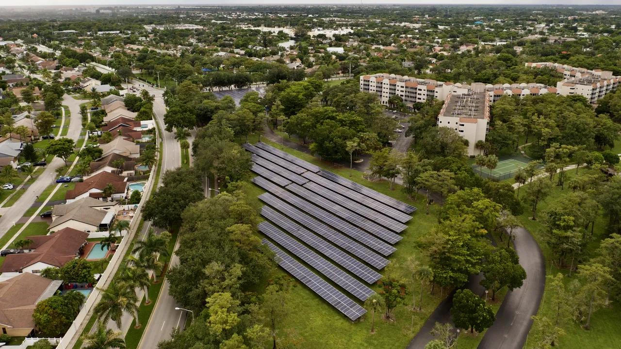
An aerial view of solar panels integrated in a residential area
In the quest for sustainable energy solutions, renewable energy sources such as solar and wind power have become pivotal. As the global demand for clean energy rises, the need for optimized site selection becomes critical. Finding the right location for renewable energy installations involves numerous environmental, logistical, and regulatory considerations. This is where geospatial data plays an essential role. By leveraging advanced geographic information systems (GIS) and spatial analysis tools, renewable energy developers can make informed decisions that lead to more efficient and cost-effective energy production.
The Importance of Site Selection in Renewable Energy
Selecting the ideal location for renewable energy projects, particularly solar and wind farms, is a multifaceted process. It requires an in-depth understanding of local terrain, climate conditions, proximity to infrastructure, and environmental impact. Poor site selection can result in underperforming projects that fall short of energy production targets, create logistical challenges, or even face legal hurdles due to non-compliance with environmental regulations.
For instance, the success of a solar power plant hinges on access to ample sunlight, minimal shading, and optimal panel orientation. Similarly, wind farms require high wind speeds, low turbulence, and easy access for maintenance teams. The wrong site can lead to inefficiencies in power generation, increased operational costs, or both.
This complexity underscores the value of geospatial data in guiding decision-making. By integrating multiple layers of geospatial information, developers can analyze potential sites comprehensively, assessing them based on environmental, technical, and logistical criteria.
What is Geospatial Data?
Geospatial data refers to information that has a geographic aspect to it. This data provides detailed insights about physical locations, allowing users to analyze and visualize geographic patterns and relationships. Geospatial data encompasses a wide range of information, including topography, weather patterns, land use, vegetation cover, and human infrastructure.
For renewable energy site selection, geospatial data enables developers to:
Analyze sunlight or wind availability across vast areas.
Assess environmental factors such as land slope, vegetation, and proximity to protected areas.
Determine land use, ownership, and zoning restrictions.
Identify proximity to existing power infrastructure, such as transmission lines.
The integration of geospatial data into renewable energy projects is facilitated by Geographic Information Systems (GIS), which allow users to visualize, analyze, and interpret this data to make informed decisions.
Geospatial Data and Solar Energy Site Selection
Solar Radiation Data
One of the most critical aspects of selecting a site for a solar farm is understanding solar radiation levels. Geospatial data provides detailed information on the amount of solar energy available at specific locations. This data can be gathered from satellite observations or ground-based sensors and is often presented in the form of solar radiation maps. These maps show the average number of sunlight hours and solar intensity levels across different geographic regions.
By analyzing these maps, developers can determine which areas receive the most consistent and high levels of sunlight throughout the year, making them ideal for solar energy production. Moreover, geospatial data can help forecast seasonal variations in solar radiation, ensuring that selected sites offer consistent energy yields over time.
Terrain Analysis
Geospatial tools also provide crucial insights into the terrain of a potential solar farm site. Solar installations require flat or gently sloping land to maximize the exposure of solar panels to sunlight. Using GIS tools, developers can assess topographic data, which includes information about the slope, elevation, and surface characteristics of the land. These factors are vital in determining whether a particular site is suitable for solar installations, as steep slopes or uneven terrain can limit the efficiency of energy production and increase installation costs.
Environmental and Land Use Considerations
Geospatial data helps developers navigate complex environmental regulations and land-use policies. For example, solar farms must avoid environmentally sensitive areas such as wetlands, wildlife habitats, and agricultural lands. GIS allows developers to overlay various layers of geospatial data, such as protected area boundaries, soil types, and land ownership, to ensure compliance with environmental regulations and minimize the ecological impact of the project.
Furthermore, geospatial analysis can assess the availability of nearby infrastructure, such as roads and electrical grids, which is critical for connecting solar farms to the main energy network.
Geospatial Data and Wind Energy Site Selection
Wind Speed and Direction
For wind energy projects, wind speed and direction are the most crucial factors in site selection. Geospatial data provides highly accurate wind maps that illustrate wind patterns across vast geographic areas. These maps are generated using data from weather stations, satellites, and computational models that simulate wind flow. By analyzing this information, developers can identify locations with high and consistent wind speeds, which are necessary to optimize the performance of wind turbines.
Wind energy projects also require information on wind variability throughout the year. Geospatial analysis can assess wind seasonality and identify periods when wind speeds might drop below optimal levels. This information is critical in ensuring that wind farms are located in areas with consistent energy output.
Proximity to Transmission Lines and Infrastructure
Once an ideal location for wind energy has been identified, it is essential to consider its proximity to existing infrastructure. Geospatial data allows developers to assess the distance to nearby transmission lines and substations, which are needed to connect wind farms to the power grid. Projects that are closer to transmission infrastructure are generally more cost-effective, as they require less investment in new infrastructure to transport energy to consumers.
Environmental and Permitting Considerations
Wind energy projects, like solar projects, must comply with environmental regulations and permitting requirements. Wind turbines can have environmental impacts on local wildlife, particularly birds and bats. Geospatial tools can help developers identify areas where the risk of wildlife disturbance is minimal, avoiding sensitive habitats and reducing the potential for environmental conflicts.
Additionally, GIS tools enable developers to assess land use restrictions and identify conflicts with existing land activities, such as agriculture or residential development.
Geospatial Platforms for Renewable Energy Site Selection
At [Your Company Name], we support renewable energy projects by offering geospatial tools that streamline the site selection process. Our platform integrates multiple layers of geospatial data, allowing developers to assess environmental, technical, and logistical factors comprehensively. By combining solar radiation maps, wind data, topography, and land use information, our platform helps identify optimal locations for solar, wind, and other renewable energy installations.
Features of Our Geospatial Platform
Solar and Wind Resource Mapping: We provide detailed maps that show the availability of solar radiation and wind speeds across different regions, enabling developers to identify high-potential areas for energy production.
Topographic and Terrain Analysis: Our platform offers topographic maps and terrain analysis tools that allow users to assess land slope, elevation, and surface characteristics, ensuring that selected sites are suitable for renewable energy installations.
Environmental Impact Assessment: With access to environmental data layers, our platform helps developers comply with regulations and avoid environmentally sensitive areas.
Infrastructure and Accessibility Analysis: We provide insights into the proximity of potential sites to existing infrastructure, such as roads, transmission lines, and substations, helping developers minimize logistical costs and streamline project implementation.
In conclusion, geospatial data is an invaluable tool for renewable energy site selection, providing critical insights that help developers make informed decisions. By leveraging geospatial data, renewable energy projects can achieve higher efficiency, lower costs, and reduced environmental impacts. The integration of GIS technology into renewable energy planning not only improves the accuracy of site selection but also accelerates the transition to cleaner and more sustainable energy solutions. As the demand for renewable energy continues to grow, the role of geospatial data in optimizing site selection will only become more significant.