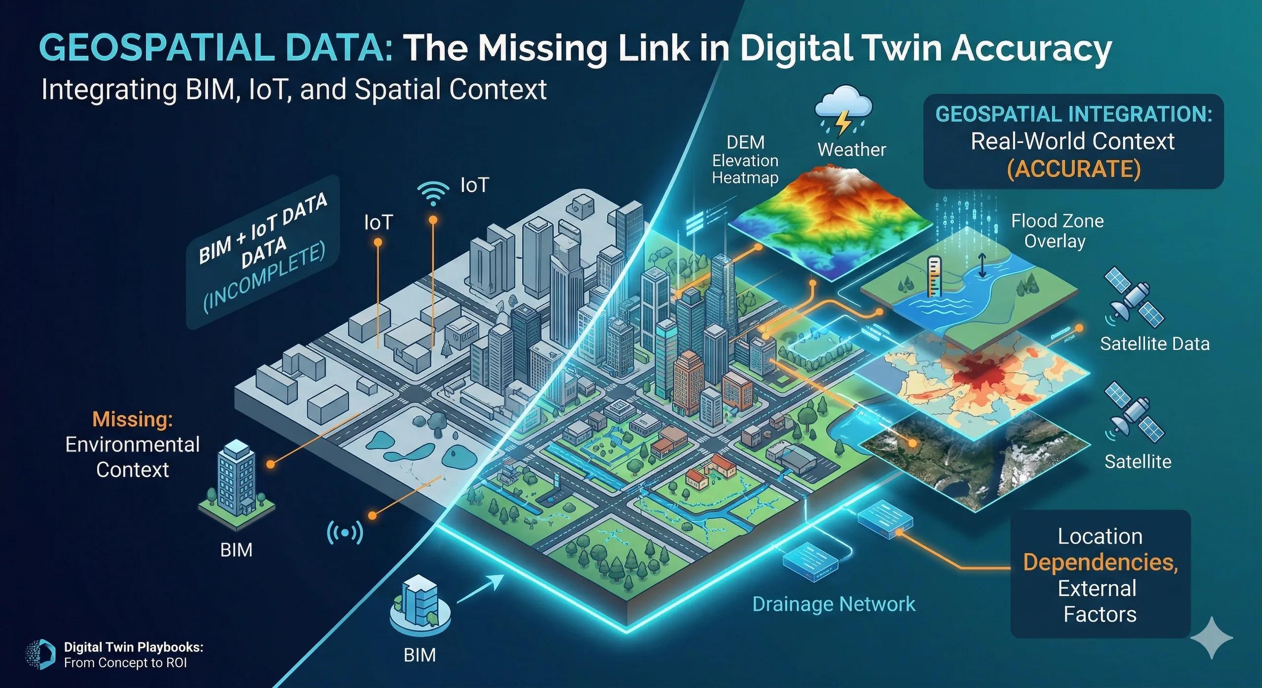
Can a Digital Twin be accurate if its location context is wrong?
Even the most advanced models fail when they are not grounded in spatial reality .
Introduction
Digital Twins are often discussed in terms of:
BIM models
IoT data
AI-driven insights
But one critical layer is often underestimated:
👉 Geospatial data
Without it, a Digital Twin may function but it cannot be accurate, contextual, or reliable .
The Core Problem: Ignoring Spatial Context
Many Digital Twin implementations focus on:
Asset-level data
Sensor outputs
Internal system behavior
But overlook:
Surrounding environment
Location dependencies
External influencing factors
👉 This creates a system that is technically correct, but operationally incomplete
Why Location Matters More Than It Seems
Every asset exists within a spatial context.
That context influences:
Performance
Risk
Accessibility
Environmental impact
Examples:
A pipeline’s behavior depends on terrain and soil conditions
Traffic patterns depend on surrounding land use
Infrastructure risk depends on proximity to flood zones
👉 Without geospatial context, decisions lack completeness
What Geospatial Data Brings to a Digital Twin
1. Context
Where the asset is located
What surrounds it
2. Relationships
Connectivity with other assets
Proximity-based interactions
3. External Factors
Weather
Terrain
Population density
Environmental risks
4. Scale
From individual assets to city-level systems
👉 It transforms a Digital Twin from an isolated model into a system within a real-world environment
Accuracy is Not Just About Geometry
Many assume accuracy comes from:
High-quality BIM models
Precise sensor data
But accuracy also depends on: 👉 correct spatial alignment and context
Even small spatial errors can lead to:
Incorrect analysis
Misguided decisions
Operational inefficiencies
Practical Example
Scenario: Flood Risk Management
A Digital Twin includes:
Infrastructure models
Real-time water level sensors
But without geospatial layers:
Elevation (DEM)
Drainage networks
Land use patterns
👉 The system cannot accurately predict:
Flood spread
Impact zones
Response priorities
With geospatial integration:
Risk zones are identified
Response is optimized
Damage is minimized
Where Most Projects Go Wrong
1. Treating GIS as a Visualization Layer
Used only for mapping, not analysis.
2. Poor Spatial Data Quality
Inaccurate coordinates, outdated layers.
3. Lack of Integration with BIM
Disconnected models and spatial layers.
4. Ignoring External Data Sources
Weather, environmental, and demographic data not included.
Ask Yourself
Are your decisions based only on asset data or also on the environment in which those assets operate?
What a Better Approach Looks Like
1. Establish Spatial Accuracy
Correct georeferencing of all assets
2. Integrate GIS with Core Systems
BIM + GIS alignment
3. Use Multi-Layered Data
Terrain, environment, infrastructure
4. Continuously Update Spatial Data
Keep context current
Indian Context
In India, geospatial data plays a critical role in:
Infrastructure planning
Disaster management
Urban development
With increasing availability of:
Satellite data
UAV surveys
Open datasets
👉 The opportunity is to embed geospatial intelligence into Digital Twins from the start
Benefits of Geospatial Integration
Improved decision accuracy
Better risk assessment
Enhanced planning and forecasting
Context-aware operations
Scalable system design
Conclusion
A Digital Twin without geospatial data is incomplete.
It may show:
What the asset is
What it is doing
But not: 👉 how its environment affects it
That is where true accuracy comes from.