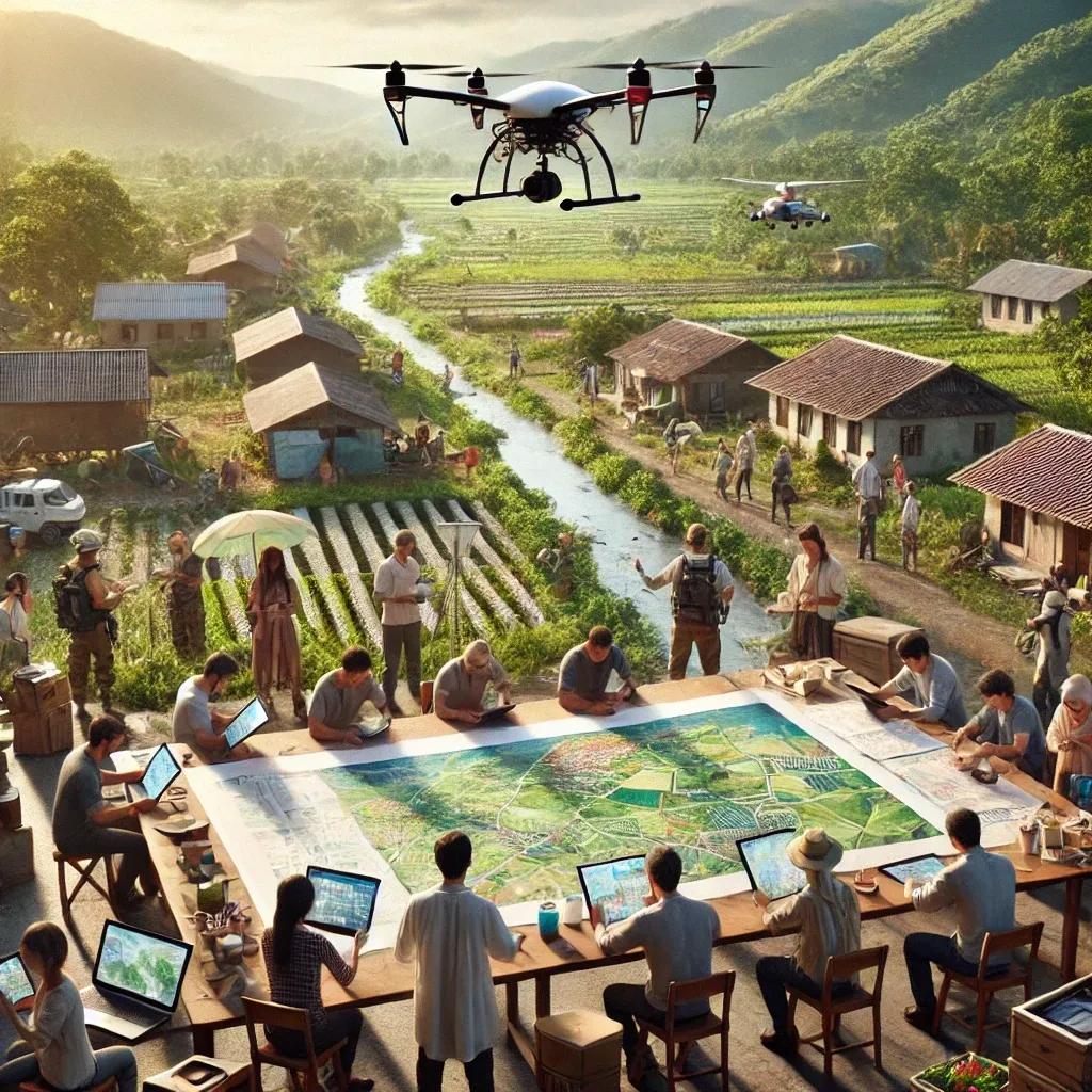
Geospatial technology has emerged as a transformative tool, reshaping how we understand, analyze, and interact with the world around us. From urban planning to disaster management, this technology plays a critical role in addressing complex challenges. A unique and increasingly impactful aspect of geospatial technology is the rise of community-driven geospatial projects. These initiatives harness the collective efforts of individuals, organizations, and stakeholders to address localized issues and provide scalable solutions.
In this article, we explore the power of community-driven geospatial projects, delving into their operational frameworks, benefits, challenges, and potential to catalyze sustainable development.
Understanding Community-Driven Geospatial Projects
Community-driven geospatial projects are initiatives where local communities actively participate in data collection, analysis, and decision-making processes using geospatial tools. Unlike traditional top-down approaches, these projects emphasize inclusivity, empowerment, and localized knowledge, integrating the lived experiences of communities into geospatial systems.
Examples of such projects include mapping flood-prone areas, identifying optimal locations for renewable energy installations, and tracking biodiversity in rural regions. These projects leverage technologies such as Geographic Information Systems (GIS), satellite imagery, and open-source mapping platforms to empower communities and enhance decision-making processes.
Core Components of Community-Driven Geospatial Projects
1. Community Engagement
At the heart of these projects lies community involvement. Residents are not just end-users of geospatial data but active contributors. This involvement fosters ownership and ensures that the solutions align with local needs.
2. Open Data Platforms
Open-source platforms like OpenStreetMap (OSM) are instrumental in community-driven projects. They provide accessible tools for mapping and data sharing, enabling communities to contribute and use geospatial information without prohibitive costs.
3. Capacity Building
Training programs and workshops help community members acquire technical skills in geospatial technology. This capacity-building effort ensures sustainability, as communities can independently manage and update their geospatial datasets.
4. Collaborative Ecosystems
Partnerships between local governments, NGOs, academic institutions, and private organizations enhance the scope and impact of community-driven geospatial projects. These collaborations bring together technical expertise, funding, and policy support.
Advantages of Community-Driven Geospatial Projects
1. Localized Insights
Community-driven projects integrate the rich, contextual knowledge of local populations. For instance, farmers involved in mapping agricultural lands can provide nuanced insights into soil quality, water sources, and crop patterns, resulting in more precise geospatial datasets.
2. Enhanced Data Accuracy
Crowd-sourced data collection reduces gaps and errors often present in large-scale, top-down mapping initiatives. Community involvement ensures real-time updates and the inclusion of granular details that might otherwise be overlooked.
3. Empowerment Through Participation
When communities are engaged in geospatial projects, they gain a sense of agency over decisions affecting their environment. This empowerment fosters resilience and motivates individuals to actively address challenges.
4. Cost-Effectiveness
By leveraging local knowledge and open-source tools, community-driven geospatial projects significantly reduce costs compared to traditional, consultant-led mapping initiatives.
5. Scalability and Adaptability
Once established, these projects can be replicated and scaled to other regions with similar challenges. Moreover, the adaptable nature of open-source platforms allows for continuous improvement and innovation.
Applications of Community-Driven Geospatial Projects
1. Disaster Preparedness and Response
Community-generated maps have been pivotal in disaster-prone regions. For example, OSM's Missing Maps project mobilizes volunteers to map vulnerable areas, enabling relief organizations to respond swiftly during emergencies.
2. Environmental Conservation
Community-driven projects play a vital role in monitoring deforestation, wildlife habitats, and water resources. In Brazil, indigenous communities use drones and GIS tools to protect the Amazon rainforest from illegal logging.
3. Urban Planning
Inclusive urban planning initiatives rely on community input to map infrastructure, public spaces, and mobility patterns. This approach ensures equitable resource allocation and addresses the needs of marginalized groups.
4. Public Health
During the COVID-19 pandemic, community-driven geospatial projects mapped healthcare facilities, vaccination centers, and infection hotspots. These efforts improved accessibility to essential services and informed policy decisions.
5. Sustainable Agriculture
Geospatial projects involving farmers help optimize irrigation systems, identify fertile lands, and monitor crop health. Such initiatives contribute to food security and sustainable agricultural practices.
Challenges in Community-Driven Geospatial Projects
1. Digital Divide
Access to technology remains a significant barrier in many regions. Without reliable internet, smartphones, or computers, communities cannot fully participate in geospatial projects.
2. Data Privacy and Security
Community-driven projects often involve sensitive data, such as personal information or cultural heritage sites. Ensuring data privacy and preventing misuse is a critical challenge.
3. Technical Complexity
While open-source platforms are accessible, mastering geospatial technology still requires a level of technical expertise. Training programs must address this gap to ensure meaningful community participation.
4. Sustainability
Once initial funding and external support end, maintaining and updating geospatial systems can be challenging for communities with limited resources.
5. Coordination and Collaboration
Managing diverse stakeholders with varying priorities can lead to conflicts and inefficiencies. Clear communication and shared objectives are essential for project success.
Overcoming Challenges: Strategies for Success
1. Bridging the Digital Divide
Initiatives like community internet hubs, low-cost hardware, and offline geospatial tools can help bridge the digital divide and enable broader participation.
2. Prioritizing Data Ethics
Establishing robust data governance frameworks ensures that data collection and usage respect privacy and cultural sensitivities.
3. Simplifying Technology
User-friendly interfaces and intuitive tools can lower the barriers to entry for community members with limited technical expertise.
4. Fostering Long-Term Partnerships
Continuous engagement with NGOs, academic institutions, and private organizations ensures sustained support and knowledge transfer.
5. Community-Led Maintenance
Empowering local communities to take ownership of project maintenance, supported by periodic training and updates, ensures long-term viability.
Case Studies: The Impact of Community-Driven Geospatial Projects
1. Mapping for Resilience in Nepal
Following the 2015 earthquake in Nepal, community volunteers used OSM to map damaged areas and infrastructure. These maps guided rescue operations and resource distribution, highlighting the power of community-driven geospatial projects in disaster recovery.
2. Conserving Mangroves in Indonesia
Local communities in Indonesia collaborated with NGOs to map mangrove ecosystems using drones and GIS tools. This initiative helped restore degraded areas and bolster community livelihoods through sustainable aquaculture.
3. Urban Upgrades in Kibera, Kenya
In Kibera, one of Africa's largest informal settlements, residents created detailed maps of water points, sanitation facilities, and roads. These maps informed urban upgrading projects, improving living conditions and access to basic services.
Future Directions: Unlocking the Full Potential
As geospatial technology continues to evolve, the potential for community-driven projects grows exponentially. Emerging tools like artificial intelligence (AI), machine learning (ML), and blockchain can enhance data analysis, ensure transparency, and incentivize participation.
Additionally, integrating community-driven geospatial projects with broader initiatives like the Sustainable Development Goals (SDGs) can amplify their impact. By aligning local efforts with global priorities, these projects can address critical challenges such as climate change, urbanization, and inequality.
In conclusion, community-driven geospatial projects represent a paradigm shift in how we approach problem-solving in the geospatial domain. By empowering local communities, these initiatives generate accurate data, foster inclusivity, and promote sustainable development. While challenges remain, strategic interventions and technological advancements can unlock their full potential.
The power of community-driven geospatial projects lies in their ability to transform localized efforts into scalable solutions. As more communities embrace this approach, they contribute not only to their immediate surroundings but also to a more equitable and resilient global future.