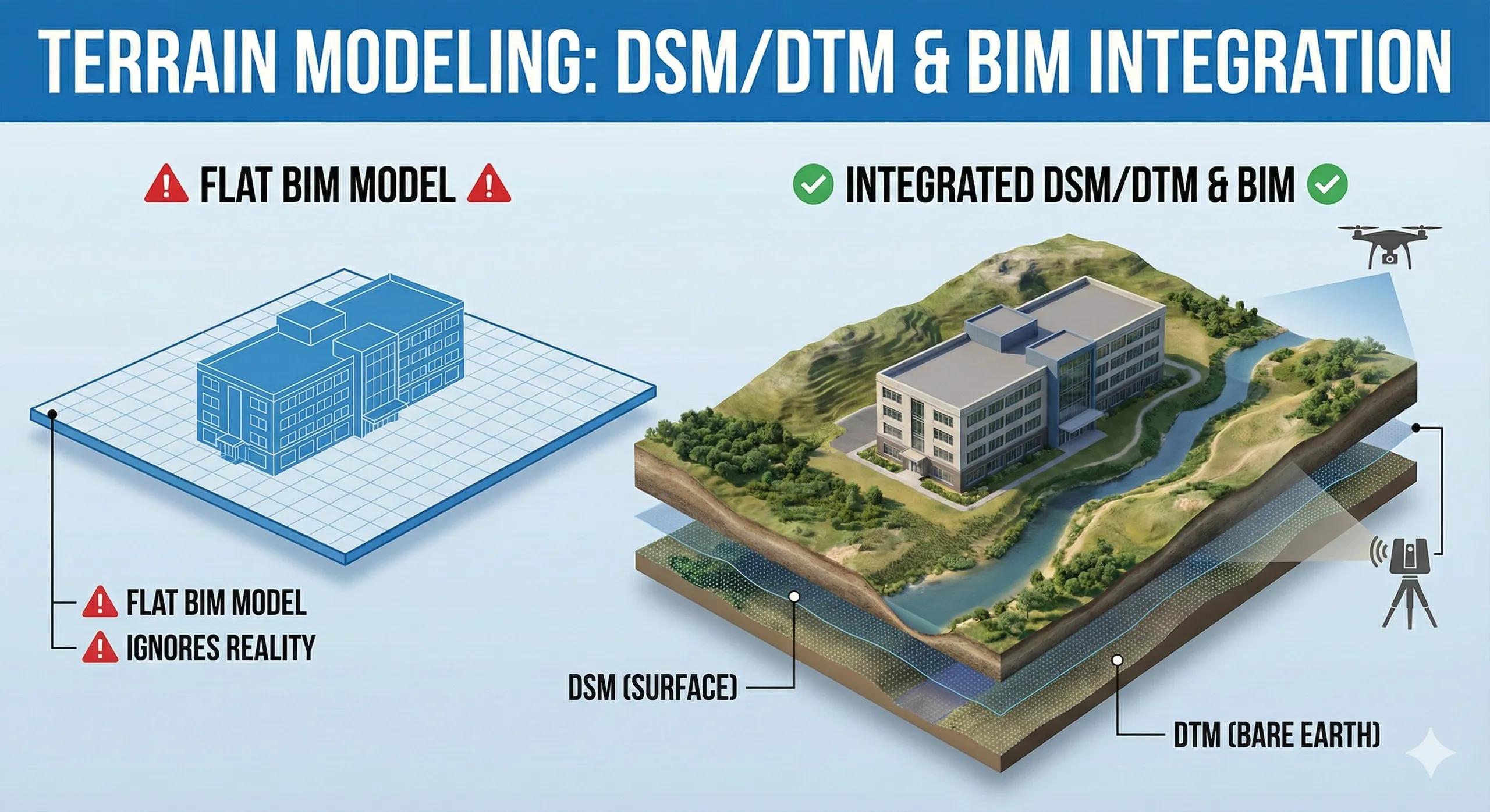
Many BIM models begin on a flat plane.
Reality does not.
Terrain, its slope, undulations, drainage paths, and elevation differences, quietly governs constructability, access, flood risk, cut–fill volumes, and long-term asset performance. When BIM ignores terrain fidelity, decisions made in 3D fail in 4D and 5D.
This is where DSM and DTM integration becomes critical.
1. DSM vs DTM: Why the Difference Matters
DSM (Digital Surface Model) represents everything on the surface (vegetation, buildings, temporary objects).
DTM (Digital Terrain Model) represents the bare earth.
Using the wrong one leads to:
Incorrect earthwork estimates
Misjudged access and logistics
Faulty drainage assumptions
BIM must know which surface it is standing on .
2. Why Flat BIM Models Fail on Sloped Sites
When terrain is oversimplified:
Levels appear correct but don’t match reality
Excavation volumes are underestimated
Retaining structures are mis-scoped
Water behaves unpredictably
The problem isn’t BIM geometry.
It’s terrain abstraction .
3. Terrain Is a Geospatial Asset First
Terrain models originate from:
UAV photogrammetry
LiDAR surveys
Traditional ground surveys
They belong to the geospatial domain .
BIM should:
Consume terrain as a referenced surface
Respect its resolution and accuracy
Avoid re-creating terrain manually
Terrain must be inherited , not redrawn.
4. Where DSM and DTM Fit in BIM Workflows
Practical usage:
DTM → Earthworks, foundations, drainage, flood modeling
DSM → Access planning, crane studies, visibility, construction logistics
Mixing the two creates confusion and errors.
5. Resolution and Accuracy Are Not Optional
Over-smoothing terrain hides risk.
Over-detailing slows performance.
Best practice:
Match terrain resolution to decision scale
High resolution for site grading and drainage
Lower resolution for planning and visualization
Terrain detail should be decision-driven , not sensor-driven.
6. Vertical Datum Alignment: The Silent Failure Point
Even accurate terrain fails if:
Vertical datum differs from BIM levels
Mean Sea Level vs local benchmarks are mixed
Geoid models are ignored
Misaligned datums cause:
Level mismatches
Drainage errors
Infrastructure conflicts
Vertical alignment is non-negotiable.
7. Terrain Drives Risk, Not Just Design
Good terrain modeling integration enables:
Flood-risk assessment
Slope stability checks
Access and haul-road optimization
Better sequencing decisions
Terrain is not background context.
It is active risk intelligence .
8. India Context: Terrain Is Often Underestimated
In many Indian projects:
Terrain is flattened too early
Monsoon effects are under-modeled
Drainage paths are assumed, not analyzed
Accurate DSM/DTM integration:
Reduces waterlogging risks
Improves site resilience
Prevents costly rework during monsoon seasons
9. Terrain in Digital Twins
A digital twin without terrain intelligence:
Cannot simulate flooding
Cannot predict access disruption
Cannot support long-term planning
Terrain is the foundation layer of any spatial twin.
10. A Simple Terrain Rule
If water flow and gravity are not represented correctly, the model is lying.
Conclusion
BIM models describe structures.
Terrain models describe the forces acting on them .
When DSM and DTM are correctly integrated:
Designs become realistic
Risks surface early
Site decisions improve
BIM earns operational credibility
Without terrain intelligence, BIM floats.
With it, BIM stands on solid ground.