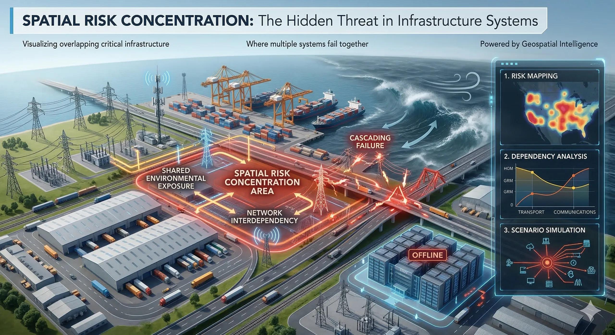
When One Failure Becomes Many
Modern infrastructure systems are designed to increase efficiency.
Power grids connect vast regions.
Transport corridors link multiple cities.
Water systems distribute resources across large populations.
Digital networks integrate global communication.
These interconnected systems improve productivity and service reliability.
But they also create a less visible risk:
spatial risk concentration.
When critical infrastructure nodes cluster in specific locations, a single disruption can cascade across multiple systems.
Infrastructure Networks Are Spatial Systems
Infrastructure does not exist in isolation.
Road networks connect ports to logistics hubs.
Power grids support industrial zones and cities.
Telecommunication networks enable digital services.
Water systems sustain both communities and industries.
These systems overlap geographically.
When several critical assets are concentrated in the same region, the landscape itself becomes a risk amplifier .
How Spatial Risk Concentration Emerges
Several patterns contribute to concentrated infrastructure vulnerability.
1️⃣ Critical Node Dependency
Many infrastructure networks rely on key nodes such as:
major substations
port terminals
transport hubs
data centers
When these nodes fail, entire networks can be disrupted.
2️⃣ Geographic Clustering
Infrastructure is often built where economic activity is concentrated.
Industrial zones, ports, and logistics hubs frequently cluster in the same areas.
While this increases efficiency, it also increases shared exposure to disruption.
3️⃣ Environmental Exposure
Natural hazards rarely occur randomly.
Flood plains, coastal zones, and seismic regions expose multiple infrastructure systems simultaneously.
When infrastructure clusters in these locations, climate events can cause cascading failures.
4️⃣ Network Interdependency
Modern infrastructure systems depend on each other.
For example:
transport networks rely on electricity
communication systems depend on power grids
industrial facilities rely on water infrastructure
A failure in one system can propagate through others.
A Realistic Scenario
Imagine a coastal industrial region where several systems converge:
a major port
logistics warehouses
power substations
fuel storage terminals
highway connections
If a cyclone impacts this area, several disruptions can occur simultaneously:
port shutdown
transport corridor blockage
power outages
supply chain delays
The problem is not just the storm.
The problem is spatial concentration of critical infrastructure .
Why Traditional Risk Models Miss This
Many infrastructure risk assessments focus on individual assets.
They evaluate whether a specific facility can withstand disruption.
However, they often overlook the broader question:
What happens when multiple systems in the same geography fail together?
Spatial concentration transforms isolated risks into systemic vulnerability .
The Role of Geospatial Intelligence
Geospatial analysis helps identify hidden patterns of infrastructure concentration.
Key capabilities include:
mapping critical infrastructure nodes
analyzing network dependencies
identifying geographic clustering of assets
overlaying climate and hazard exposure layers
These insights allow planners to detect potential cascading failures before they occur.
Designing for Spatial Resilience
Once spatial concentration risks are identified, organizations and governments can redesign systems to improve resilience.
Examples include:
diversifying infrastructure nodes
building redundant transport routes
distributing energy infrastructure across regions
relocating critical assets away from hazard-prone zones
Resilience improves when infrastructure networks are geographically balanced rather than tightly clustered .
The Monetization Bridge
As infrastructure systems become more interconnected, organizations are increasingly adopting geospatial analytics and digital twin platforms to monitor asset distribution, evaluate network dependencies, and simulate disruption scenarios. These systems allow planners to identify spatial risk concentrations and design infrastructure networks that remain resilient under environmental, operational, or geopolitical stress.
Looking Ahead
Infrastructure systems will continue to grow in complexity.
Urban expansion, digital connectivity, and global supply chains are creating increasingly dense networks of interdependent assets.
Managing these systems will require not only engineering expertise but also spatial intelligence .
Understanding where infrastructure is concentrated will be essential for preventing cascading failures.
Closing Insight
Infrastructure networks create strength through connectivity.
But when too many critical assets occupy the same geography, connectivity can also create vulnerability.
Resilient systems are not only well engineered.
They are well distributed across the landscape .