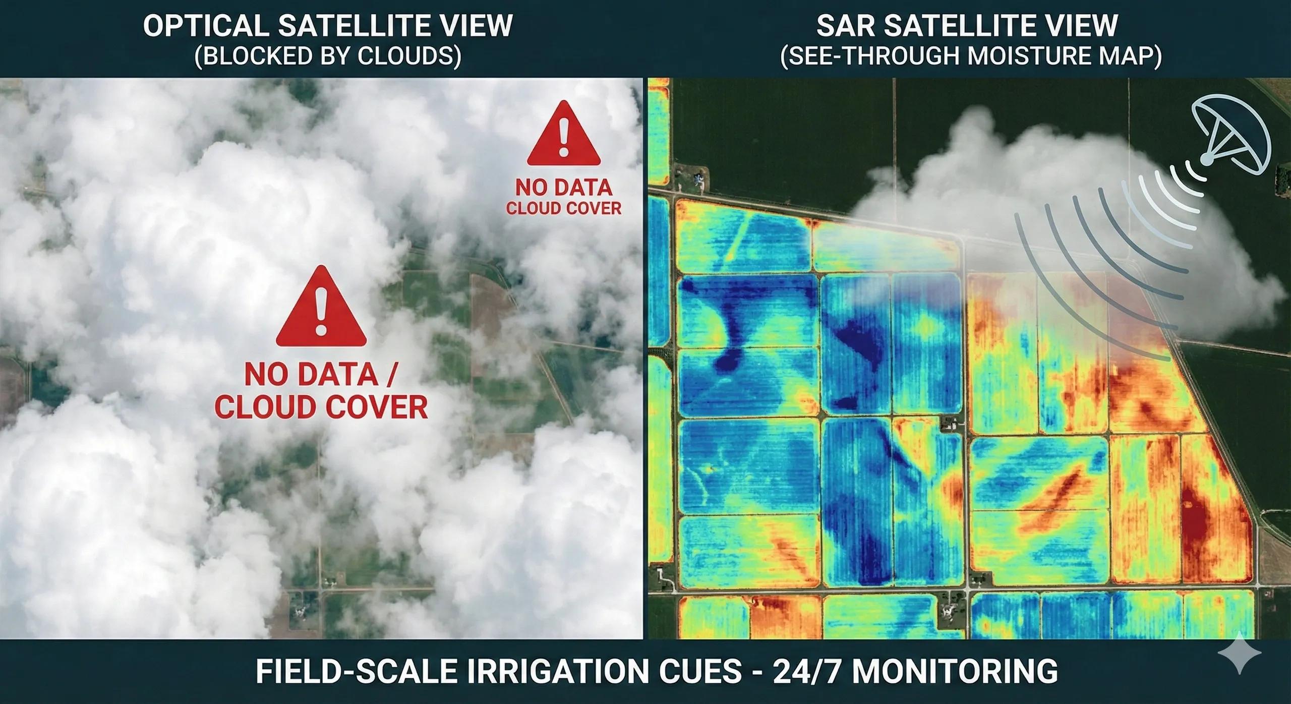
What if we could measure soil moisture for every field, every week, without ever touching the soil?
For decades, soil moisture was measured through manual probes, lysimeters, or sparse weather stations, reliable, but not scalable.
Today, Synthetic Aperture Radar (SAR) has changed that equation.
SAR’s ability to penetrate clouds, operate day-night, and respond to dielectric properties of wet soil makes it the most powerful tool for field-scale soil moisture estimation .
When fused with crop stages, irrigation patterns, and weather data, SAR becomes the intelligence layer powering:
irrigation advisories
drought assessment
precision farming
crop-water budgeting
early stress detection
groundwater pumping optimization
This is how Earth’s microwave reflections become irrigation cues.
1️⃣ Why SAR Is Ideal for Soil Moisture
Unlike optical sensors that only see the surface, SAR responds to how water changes the electromagnetic behavior of soil .
Key reasons SAR works so well:
A. Dielectric Constant Sensitivity
Wet soil has a higher dielectric constant → stronger SAR backscatter.
B. Cloud-Proof, All-Weather Imaging
Critical for monsoon agriculture where optical imagery fails.
C. Shallow Penetration
C-band (Sentinel-1) penetrates a few centimeters, perfect for topsoil moisture.
D. High Temporal Frequency
6–12 day repeat cycle; daily possible with commercial systems.
This makes SAR the backbone of operational soil moisture mapping .
2️⃣ How Soil Moisture Is Derived from SAR
There is no single formula, but a set of well-established methods:
A. Backscatter Models (σ⁰)
σ⁰ increases with moisture content.
Models like Oh , Dubois , and Water Cloud Model (WCM) extract moisture from:
VV, VH polarization
incidence angle
surface roughness
vegetation cover
B. Change Detection (Relative Moisture)
Comparing SAR before/after rainfall or irrigation shows moisture gain/loss.
C. Vegetation-Corrected Models
WCM + NDVI from Sentinel-2 corrects vegetation attenuation.
D. AI Models
Random Forest, XGBoost, and CNNs trained on field data predict moisture more accurately, especially under:
dense crops
rough soil
mixed pixels
E. Downscaling
Coarse products (SMAP, SMOS) are downscaled to field scale using SAR textures + optical indices → 10 m moisture maps.
3️⃣ Field-Scale Irrigation Cues from SAR
This is where SAR becomes a practical farm tool.
Daily/weekly moisture maps indicate:
A. When a Field Was Irrigated
Recent irrigation shows as bright backscatter patches.
B. Which Portions of a Field Need Water
Uneven soil moisture reveals nozzle failures or blocked drippers.
C. Over-Irrigation
High moisture + pooling indicates waterlogging risk.
D. Stress Prediction
If moisture is low but ET demand is rising → irrigation alert.
E. Crop-Stage-Specific Thresholds
Different irrigation cues for:
sowing moisture
vegetative growth
flowering
grain filling
SAR-based moisture provides decision intelligence , not just maps.
4️⃣ India: The Perfect Case for SAR Moisture Intelligence
India’s agricultural landscape is ideal for SAR-based moisture analytics because:
70% of agriculture occurs during monsoon → optical fails
Fragmented fields → need 10 m resolution
Groundwater depletion → irrigation efficiency is critical
Multiple cropping seasons → frequent monitoring needed
Government schemes → PMKSY, IWMP, watershed programs
Moisture maps integrated with advisories help:
schedule irrigation
decide pumping hours
reduce power usage
prevent over-irrigation
detect canal leakage
support drought declarations
improve crop-water budgeting
5️⃣ GeoAI + SAR → Farm-Ready Moisture Intelligence
SAR moisture + AI unlocks:
A. Moisture Forecasting
LSTM + weather predicts moisture 7–10 days ahead.
B. Irrigation Recommendation Engines
Combine:
soil moisture
ET demand
crop stage
soil texture
rainfall forecast
Output → “Irrigate in 2 days” / “Skip irrigation this week.”
C. Field Anomaly Detection
AI detects:
irrigation pipe breaks
pump failure
uneven water distribution
canal breaches
D. District/Mandal-Level Water Demand Maps
Governments use this for:
power scheduling
canal management
drought mitigation
6️⃣ Soil Moisture in Digital Twins
A Soil Moisture Twin continuously updates:
field moisture (SAR)
rainfall (IMERG/IMD)
ET (MODIS/S2)
soil type
crop stage
irrigation events
groundwater depletion
It supports:
adaptive irrigation
canal command monitoring
micro-irrigation performance
precision advisories
stress spotting
water budgeting for entire districts
Soon, soil moisture twins will feed crop insurance and carbon farming MRV systems.
Conclusion
Soil moisture is the invisible determinant of crop health, yield, and water sustainability.
SAR transforms it from a difficult-to-measure metric into a routine, field-scale geospatial layer .
With GeoAI, moisture becomes an irrigation cue , a stress signal , and a decision tool for both farmers and policymakers.
Moisture is not just a number, it is the heartbeat of the field.