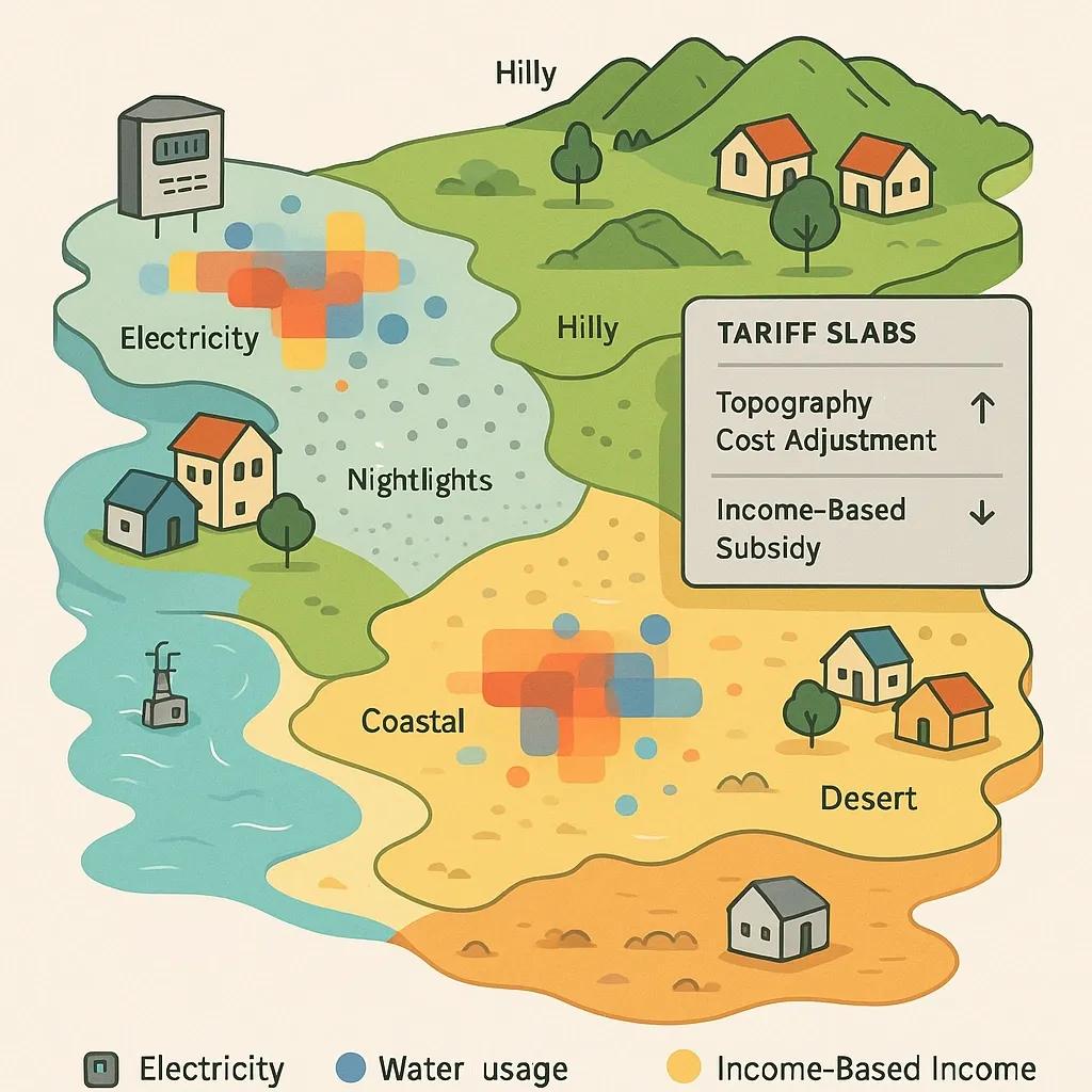
In the age of smart cities and digital governance, the process of utility billing is undergoing a data-driven transformation. Traditional utility billing models, often based solely on metered usage and flat tariffs, fail to reflect the nuanced realities of geographic, socio-economic, and environmental diversity across urban and rural areas. By leveraging location intelligence, utility providers can develop smarter, fairer, and more efficient billing mechanisms that account for consumption patterns in the context of local topography and household income levels.
This article explores how geospatial technology can enhance utility billing systems, particularly for electricity, water, and gas, by integrating spatial analytics with demographic and terrain data.
1. What is Location Intelligence in Utility Billing?
Location intelligence (LI) refers to the use of geographic data and spatial analysis to generate insights for better decision-making. In the context of utility billing, LI can be used to:
Map consumption patterns across different regions
Identify high-loss or under-served areas
Correlate usage data with terrain (elevation, slope, land use)
Layer socio-economic indicators like income levels or housing density
Inform policy decisions such as differential pricing or subsidies
By embedding spatial context into billing systems, utility providers can go beyond uniform tariff models and design location-aware pricing schemes that reflect both cost-to-serve and consumer capacity to pay.
2. Core Components of a Smart Billing System with Location Intelligence
A geospatially enabled utility billing system typically integrates the following components:
a. Geocoded Consumer Database
Each utility customer must be mapped to a precise geographic location using GPS coordinates or address-based geocoding. This enables linkage with other spatial datasets such as land cover, elevation, or administrative boundaries.
b. Consumption and Metering Data
Smart meters collect real-time or periodic usage data for electricity, water, or gas. This data can be spatially aggregated to generate heatmaps and zonal usage statistics.
c. Topographic and Environmental Layers
GIS datasets such as Digital Elevation Models (DEM), land use/land cover (LULC) maps, and hydrological models help analyze how terrain influences utility delivery and consumption, for example, higher pumping costs in hilly regions or water stress in arid zones.
d. Socio-Economic Layers
Census data, household surveys, and nightlight imagery can help estimate local income levels, housing types, and population density, enabling socio-economically sensitive pricing models.
e. Billing Logic Engine
A rules-based or AI-enabled module that uses these spatial insights to dynamically generate tariffs, apply subsidies, and flag anomalies.
3. Use Cases: Linking Consumption with Terrain and Income
a. Electricity Billing in Hilly Terrain
In hilly or mountainous areas, the cost of electricity delivery is often higher due to longer distribution lines, increased maintenance, and transformer losses. A location-aware system can tag such regions using elevation and slope layers and apply a modified base tariff or operational subsidy to reflect delivery costs while protecting consumers from excessive charges.
b. Water Billing Based on Water Table and Land Use
Groundwater extraction in low water table areas requires more energy and infrastructure. A smart billing system can integrate satellite-derived groundwater indices and charge higher volumetric rates for over-extraction while incentivizing conservation in water-rich zones. Similarly, agricultural zones may qualify for seasonal tariffs based on cropping patterns.
c. Income-Based Tariff Segmentation
Utility providers can use demographic data (such as census income brackets, informal settlement maps, or crowd-sourced economic indicators) to offer differential billing slabs. For example:
Low-income zones receive higher free consumption limits or lower base tariffs.
Higher-income areas may see progressive tariff increases after baseline usage.
This aligns with the principles of equity-based pricing, ensuring that affordability is built into the billing logic.
4. Technical Architecture and Data Flow
Here’s a simplified overview of how such a system can be implemented:
Data Integration Layer Import smart meter readings (time-stamped usage) Fetch GIS layers: DEM, LULC, administrative boundaries Pull socio-economic data from public datasets (e.g., SECC, census)
Geospatial Processing Engine Use tools like QGIS, ArcGIS, or PostGIS to link consumer meters to parcels, elevation data, and income zones Generate zonal statistics and terrain clusters
Billing Intelligence Module Use rule-based algorithms (or ML models) to segment consumers based on combined spatial and demographic profiles Apply appropriate tariffs or flags
Billing Interface Generates consumer bills with transparent spatial rationale Visual dashboard for utility staff to monitor billing clusters
Feedback Loop Continuously update income/tariff maps using surveys, consumption anomalies, and payment defaults
5. Benefits of Smart Billing with Location Intelligence
a. Improved Equity
Moving away from flat rates to terrain- and income-sensitive billing ensures that pricing reflects both capacity to pay and service delivery cost.
b. Operational Efficiency
Utilities can forecast demand better, identify losses or inefficiencies (e.g., high losses in steep slope areas), and prioritize infrastructure upgrades.
c. Policy Compliance
Governments can implement targeted subsidies or Direct Benefit Transfer (DBT) schemes that are spatially verifiable.
d. Better Revenue Recovery
Transparent and data-backed bills improve consumer trust, reduce disputes, and enable better collection in low-income areas.
6. Challenges and Considerations
While promising, implementing LI-based billing comes with challenges:
Data Quality : Geocoding errors, outdated income data, or coarse resolution terrain maps can skew pricing models.
Privacy Concerns : Linking individual consumption with income or location may raise ethical or legal issues.
Policy Alignment : Tariff restructuring needs alignment with state or national regulatory bodies.
Capacity Building : Utilities need trained GIS analysts and data scientists to run these systems.
India’s recent push toward digital utilities (e.g., AMRUT 2.0, SAUBHAGYA) creates a good foundation, but capacity gaps remain, especially in smaller municipalities and rural utilities.
7. Tools and Technologies
Some tools and platforms that can support this approach:
GIS Platforms : ArcGIS, QGIS, Google Earth Engine
Database Systems : PostgreSQL/PostGIS, GeoServer
AI & ML for Consumption Forecasting : TensorFlow, PyCaret, Scikit-learn
Visualization Dashboards : Power BI, Tableau, Kepler.gl
Remote Sensing Sources : Sentinel-2 (land cover), Landsat (urban sprawl), MODIS (vegetation), nightlights (proxy income)
8. Looking Ahead
Smart utility billing using location intelligence is more than a technical innovation, it is a socio-economic enabler. As Indian cities urbanize and the pressure on water, energy, and sanitation systems increases, billing systems must evolve from being transactional to being context-aware and equitable.
The integration of spatial thinking into billing strategy will help utilities not only optimize their revenue but also promote inclusiveness and sustainability. With the rollout of smart meters, open data policies, and GIS infrastructure, this vision is within reach.
Conclusion
Smart billing powered by location intelligence represents a paradigm shift from one-size-fits-all pricing to contextualized and data-driven service delivery. By correlating consumption data with terrain complexity and income profiles, utilities can build adaptive pricing models that balance cost recovery with consumer fairness. As governments and utilities embrace digital transformation, embedding geospatial intelligence in billing systems will be key to achieving inclusive, resilient, and efficient public services.