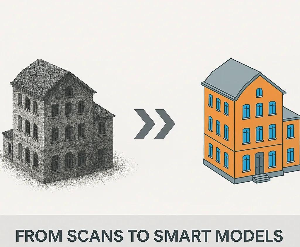
In the modern Architecture, Engineering, and Construction (AEC) industry, Scan-to-BIM (Building Information Modeling) has emerged as a powerful method to capture real-world conditions and bring them into digital workflows. As industries increasingly move towards precision-driven retrofits, renovations, and audits, Scan-to-BIM is bridging the gap between what exists and what needs to be designed or modified.
This process, driven by advances in 3D scanning, drone-based data acquisition, and automated model creation, enables architects, engineers, and facility managers to base decisions on accurate, comprehensive, and real-time information.
Let’s explore how Scan-to-BIM is shaping the future of construction and asset management.
What is Scan-to-BIM?
Scan-to-BIM refers to the workflow where existing physical spaces are scanned using 3D technologies (such as terrestrial laser scanners, drones, or mobile mapping systems) and the captured data is processed into intelligent BIM models.
These models represent the "as-is" conditions of buildings or sites and are used for various purposes, including:
Renovation planning
Retrofitting projects
Construction verification
Maintenance and asset management
Safety and compliance audits
Instead of relying on outdated blueprints or manual surveys, Scan-to-BIM ensures that stakeholders work with accurate, data-rich models.
The Workflow: From Physical Space to Digital Model
The standard Scan-to-BIM workflow involves three main stages:
3D Data Acquisition (Reality Capture)
Processing and Cleaning of Point Clouds
BIM Model Creation
Each of these stages is critical in ensuring the output is accurate, usable, and aligned with project goals.
1. 3D Data Acquisition: Capturing Reality
Reality capture is the starting point of Scan-to-BIM. It involves gathering spatial data of a site or structure using advanced scanning technologies.
Key Technologies Used:
Terrestrial Laser Scanners (TLS): These stationary devices capture millions of points per second, creating dense point clouds of the scanned environment.
Mobile Mapping Systems: Using handheld or vehicle-mounted scanners, teams can capture data efficiently across large areas.
Drones/UAVs: Equipped with LiDAR sensors or high-resolution photogrammetry cameras, drones are ideal for capturing exterior façades, roofs, and large infrastructure.
Handheld 3D Scanners: Useful for small, intricate spaces where larger equipment may not fit.
Example: In retrofit projects of old industrial facilities, drones are often deployed first to scan hard-to-reach external structures while TLS systems scan internal factory floors.
Challenges in Data Acquisition:
Environmental conditions (rain, fog) can interfere with laser scanning.
Obstructions like machinery or vegetation may require multiple scan passes.
Access permissions and safety protocols must be managed carefully.
2. Processing and Cleaning of Point Clouds
Once the data is captured, the next stage is to process and refine the raw point cloud data.
Steps Involved:
Registration: Aligning multiple scans to create a unified, georeferenced point cloud.
Noise Removal: Eliminating outlier points caused by reflections, weather, or sensor noise.
Segmentation: Identifying different elements such as walls, columns, beams, pipes, or furniture.
Simplification: Reducing data density where appropriate without losing critical detail.
Software Tools Used:
Autodesk ReCap
FARO Scene
Leica Cyclone
Bentley ContextCapture
These tools offer semi-automated workflows that speed up data cleaning and alignment, but skilled manual intervention is still often necessary.
Importance: A clean and accurately registered point cloud is crucial because any errors at this stage will propagate into the BIM model, leading to design inaccuracies later.
3. BIM Model Creation: Turning Points into Information
The final stage is transforming the processed point cloud into a structured, information-rich BIM model.
Modeling Process:
Element Extraction: Using the point cloud as a reference, walls, slabs, columns, windows, MEP (Mechanical, Electrical, Plumbing) components, and other features are manually or semi-automatically modeled.
Level of Detail (LOD): Depending on the project requirement, models can range from basic (LOD 200) to highly detailed (LOD 400+).
Metadata Integration: Materials, dimensions, equipment specifications, and maintenance schedules can be attached to model elements.
Application Areas:
Retrofit Design: Architects and engineers use Scan-to-BIM to plan updates without risking structural conflicts.
Facility Management: Asset registers linked with BIM help in preventive maintenance planning.
Construction Quality Assurance: Comparing "as-built" models against "as-designed" models during audits.
Real-World Example: In hospital retrofits, it is critical to map the exact positions of electrical and HVAC systems. Scan-to-BIM models allow designers to plan upgrades without disrupting existing services.
Scan-to-BIM in Retrofits and Audits: Why It Matters
Retrofits and building audits represent some of the most significant use cases for Scan-to-BIM, especially in aging infrastructure.
Benefits:
Risk Mitigation: Knowing exact site conditions helps prevent clashes between new installations and existing structures.
Time Efficiency: Reduces site visits, speeds up the design phase, and cuts down rework costs.
Cost Savings: More accurate planning leads to fewer unexpected expenses during construction.
Regulatory Compliance: Helps document building conditions for safety audits, heritage conservation, and legal inspections.
Challenges:
Managing large data files (terabytes) requires robust IT infrastructure.
Skilled technicians and modelers are required for accurate model interpretation.
Deciding the appropriate Level of Accuracy (LOA) and Level of Development (LOD) early in the project is critical.
Trends and Innovations Shaping Scan-to-BIM
Several technological advancements are rapidly expanding the potential of Scan-to-BIM:
AI-Driven Feature Recognition: Machine learning models are being used to automate extraction of walls, pipes, and assets from point clouds.
Cloud Collaboration: Cloud platforms allow multiple teams to access and work on the same point cloud data remotely.
Mixed Reality (MR) Integration: HoloLens and similar devices allow stakeholders to view the Scan-to-BIM model superimposed on the physical site for enhanced understanding.
Drone-LiDAR Fusion: Drones equipped with LiDAR sensors are making it easier to scan difficult terrains and large structures with high precision.
Conclusion
Scan-to-BIM is no longer a niche capability. It is becoming a standard practice across construction, real estate, industrial retrofits, and facility management.
By accurately capturing real-world conditions and turning them into usable, intelligent BIM models, Scan-to-BIM bridges the critical gap between reality and design.
It enables smarter retrofits, more efficient audits, and better decision-making, ultimately supporting a more sustainable and resilient built environment.
As 3D scanning technologies, drone data acquisition, and automation in modeling continue to advance, Scan-to-BIM will become even faster, more accurate, and accessible to a broader range of projects and industries.