Most construction delays are not caused by design errors.
They are caused by movement problems .
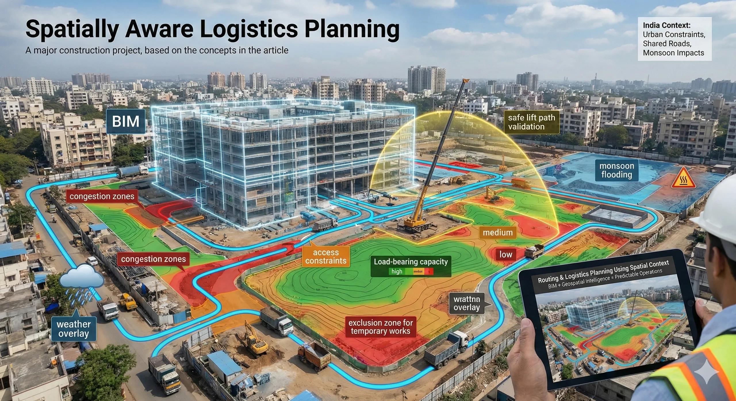
Materials arrive late. Equipment can’t access work fronts. Temporary roads fail under load. Cranes interfere with each other. What looks like poor planning is often a lack of spatial context .
Routing and logistics are inherently geospatial problems. When BIM is combined with terrain, networks, and real-world constraints, logistics planning moves from guesswork to foresight.
1. Why Logistics Is Often an Afterthought
On many projects:
Logistics planning is done in 2D
Assumptions are based on experience, not data
Site conditions are treated as static
But construction sites are dynamic systems :
Terrain changes
Access routes shift
Congestion evolves
Weather intervenes
Without spatial intelligence, plans age quickly.
2. What “Spatial Context” Means for Logistics
Spatial context includes:
Accurate terrain (DSM/DTM)
Road networks and access constraints
Load-bearing capacities
Turning radii and clearances
Temporary works and exclusion zones
Environmental and weather overlays
Logistics decisions are only as good as the context they’re based on.
3. Routing Is a Network Problem, Not a Drawing Problem
Material movement depends on:
Shortest viable paths, not shortest distances
Gradient and slope limits
Vehicle type and load
Time-based restrictions
GIS-style network analysis combined with BIM asset needs enables:
Optimized delivery routes
Reduced internal congestion
Better sequencing decisions
This cannot be solved inside isolated BIM views.
4. Crane, Equipment, and Lift Planning
Spatially aware planning supports:
Crane reach and interference analysis
Equipment access envelopes
Safe lift path validation
Conflict-free staging zones
When these are evaluated against real terrain and site constraints, safety and productivity both improve.
5. Temporary Infrastructure Deserves Permanent Intelligence
Temporary roads, laydown areas, and access ramps are often:
Poorly documented
Quickly improvised
Forgotten in models
Yet they:
Control daily productivity
Affect safety
Influence environmental impact
Treating temporary logistics as geospatial assets reduces surprises.
6. Weather and Seasonality Matter
Routing plans that ignore:
Monsoon flooding
Heat stress
Soil saturation
are fragile.
Environmental overlays allow planners to:
Adjust haul routes seasonally
Anticipate access disruptions
Reduce downtime
Logistics intelligence is temporal, not just spatial.
7. India Context: Why This Is Critical
In India:
Urban sites are constrained
Access roads are shared with public traffic
Informal encroachments change conditions
Monsoon impacts are severe
Spatially driven logistics planning:
Reduces conflict with surroundings
Improves coordination with authorities
Prevents reactive firefighting on site
8. From Planning to Operations
When routing intelligence is embedded:
Daily logistics become predictable
Site supervisors act on shared context
Changes are evaluated before execution
This is where digital twins begin to influence daily operations , not just planning meetings.
9. Why Visualization Alone Is Not Enough
3D visuals help explain plans.
They do not optimize them.
Optimization comes from:
Network analysis
Constraint modeling
Scenario comparison
Spatial context turns visuals into decisions.
10. A Simple Logistics Rule
If you can’t explain why a route works under worst-case conditions, it’s not a plan, it’s a hope.
Conclusion
Routing and logistics are the circulatory system of construction projects.
When spatial context is ignored:
Delays multiply
Safety risks rise
Costs creep in unnoticed
When BIM is fused with geospatial intelligence:
Movement becomes predictable
Constraints surface early
Decisions improve daily execution
In spatially complex projects, logistics intelligence is not optional, it is operational survival .