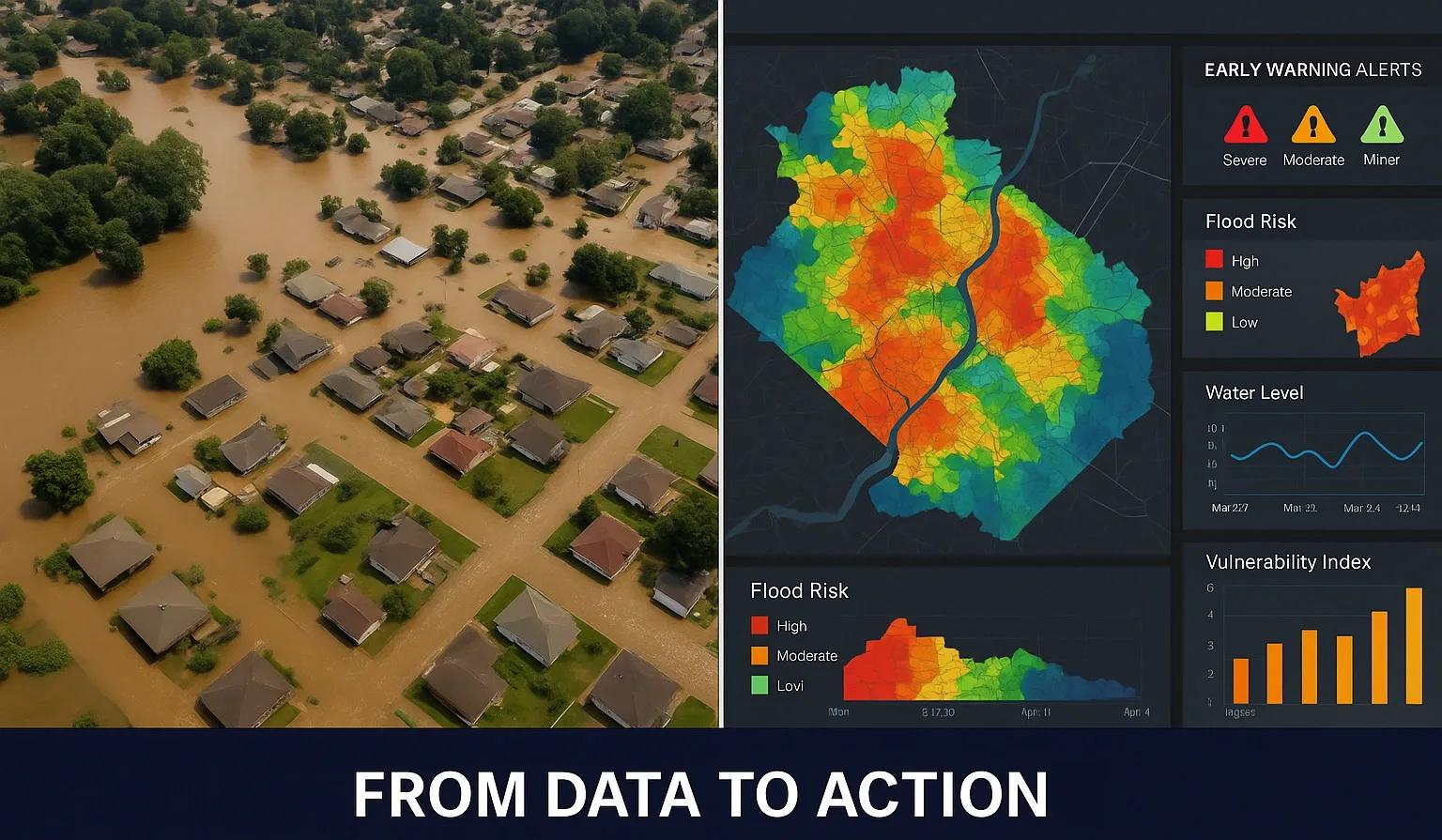
Climate change is intensifying the frequency and impact of natural disasters across the globe. From urban flooding and heatwaves to cyclones and forest fires, vulnerable regions are being pushed to the edge. Amidst this growing uncertainty, geospatial technology has emerged as a crucial enabler of climate resilience and disaster preparedness. Its ability to visualize, analyze, and interpret data across time and space empowers stakeholders to make timely, informed decisions.
This article explores how geospatial technology contributes to early warning systems, flood risk management, and urban resilience, focusing on real-world applications, evolving trends, and strategic implications for climate and disaster planning.
Geospatial Technology: An Overview
Geospatial technology encompasses a range of tools and techniques, including Geographic Information Systems (GIS), Remote Sensing, Global Navigation Satellite Systems (GNSS), and Unmanned Aerial Vehicles (UAVs), to collect, manage, and analyze spatial data. By integrating temporal and location-based insights, it enables the modeling of environmental conditions, infrastructure systems, and socio-economic factors relevant to disaster scenarios.
Key features include:
Spatial analysis for hotspot identification
Real-time mapping and monitoring
Predictive modeling for risk forecasting
Decision support for emergency response and recovery
1. Enabling Early Warning Systems
Early warning systems (EWS) are designed to detect potential hazards and disseminate timely alerts to reduce disaster risks. Geospatial platforms are foundational to these systems, offering dynamic inputs that allow decision-makers to monitor evolving threats.
Applications:
Satellite remote sensing helps track cyclonic activity, rainfall patterns, and drought conditions. Platforms like NASA’s Earth Observing System (EOS) and India’s INSAT/IRS satellites offer near real-time data for hazard monitoring.
GIS-based modeling helps simulate scenarios like tsunami propagation or wildfire spread, allowing emergency teams to design evacuation routes and allocate resources.
Sensor networks integrated with GIS provide continuous input from ground-based stations measuring rainfall, temperature, river flow, or air quality, key for issuing localized alerts.
For example, India’s Integrated Flood Warning System (IFLOWS-Mumbai) combines weather models, hydrological simulations, and geospatial analysis to generate location-specific flood forecasts and evacuation advisories.
2. Mapping Flood Risk and Vulnerability
Floods are among the most devastating climate-induced disasters, especially in low-lying urban and coastal areas. Geospatial technologies support flood risk management across three phases: prediction, monitoring, and recovery.
Predictive Mapping:
Hydrodynamic models, when fed with high-resolution digital elevation models (DEMs) and rainfall data, help delineate flood-prone zones. GIS can overlay this with demographic data to identify vulnerable populations, critical infrastructure, and potential damage.
Monitoring and Response:
Drones and satellites provide aerial views of inundated areas during floods. These visuals help assess breach points, road accessibility, and the extent of damage in real time. Data from Copernicus Sentinel satellites and NASA's MODIS are widely used for such monitoring.
Post-Event Recovery:
Geospatial analysis is essential in damage assessment, insurance claims, and infrastructure repair planning. UAVs can quickly map affected regions and generate orthophotos for reconstruction.
In the UK’s Environment Agency Flood Warning Information Service, GIS and LiDAR data are used to continuously update flood maps and communicate risks to local authorities and the public.
3. Building Urban Climate Resilience
Urban areas are at the frontline of climate impacts due to high population density, infrastructure concentration, and altered land surfaces. Geospatial intelligence plays a strategic role in climate-resilient urban planning.
Heat Island Mapping:
Remote sensing identifies urban heat islands (UHIs) by analyzing surface temperature differences. These insights support the design of green infrastructure like parks and reflective roofing to lower ambient temperatures.
Stormwater Infrastructure Planning:
GIS models simulate surface runoff to identify choke points, optimize drainage designs, and reduce urban flooding. This is especially valuable in cities with rapid, unplanned growth.
Land Use and Zoning:
Geospatial platforms assess land suitability based on topography, soil, vegetation, and flood history. This data supports zoning regulations and ensures that future developments avoid high-risk areas.
Cities like Singapore and Amsterdam are leveraging digital twins, 3D geospatial models of the urban environment, to simulate climate scenarios, manage utilities, and evaluate the impact of proposed developments on urban resilience.
4. Community-Level Preparedness and Participation
Effective climate adaptation requires not only data-driven decision-making but also community involvement. Geospatial dashboards and participatory GIS allow local populations to contribute to risk mapping and preparedness.
Examples:
Community-based flood mapping uses mobile apps to collect local observations, improving the granularity of flood models.
Wildfire evacuation apps integrate user locations with real-time geospatial alerts to guide communities during emergencies.
Open-source platforms like QGIS and mobile tools like Collector for ArcGIS are making it easier for NGOs, students, and community leaders to engage with spatial data for resilience-building.
5. Trends and Future Directions
Integration with AI/ML:
Geospatial data, when combined with machine learning, can enhance pattern recognition for hazard prediction. AI models can analyze historical satellite imagery to forecast droughts, landslides, or crop failures with improved accuracy.
Real-Time IoT Monitoring:
Deploying IoT sensors in rivers, roads, and buildings provides a constant stream of environmental data. Integrating this with geospatial platforms enables proactive maintenance and rapid response.
Immersive Planning with XR:
Extended Reality (XR) tools powered by geospatial data can simulate flood zones or evacuation drills in virtual environments. These tools are proving valuable in stakeholder engagement and training.
Geospatial in Policy-Making:
Governments are increasingly embedding geospatial tools into national disaster frameworks. For instance, India's National Disaster Management Plan (NDMP) explicitly mentions GIS as a key component for hazard zonation, risk assessment, and infrastructure planning.
Conclusion
Geospatial technology is no longer a support tool, it is a core driver of climate and disaster resilience. From mapping flood risks to enabling real-time alerts and resilient urban designs, its applications span the entire disaster lifecycle. As climate risks escalate, geospatial systems must be embedded deeper into infrastructure planning, emergency response, and community engagement efforts.
To realize their full potential, geospatial solutions must be:
Accessible : Open data policies and community training are essential.
Integrated : Systems must interoperate across platforms, sensors, and departments.
Scalable : From local initiatives to national infrastructure, solutions must adapt to different scales.
With global investments and policy attention aligning around climate resilience, geospatial intelligence will play an even more decisive role in safeguarding communities and ecosystems in the years to come.