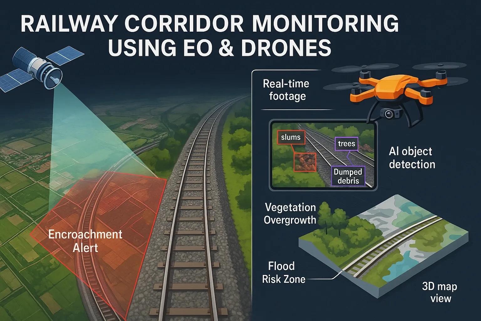
India has one of the largest and most complex railway networks in the world, spanning over 69,000 kilometers. Maintaining this vast infrastructure is a massive challenge, particularly when it comes to monitoring encroachments, tracking unauthorized activities, and identifying environmental risks that can compromise safety and operations. Traditional manual methods are slow, reactive, and often inaccurate. The integration of Earth Observation (EO) satellites and drone technologies offers a proactive and scalable solution to monitor railway corridors, safeguard assets, and ensure regulatory compliance.
This article outlines the technical frameworks, workflows, and benefits of using EO and UAV (Unmanned Aerial Vehicle) systems in railway corridor monitoring, with a focus on encroachment detection and environmental risk mitigation.
Why Monitoring Railway Corridors Is Critical
Railway corridors face multiple threats:
Unauthorized encroachments (slums, shops, cultivation, etc.)
Illegal dumping and waste accumulation
Soil erosion and vegetation overgrowth
Flooding and waterlogging
Landslides and geohazards in hilly regions
Vandalism or theft of railway assets
Undetected, these risks can lead to derailments, service disruptions, legal disputes, and long-term asset degradation.
EO & Drone Technologies: Complementary Tools
1. Earth Observation (EO)
EO satellites provide regular, wide-area coverage. Multispectral and synthetic aperture radar (SAR) data can detect physical changes in land use and surface deformation. Key features:
Temporal change detection: Identifying encroachments by comparing imagery over time.
Vegetation and water body monitoring: Using NDVI and water index algorithms to track growth or encroachment of greenery and flood-prone zones.
SAR-based monitoring: Detecting subsidence or landslide-prone zones even under cloud cover.
Common satellite sources:
Sentinel-1 & 2 (free): SAR and multispectral data for environmental monitoring.
PlanetScope, WorldView (commercial): High-resolution imagery (up to 30 cm) for detailed asset inspection.
2. Drones / UAVs
Drones offer high-resolution imagery (2–5 cm GSD), real-time flexibility, and low-altitude inspection of rail assets. They are ideal for:
Spot inspections in high-risk areas
Capturing oblique imagery for 3D modeling
AI-based object detection (e.g., for illegal structures)
Types of drones:
Fixed-wing: Suitable for long linear corridors
Multirotor: Suitable for short-range and localized monitoring
LiDAR-equipped UAVs: For elevation profiling and encroachment volume estimation
Workflow: EO and Drone Integration for Railway Corridor Monitoring
Step 1: Corridor Mapping and Baseline Creation
Use satellite imagery or drone LiDAR to establish a digital corridor boundary (e.g., 15m or 30m RoW buffer from railway centerline).
Digitize existing infrastructure like tracks, electric poles, stations, signaling systems, culverts, etc.
Create a base layer in GIS for future comparison.
Step 2: Periodic Satellite Monitoring
Schedule satellite image acquisitions (monthly or quarterly).
Use change detection algorithms to flag anomalies. Example: Built-up area increases inside the buffer zone Surface deformation near embankments or bridges
Step 3: Drone Deployment for High-Risk Zones
Based on satellite flags or ground alerts, deploy drones for spot inspections.
Capture geotagged imagery and videos.
Use AI-based analytics (YOLO, TensorFlow models) to classify objects, temporary shacks, permanent buildings, garbage dumps, or tree encroachments.
Step 4: Analytics and Alerting
Use GIS dashboards to visualize: Encroachment hotspots Vegetation overgrowth Soil erosion-prone areas
Generate automated alerts to railway engineering teams and law enforcement agencies.
Step 5: Record Keeping and Legal Evidence
Archived drone videos and satellite images act as legal documentation in court cases involving encroachments or asset damage.
Time-stamped reports improve accountability.
Case Example
Corridor : Kalyan–Kasara suburban stretch near Mumbai (20 km)
Challenges:
Frequent illegal hutments along railway fencing
Monsoon flooding in low-lying sections
Theft of signaling equipment
Implementation:
High-resolution Sentinel-2 imagery processed monthly
EO change detection flagged 14 unauthorized developments in 3 months
Drone inspection confirmed 9 of them as illegal permanent structures
GIS dashboard shared with Railway Protection Force (RPF)
Encroachment data shared with municipal authorities for eviction
Result : 85% reduction in encroachment in flagged areas within six months
Benefits of EO & Drone-Based Monitoring
Parameter - Traditional Methods - EO + Drone Monitoring
Coverage - Manual, slow - Scalable, automated
Accuracy - Subjective - Objective (cm-level)
Frequency - Annual or reactive - Monthly / event-based
Cost - Labour-intensive - Scalable and efficient
Legal documentation - Weak paper trails - Verifiable image/video records
Technical Considerations
Geo-referencing : Ensure that all drone and satellite data is aligned to the same coordinate reference system (e.g., WGS84 or Indian Grid System).
Cloud Processing : Use platforms like Google Earth Engine, Sentinel Hub, or AWS for EO analysis For drones, use DroneDeploy, Pix4D, or WebODM for 3D reconstruction and object detection
Data Storage and Access : Use cloud-based repositories with time-series access Access control for different stakeholders, engineers, surveyors, enforcement teams
Regulatory Compliance : Drones in India must comply with DGCA regulations and No-Permission-No-Takeoff (NPNT) rules Use only certified drones and pilots with UINs
Environmental Monitoring Add-ons
Besides encroachments, EO and drone data can help in:
Air quality monitoring : Using onboard sensors or correlating land use with emission hotspots
Slope stability analysis : Using EO-based DEMs and InSAR for landslide detection
Flood prediction : Integration with rainfall data and terrain models to map flood-prone zones
Challenges and Mitigation
Challenge - Mitigation Strategy
Weather/cloud interference in EO - Use SAR data like Sentinel-1
Drone battery limitation - Use fixed-wing drones for extended coverage
Data overload - Use AI to auto-classify and prioritize risks
Regulatory hurdles - Partner with certified drone operators
Skill gaps - Train railway staff on basic GIS and drone ops
Future Directions
Real-time drone streaming to command centers using 5G or Starlink
Integration with IoT sensors (e.g., vibration, intrusion sensors)
Edge AI for real-time object detection on drones
Digital Twin creation of critical railway assets
Conclusion
Railway corridor monitoring using Earth Observation and drone technologies is no longer a futuristic concept, it’s a practical, scalable, and cost-effective strategy for asset protection. As India invests in railway modernization and safety, integrating EO and UAV-based monitoring systems will be key to proactively managing risks, minimizing operational disruptions, and enforcing regulatory boundaries. These technologies also open doors for predictive maintenance and smart infrastructure management across the rail network.