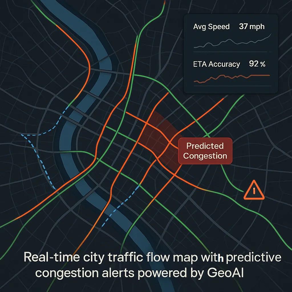
In today’s rapidly urbanizing world, traffic congestion continues to be a persistent challenge. As cities expand and mobility demands increase, traditional reactive congestion management approaches, such as widening roads or adjusting traffic signals post-facto, are proving insufficient. The answer lies in Predictive Congestion Management (PCM) powered by GeoAI, a blend of geospatial technologies and artificial intelligence. This article explains how GeoAI enables the prediction and proactive mitigation of traffic bottlenecks, reshaping how urban transport systems are managed.
What Is GeoAI?
GeoAI combines geospatial data (e.g., satellite imagery, GPS traces, remote sensing, GIS layers) with artificial intelligence techniques (such as machine learning, deep learning, and computer vision). It enhances the ability to analyze spatial patterns, detect anomalies, and predict future scenarios with high precision.
In the context of traffic systems, GeoAI ingests location-based data from a variety of sources to train AI models that can predict congestion trends before they manifest on the road.
Components of a Predictive Congestion Management System
A robust PCM framework using GeoAI involves several key components:
1. Geospatial Data Acquisition
a. Traffic sensors and cameras : Real-time data on vehicle speed, density, and flow.
b. GPS and mobile apps : Anonymized location data from smartphones and navigation apps.
c. Aerial imagery and satellite data : Used for base mapping and to detect construction, land-use changes, and road blockages
d. Open street maps and infrastructure databases : Provide contextual data on road hierarchy, public transport lines, and junction design.
2. AI-Based Predictive Modeling
a. Time-series forecasting : Models like LSTM (Long Short-Term Memory) are trained on historical traffic patterns.
b. Classification and regression models : Predict the likelihood and severity of congestion.
c. Graph neural networks (GNNs) : Model traffic as a network of nodes and edges (intersections and roads), enabling learning from both temporal and spatial dependencies.
3. Dynamic Data Integration
a. Weather feeds : Rain, fog, or storms can drastically affect congestion.
b. Event data : Sporting events, festivals, or protests that might influence traffic volume.
c. Incident reports : Real-time updates from emergency services or crowd-sourced platforms like Waze.
4. Visualization and Decision Support Tools
a. GIS dashboards : Visualize predicted hotspots, traffic flows, and suggested interventions.
b. Digital twins of transport networks : Simulate and assess the impact of interventions in a virtual environment.
How GeoAI Enables Predictive Congestion Management
1. Identifying Bottlenecks Before They Form
GeoAI models can process live streaming data to identify early signs of congestion, like a drop in average speed or an increase in stop-start behavior, before they escalate. Machine learning models can detect these subtle changes much earlier than humans or basic threshold-based systems.
For example, if a highway segment typically maintains 60 km/h but starts showing signs of a speed dip during a non-peak hour, the system flags it for further investigation. Predictive models then evaluate whether this is an anomaly, an early indication of an incident, or part of a longer pattern.
2. Proactive Traffic Diversion and Routing
Once a potential bottleneck is identified, the system can recommend alternate routes in real-time. These recommendations are sent to navigation apps, traffic control rooms, or connected vehicle systems. GeoAI models continuously update based on feedback loops to optimize diversion efficiency.
3. Signal Timing Optimization
Using reinforcement learning, AI models can suggest adaptive traffic signal strategies. GeoAI-powered systems simulate various timing configurations and select the one that will best relieve current or projected congestion, minimizing average waiting time per vehicle.
4. Scenario Simulation and Contingency Planning
City planners use GeoAI simulations to prepare for high-impact scenarios such as:
Sudden road closures due to maintenance or accidents.
Surge traffic after large public gatherings.
Evacuation routes during natural disasters.
These digital twins simulate multiple scenarios and produce optimized intervention strategies based on live and historical data.
Case Studies and Applications
1. Singapore’s Land Transport Authority (LTA)
Singapore uses a blend of AI and geospatial analytics to optimize bus routes and predict traffic congestion. Their system integrates fare card data, CCTV footage, and GPS feeds to dynamically reassign bus frequencies during peak congestion windows.
2. INRIX + HERE Technologies (Global Urban Areas)
INRIX partners with HERE Technologies to offer predictive traffic analytics for major cities. Their system uses a combination of floating car data, IoT sensors, and real-time feeds to offer congestion forecasts with up to 85% accuracy up to 60 minutes in advance.
3. India’s Smart Cities Mission
Under the Smart Cities initiative, cities like Pune and Surat are using GeoAI to map traffic congestion patterns and deploy dynamic traffic management strategies using AI-based video analytics integrated with command-and-control centers.
Benefits of Using GeoAI in Traffic Management
Proactive Intervention : Congestion is reduced before it impacts large volumes of vehicles.
Data-Driven Planning : Transport departments can prioritize infrastructure upgrades based on congestion trends.
Reduced Emissions : Shorter travel times and optimized routing contribute to lower CO₂ emissions.
Improved Commuter Experience : Reduced delays and smoother flow lead to improved citizen satisfaction and productivity.
Enhanced Safety : Early warnings about unusual traffic behavior can be linked to emergency dispatch systems.
Challenges and Considerations
Despite its promise, GeoAI-based congestion management faces a few limitations:
Data Quality and Accessibility Inconsistent or sparse data can reduce model accuracy. Coverage gaps, especially in Tier-2 cities or rural corridors, need to be addressed.
Privacy and Ethical Concerns Location data, even when anonymized, requires strong governance under laws like the Digital Personal Data Protection Act, 2023 in India or the GDPR in Europe.
Integration with Legacy Systems Many urban traffic systems still rely on traditional ITS (Intelligent Transportation System) infrastructure, which may not easily integrate with AI and cloud-based platforms.
Computational Demand Real-time data ingestion, model training, and edge inference require significant computing resources and efficient backend architecture.
The Road Ahead
The future of congestion management lies in real-time, adaptive, and decentralized decision-making. With increasing adoption of connected vehicles, 5G networks, and edge computing, GeoAI systems will evolve to operate closer to the source, within vehicles, smart poles, or local control units, reducing latency and improving response times.
Further, integration with urban mobility platforms (like ride-sharing and public transport apps) will make congestion mitigation a collaborative, multi-modal effort rather than a siloed process.
Conclusion
GeoAI represents a shift from reactive to predictive congestion management. By combining spatial intelligence with machine learning, cities can anticipate bottlenecks, take action before traffic grinds to a halt, and build a more intelligent, responsive urban transport system. As more cities embrace digital transformation, predictive congestion management using GeoAI will be key to designing smarter, more livable urban environments.