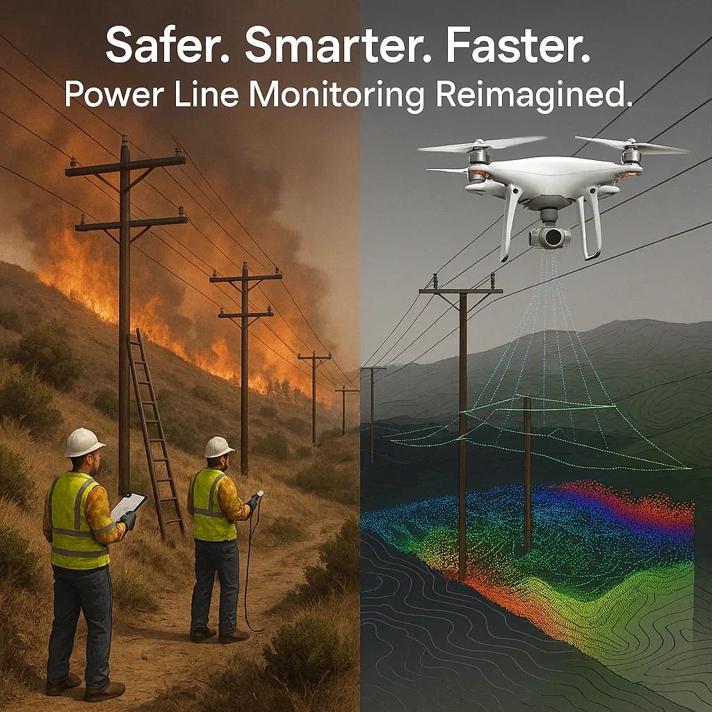
Power transmission infrastructure is critical to national and regional energy networks. Ensuring the health and safety of power lines, especially in hilly or remote terrain, presents significant operational challenges. Traditionally, power line inspections in such areas rely on manned helicopters, ground patrols, and manual surveys, methods that are labor-intensive, time-consuming, and often hazardous. With the advancement of unmanned aerial vehicles (UAVs) and LiDAR (Light Detection and Ranging) technology, utilities are now transforming how they monitor transmission assets, particularly in challenging geographies.
This article presents a technical exposition on how drones equipped with LiDAR sensors are enabling more effective power line monitoring in hilly terrains, significantly reducing downtime and mitigating wildfire risk.
1. The Complexity of Power Line Inspection in Hilly Terrain
Power lines in mountainous or forested regions are exposed to high mechanical stress, rapid vegetation growth, and harsh environmental conditions. Some of the critical challenges include:
Limited accessibility for ground vehicles and manual inspection teams.
Dynamic vegetation encroachment , which can lead to line sagging or contact.
Increased wildfire risk due to dry biomass and electrical faults.
Longer inspection cycles , leading to delayed maintenance and higher failure risks.
These factors create the need for a scalable, accurate, and repeatable monitoring solution that can operate efficiently in difficult terrain.
2. Drones and LiDAR: A Transformative Combination
2.1 Drone Platforms for Power Line Monitoring
Drones (UAVs) offer a mobile, flexible platform capable of flying close to power lines while capturing high-resolution data. Key advantages include:
Autonomous flight planning over complex routes using GPS and inertial navigation.
VTOL (Vertical Take-Off and Landing) capability, enabling deployment in confined hilly areas.
Real-time data streaming and geotagged imagery for immediate situational awareness.
Industrial drones used in utility inspections are equipped with redundancy systems (dual IMUs, RTK GPS, obstacle avoidance), enabling safe operation near energized lines.
2.2 Role of LiDAR Sensors
LiDAR systems use laser pulses to measure distances to objects, producing highly accurate 3D point clouds. When mounted on drones, LiDAR enables:
Vegetation clearance analysis by calculating the distance between conductors and nearby tree canopies.
Sag and sway detection by profiling conductor geometry in 3D.
Topographic mapping of the terrain under and around the transmission corridor.
Compared to photogrammetry, LiDAR offers higher accuracy in canopy-penetrating applications, making it ideal for dense forested or mountainous regions.
3. Technical Workflow for Drone-LiDAR Power Line Monitoring
The typical technical workflow involves the following steps:
3.1 Pre-Flight Planning
Route Planning: Flight paths are designed based on corridor geometry and clearance zones.
Regulatory Compliance: Airspace approvals, especially near sensitive locations, are obtained.
Ground Control Points (GCPs): If high-accuracy geo-referencing is required, GCPs are established.
3.2 Data Acquisition
UAVs equipped with LiDAR and RGB/thermal cameras follow pre-programmed routes.
The drone maintains a safe offset from the power lines (typically 5–10 meters).
Data is captured at high frequency (e.g., 200–300 kHz pulse rate) to ensure dense point clouds.
3.3 Data Processing
Point Cloud Classification: Ground, vegetation, conductor, and structure points are classified using automated algorithms.
Digital Terrain Model (DTM) and Digital Surface Model (DSM) are extracted.
Clearance Calculations: The distance between conductors and vegetation is computed along the corridor.
Defect Detection: Anomalies such as insulator damage, broken strands, or corrosion are identified using AI-based analytics.
3.4 Reporting and Integration
Interactive 3D models and geospatial reports are generated.
Data is integrated into enterprise asset management (EAM) or GIS platforms.
Maintenance teams receive actionable insights for scheduling preventive or corrective measures.
4. Use Case: Reducing Downtime and Fire Risk in Mountainous Regions
4.1 Vegetation Encroachment Risk
In hilly terrains with dense vegetation, traditional ground-based inspection often fails to detect fast-growing species near conductors. With drone-LiDAR:
Vegetation growth trends are monitored through temporal analysis of point clouds.
Clearance violations are automatically flagged based on regulatory limits.
Predictive models estimate growth rates and schedule trimming cycles in advance.
This proactive approach helps reduce the risk of arcing or line contact that can trigger wildfires.
4.2 Detecting Sag, Tilt, and Conductor Anomalies
Temperature-induced sag or structural fatigue can cause conductors to hang dangerously low or oscillate beyond safe thresholds.
LiDAR-derived 3D profiles enable centimeter-level measurement of conductor catenary curves.
Comparing against design specs highlights sections needing tension adjustments or re-stringing.
Early detection of anomalies prevents failures that may lead to unplanned outages.
4.3 Post-Storm Damage Assessment
After landslides, windstorms, or lightning events, drones can be rapidly deployed to assess structural damage without waiting for ground access.
High-resolution LiDAR and orthomosaics reveal pole tilts, snapped conductors, or blocked access paths.
Real-time situational awareness reduces the mean time to repair (MTTR).
Maintenance crews can be dispatched with precise instructions, minimizing downtime.
5. Integration with SCADA and Digital Twins
Drone-LiDAR data can be integrated with Supervisory Control and Data Acquisition (SCADA) systems and digital twins of transmission infrastructure.
Digital twin models created from point clouds can simulate physical behavior under varying load or weather conditions.
LiDAR-derived thermal profiles from concurrent IR camera data enhance situational diagnostics.
SCADA integration enables correlation between real-time operational data and physical asset conditions.
This creates a closed-loop monitoring system capable of driving predictive maintenance and smart grid reliability.
6. Benefits and ROI for Utilities
Implementing drone and LiDAR-based power line monitoring provides several quantifiable benefits:
Benefit - Impact
Reduced downtime - Faster fault detection and restoration in remote areas
Enhanced safety - Eliminates the need for personnel to enter hazardous zones
Fire risk mitigation - Early identification of clearance violations and dry vegetation
Cost savings - Reduces reliance on helicopters and large ground crews
Asset longevity - Enables preventive maintenance and better load planning
According to industry reports, utilities adopting UAV-LiDAR-based inspections have seen 20–30% reduction in inspection costs and up to 40% reduction in vegetation-related outages .
7. Regulatory and Operational Considerations
Adoption at scale requires addressing regulatory, operational, and data management aspects:
BVLOS (Beyond Visual Line of Sight) approvals are critical for long-distance corridor inspections.
Battery life and flight time limitations must be considered when planning for mountainous terrain.
Data privacy and security of infrastructure maps must be ensured through encrypted storage and access control.
Training and certification for drone pilots and LiDAR data analysts are essential for operational efficiency.
Conclusion
In regions where hilly terrain complicates power line inspection, drone-based LiDAR monitoring offers a safe, precise, and efficient alternative to traditional methods. It not only improves situational awareness and reduces inspection cycle time but also plays a critical role in prevention of wildfire and rapid post-disaster recovery. With advancements in AI-driven analytics, digital twin integration, and extended drone flight endurance, this approach is poised to become standard for modern utility asset management.
Utilities and infrastructure agencies must move towards adopting these technologies, not just to reduce costs and enhance safety, but to ensure uninterrupted, resilient, and sustainable energy delivery in a climate-challenged world.