When Every Minute Matters
Forecasting tells us what might happen tomorrow .
Nowcasting tells us what’s about to happen in the next 3 hours.
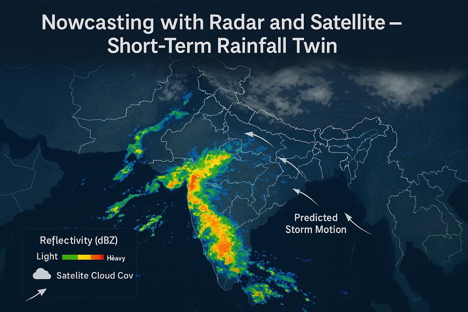
It’s the high-speed layer of weather intelligence, powered by Doppler radar , satellite imagery , and AI models that simulate precipitation in near real time.
In a world of flash floods and extreme rainfall events, this short-term predictive capability isn’t just meteorology, it’s infrastructure resilience intelligence.
From Forecasting to Nowcasting
Traditional weather models rely on global circulation equations, physics-heavy and computationally expensive.
Nowcasting instead fuses real-time radar scans, satellite data, and AI algorithms to make fast, localized predictions .
Time horizon: 0–6 hours Spatial resolution: 1–2 km grids Update frequency: Every 5–15 minutes
It’s a constantly refreshing geospatial loop, rainfall intensity, motion vectors, and cloud evolution combined to build a Rainfall Digital Twin of the atmosphere.
The Core Inputs: Radar + Satellite
1️⃣ Doppler Weather Radar (DWR)
Measures reflectivity (Z) → rainfall intensity (R).
Tracks storm cells, direction, and speed.
India’s IMD network: 38+ S-band and C-band radars covering all major metros and coastal belts.
2️⃣ Satellite Systems
INSAT-3D/3DR: 15-minute multispectral imagery for cloud-top temperature and motion.
GPM (Global Precipitation Measurement): Global coverage for rainfall estimation.
Sentinel-1 SAR: Detects flood inundation post-rainfall for validation.
Together, these sensors feed data into gridded rainfall models that update every few minutes, effectively creating a live map of atmospheric water movement.
The Modeling Engine
Nowcasting models combine physics and pattern recognition.
Model Type - Method - Key Strength
Extrapolation Models - Tracks radar echoes and projects motion vectors forward (e.g., TITAN, SWIRLS) - Fast and reliable up to 3 hours
Numerical Nowcasting Models (NWP) - High-resolution WRF variants with frequent boundary updates - Integrates dynamics and thermodynamics
AI / Deep Learning Models - Uses radar sequences as training data (e.g., ConvLSTM, GANs) - Captures non-linear storm evolution
IMD and IITM Pune have developed hybrid models like MesoNowcast and RadarAI that combine radar fields, satellite imagery, and reanalysis data to achieve RMSE < 5 mm/hr for 0–3 hour forecasts.
Building the Rainfall Digital Twin
A Rainfall Digital Twin is a live geospatial simulation of precipitation behavior. It links sensor observations with predictive analytics to visualize and forecast:
Rainfall intensity (mm/hr).
Cloud cell motion and growth.
Likely inundation zones (when coupled with DEM + land use).
Urban drainage load forecasts.
The twin continuously synchronizes radar data (every 10 min) with AI-generated rainfall trajectories, enabling “now” + “next” visibility.
Use Case 1: Urban Flood Forecasting, Mumbai
Mumbai’s Municipal Corporation (BMC) now integrates radar-based rainfall nowcasts from IMD’s Colaba station into its GIS flood dashboard :
Combines radar reflectivity (Z–R conversion) with storm drain capacity maps .
Predicts street-level flooding up to 90 minutes ahead.
Alerts citizens via SMS and municipal command centers.
In 2023, the system achieved >85% accuracy in predicting localized high-intensity rainfall (>50 mm/hr), reducing response lag for emergency teams.
Use Case 2: Reservoir and Agriculture Decision Support
The Krishna–Godavari basin authorities use INSAT-3D cloud-top data + radar rainfall mosaics to predict short-term inflows.
Farm advisories integrate this into DSS platforms to delay irrigation or harvesting during forecasted convective bursts.
Even a 2-hour early warning can prevent irrigation water loss or fertilizer washout, translating to measurable economic gains.
GeoAI for Rainfall Motion Prediction
Deep learning models trained on multi-temporal radar and satellite sequences now outperform traditional extrapolation.
ConvLSTM (Convolutional LSTM): Predicts next 6 radar frames based on spatio-temporal learning.
Optical Flow + GAN Models: Track and evolve cloud fields realistically in 3D space.
Fusion Networks: Combine radar, GPM, and INSAT data into unified rainfall prediction grids.
This AI-driven pipeline enables spatial continuity , filling radar coverage gaps and extending predictions to data-sparse regions.
The Architecture of a Nowcasting System
Data Flow:
1️⃣ Radar reflectivity → Rain rate conversion
2️⃣ Satellite cloud motion vectors
3️⃣ AI forecast engine (ConvLSTM / GAN)
4️⃣ Real-time visualization on GIS platform
5️⃣ Alert dissemination via web dashboards, APIs, or IoT devices
The resulting map updates every 5–10 minutes, essentially a Rainfall Twin , capable of simulating rainfall as a “live stream” rather than a static map.
Challenges and the Road Ahead
Radar Gaps: Hilly and remote areas still lack sufficient coverage.
Data Latency: Real-time transmission consistency is critical.
Calibration: Radar Z–R relationships vary by geography and season.
Validation: IoT rain gauges and AWS stations provide feedback loops for tuning models.
India’s Next-Gen Weather Radar Network (NGWRN) aims to expand coverage to 100+ radars by 2030 , forming the foundation for a nationwide rainfall twin grid.
Outlook: Predictive Infrastructure for a Rain-Intense Future
With climate variability increasing short-duration extremes, rainfall nowcasting becomes an essential resilience tool.
By integrating radar, satellites, and GeoAI, India can move from reactive flood response to predictive management, city by city, basin by basin.
This isn’t just weather monitoring, it’s digital hydrology in motion.
Conclusion
Every cloud now casts data, not just rain.
Through real-time fusion of radar and satellite inputs, nowcasting transforms rainfall into an intelligent, time-sensitive data layer, powering faster, localized, and life-saving decisions.
When we model rainfall as a digital twin, we’re no longer watching the storm; we’re simulating it.