The World Is Becoming a Live Map
Cities are growing faster than ever.
Infrastructure networks are becoming more complex.
Climate volatility is reshaping landscapes.
Supply chains span continents.
In this environment, governments are discovering a simple truth:
Managing a country requires understanding it spatially.
Traditional statistics and periodic reports are no longer enough.
To govern effectively, nations are beginning to build something new:
National Digital Twins.
What Is a National Digital Twin?
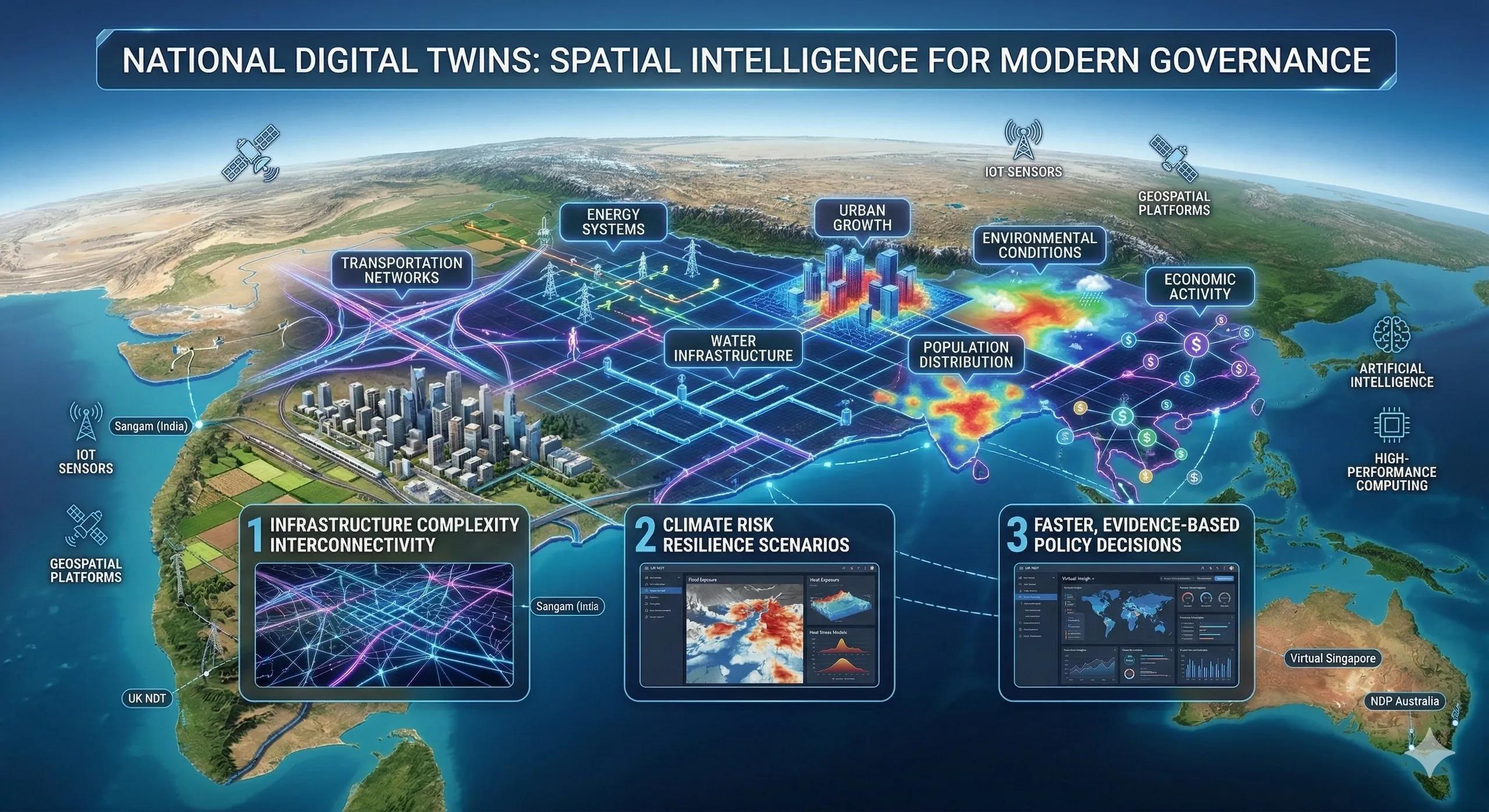
A National Digital Twin is a dynamic, digital representation of a country's physical systems.
It integrates data from multiple domains into a spatial intelligence environment, including:
transportation infrastructure
energy networks
water systems
land use and urban development
environmental conditions
population distribution
economic activity
This allows governments to simulate, monitor, and plan national systems with geographic precision.
Instead of analyzing isolated datasets, policymakers can observe how systems interact across the landscape .
3. Why Countries Are Building Digital Twins
National digital twins are emerging for three primary reasons.
1️⃣ Infrastructure Complexity
Modern infrastructure systems are deeply interconnected.
Roads influence logistics networks.
Energy systems depend on water availability.
Urban growth affects transportation demand.
A digital twin allows governments to understand these relationships spatially and anticipate bottlenecks before they occur.
2️⃣ Climate Risk and Environmental Pressure
Climate change is uneven across regions.
Flood risk increases in some basins.
Heat stress rises in certain urban corridors.
Water scarcity intensifies in particular watersheds.
National digital twins allow governments to model climate scenarios geographically and design long-term resilience strategies.
3️⃣ Faster, Evidence-Based Policy Decisions
Traditional planning often relies on delayed data.
Digital twins provide near real-time insights into national systems, enabling governments to:
simulate infrastructure investments
evaluate disaster preparedness
assess environmental impact
coordinate cross-agency decision-making
Policy becomes evidence-driven rather than reactive .
A Practical Example
Consider a country planning a new high-speed rail corridor.
Without a digital twin, planners evaluate:
engineering feasibility
projected demand
financial viability
With a national digital twin, planners can also evaluate:
flood exposure along the route
population growth corridors
environmental impact zones
integration with existing logistics networks
The result is more resilient infrastructure planning .
Countries Leading This Transformation
Several governments have already begun developing national digital twin initiatives.
Examples include:
Sangam Digital Twin initiative India
UK National Digital Twin Programme
Virtual Singapore
National Digital Twin Programme Australia
These initiatives aim to integrate infrastructure, environment, and economic data into unified geographic intelligence platforms.
The goal is not simply visualization.
It is better national decision-making .
The Technology Behind National Digital Twins
Building a national digital twin requires combining several digital technologies:
Geospatial platforms for mapping and spatial analysis
Remote sensing and satellite data for environmental monitoring
Internet of Things (IoT) sensors for real-time infrastructure data
Artificial intelligence for predictive analytics
High-performance computing for scenario simulation
Together, these technologies create a continuously updated representation of national systems.
Why This Matters for Businesses
National digital twins are not just government tools.
They affect how businesses operate as well.
Companies benefit through:
improved infrastructure planning
better climate risk visibility
optimized logistics networks
clearer regulatory environments
Organizations that integrate their spatial intelligence with national systems gain better situational awareness .
The Monetization Bridge
As governments develop national digital twin initiatives, demand is growing for geospatial platforms, data integration frameworks, simulation models, and digital infrastructure solutions. Technology providers, infrastructure firms, and analytics companies are increasingly participating in these ecosystems to support national-scale decision environments.
Looking Ahead
The future of governance will be increasingly spatial.
Instead of managing isolated systems, governments will oversee living geographic models of their nations .
Digital twins will allow countries to:
test infrastructure policies before implementation
anticipate climate impacts
optimize resource allocation
strengthen disaster preparedness
The countries that build these capabilities early will gain strategic advantages in resilience and economic planning.
Closing Insight
A nation is not just an economy.
It is a landscape of infrastructure, ecosystems, and communities.
Understanding that landscape in real time is becoming essential for modern governance.
National digital twins represent the next evolution of geographic intelligence.