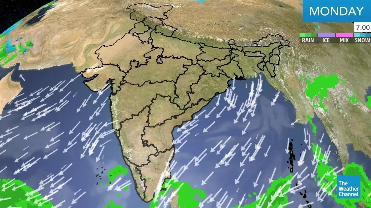
The Pulse That Drives a Continent
Every year, the Indian monsoon arrives not as a season, but as a moving data layer.
It surges northward, withdraws southward, oscillates east to west, a living, shifting phenomenon that defines the rhythm of India’s economy, ecology, and energy systems.
Today, thanks to satellite rainfall datasets, reanalysis products, and geospatial analytics , we can track this pulse with precision, quantifying its onset, progress, and retreat in near real-time.
The monsoon has become more than a forecast, it’s a dynamic geospatial layer in the nation’s climate intelligence stack.
Decoding the Dynamic Layer
The monsoon’s spatial evolution can be analyzed through three key phases, onset, active, and withdrawal , each mapped through measurable geospatial indicators.
Phase - Indicator - Dataset / Tool - Spatial Resolution
Onset - Rainfall ≥ 2.5 mm/day for 3 consecutive days - IMD / CHIRPS / GPM - 0.05° (≈5 km)
Active / Break Cycles - Standardized rainfall anomaly; OLR; wind vectors - ERA5 / INSAT-3D - 0.25°
Withdrawal - Consecutive dry days + retreat of wind discontinuity - IMD / NOAA Reanalysis - 0.25°
Each variable, rainfall, wind, humidity, pressure, becomes a time-encoded raster layer . Stacked together, they produce the “Monsoon Motion Map” , a visual timeline of India’s most powerful climatic process.
From IMD Charts to GeoAI Models
Traditionally, IMD declared monsoon onset based on surface rainfall and pressure observations along the Kerala coast.
Now, the process is augmented with machine learning models trained on 40+ years of ERA5 reanalysis data, incorporating:
850 hPa wind reversals (cross-equatorial flow).
Outgoing Longwave Radiation (OLR < 200 W/m²) , a proxy for deep convection.
Precipitation persistence and spatial coherence.
These models can estimate onset date anomalies up to 10 days in advance , crucial for agriculture, reservoir operations, and disaster preparedness.
Mapping the Journey: How the Monsoon Moves
With geospatial analytics, the monsoon is visualized as a moving front , not a static zone:
June 1–15: Onset over Kerala, spreading to central India.
July: Active over Indo-Gangetic plains and northeast India.
August: Stabilization and western spread.
September–October: Gradual withdrawal from northwest to southeast.
Satellite-based rainfall composites (CHIRPS, GPM, TRMM) generate daily movement contours , like isolines of rainfall advance.
Overlaying them year-on-year creates onset climatology maps , showing how each monsoon behaves differently yet follows familiar tracks.
India’s Monsoon Monitoring Grid
Several national and global systems now maintain real-time monsoon monitoring dashboards :
IMD’s Monsoon Onset & Withdrawal Portal: Maps progression with rainfall and wind overlays.
ISRO’s MOSDAC: Uses INSAT-3D and SCATSAT-1 data for daily convection visualization.
IITM Pune’s Monsoon Mission Analytics: Combines models and satellite data for seasonal forecasts.
India-WRIS / Bhuvan Portals: Integrate rainfall grids with basin-level runoff and reservoir data.
Each layer feeds into a national hydrometeorological twin , connecting the atmosphere with agriculture and water resource planning.
Use Case 1: Agricultural Timing Intelligence
Farmers’ biggest risk is when to sow .
Geospatial monsoon analytics link onset timing and spatial spread with soil moisture anomalies and crop calendars :
Early onset → Pre-sowing moisture forecast.
Delayed onset → Drought watch zones.
Erratic rainfall → Mid-season advisories for seed replacement or re-sowing.
In 2023, IMD’s monsoon anomaly map predicted a 10–12 day delay over Marathwada , which enabled crop advisory agencies to postpone sowing, reducing yield loss by nearly 18% compared to 2019’s unplanned early sowing year.
Use Case 2: Reservoir and Power Planning
Hydropower and reservoir managers use monsoon progress maps to forecast inflows and optimize dam operations.
Rainfall–runoff models (SWAT / HEC-HMS) coupled with CHIRPS data estimate cumulative inflow per basin.
Daily rainfall deviation maps inform hydropower scheduling and thermal load management during lulls.
Spatial rainfall correlation helps forecast catchment synchronization , critical for dam safety.
This basin-wise visibility transforms water resource management from reactive to anticipatory.
Use Case 3: Logistics and Disaster Preparedness
By fusing monsoon rainfall + flood risk + road network layers , planners identify high-disruption corridors during heavy monsoon phases.
For example, NHAI’s GIS flood dashboard overlays IMD’s rainfall grids with elevation and drainage data , enabling real-time route advisories .
Disaster response teams also use onset and withdrawal maps to predict likely cyclone transition windows over the Bay of Bengal.
GeoAI: The Predictive Monsoon Engine
AI is accelerating monsoon understanding:
LSTM models: Predict onset and withdrawal dates using ERA5 and IMD archives.
Spatio-temporal CNNs: Classify rainfall clusters for break/active cycles.
Bayesian Networks: Estimate probability of drought or flood onset within 30 days of deviation.
In essence, the monsoon is now being treated as a time-series object , not just a weather event, continuously tracked, modeled, and improved through learning.
Outlook: Toward India’s Monsoon Digital Twin
The next frontier is a Monsoon Digital Twin , combining:
Satellite rainfall (GPM, INSAT).
Wind and pressure reanalysis (ERA5).
Ground observations (IMD, AWS).
Crop, soil, and hydrology layers.
This twin would enable:
Dynamic flood forecasts synchronized with rainfall pulses.
Agricultural advisories auto-triggered by onset deviations.
Reservoir operation simulations under projected monsoon scenarios.
Such a system would convert the annual monsoon from a forecasted phenomenon to a continuously managed data layer , responsive, adaptive, and predictive.
Conclusion
The Indian monsoon isn’t a mystery anymore, it’s a moving dataset .
By mapping its onset and withdrawal with satellites, sensors, and AI models, we’re finally turning climate variability into spatial intelligence.
Every raindrop that falls tells a story, and now, the map can read it in motion.