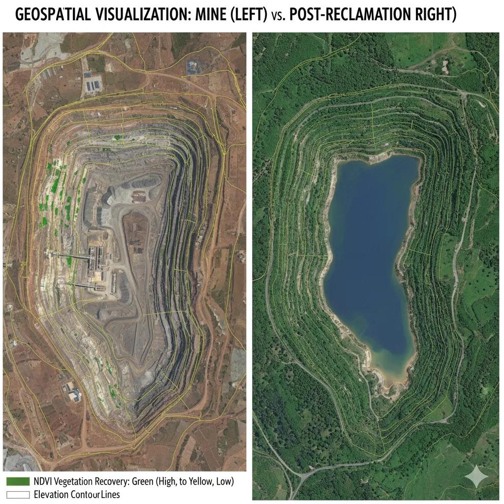
Mining Leaves a Signature. Technology Can Rewrite It.
Every mine, open-pit or underground, reshapes the land. From soil loss to drainage alteration, each operation leaves a geospatial footprint visible from space.
But the story doesn’t end when the mining stops. With digital twins, remote sensing, and AI , we can now monitor, predict, and even reverse these impacts, creating Reclamation Twins that model how landscapes recover.
In short, the same tools once used to locate mineral wealth are now being used to restore ecological balance.
Decoding Mining Footprints from Space
Mining footprints are easily detectable because extraction alters the surface geometry, spectral reflectance, and vegetation cover, all measurable through satellite data.
Common geospatial indicators:
Topographic Change: DEM differencing reveals cut and fill volumes.
Spectral Anomalies: High reflectance in SWIR/NIR bands indicates exposed rock, tailings, or barren soil.
Vegetation Loss: NDVI/NDRE time-series show deforestation and reclamation progress.
Water Quality: Sentinel-2 and MODIS data detect turbidity, suspended solids, and acid drainage plumes.
Thermal Patterns: Landsat TIR bands identify waste heat from smelting or spoil heaps.
When combined with cadastral and environmental datasets, these features form a compliance map , showing how mining activities align with approved boundaries and environmental conditions.
India’s Challenge: Mapping 5000+ Operational Mines
India’s mining sector contributes over 2.5% to GDP and employs millions, but compliance visibility remains fragmented.
The Ministry of Environment and Forests and the Indian Bureau of Mines (IBM) increasingly rely on geospatial audits :
Bhuvan–MoEFCC Portal: Uses multi-temporal satellite imagery for environmental clearance monitoring.
National Remote Sensing Centre (NRSC): Tracks forest cover loss and mining encroachment near protected areas.
State SPCBs (Pollution Control Boards): Use drone and UAV imagery to assess overburden dumping, land degradation, and post-mining reclamation.
In 2023 alone, satellite audits identified 120+ unauthorized mining expansions , proving that space-based monitoring is now a compliance instrument.
The Rise of Reclamation Twins
Once extraction ends, reclamation begins, but verifying it on the ground is slow, subjective, and often incomplete.
Enter Reclamation Digital Twins , geospatial models that simulate rehabilitation progress in near real time.
How they work:
Baseline Twin: A digital model of pre-mining terrain (from LiDAR or CartoDEM).
Operational Twin: Updated through drone photogrammetry and Sentinel-2 imagery.
Reclamation Twin: Tracks landform reshaping, revegetation, and water recovery through temporal analysis.
AI models then compare spectral and structural recovery curves to ideal ecological baselines, giving regulators a quantifiable measure of success.
For example:
Vegetation NDVI returns to 70% of baseline → “Reclamation in progress.”
Drainage network realigned and stable → “Hydrological recovery achieved.”
Surface deformation <0.2 m over 6 months → “Landform stabilization complete.”
These indicators turn environmental restoration into a measurable science.
Case Example: Coal Mining Belt, Jharkhand
In the Dhanbad–Jharia coalfields, where subsidence and fire hazards complicate reclamation, NRSC and CMPDI used a hybrid dataset, CartoDEM, Sentinel-1 SAR, and UAV photogrammetry , to develop a mine-to-rehab twin.
Key findings:
Overburden dump reshaping reduced surface roughness by 35% .
NDVI-based vegetation recovery achieved 0.65 (vs. 0.8 baseline) within two years.
SAR coherence analysis detected minor residual subsidence, guiding soil compaction measures.
This twin-based monitoring not only validated rehabilitation claims but also provided automated compliance reporting , saving months of manual inspection.
GeoAI for Automated Compliance
AI-driven platforms now analyze hundreds of mining sites simultaneously:
Change Detection Models: Identify unauthorized expansion or dumping.
Semantic Segmentation on UAV Imagery: Classify active pits, tailings, vegetation, and water bodies.
Anomaly Detection Algorithms: Flag deviations from approved mining leases.
Predictive Recovery Modeling: Estimate how long reclamation will take to reach ecological thresholds.
Regulators can visualize this data in a dashboard interface , showing each mine’s compliance score and reclamation progress in near real time.
From Monitoring to Incentivizing Sustainability
Imagine a future where rehabilitation credits are awarded for faster, verifiable reclamation, tradable like carbon credits.
Digital twins can anchor this system by validating outcomes transparently, creating economic incentives for environmental performance.
In effect, compliance evolves from paperwork to data-driven accountability.
Outlook: Toward a National Mining Digital Twin Grid
The next step for India could be a unified Mining Digital Twin Grid linking:
Ministry of Mines lease databases
Bhuvan–MoEFCC satellite audits
CPCB air and water quality sensors
State drone survey repositories
Such a grid could deliver a single, dynamic map of India’s extractive footprint , from discovery to closure, from impact to recovery.
This would not just strengthen governance but also improve investor transparency and ESG (Environmental, Social, and Governance) ratings globally.
Conclusion
Mining and reclamation are no longer opposite ends of a timeline, they’re two sides of a continuous digital process .
With geospatial intelligence, every excavation becomes a monitored system, and every restoration becomes a measurable outcome.
The Earth keeps score, and now, with Reclamation Twins, we can read the numbers.