Floods don’t strike randomly.
Infrastructure failures don’t occur evenly.
Market collapses don’t affect every region equally.
Risk has geography.
The organizations that understand this early don’t just react better, they avoid crises altogether.
The real decision behind risk management
Every leadership team eventually faces these questions:
Where are we most vulnerable?
Which regions could disrupt operations?
What exposure are we carrying unknowingly?
Where should we strengthen resilience first?
Traditional risk management often relies on historical reports, static compliance checklists, or broad probability models. These approaches miss one critical dimension:
Spatial concentration of risk.
Risk is rarely uniform. It clusters. It overlaps. It intensifies in specific places.
Why location intelligence transforms risk thinking
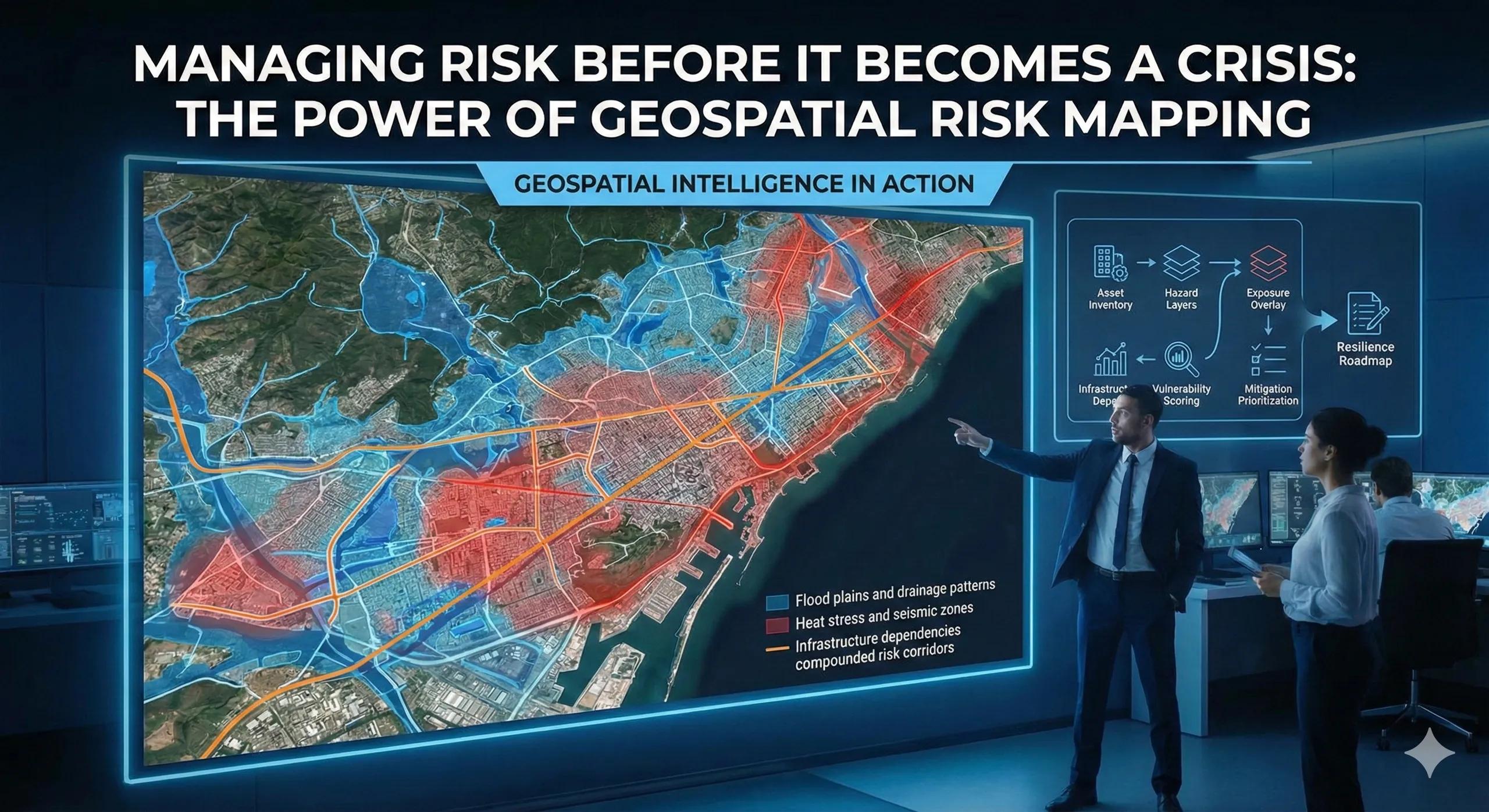
Geospatial intelligence allows organizations to move from abstract risk categories to visible exposure zones .
By layering spatial data such as:
Flood plains and drainage patterns
Seismic zones
Land subsidence patterns
Population vulnerability
Infrastructure dependencies
Climate projections
Leaders can see how risks overlap geographically.
Instead of asking “Do we have flood risk?” , the better question becomes:
“Which of our assets lie within compounded risk corridors?”
That clarity changes preparedness strategy.
From data to decision: the risk mapping flow
A structured geospatial risk framework typically follows:
Asset or region inventory → hazard layers → exposure overlay → vulnerability scoring → mitigation prioritization
This shifts decision-making from reactive crisis management to proactive risk containment.
The output is not a risk report.
It is a resilience roadmap.
A practical scenario
Imagine a logistics company operating multiple regional warehouses.
Individually, each facility appears compliant and operational. However, spatial risk mapping reveals:
Two high-value warehouses sit within projected 20-year flood expansion zones
One lies near transport corridors prone to seasonal disruption
Another overlaps with high heat stress zones affecting energy reliability
The risk isn’t catastrophic today, but exposure is visible.
The company shifts investment:
Reinforces vulnerable sites
Adjusts insurance structures
Diversifies network dependencies
The crisis never happens, but preparedness improves.
Business and operational impact
Organizations applying geospatial risk mapping often experience:
Reduced unplanned downtime
Lower insurance exposure
Smarter capital allocation toward mitigation
Stronger compliance readiness
Increased stakeholder confidence
The value is not in predicting disasters perfectly.
It is in reducing uncertainty before disruption occurs.
Where most risk strategies fall short
Common gaps include:
Risk registers without geographic context
Asset-level risk assessments without regional overlays
Climate considerations treated separately from infrastructure planning
No continuous updating of risk exposure
In many cases, risk becomes visible only after loss.
Geospatial intelligence makes risk visible beforehand.
Scaling risk mapping into decision systems
Forward-looking organizations integrate geospatial risk mapping into:
Expansion planning
Infrastructure prioritization
Insurance strategy
Regulatory compliance
ESG reporting
This approach naturally connects with BIM models, IoT sensors, and digital twins, creating dynamic risk-aware systems rather than static reports.
Risk becomes measurable, monitorable, and manageable.
The monetization bridge
As portfolios grow and climate volatility increases, manual risk assessments become inadequate. Organizations begin looking for structured advisory frameworks and scalable spatial decision systems that continuously evaluate exposure across assets and regions, turning resilience into a measurable capability rather than a reactive cost center.
Looking ahead
With real-time environmental data, predictive analytics, and AI-driven simulations, geospatial risk mapping is evolving toward continuous exposure monitoring .
Instead of reviewing risk annually, organizations will assess it daily.
Resilience will become a live dashboard, not a PDF.
Closing insight
Risk is unavoidable.
Unseen risk is optional.
The advantage lies not in eliminating uncertainty, but in knowing exactly where it resides.