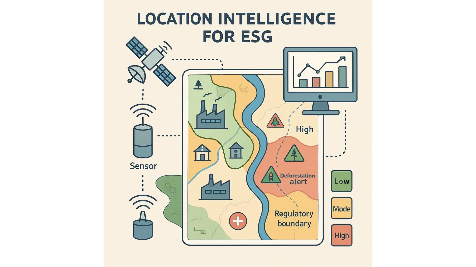
Environmental, Social, and Governance (ESG) strategy has become a crucial framework for responsible business conduct. Companies are increasingly expected to disclose how they manage climate risks, optimize social outcomes, and maintain strong governance practices. However, static ESG reporting systems often lack the dynamic spatial context required to assess, monitor, and optimize these factors in real-time. This is where Location Intelligence (LI) plays a transformative role.
Location Intelligence leverages geospatial data, spatial analytics, and mapping tools to turn raw geographic information into actionable insights. When integrated into ESG strategies, LI enables organizations to align sustainability goals with spatial realities, bridging the gap between policy intent and on-ground execution. This article unpacks how Location Intelligence is redefining ESG strategy formulation, sustainability investments, and impact measurement.
1. Understanding Location Intelligence and Its Relevance to ESG
Location Intelligence involves the analysis of spatial data to derive meaningful insights about the “where” of phenomena. It combines GIS (Geographic Information Systems), Earth Observation (EO), sensor data, mobility data, and AI/ML-driven analytics to understand spatial patterns and trends.
In the context of ESG:
Environmental performance is inherently spatial, related to emissions, land use, biodiversity, and climate risk zones.
Social considerations depend on geographic access to healthcare, education, employment, and safe environments.
Governance practices often involve regulatory compliance tied to jurisdictional boundaries and risk assessments that are spatially dependent.
Thus, ESG without a location-aware framework risks missing key dependencies and ground-level variations that could affect both performance and compliance.
2. Driving Environmental Stewardship with Geospatial Insights
Location Intelligence provides critical visibility into environmental data, helping organizations track and reduce their ecological footprint. Core applications include:
a. Carbon Emissions and Air Quality Mapping
By integrating satellite data and IoT sensors, organizations can monitor GHG (Greenhouse Gas) emissions across their facilities or supply chains. Spatial models help identify pollution hotspots and optimize mitigation plans.
b. Climate Risk Assessment
Using climate projection datasets, organizations can simulate flood, drought, wildfire, or sea-level rise scenarios across their assets. This helps prioritize infrastructure upgrades or relocation planning in vulnerable regions.
c. Land Use and Deforestation Monitoring
Remote sensing tools enable near real-time tracking of land cover changes. Companies in agriculture, mining, or infrastructure can verify compliance with deforestation-free supply chain goals using spatial verification methods.
d. Water Risk Mapping
Watershed-level analysis allows companies to assess local water stress, predict seasonal availability, and manage industrial water use more sustainably.
3. Supporting Social Impact Through Spatial Equity Metrics
The “S” in ESG often involves qualitative or aggregated metrics, which can obscure disparities. Location Intelligence makes social performance quantifiable and spatially explicit.
a. Community Impact Mapping
Businesses can visualize how their operations affect nearby communities by mapping proximity to schools, hospitals, and residential areas. This supports proactive risk mitigation (e.g., in the case of hazardous materials) and inclusive development planning.
b. Accessibility and Service Reach
Organizations in healthcare, retail, and education can use geospatial analytics to assess whether their services are equitably accessible across demographics and geographies, especially in underserved or rural areas.
c. Labor Supply and Vulnerability Assessment
LI tools help map labor force distributions, migration trends, and socioeconomic vulnerability indices to ensure fair labor practices and anticipate workforce disruptions due to climate migration or urban displacement.
4. Enhancing Governance and Compliance Tracking with Spatial Context
Governance is often tied to regulatory compliance, ethical sourcing, and supply chain transparency. Spatial analytics offers a systematic method for tracking location-specific compliance.
a. Supply Chain Traceability
By geotagging suppliers and logistic nodes, companies can trace the geographic origin of raw materials and assess ESG risks associated with particular locations, like conflict zones or ecologically sensitive areas.
b. Regulatory Risk Mapping
With geospatial overlays of jurisdictional boundaries, protected zones, and regulatory zones (e.g., emission control areas), organizations can prevent inadvertent violations and align operations with local policies.
c. Ethical Procurement Zones
Mapping areas prone to forced labor, child labor, or environmental violations allows procurement teams to establish dynamic ethical sourcing zones and avoid high-risk geographies.
5. Applications Across Sectors
Location Intelligence adapts flexibly across industries, enhancing ESG reporting and strategy across sectors:
Energy : Optimize renewable energy siting by mapping solar irradiance, wind speeds, and community impact zones.
Real Estate : Identify and invest in sustainable development zones with green infrastructure potential.
Agriculture : Monitor crop yield, land degradation, and water use through EO data to ensure sustainable farming practices.
Logistics : Minimize carbon footprint by optimizing transportation routes and warehouse locations based on emission zones and congestion data.
Finance : Integrate spatial ESG risk scoring into investment models to assess asset-level vulnerabilities.
6. Informing Sustainability Investments and Green Finance
Investors increasingly demand granular, verifiable data to back ESG claims. Location Intelligence allows for spatially resolved disclosures and investment impact reporting.
a. Green Bond Monitoring
Green finance instruments often fund projects with environmental benefits. EO data and geospatial platforms enable real-time monitoring and validation of these projects, e.g., reforestation, renewable energy installations, or flood defenses.
b. ESG Heatmaps for Investment Decisions
Financial institutions use spatial ESG heatmaps to overlay climate risks, population vulnerabilities, and regulatory landscapes, guiding responsible capital allocation.
c. Impact Reporting with Spatial Evidence
Companies can generate detailed sustainability reports with location-specific visuals, maps showing afforestation areas, emissions reductions, or community outreach projects. This adds transparency and credibility to ESG disclosures.
7. Key Technologies Powering Location Intelligence for ESG
GIS Platforms (e.g., ArcGIS, QGIS): Core spatial analysis tools for visualizing and querying location-based ESG data.
Earth Observation Satellites (e.g., Sentinel, Landsat): Provide frequent, large-scale data on land use, vegetation, water bodies, and urban growth.
IoT and Edge Sensors : Enable real-time monitoring of emissions, water quality, noise levels, and more at a granular level.
AI/ML Algorithms : Detect patterns, predict trends, and automate ESG compliance alerts using spatial data models.
Dashboards and Digital Twins : Combine location data with operational data for real-time monitoring, scenario simulations, and decision support.
8. Challenges and Considerations
While powerful, implementing Location Intelligence in ESG workflows comes with challenges:
Data Privacy : Especially in social metrics, mapping demographic data must comply with local data protection laws.
Data Gaps : In many emerging markets, high-resolution or regularly updated geospatial datasets may be limited.
Interpretation Complexity : Non-technical ESG teams may find spatial outputs hard to interpret without simplified dashboards.
Integration Overhead : Combining location data with enterprise systems (ERP, CSR platforms) requires upfront investment.
Addressing these requires strategic partnerships with geospatial experts, clear governance protocols, and scalable cloud-based platforms.
Conclusion
Location Intelligence is no longer optional for serious ESG strategy, it’s foundational. With growing pressure for transparent, measurable, and actionable ESG outcomes, spatial insights offer the missing link between corporate sustainability narratives and real-world impact. Whether identifying vulnerable populations, forecasting climate risks, or validating green finance projects, the power of “where” unlocks smarter, more responsible business decisions.
Organizations that embed Location Intelligence into their ESG frameworks not only gain compliance and reputation advantages, they also future-proof their operations in an increasingly climate-aware and stakeholder-driven world.