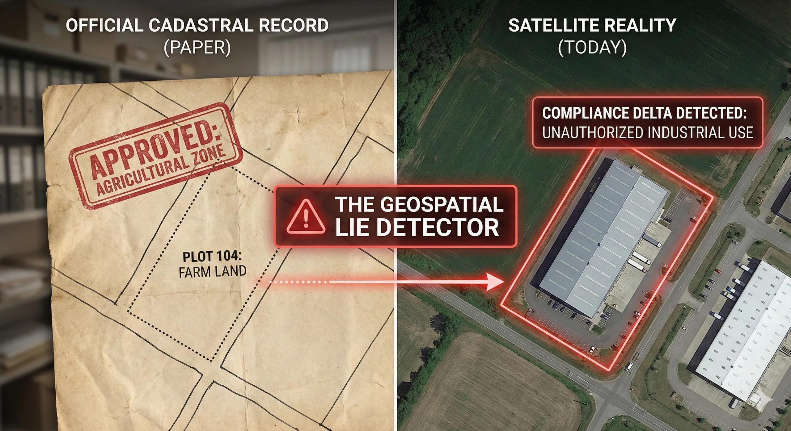
What if land-use violations could be detected automatically, before they become irreversible?
Across India and many parts of the world, land is the foundation for every decision: infrastructure, agriculture, conservation, taxation, and urban expansion.
Yet most land systems still rely on periodic surveys , manual inspections , and paper-based records .
This creates a persistent gap between what land is legally designated for … and what is actually happening on the ground .
Land-Use/Land-Cover (LULC) analytics + cadastral geospatial systems close this gap and turn compliance into a real-time, map-based governance function .
1️⃣ Land-Use Change Is a Signal, And Satellites Capture It Perfectly
LULC classification maps reveal how land evolves in response to:
expansion of agriculture
urban sprawl
industrial growth
mining activity
forest degradation
encroachment in riverbeds or wetlands
fragmentation of ecosystems
Using multi-temporal imagery (Sentinel-2, Landsat-8/9, IRS-LISS, Planet), change detection becomes measurable and automated.
Key spatial operations:
NDVI/NDWI/BSI trends
Machine learning classification (RF, SVM, U-Net)
Time-series differencing
Post-classification comparison
NDBI growth for urbanization
Burn scar and mining expansion detection
Every LULC transition has a compliance implication.
2️⃣ Cadastral Maps: The Legal Boundaries of Land
Cadastral layers represent:
plot boundaries
ownership
revenue codes
permitted land-use (agri, residential, industrial, forest)
ROW limits
waterbody buffers
restricted zones
Historically stored as paper maps, many states now digitize them as:
vector polygons (GeoJSON/SHAPE)
raster scans aligned using georeferencing
parcel-level metadata in Bhuvan, Bhu-Aadhaar, and state LR systems
The real magic happens when LULC layers intersect with cadastral layers.
3️⃣ Overlay Analysis: Where Compliance Becomes Measurable
The most common violations surface instantly when LULC and cadastral boundaries overlap.
A. Agricultural → Built-up inside agricultural parcels
Indicates illegal conversion, often without change-of-land-use (CLU) approval.
B. Forest → Non-forest in forest cadastral blocks
A key indicator for:
deforestation
encroachment
compliance with Forest Conservation Act
C. Waterbody → Built-up encroachment
Critical for:
lakes
wetlands
river floodplains
drainage buffers
D. Industrial activity inside residential/commercial parcels
Detected using:
bare soil index
heat signatures
nighttime lights
routine LULC updates
E. Mining expansion beyond permitted lease boundaries
A major compliance domain where spatial checks are essential.
F. Urban violations
setback violations
ROW encroachments
construction beyond approved layout
GIS turns violations into quantifiable geometry , not subjective opinion.
4️⃣ Land Governance as a Geospatial Workflow
A typical state-level land governance workflow integrates:
Master Plan Zones
Cadastral parcels
LULC time-series
Change detection outputs
Notification buffers (50–100 m)
Compliance rules (CLU, zoning, environmental)
Field verification
Enforcement or regularization decision
This allows departments to catch issues early, not after construction begins.
5️⃣ GeoAI for Land-Use Compliance
AI models enhance detection:
A. U-Net Segmentation
Detects built-up expansion block-by-block.
B. LSTM Time-Series
Predicts future transitions, early warning for sprawl.
C. Object-Based ML
Identifies rooftop-level changes in high-resolution imagery.
D. Anomaly Detection
Flags unusual patterns like:
sudden ground clearing
tree removal
new access roads
mining pits
E. Legal Rule Engines
Automated compliance scoring based on:
zoning codes
plot size
proximity to protected zones
This is the beginnings of AI-assisted land governance .
6️⃣ India’s Land Governance Landscape: Rapid Digitization, Growing Need
India’s land ecosystem is undergoing its largest digital transformation ever:
DLRMP (Digital Land Records Modernization Programme)
SVAMITVA (drone-based rural property mapping)
Bhu-Aadhaar
UP, Karnataka, Telangana digitization initiatives
Bhuvan LULC services
Forest clearance portals
Mining lease monitoring systems
Yet compliance is still largely manual .
Integrating LULC + cadastral analytics creates the automated governance layer India needs.
7️⃣ Toward a Land-Use Compliance Digital Twin
A Land Compliance Twin integrates:
parcels + ownership
permitted land-use
actual LULC
ML-based change detection
encroachment probability
environmental buffers
CLU approval workflows
field verification mobile apps
violator clustering
enforcement reporting
This twin becomes a single source of truth across planning, revenue, environment, and urban local bodies.
Conclusion
Land is the foundation of development, and the most contested resource.
When LULC analytics and cadastral databases converge, compliance becomes transparent, measurable, and enforceable at scale.
This is how we move from land disputes to data-driven land governance.
From guesswork to geometry.
From violations to visibility.