The Silent Expansion of the Invasives
Ecosystems evolve over millennia, but invasives rewrite them in decades.
Species like Prosopis juliflora , Lantana camara , Parthenium hysterophorus , and Eichhornia crassipes (Water Hyacinth) are silently redrawing India’s ecological maps, displacing native flora and degrading habitats.
Detecting and managing invasives isn’t just a biodiversity challenge, it’s a spatial intelligence problem .
And machine learning, powered by spectral and textural analytics , is now decoding these biological takeovers from space.
Why Detecting Invasives is So Complex
Invasive plants mimic their surroundings. They blend spectrally with native vegetation and change seasonally, often sharing the same chlorophyll signatures as grasses and shrubs.
Traditional vegetation indices (NDVI, SAVI) can’t always distinguish them. What’s needed is multi-feature differentiation , combining:
Spectral signatures (reflectance patterns)
Textural patterns (spatial arrangement of pixels)
Temporal behavior (growth cycles, phenology shifts)
Machine learning models integrate these to identify anomalies in “normal” vegetation behavior.
The Spectral Story: How Invasives Reflect Differently
Different plant species reflect sunlight differently across the electromagnetic spectrum.
Band - Sensitive To - Invasive Detection Use
Blue (B2) - Chlorophyll absorption - Discriminate dense vs. sparse vegetation
Red (B4) - Pigment activity - Identifies stressed or senescent invasives
NIR (B8) - Leaf cell structure - Highlights biomass and canopy density
SWIR (B11–B12) - Moisture content - Detects species like Prosopis or Lantana with low leaf water content
For example, Prosopis juliflora shows higher SWIR reflectance and lower red-edge response than native Acacia species, a clear spectral fingerprint when analyzed properly.
Adding Texture: The Spatial DNA of Vegetation
Beyond color (spectral), invasives differ in texture , the spatial arrangement of reflectance values in imagery.
Texture metrics (GLCM – Grey Level Co-occurrence Matrix):
Homogeneity: Smoothness of vegetation (low = coarse structure like Lantana ).
Contrast: Variation in reflectance (high = heterogeneous patches).
Entropy: Randomness, higher in fragmented invasive spreads.
Combining NDVI + GLCM metrics enhances classification accuracy by up to 20–30% , especially for patchy invasions.
Machine Learning Models for Invasive Detection
Machine learning thrives where spectral overlap confuses conventional classification.
Model - Key Advantage - Typical Accuracy
Random Forest (RF) - Handles mixed data (spectral + texture) - 85–92%
Support Vector Machine (SVM) - High precision with small datasets - 80–88%
Gradient Boosting (XGBoost) - Strong generalization - 88–93%
CNN (Convolutional Neural Network) - Learns spatial–spectral texture patterns directly from imagery - 90–95%
These models are trained on ground truth data, drone imagery, GPS field samples, and high-resolution satellite data (e.g., Sentinel-2, PlanetScope, or WorldView-3 ).
Case Example: Prosopis Mapping in the Rann of Kutch
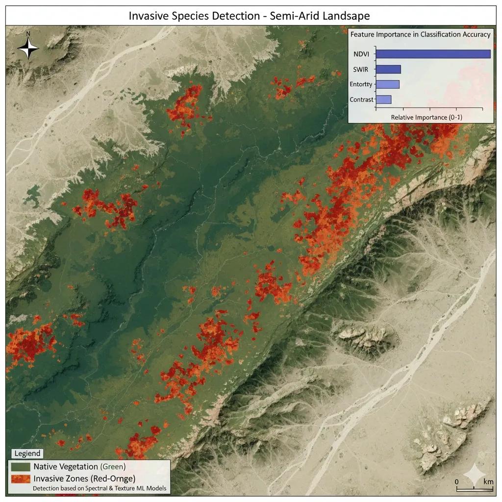
A 2023 study used Sentinel-2 MSI (10 m) imagery with Random Forest + GLCM texture metrics to map Prosopis juliflora in Kutch.
Inputs: NDVI, SWIR, NIR bands + entropy + contrast + elevation.
Overall accuracy: 91%.
Key finding: Invasion spread increased by 24% between 2015–2022 , replacing native grasslands critical for the Indian Wild Ass ( Equus hemionus ).
Validation: UAV-based sampling confirmed spectral misclassification <5%.
The outputs now support Gujarat Forest Department’s grassland restoration program under the Desert Ecosystem Initiative.
Detecting Floating Invasives: Water Hyacinth Monitoring
Aquatic invasives like Eichhornia crassipes require multi-temporal, multispectral analysis:
Optical indices: NDVI + NDWI (Normalized Difference Water Index).
SAR data (Sentinel-1): Backscatter decreases over hyacinth mats due to smoother water surface.
Phenology tracking: Machine learning models detect abnormal growth peaks during non-rainy months.
An ensemble model combining NDWI, VH/VV backscatter, and texture achieved 93% accuracy in detecting hyacinth infestations in Vembanad Lake.
GeoAI for Dynamic Invasion Modeling
AI models are evolving from detection to prediction .
Spatio-Temporal CNNs: Track invasion expansion using multi-date imagery.
LSTM Models: Forecast future invasion zones based on climate and soil variables.
Transfer Learning: Applies pre-trained invasive models across different ecosystems (e.g., Prosopis in Africa → India).
Explainable AI (XAI): Identifies which features (bands or textures) most influence detection confidence.
This approach helps planners simulate “if unchecked” scenarios, predicting where invasions will spread next.
Building an Invasive Species Digital Twin
A Digital Twin for Invasive Dynamics would continuously ingest:
Satellite & UAV imagery
Climatic drivers (rainfall, temperature)
Soil & hydrology layers
Anthropogenic activity maps (roads, settlements)
It could then simulate:
Real-time invasion growth
Impact on native species and biomass
Effectiveness of removal or containment interventions
This twin transforms reactive control into predictive ecological management.
Policy Implications for India
With over 1,500 invasive alien species , India needs coordinated geospatial intelligence to manage spread across forest, wetland, and agro-ecosystems.
Key initiatives gaining traction:
National Biodiversity Authority (NBA): Creating a unified invasive species geodatabase.
NRSC–ISRO: Developing AI-based detection modules in the Bhuvan platform.
State Forest Departments: Using satellite-based invasive alerts for eco-restoration planning.
GeoAI-integrated systems will help India move toward ecosystem-specific restoration targets under the UN Decade on Ecosystem Restoration (2021–2030).
Conclusion
Every invasive spread is a spatial signal, a deviation from nature’s original pattern.
By fusing spectral, textural, and temporal data , we can now detect these disruptions early, model their trajectories, and guide intervention strategies.
Machine learning is no longer just classifying pixels, it’s classifying resilience.