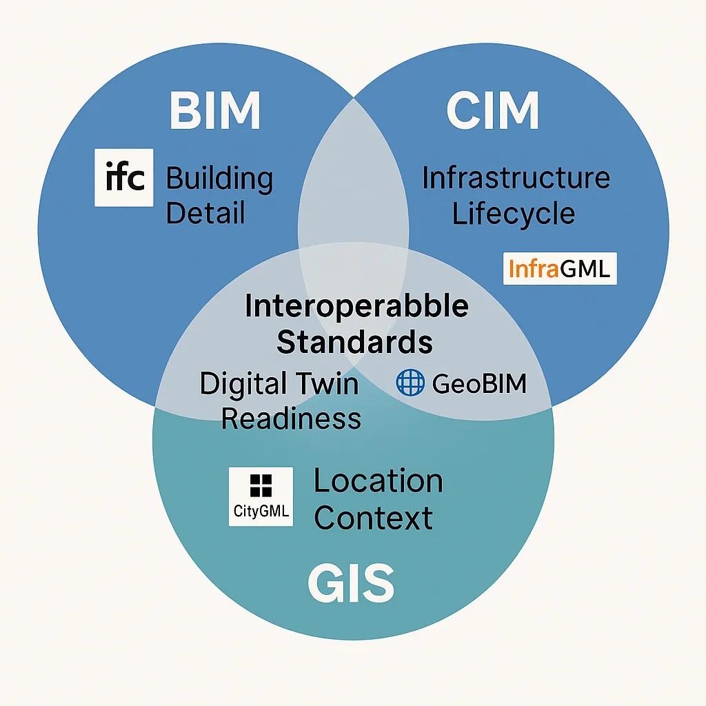
The convergence of Building Information Modeling (BIM), Geographic Information Systems (GIS), and City Information Modeling (CIM) represents a critical shift in digital infrastructure development. These systems, traditionally siloed, now increasingly need to work together to support smarter cities, resilient infrastructure, and sustainable planning. Achieving seamless integration requires interoperable data models that can harmonize the semantics, schemas, and spatial-temporal attributes across these domains.
This article explores the need for harmonization, technical challenges, emerging standards, and tools enabling effective data exchange between BIM, GIS, and CIM systems.
Understanding the Differences
BIM focuses on detailed 3D models of buildings and facilities with construction-level geometry and metadata such as materials, HVAC systems, and schedules. GIS handles large-scale geospatial data and spatial relationships, dealing with terrain, parcels, utilities, and networks. CIM applies infrastructure modeling across roads, bridges, railways, and urban planning, combining aspects of both BIM and GIS.
Although their domains overlap in infrastructure and urban environments, their data structures, coordinate systems, and semantics differ fundamentally.
Why Harmonization Is Essential
Urban Digital Twins : Large-scale twins need high-resolution BIM data contextualized within GIS environments and enriched with CIM-based infrastructure models.
Infrastructure Lifecycle Management : Harmonized data supports planning, construction, operation, and decommissioning using integrated datasets.
Smart Cities and Sustainability : For energy analysis, climate adaptation, and mobility planning, interoperability among systems is a prerequisite.
Regulatory Compliance and Permitting : Governments increasingly require integrated models for validation, simulation, and digital submissions.
Interoperability Challenges
Semantic Mismatch : Different terminologies, such as "wall" in BIM vs. "structure" in GIS, create translation issues.
Coordinate Systems : BIM uses local coordinate systems, whereas GIS relies on global spatial reference systems (like WGS 84 or UTM).
Granularity Differences : BIM focuses on fine-grain detail (millimeters), while GIS/CIM models often operate at broader scales (meters to kilometers).
Data Volume and Format : BIM data (e.g., IFC, RVT) is heavy and proprietary, whereas GIS favors open formats like GeoJSON, GML, or shapefiles.
Lifecycle Orientation : BIM is design and construction-focused, GIS emphasizes spatial relationships, and CIM targets city asset planning and simulation.
Standards Enabling Interoperability
Several data standards and specifications are emerging to bridge these differences:
1. IFC (Industry Foundation Classes)
Developed by buildingSMART, IFC is the most common open BIM standard. IFC4 includes support for spatial structures and allows mapping to GIS objects via extended definitions.
2. CityGML
A widely used standard for 3D city modeling, CityGML enables semantically rich, multi-scale city data. Efforts to link IFC and CityGML have advanced through mappings and transformation tools (e.g., IfcExplorer, IfcCityGML).
3. LandInfra / InfraGML
These are OGC (Open Geospatial Consortium) standards designed specifically for infrastructure modeling. LandInfra provides a conceptual model, while InfraGML offers its XML implementation.
4. IMDF (Indoor Mapping Data Format)
Used by Apple and others, IMDF bridges indoor BIM data with outdoor GIS environments using simplified geometric representation suitable for navigation apps.
5. GeoBIM Standard (OGC + buildingSMART)
A collaborative effort to define best practices, APIs, and ontologies for integrating BIM and GIS workflows. The OGC buildingSMART GeoBIM Working Group is actively developing this interoperability framework.
Tools and Platforms Supporting BIM-GIS-CIM Integration
Several commercial and open-source tools are now supporting cross-domain integration:
1. Autodesk InfraWorks
InfraWorks connects BIM models (from Revit/Civil 3D) with GIS data (via ArcGIS integration) to visualize infrastructure projects in real-world context.
2. Esri ArcGIS GeoBIM
This cloud-based solution links ArcGIS with Autodesk Construction Cloud, allowing project stakeholders to navigate BIM models within geospatial dashboards and maps.
3. FME (Feature Manipulation Engine)
FME by Safe Software is a leading data transformation platform that enables conversion between IFC, CityGML, GML, and other formats, facilitating integration.
4. Bentley OpenCities Planner & OpenRail Designer
Bentley supports CIM-centric projects with integration points for GIS and BIM models, particularly in rail and urban planning.
5. Trimble Quadri and Novapoint
Trimble’s solutions focus on city information modeling (CIM) and integrate with GIS and BIM using open standards and custom APIs.
Use Cases Driving Adoption
1. Urban Rail Development
City planners can overlay rail alignment (CIM) with land parcels and zoning data (GIS) while referencing underground utility networks and station structures (BIM).
2. Flood Risk Assessment
High-resolution BIM models of buildings are merged with terrain and drainage data (GIS) to simulate flood impacts and design resilient infrastructure (CIM).
3. Smart Utility Management
Utility companies use GIS for asset tracking, BIM for facility models, and CIM for pipeline and roadway infrastructure, all integrated into a common platform.
4. Airport Digital Twin
Airports require fine-detailed BIM for terminals, GIS for airside navigation, and CIM for roads and tunnels, creating a hybrid model for operations and simulations.
Emerging Practices and Harmonization Approaches
Model Transformation via Middleware Middleware tools perform syntactic and semantic conversions using mapping templates (e.g., IFC ↔ CityGML). This approach reduces manual intervention and supports automation.
LOD Harmonization Establishing Level of Detail (LOD) equivalence across BIM (LOD100–500), GIS (LoD0–LoD4 in CityGML), and CIM models enables model alignment for scale and resolution.
Linked Data and Ontologies Using semantic web technologies like RDF and OWL, stakeholders define ontologies for mapping BIM-GIS-CIM data entities and relationships.
Common Data Environments (CDEs) CDEs with multi-format support act as central repositories where BIM, GIS, and CIM data are stored, synchronized, and visualized together.
APIs and Web Services OGC APIs (e.g., OGC API – Features, OGC API – Tiles) allow flexible, web-based access to geospatial and BIM data for developers building interoperable applications.
Future Outlook
As digital twins, sustainability mandates, and smart infrastructure projects scale globally, the need for harmonized data models will intensify. Key trends include:
AI-driven Semantic Translation : Using AI to automate data schema mapping and detect inconsistencies across models.
Cloud-Native Platforms : Integration via cloud services like Esri ArcGIS Online, Autodesk Forge, and Bentley iTwin platforms.
Real-Time Synchronization : Using IoT-linked BIM-CIM models embedded in GIS environments for operational monitoring.
Conclusion
Harmonizing BIM, GIS, and CIM through interoperable data models is no longer a technical novelty, it is a strategic imperative for delivering integrated infrastructure solutions. The convergence of open standards, powerful transformation tools, and collaborative APIs is steadily eliminating data silos. For practitioners, the focus should now shift from whether integration is possible to how seamlessly and at what scale it can be implemented.